shopblog.nl
Categorieën
  Sluiten

Meer ITMB
Meer ITMB in Literatuur boeken

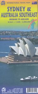
Wegenkaart - landkaart Sydney & Australia Southeast | ITMB

Plattegrond van Sydney, schaal 1:7.500, met aan de andere zijde een overzichtskaart van zuidoost Australië, schaal 1:2.000.000   Sydney is probably the best-known city in Australia and this map benefits from trips we have taken to ground-truth the information. It is attractive, pertinent, and easy to use as a map. As with many of our international ...
13,95

Webshops met dit product

Webshop
Bezorging
Prijs

Anderen bekeken ook

Wegenkaart - landkaart Sydney & Australia Southeast | ITMB
Plattegrond van Sydney, schaal 1:7.500, met aan de andere zijde een overzichtskaart van zuidoost Australië, schaal 1:2.000.000   Sydney is probably the best-known city in Australia and this map benefits from trips we have taken to ground-truth the information. It is attractive, pertinent, and easy to use as a map. As with many of our international city maps, we have re-worked this title into a double-sided map with the souteastern half of Australia on the reverse side. As with many of ITMB's map this edition is freshly printed on waterproof paper, more for its durability in the case of Australia than humidity.   Legend Includes: Roads by classification, International Airports, Airports, Ferry lines, Boat-Ferry docks, Railways, Railway stations, Bus terminals, Bicycle Trails, Foreshore trail systems, Pedestrian streets, Staircases, Small Nature reservesm Zoos, Fishing, Caves, Camps sites, Accomodation, Tourism information centers, Museums, Live Theatres, Cinemas, Post offices, Police St…
13,95
Wegenkaart - landkaart New South Wales, Victoria, & Tasmania | ITMB
Een degelijke wegenkaart , schaal 1:1.900.000, met aanduidingen van o.a. nationale parken, vliegveld, benzinepomp, dirt-roads. Als overzichtskaart goed te gebruiken. We are pleased to announce the completion of our regional maps covering Australia with this map of the south-eastern segment of the country. This is the most densely-populated part of Australia, stretching from Lismore in the northeast to the Tasman Sea in the south. It includes all of New South Wales (NSW) and Victoria State, with South Australia as far west as Adelaide. It also shows Tasmania, Australia’s only island state, in good detail, as well as Flinders Island and King Island. The map includes two very large inset maps of Melbourne and of Sydney. This map covers the travel plans of 90% of the visitors travelling around Australia, a continental country that is very difficult to see all of in one trip. The expanded scale we’ve used allows adequate room to include wilderness campgrounds, recreational vehicle parks, ai…
13,95
Wegenkaart - landkaart Brisbane & Queensland | ITMB
Australia is a very large country. It is also very unevenly populated, with most of the people living close to the eastern coast. Brisbane is the second-largest city in Australia, and the preferred landing spot for most international flights. This makes Brisbane an attractive point of entry to Australia for visitors. The city has several attractions, which are noted on the map, several transit lines, also noted, and an interesting ferry boat system along the Brisbane River. The city is also the capital of Queensland, which occupies the north-east quarter of the continent and fills the second side of the map. Our map of the state stretches from the northern tip of Cape York to beyond the southern boundary of the state to just south of Sydney, in New South Wales. An inset map of central Sydney is included, but the strength of the map is the fact that Queensland is covered in excellent detail. ITMB also has a separate map of Sydney.   Legend Includes: Roads by classification, Rivers and L…
13,95
Wegenkaart - landkaart Tasmania & Victoria | ITMB
Een degelijke wegenkaart van Tasmanie & Victoria, schaal 1:1.800.000, en Tasmanië, schaal 1:800.000 met aanduidingen van o.a. nationale parken, vliegveld, benzinepomp, dirt-roads. Als overzichtskaart goed te gebruiken. The island of Tasmania is Australia’s smallest state, but is packed with touristic delights. Hobart is the capital and a charming Victorian city in the south of the island. Much of the west coast is a large nature preserve with limited access and most development is close to the northern shore, centred on Devonport and its ferry connections with Melbourne, in Victoria State. Tasmania also administers several offshore islands, such as King, Flinders, and Bruny. We have included a Top Attractions listing for the reader to enjoy. The other side of the sheet is the Australian mainland state of Victoria, best known as the home of Melbourne and the beautiful coastal highway to Adelaide. A basic inset map of Melbourne is included, but the focus of the map is on the recreational…
13,95
Wegenkaart - landkaart Bahrain & Qatar | ITMB
Een degelijke kaart met aanduidingen van o.a. nationale parken, vliegveld, benzinepomp, dirt-roads en kleine plattegrond van hoofdstad. Als overzichtskaart goed te gebruiken.  Schaal: - Bahrein 1:115.000 - Qatar 1:300.000 The northern portion of the United Arab Emirates consists of a small peninsula (Qatar) and an island (Bahrain). Although these countries are not geographically significant in relation to their neighbours, they are enormously wealthy, thanks to oil, and have aspirations of grandeur. Qatar hosted the FIFA World Cup of soccer in November 2022. This is significant. Qatar, as a destination country, is now 'on the map'. Its capital, Doha, is quite well developed, with three Metro subway lines, motorways, and a sophisticated city centre dominated by superb high-rise architecture. Just to the west, the island of Bahrain is just as wealthy, and just as likely to have ornate architecture, luxurious shopping arcades, and an extravagant lifestyle. Its capital, Manama, is growing …
13,95
Wegenkaart - landkaart Australia - Australie | ITMB
Een degelijke kaart - geplastificeerd en 2-zijdig bedrukt - met aanduidingen van o.a. nationale parken, vliegveld, Aboriginal-gebieden, gebieden waar koraal te vinden is, dirt-roads en een kleine plattegrond van Sydney. Als overzichtskaart goed te gebruiken. Australia Travel Reference Map 6th Ed. 2010 1:3,500,000 on waterproof ITM paper. This was a minor update to Australia, and we’ve kept the same cover picture. The changes may be less important than the price, which has been decreased for this edition only for the North American market to stimulate demand. As a result, the ISBN has changed. At $10.95, this map is a bargain – updated, double-sided, and printed waterproof paper for durability. The map also contains excellent inset maps of Brisbane, Melbourne, and Sydney. It never ceases to amaze me how many editions some of our maps have gone through. At the start of this new edition, we have sold 25,000 copies of this title and are on our way to 30,000. Legend Includes: Roads by class…
13,95
Wegenkaart - landkaart Brisbane & Queensland | ITMB
Australia is a very large country. It is also very unevenly populated, with most of the people living close to the eastern coast. Brisbane is the second-largest city in Australia, and the preferred landing spot for most international flights. This makes Brisbane an attractive point of entry to Australia for visitors. The city has several attractions, which are noted on the map, several transit lines, also noted, and an interesting ferry boat system along the Brisbane River. The city is also the capital of Queensland, which occupies the north-east quarter of the continent and fills the second side of the map. Our map of the state stretches from the northern tip of Cape York to beyond the southern boundary of the state to just south of Sydney, in New South Wales. An inset map of central Sydney is included, but the strength of the map is the fact that Queensland is covered in excellent detail. ITMB also has a separate map of Sydney.   Legend Includes: Roads by classification, Rivers and L…
13,95

Klanten-reviews van Wegenkaart - landkaart Sydney & Australia Southeast | ITMB

Er zijn nog geen beoordelingen voor dit productBen jij de eerste die een review plaatst?

Meer over Wegenkaart - landkaart Sydney & Australia Southeast | ITMB

Productomschrijving

Plattegrond van Sydney, schaal 1:7.500, met aan de andere zijde een overzichtskaart van zuidoost Australië, schaal 1:2.000.000   Sydney is probably the best-known city in Australia and this map benefits from trips we have taken to ground-truth the information. It is attractive, pertinent, and easy to use as a map. As with many of our international city maps, we have re-worked this title into a double-sided map with the souteastern half of Australia on the reverse side. As with many of ITMB's map this edition is freshly printed on waterproof paper, more for its durability in the case of Australia than humidity.   Legend Includes: Roads by classification, International Airports, Airports, Ferry lines, Boat-Ferry docks, Railways, Railway stations, Bus terminals, Bicycle Trails, Foreshore trail systems, Pedestrian streets, Staircases, Small Nature reservesm Zoos, Fishing, Caves, Camps sites, Accomodation, Tourism information centers, Museums, Live Theatres, Cinemas, Post offices, Police Stations, Shopping centers, Schools, Universities, Hospitals, Churches, Mosques, Synagogues, Buddhist temples, Stadiums, Playing fields, Golfing, Beaches, Points of interest, Ruins, Aboriginal settlements, Lighthouses, Castles, Palaces, Unesco World Heritages Sites, Mines, Oil, Gas wells, Moutains, and much more...

Productspecificaties

Artikelnummer(s)
Brand
ITMB

Verken gerelateerde categorieën

Shopblog.nl maakt gebruik van cookies. Ga je verder op onze website, ga dan akkoord met het plaatsen van cookies en de verwerking van deze data door ons en vermelde partners.