shopblog.nl
Categorieën
  Sluiten

Meer Infomap

Wegenkaart - landkaart Swaziland | Infomap

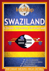
De Zuid-Afrikaanse producent InfoMap slaagt er in om voor de zuidelijke staten van Afrika uitstekende kaarten te maken. Met een heldere cartografie en een keur aan topografische informatie zijn deze kaarten goed geschikt en aan te bevelen voor diegene die zelfstandig gaat reizen in een van de zuidelijke staten van Afrika. De kaarten bevatten ook aa...
15,95

Webshops met dit product

Webshop
Bezorging
Prijs

Anderen bekeken ook

Wegenkaart - landkaart Swaziland | Infomap
De Zuid-Afrikaanse producent InfoMap slaagt er in om voor de zuidelijke staten van Afrika uitstekende kaarten te maken. Met een heldere cartografie en een keur aan topografische informatie zijn deze kaarten goed geschikt en aan te bevelen voor diegene die zelfstandig gaat reizen in een van de zuidelijke staten van Afrika. De kaarten bevatten ook aanduidingen voor tankstations, afstanden en andere praktische reisinformatie. This 3rd edition has been completely re-designed and updated making a visit to this tiny, yet exciting country, so much easier. Ruled by Africa’s last absolute monarch, King Mswati III, Swaziland is an often over-looked Southern African travel destination. Laid back, safe, with much of its traditional Swazi culture intact, Swaziland offers a different kind of holiday experience.   At around 17 000 square kilometres in size Swaziland is a landlocked country bordered by South Africa and Mozambique. Geographically the country is composed of savannah, hills and mountains…
15,95
Wegenkaart - landkaart Botswana | Infomap
Goede betrouwbare kaart van Botswana. Met GPS coordinaten. Easy to read in a vehicle Practical, user-friendly scale Extensive countrywide accommodation listing and contact details Experienced-based tips and route comments Includes many off-road tracks GPS co-ordinates of intersections Border post information Many points of interest Distances, fuel points, airports Booking details for national parks Roads and tracks in the national park and reserves Inset of Tuli Block A classic. Our Botswana map, now in its 14th edition, is one of our top sellers. From more frequented destinations such as the country’s famous game parks to other lesser known ones like Tsodilo Hills – Botswana’s World Heritage site with over 4000 rock paintings – this map is a one-stop resource for both self-drive travellers and fly-in tourists alike. Use it to navigate your way from Gaborone to Maun, from Kasane down the Hunters Road to Khubu Island, from Twee Rivieren to the Kalahari, or simply use it as a…
15,95
Wegenkaart - landkaart Zimbabwe | Infomap
Easy to read in a vehicle Various accommodation options with contact details Major and secondary roads with many off-road tracks Roads in the national parks and reserves Distances between points on major roads Border post information Points of interest   While Zimbabwe has for many years now made headlines for its economic hardships, it’s worth remembering that for a long time this country was the ‘’breadbasket of Africa’ and one of the premier wildlife destinations on the continent. A changing political landscape in the late 90’s however, virtually caused a complete collapse in the tourism industry – a vital bloodline to the economy.   Those troubled times seem to be coming to a close and Zimbabwe is back on the tourist map. Foreign visitors are slowly rising and recently the country was voted the World’s Best Tourism Destination by the World Tourism Organisation. With a wealth of tourist-sites, activities and wildlife reserves, any trip to this country will be memorable. From …
15,95
Wegenkaart - landkaart Angola | ITMB
Goede overzichtskaart van Angola met een helder kleurgebruik. Angola is a fascinating mixture of ethnicity and wealth. It is still climbing out of the morass of post-colonial rule, but is now as safe as any country for travellers. Its infrastructure, particularly its roads, are of uneven quality, and we hope that this map will stimulate visitors to write us of their experiences with travelling through this vast country. We have tried to include as much detail as possible, and as accurately as possible, given the uncertain nature of much of the base material. The map includes a decent inset of Luanda , the capital, and all areas designated as parkland. This is the latest ITM map related to Africa and completes our coverage of Central and Southern Africa. East Africa and North East Africa have also been completed, and we are now working on Equatorial Africa. This map is double-sided (north half/south half). Legend Includes: Roads by classification, ferry route, ruins, camping sites, acco…
13,95
Wegenkaart - landkaart Namibië | Infomap
Another InfoMap classic – now in its 13th edition and highly recommended!   Famous for its Namib desert, the oldest desert in the world, which straddle the western shore along the Atlantic, Namibia is country of intense beauty and seemingly unlimited space. It is a photographer’s paradise. Watch the afternoon shadows add drama to the dunes at Sossusvlei, walk through the ghost town of Kolmanskop, hike the Fish River Canyon, see the lunar landscape and Quiver trees near Keetmanshoop, experience a world transformed when the Etosha pan fills with water, or look out for the endangered cheetah of which Namibia has the highest population left in Africa.   The country is a hugely popular tourist destination that offers endless possibilities to travellers throughout all budgets and travel requirements. Tourism is one of the country’s main economic activities, with around one million tourists visiting Namibia each year. Given that the country’s population currently sits somewhere around 2 milli…
15,95
Wegenkaart - landkaart Angola | ITMB
Goede overzichtskaart van Angola met een helder kleurgebruik. Angola is a fascinating mixture of ethnicity and wealth. It is still climbing out of the morass of post-colonial rule, but is now as safe as any country for travellers. Its infrastructure, particularly its roads, are of uneven quality, and we hope that this map will stimulate visitors to write us of their experiences with travelling through this vast country. We have tried to include as much detail as possible, and as accurately as possible, given the uncertain nature of much of the base material. The map includes a decent inset of Luanda , the capital, and all areas designated as parkland. This is the latest ITM map related to Africa and completes our coverage of Central and Southern Africa. East Africa and North East Africa have also been completed, and we are now working on Equatorial Africa. This map is double-sided (north half/south half). Legend Includes: Roads by classification, ferry route, ruins, camping sites, acco…
13,95
Wegenatlas Traveller's Atlas Southern Africa - Zuidelijk Afrika | A3-F
Deze atlas omvat tien landen in zuidelijk Afrika en is speciaal gericht op reizigers die zelf rijden. De betrokken landen zijn: Angola, Botswana, Lesotho, Malawi, Mozambique, Namibië, Zuid-Afrika, Swaziland, Zambia en Zimbabwe.   De Atlas bevat 223 kaartpagina's met hetzelfde vertrouwde kaartdetail waarvoor Tracks4Africa bekend is.   De wegenatlas is afgedrukt in A3 formaat, weegt 2750g, heeft een stevige omslag, spiraal gebonden en de pagina's zijn afgedrukt op dik papier.   Bigger coverage than ever before: 1:4m maps for Southern and Eastern Africa – ideal for macro planning. 1:1m maps for Southern Africa, covering the following countries: Angola, Botswana, eSwatini, Lesotho, Malawi, Mozambique, Namibia, South Africa, Zambia and Zimbabwe. 1:500k maps for South Africa, Malawi, most part of Zambia and the area around Moremi/Chobe in Botswana. Road coverage: This Atlas is designed for overland travel and compiled from the same data used on our famous GPS maps. Use it for trip pl…
79,95

Klanten-reviews van Wegenkaart - landkaart Swaziland | Infomap

Er zijn nog geen beoordelingen voor dit productBen jij de eerste die een review plaatst?

Meer over Wegenkaart - landkaart Swaziland | Infomap

Productomschrijving

De Zuid-Afrikaanse producent InfoMap slaagt er in om voor de zuidelijke staten van Afrika uitstekende kaarten te maken. Met een heldere cartografie en een keur aan topografische informatie zijn deze kaarten goed geschikt en aan te bevelen voor diegene die zelfstandig gaat reizen in een van de zuidelijke staten van Afrika. De kaarten bevatten ook aanduidingen voor tankstations, afstanden en andere praktische reisinformatie. This 3rd edition has been completely re-designed and updated making a visit to this tiny, yet exciting country, so much easier. Ruled by Africa’s last absolute monarch, King Mswati III, Swaziland is an often over-looked Southern African travel destination. Laid back, safe, with much of its traditional Swazi culture intact, Swaziland offers a different kind of holiday experience.   At around 17 000 square kilometres in size Swaziland is a landlocked country bordered by South Africa and Mozambique. Geographically the country is composed of savannah, hills and mountains with many rivers such as the Komati, Lomati and Umbuluzi. Despite its size Swaziland boasts 17 protected areas or wildlife sanctuaries such as Mlilwane and Hlane and Mkhaya reserves that offer safari’s, accommodation options and a wide range of fauna. Wildlife include rhino, elephant, lion, leopard, kudu, buffalo and many more.   Tourist activities include hiking trails, white water rafting and cultural villages, while points of interest worth visiting include Sibebe rock (the largest exposed granite rock in the world), Swazi Candle craft market, the Royal residencies and the Umhlanga Reed Dance. This last event is one of the most memorable cultural events held at the end of August, in which thousands of young women from all over the country take part.   So whether you are flying to Mbabane or crossing the border by car, our Swaziland map will be of much use. With detailed road information, GPS coordinates, points of interest, border posts, accommodation information as well as booking information for the national parks this is the map to take with on your next Swazi holiday.
Productspecificaties

Artikelnummer(s)
Brand
Infomap
Shopblog.nl maakt gebruik van cookies. Ga je verder op onze website, ga dan akkoord met het plaatsen van cookies en de verwerking van deze data door ons en vermelde partners.