shopblog.nl
Categorieën
  Sluiten

Meer ITMB
Meer ITMB in Literatuur boeken

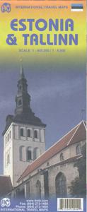
Wegenkaart - landkaart - Stadsplattegrond Estonia, Estland en Tallinn

Goede wegenkaart van Estland met bezienswaardigheden, kilometers etc. daarop aangegeven. The map displays Estonia on one side and Tallin on the other, each showing a separate index. Road networks distinguish motorways, major and minor roads with intermediate distances on connecting roads. Railways and ferry routes are also shown, while symbols clea...
13,95

Webshops met dit product

Webshop
Bezorging
Prijs

Anderen bekeken ook

Wegenkaart - landkaart - Stadsplattegrond Fleximap Dubai | Insight Gui
Geplastificeerde centrumkaart van Dubai, met register. Voor de 'gewone' toerist een handige kaart, geen groot formaat, overzichtelijk met alle belangrijke plaatsen goed weergegeven. Flexi Map Dubai is a laminated, tear-resistant map which includes 3 maps, each accompanied by separate indexes that are categorized for ease of use. The main map depicts Central Dubai at a scale of 1:15 000 and identifies places of interest, public buildings, selected hotels, parks and shopping areas. Both main and minor roads are named, car parks and one-way systems are clearly shown. The Dubai area is shown  at a scale of 1:100 000, Main roads are named, and numbered where applicable, and the Metro system is clearly marked.  An overview map of the United Arab Emirates, at a scale of 1:1 million, shows the road network with intermediate driving distances. Points of interest are shown as well as other features, such as, water springs, coral reefs, shipwrecks and offshore oilfields.   Flexi Map Dubai also gi…
9,95
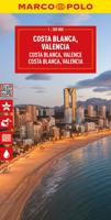
Wegenkaart - landkaart Costa Blanca Valencia Granada | Marco Polo
Goede wegenkaart van een deel van Spanje,met schaal 1:200.000: meer details dan de Michelin wegenkaarten van Spanje. Deze kaarten hebben een register, een tabel met afstanden tussen steden, enkele centrumkaarten van de meest belangrijke steden, vermelding van o.a. campings aan de hand van symbolen alsmede de bezienswaardigheden. Ook benzinepompen worden bijvoorbeeld vermeld! The map boldly stresses main roads and motorways in strong colours and selected towns in large letters, but also shows minor roads and villages in considerable detail. Road information includes toll roads, traffic restrictions and seasonal closures, gradient marking for steep roads, scenic roads and special tourist routes, etc. Motorway services clearly indicate types of facilities available there. Railway network is shown with stations and includes tourist lines Picturesque towns or villages and sites worth visiting, including areas with interesting landscape, are given star rating, and other tourist information i…
14,95
Wegenkaart - landkaart - Stadsplattegrond Fleximap Dubai | Insight Gui
Geplastificeerde centrumkaart van Dubai, met register. Voor de 'gewone' toerist een handige kaart, geen groot formaat, overzichtelijk met alle belangrijke plaatsen goed weergegeven. Flexi Map Dubai is a laminated, tear-resistant map which includes 3 maps, each accompanied by separate indexes that are categorized for ease of use. The main map depicts Central Dubai at a scale of 1:15 000 and identifies places of interest, public buildings, selected hotels, parks and shopping areas. Both main and minor roads are named, car parks and one-way systems are clearly shown. The Dubai area is shown  at a scale of 1:100 000, Main roads are named, and numbered where applicable, and the Metro system is clearly marked.  An overview map of the United Arab Emirates, at a scale of 1:1 million, shows the road network with intermediate driving distances. Points of interest are shown as well as other features, such as, water springs, coral reefs, shipwrecks and offshore oilfields.   Flexi Map Dubai also gi…
9,95
Wegenkaart - landkaart Costa Blanca Valencia Granada | Marco Polo
Goede wegenkaart van een deel van Spanje,met schaal 1:200.000: meer details dan de Michelin wegenkaarten van Spanje. Deze kaarten hebben een register, een tabel met afstanden tussen steden, enkele centrumkaarten van de meest belangrijke steden, vermelding van o.a. campings aan de hand van symbolen alsmede de bezienswaardigheden. Ook benzinepompen worden bijvoorbeeld vermeld! The map boldly stresses main roads and motorways in strong colours and selected towns in large letters, but also shows minor roads and villages in considerable detail. Road information includes toll roads, traffic restrictions and seasonal closures, gradient marking for steep roads, scenic roads and special tourist routes, etc. Motorway services clearly indicate types of facilities available there. Railway network is shown with stations and includes tourist lines Picturesque towns or villages and sites worth visiting, including areas with interesting landscape, are given star rating, and other tourist information i…
14,95
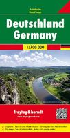
Wegenkaart - landkaart Deutschland - Duitsland | Freytag & Berndt
Gedetailleerde, eenzijdige landkaart van de Duitsland. De berijdbare wegen zijn goed weergeven, zowel de hoofdwegen als provinciale en lokale wegen; wegnummers worden vermeld. Afstanden tussen plaatsen zijn in kilometers op de kaart ingetekend, daarnaast worden ook op belangrijke plekken benzinepompen gemarkeerd. In het kaartbeeld wordt door middel van schaduw het reliëf weergegeven en soms enkele punten in het landschap met de daadwerkelijke hoogte. Provinciegrenzen zijn goed terug te vinden, nationale parken en reservaten ook. Met allerhande symbolen worden toeristische bezienswaardigheden weergegeven als monumenten, historisch belangrijke plekken en uitzichtpunten. In bepaalde plaatsen zijn hotels en campings te vinden, luchthavens, treinverbindingen en havens vindt u er ook op! Germany at 1:700,000 on a large, single-sided road map from Freytag & Berndt, with a separate extensive index booklet listing locations with postcodes and providing street plans of 18 town centres in the cou…
14,95
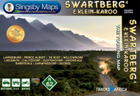
Wegenkaart - landkaart South Africa: Swartberg & Klein-Karoo | Slingsb
All roads from National Highways to minor gravel roads are shown; the many classifications that indi- cate the quality of each road help you plan your route No less than 28 mountain passes are shown — all are public roads! Distances are clearly shown; comprehensive 4 x 4 information GPS coordinates in DD MM SS format are provided for every road-junction All tourism facilities and accommodation establishments are shown in the out-of-town areas; there are insets of the major towns The map links to our maps of the Baviaanskloof, the Garden Route, Overberg and the Tankwa-Karoo Additional info:   Swartberg and Klein-Karoo region on a contoured and GPS compatible, double-sided, waterproof and   tear-resistant map at 1:160,000 from Slingsby Maps, with excellent topographic detail and plenty of tourist information, including street plans of ten main towns.   The map provides a very detailed picture of this mountainous terrain, with altitude colouring, shading, con- tours at 20m intervals and n…
29,95
Wegenkaart - landkaart Argentinië - zuid en Patagonië en Uruguay | Nel
Goede kaart van het zuiden van Argentinie, Uruguay met Patagonië. Aan beide kanten bedrukt. Met veel toeristische aanduidingen als nationale parken en culturele bezienswaardigheden. Prima leesbare kaart, scheur- en watervast! This map shows the southern 90% of Argentina, including Patagonia and Tierra del Fuego as well as Uruguay, at a scale of 1:2 500 000. The map uses shaded relief to indicate topography so that the mountains and plains are clearly visible. Roads, railroads and airports are all shown as are points of interest and tourist destinations. Distances are marked on the roads.    Inset maps show Central Buenos Aires at 1:20 000, Greater Buenos Aires1:750 000, Comodor Rivadavia1:12 000, Punta Arenas at 1:10 000 and Peninsula Valdes at 1:550 000. Details on the insets include hotels, public buildings, Gemples and Shopping areas. The Subway (Metro) is shown on the Buenos Aires map inset. The legend is in English, German, Spanish and French.   For over 20 years Nelles maps have …
11,95
Stadsplattegrond - Wegenkaart - landkaart Quito & Ecuador Central | IT
Een degelijke wegenkaart van Ecuador met aanduidingen van o.a. nationale parken, vliegveld, benzinepomp, dirt-roads en kleine plattegrond van hoofdstad. Als overzichtskaart goed te gebruiken. Finally, ITMB releases its long-awaited re-worked map of the wonderful South America city of Quito. The city is squeezed in between mountain ranges and, the entire city stretches from north (on the right-hand side of the map) to the south. The "bottom" of the map is, actually the eastern portion. A regional inset map clarifies the situation. The street network is clearly shown, along with the rapid line bus way and the city's Metro. The Old Town is perhaps the most interesting portion of the city for visitors and is on the left-hand portion of the map. The newer downtown is centered on La Carolina Park on the right-hand side of the map. This is where most of the shopping malls and hotels are located. The old airport is shown in part on the far right, but the new international airport is located fa…
13,95
Wegenkaart - landkaart Deutschland - Duitsland | Freytag & Berndt
Gedetailleerde, eenzijdige landkaart van de Duitsland. De berijdbare wegen zijn goed weergeven, zowel de hoofdwegen als provinciale en lokale wegen; wegnummers worden vermeld. Afstanden tussen plaatsen zijn in kilometers op de kaart ingetekend, daarnaast worden ook op belangrijke plekken benzinepompen gemarkeerd. In het kaartbeeld wordt door middel van schaduw het reliëf weergegeven en soms enkele punten in het landschap met de daadwerkelijke hoogte. Provinciegrenzen zijn goed terug te vinden, nationale parken en reservaten ook. Met allerhande symbolen worden toeristische bezienswaardigheden weergegeven als monumenten, historisch belangrijke plekken en uitzichtpunten. In bepaalde plaatsen zijn hotels en campings te vinden, luchthavens, treinverbindingen en havens vindt u er ook op! Germany at 1:700,000 on a large, single-sided road map from Freytag & Berndt, with a separate extensive index booklet listing locations with postcodes and providing street plans of 18 town centres in the cou…
14,95
Wegenkaart - landkaart - Stadsplattegrond Fleximap Shanghai | Insight
Geplastificeerde centrumkaart van Shanghai, met register. Voor de 'gewone' toerist een handige kaart, geen groot formaat, overzichtelijk met alle belangrijke plaatsen goed weergegeven.   Flexi Map Shanghai is laminated, tear-resistant comprising 2 separate maps featuring the city and its surroundings; each map has its own index which has been categorised for ease of use.    It includes a list - with descriptions and some photographs - of 37 recommended sights, divided by theme and linked to the mapping by numbered markers. There is also a handy information section with concise details on getting around, tourist offices, money, tipping, opening times, public holidays, telecommunications, emergency tel...ephone numbers and climate.   On one side is a street plan of the city's central districts at a scale of 1:18 500 (1cm = 0.18km). One way streets, car parks, train and metro routes are clearly shown, in addition a Metro map is located on the back cover for easy reference. Many promi…
9,95

Klanten-reviews van Wegenkaart - landkaart - Stadsplattegrond Estonia, Estland en Tallinn

Er zijn nog geen beoordelingen voor dit productBen jij de eerste die een review plaatst?

Meer over Wegenkaart - landkaart - Stadsplattegrond Estonia, Estland en Tallinn

Productomschrijving

Goede wegenkaart van Estland met bezienswaardigheden, kilometers etc. daarop aangegeven. The map displays Estonia on one side and Tallin on the other, each showing a separate index. Road networks distinguish motorways, major and minor roads with intermediate distances on connecting roads. Railways and ferry routes are also shown, while symbols clearly indicate parking and international and domestic airports.   Topography is represented by altitude colouring and graphics locate rivers, lakes, national parks and reserves, Unesco World Heritage sites, scenic spots, hotsprings etc. Symbols mark locations of various places of interest including hotels, campsites, historic ruins, castles, beaches, ports etc. International and administrative boundaries are marked. Latitude and longitude lines are drawn at intervals of 20’.   The street plan of Tallin is a clearly laid out and extends from the Gulf of Tallin to Tallin international airport and the intercity bus station in the south, the Central railway terminal in the west and the Kadriorg Art Museum in the east. The plan clearly illustrates the different types of roads with different colours, as well as the tram, intercity rail and electric trolley bus lines. Information for tourists includes monuments, information points, shopping centres, theatres, embassies, bicycle routes, walking paths etc. Separate enlargements represent Tallin Old Town at approximately 1:4,000, Tallin public transport network and Estonia’s main roads network.   The map is annotated with historical and tourist information of places of interest, it is indexed and all place names are shown transliterated only. The multilingual legend includes English.

Productspecificaties

Artikelnummer(s)
Brand
ITMB

Verken gerelateerde categorieën

Shopblog.nl maakt gebruik van cookies. Ga je verder op onze website, ga dan akkoord met het plaatsen van cookies en de verwerking van deze data door ons en vermelde partners.