shopblog.nl
Categorieën
  Sluiten

Meer ITMB

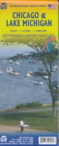
Wegenkaart - landkaart - Stadsplattegrond Chicago and the Lake Michiga

Stadsplattegrond van Chicago (1:12.500) en een overzichtskaart van Lake Michigan (1:100.000) op scheur- en watervast papier. Chicago is the third most populous city in the USA and has historically been a transportation hub. Americans have never developed trans-continental rail lines or highways and now are using O'Hare airport as one of the nation'...
13,95

Webshops met dit product

Webshop
Bezorging
Prijs

Anderen bekeken ook

Wegenkaart - landkaart - Stadsplattegrond Chicago and the Lake Michiga
Stadsplattegrond van Chicago (1:12.500) en een overzichtskaart van Lake Michigan (1:100.000) op scheur- en watervast papier. Chicago is the third most populous city in the USA and has historically been a transportation hub. Americans have never developed trans-continental rail lines or highways and now are using O'Hare airport as one of the nation's regional hubs. Historic Route 66 begins its westward trek here and all passengers from eastern cities change trains here. I-90 does pass through Chicago on its westward route, but only because Lake Michigan forces it southward. As a city, Chicago offers fabulous lakeside parks, the 'Golden Mile' of shops, the Loop, the world-class Field Museum, a number of Frank Lloyd Wright designed houses, and the Lincoln Park Zoo. Apart from updating information, this map adds two aspects of value to the previous edition. First, the reverse side now includes a regional map that encompasses Indianapolis, Detroit, Marquette and Sault Ste. Marie at the nort…
13,95
Reisgids Great Lakes and Chicago | Rough Guides
Practical travel guide to The Great Lakes & Chicago with a free eBook featuring points-of-interest structured lists of all sights and off-the-beaten-track treasures, with detailed colour-coded maps, practical details about what to see and to do in The Great Lakes & Chicago, how to get there and around, pre-departure information, as well as top time-saving tips, like a visual list of things not to miss in The Great Lakes & Chicago, expert author picks and itineraries to help you plan your trip. The Rough Guide to The Great Lakes & Chicago covers: Chicago, The rest of Illinois, Indiana, Ohio, Michigan, Wisconsin and Minnesota. Inside this travel guide you'll find: RECOMMENDATIONS FOR EVERY TYPE OF TRAVELLER Experiences selected for every kind of trip to The Great Lakes & Chicago, from off-the-beaten-track adventures in The North Shore to family activities in child-friendly places like Cleveland Metroparks Zoo Ohio or chilled-out breaks in popular tourist areas, like the Lake Erie Isla…
13,95
Stadsplattegrond Chicago | Borch
Borch Chicago is een duidelijke, geplastificeerde plattegrond van het centrum met informatie over openbaar vervoer en bezienswaardigheden. Inclusief straatnamenregister.   Our soft-laminated folded map of Chicago shows: Chicago Downtown 1:8 000, Lincoln Park 1:16 000, Hyde Park 1:20 000, Chicago & Region 1:250 000, O'Hare Airport 1: 22 500, Public Transportation CTA, Top 30 Sights and USA administrative & time zones. Borch Maps are easy to fold, durable and water-repellent with a wipeable surface. Borch Maps show hotels, museums, monuments, markets, public transport, top sights and points of interest, useful statistics, conversion charts for temperatures, weights and measurements, climate charts showing temperatures, sunshine hours, precipitation and humidity, overview maps, time zones, and much more...   Not only famous for Barack Obama and Al Capone, Chicago is also called "America's second city" or the "Windy City". Chicago is the largest city in the state of Illinois, is located on…
10,25
Wegenkaart - landkaart 3124 Great Lakes | National Geographic
Mooie kaart van de bekende kaartenmaker National Geographic. Veel details door kleurgebruik. De wegen zijn met kleuren verdeeld in drukke en minder drukke, de wegnummers zijn goed terug te vinden. De kaart onderscheidt zich van andere series door de hoeveelheid topografische details als counties, plaatsnamen en waterwegen en het bevat een register waarin het eenvoudig zoeken is. Daarnaast is de kaart gedrukt op scheur- en watervast papier.   The United States Great Lakes Adventure Map will guide you to the five Great Lakes of Superior, Michigan, Huron, Erie, and Ontario. This region of the country has used the Great Lakes as a pathway for exploration, trade and recreation for hundreds of years and these traditions still thrive as witnessed by the cities and towns that border the Great Lakes. The states of Minnesota, Wisconsin, Illinois, Michigan, Indiana, Ohio, Pennsylvania, and New York all benefit from their contact with the largest freshwater lake system on Earth. The map includes t…
17,50
Wegenkaart - landkaart 173 Great Lakes - Grote Meren USA | Michelin
Bijzonder goed leesbare kaart van een deel van de Verenigde Staten - USA, in dit geval het gebied van de staten rond de Great Lakes - Grote Meren.   Op deze kaart zijn de Nationale Parken goed zichtbaar ingetekend met een heldere achtergrondkleur. Wegnummers, register, afstanden tussen steden en bijvoorbeeld de beroemde groene wegenaanduiding van Michelin ontbreken niet.    Met stadsplattegronden (alleen het centrum) van Buffalo/Niagar Falls, Chicago, Cleveland, Detroit, Milwaukee en Toronto.   Michelin USA Great Lakes Map 173 (scale: 1:1,267,000)—part of Michelin's brand-new US regional map series with bright green covers—zooms in close for comprehensive coverage of Wisconsin and Michigan, as well as areas of the other states surrounding the Great Lakes (Minnesota, Iowa, Illinois, Indiana, Ohio, Pennsylvania) and southern Ontario in Canada. It contains city maps for easy driving in Buffalo, Chicago, Cleveland, Detroit, Indianapolis, Milwaukee, Minneapolis/St. Paul, Pittsburgh and Toro…
9,95
Wegenkaart - landkaart - Stadsplattegrond Poland east - Warsaw, Oost P
ITMB wegenkaarten en wandelkaarten kenmerken zich door het kleurgebruik waarbij zo de nadruk wordt gelegd op de natuurkundige aspecten van het land of de streek. Het soort landschap en de hoogte worden hierdoor zeer duidelijk zichtbaar. Natuurlijk vind je ook de 'gewone' zaken als wegennet, spoorwegen, vliegvelden, ferrys, toeristische bezienswaardigheden en nationale parken er op terug.. Vaak - maar niet op alle kaarten - staat op de achterzijde een stadsplattegrond van hoofdstad of belangrijkste stad in de regio.  Voorzijde: Oost Polen shcaal 1:650.000 Achterzijde: Warschau, schaal 1:9.000 This is, at the same time, our second edition updated map of Warsaw and a brand new title for ITMB, in that we have added a regional map of the eastern half of Poland to the second side of the map. This gives the end user two maps for the price of one by combining the many attractions of the city with its surrounding countryside. Anyone with a small amount of historical knowledge knows that Warsaw …
13,95

Klanten-reviews van Wegenkaart - landkaart - Stadsplattegrond Chicago and the Lake Michiga

Er zijn nog geen beoordelingen voor dit productBen jij de eerste die een review plaatst?

Meer over Wegenkaart - landkaart - Stadsplattegrond Chicago and the Lake Michiga

Productomschrijving

Stadsplattegrond van Chicago (1:12.500) en een overzichtskaart van Lake Michigan (1:100.000) op scheur- en watervast papier. Chicago is the third most populous city in the USA and has historically been a transportation hub. Americans have never developed trans-continental rail lines or highways and now are using O'Hare airport as one of the nation's regional hubs. Historic Route 66 begins its westward trek here and all passengers from eastern cities change trains here. I-90 does pass through Chicago on its westward route, but only because Lake Michigan forces it southward. As a city, Chicago offers fabulous lakeside parks, the 'Golden Mile' of shops, the Loop, the world-class Field Museum, a number of Frank Lloyd Wright designed houses, and the Lincoln Park Zoo. Apart from updating information, this map adds two aspects of value to the previous edition. First, the reverse side now includes a regional map that encompasses Indianapolis, Detroit, Marquette and Sault Ste. Marie at the northern end of the massive lake. To my knowledge, there has never been a regional map of this scale before, centred on Chicago but including Wisconsin, Michigan, Indiana, Illinois and a bit of Ohio. Second, the map is printed on ITM waterproof plastic paper for durability. As Chicago is a major arrival point for visitors to the USA, the map is perfect for those who wish to explore the region as well as the city while using only one map.   Legend Includes: Roads by classification, Accomodations, Churches, Museums, Points of Interest, Post Offices, Police Stations, Bicycle Routes, Tourist Informations, Live Theatres, Cinemas, Department Stores, Bus Terminals, Schools, Universities, Colleges, Hospitals, Buildings of Architectural Merit, Lift Bridges, Rest Areas, Lodges, International and Domestic Airports, Information Centers, Golf Courses, Port of Entry, Gas Stations, and much more.

Productspecificaties

Artikelnummer(s)
Brand
ITMB
Shopblog.nl maakt gebruik van cookies. Ga je verder op onze website, ga dan akkoord met het plaatsen van cookies en de verwerking van deze data door ons en vermelde partners.