shopblog.nl
Categorieën
  Sluiten

Meer ITMB
Meer ITMB in Literatuur boeken

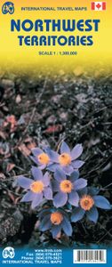
Wegenkaart - landkaart Northwest Territories | ITMB

Een degelijke kaart met aanduidingen van o.a. nationale parken, vliegveld, benzinepomp, dirt-roads en kleine plattegrond van hoofdstad. This detailed map of Canada's Northwest Territories covers the entire Territory and includes a bit of the eastern Yukon and the westernmost part of Nunavut, Great Bear and Great Slave Lakes, the high Arctic islands...
13,95

Webshops met dit product

Webshop
Bezorging
Prijs

Anderen bekeken ook

Wegenkaart - landkaart Northwest Territories | ITMB
Een degelijke kaart met aanduidingen van o.a. nationale parken, vliegveld, benzinepomp, dirt-roads en kleine plattegrond van hoofdstad. This detailed map of Canada's Northwest Territories covers the entire Territory and includes a bit of the eastern Yukon and the westernmost part of Nunavut, Great Bear and Great Slave Lakes, the high Arctic islands, and an inset map of Yellowknife (the capital). The map is printed on both sides. Legend includes roads by classification, provincial borders, time zones, lakes, rivers, glaciers, protected areas, day-use areas, visitor information centers, points of interest, skiing areas, medical services, gas stations, and other information.
13,95
Wegenkaart - landkaart Nunavut - Northwest Territories | ITMB
The far north of Canada, north of 60 degrees, consists of three territories; the Yukon, the Northwest Territories, and Nunavut. Until now, there has never been a proper map of the territory that was carved off from the NWT a quarter century ago. With only 30,000 people and a scattering of settlements, Nunavut is larger than western Europe in area. This map took us years to prepare, using 1:250,000 government topo maps as a base and tracing thousands of little lakes. The traditional passageway of the fabled Northwest Passage is also shown. The most northerly civilian community in the world is on the map – Grise Bay, as well as Alert, the most remote place on earth. Originally, the NWT covered all of northwestern North America west of the Louisiana Purchase and the Loyalist colonies, and north of the Spanish provinces (essentially north of current day Sactamento). Political changes have reduced its size over the past century and a half to the region of Canada north of the 60th parallel a…
13,95
Wegenkaart - landkaart Québec | ITMB
Een degelijke kaart met aanduidingen van o.a. nationale parken, vliegvelden en grote wegen. Als overzichtskaart goed te gebruiken. Tweezijdig. La Belle Province is historically rich, linguistically unique in North America, and attractive for tourism. It is a very large area of land, forcing us to portray the northern portion at a different scale than the more populated southern portion. The map extends to Ottawa in the west and includes most of New Brunswick in the east, as well as all the border areas with the USA to the south. Due to the size of Quebec, the focus of this map is concentrated on providing road information to get around, parks and geographic features, and symbols portraying ski resort areas, urban areas, and road numbers. A basic inset showing the major routes around Montreal is an added feature.   Legend Includes: Roads by classification, Points of Interest, Mines, Museums, Airports, National Parks, Rivers, Lakes, Mountain Peaks, Waterfalls, Border Crossings, Rest Area…
13,95
Wegenkaart - landkaart Panama | ITMB
Een degelijke kaart met aanduidingen van o.a. nationale parken, vliegveld, benzinepomp, dirt-roads en kleine plattegrond van hoofdstad. Als overzichtskaart goed te gebruiken. Panama on an indexed, double-sided map from ITMB, printed on waterproof and tear-resistant plastic paper, with large, clear street plan of central Panama City highlighting various places of interest and tourist facilities, including 18 selected hotels. The map divides the country east/west, with some overlap between the two sides. Topography is shown by altitude colouring with spot heights and names of mountain ranges. Swaps, mangrove and salt marshes are marked, and national parks or protected areas and Indian Reserves highlighted. The map shows the country’s road network with locations of petrol stations and border crossings, plus railways and local airports or landing grounds. Internal administrative boundaries are shown with names of the provinces. Symbols highlight various places of interest, archaeological s…
13,95
Wegenkaart - landkaart Western Canada | ITMB
Een degelijke kaart met aanduidingen van o.a. nationale parken, vliegveld, benzinepomp, dirt-roads. Als overzichtskaart goed te gebruiken. This is actually our second attempt at mapping the western portion of Canada; the first covered everything from northwestern Ontario to the Pacific Ocean and, while it was an excellent map, the scale that such a huge area covered necessitated severe problems. In this version, all of British Columbia, Alberta, and the Yukon have been mapped from fresh digital data and presented at 1:1.4T scale. This would have been impossible when we prepared the first map. The Northwest Territories portion had to be compressed in two ways; first, the scale is 1:2M; second, only the portion with roads is shown. This is still an extremely large area. One has to consider the actual size of Canada when designing a map. Most countries in Europe would fit into this area, which only covers 20% of Canada. The Fort McMurray forest fire of a year ago covered an area larger th…
13,95
Wegenkaart - landkaart Egypt & Cairo | ITMB
Following the so-called Arab spring of a few years ago, northern Africa experienced much turbulence. Egypt experienced the overthrow of the government, the installation of a radical religious-oriented replacement, and the installation of military governance. Tourism plummeted. Most map publishers discontinued their maps of the country. Five years later, Egypt has stabilized and tourism is growing. We feel that the time is right to re-introduce our ITMB map of Egypt. This version focuses on the portions of the country that have been re-opened for tourism, which means from the Mediterranean coastline south to the Aswan Dam. The portion further south remains closed for the moment, as is the border crossing with Sudan. We have also been forced to leave off the Great Sand Sea and the Western Desert portions for the same reason of unrest, as the border areas with Libya remain very unstable. However, we have provided a large inset map of Egypt, covering everything, in the area of desert. We h…
13,95
Wegenkaart - landkaart Québec | ITMB
Een degelijke kaart met aanduidingen van o.a. nationale parken, vliegvelden en grote wegen. Als overzichtskaart goed te gebruiken. Tweezijdig. La Belle Province is historically rich, linguistically unique in North America, and attractive for tourism. It is a very large area of land, forcing us to portray the northern portion at a different scale than the more populated southern portion. The map extends to Ottawa in the west and includes most of New Brunswick in the east, as well as all the border areas with the USA to the south. Due to the size of Quebec, the focus of this map is concentrated on providing road information to get around, parks and geographic features, and symbols portraying ski resort areas, urban areas, and road numbers. A basic inset showing the major routes around Montreal is an added feature.   Legend Includes: Roads by classification, Points of Interest, Mines, Museums, Airports, National Parks, Rivers, Lakes, Mountain Peaks, Waterfalls, Border Crossings, Rest Area…
13,95
Wegenkaart - landkaart Western Australia | ITMB
The State of Western Australia occupies the western third of the continental country of Australia. The main city is Perth, in the southwest portion, and this is the part of the State with the best land and the most people. Much of the interior is arid desert-like grassland with shallow lakes that often dry out. The road network in the south is generally paved highways and secondary roads, with one road and one rail line heading east to SZ and the rest of the country. Roads in the north tend to be dirt, with the exception of the highway going towards Darwin in NT. There are no roads through the Great Sandy Desert, but the Canning Stock Route crosses the eastern fringe, going north-south. One needs an expensive permit to drive this hazardous track. Most of the attractions of the State are to be found fairly close to the coastline. Most of the larger urban areas tend to have been named after British places, such as Albany, Exmouth, and Port Hedland, but many names have been adopted from a…
13,95

Klanten-reviews van Wegenkaart - landkaart Northwest Territories | ITMB

Er zijn nog geen beoordelingen voor dit productBen jij de eerste die een review plaatst?

Meer over Wegenkaart - landkaart Northwest Territories | ITMB

Productomschrijving

Een degelijke kaart met aanduidingen van o.a. nationale parken, vliegveld, benzinepomp, dirt-roads en kleine plattegrond van hoofdstad. This detailed map of Canada's Northwest Territories covers the entire Territory and includes a bit of the eastern Yukon and the westernmost part of Nunavut, Great Bear and Great Slave Lakes, the high Arctic islands, and an inset map of Yellowknife (the capital). The map is printed on both sides. Legend includes roads by classification, provincial borders, time zones, lakes, rivers, glaciers, protected areas, day-use areas, visitor information centers, points of interest, skiing areas, medical services, gas stations, and other information.

Productspecificaties

Artikelnummer(s)
Brand
ITMB

Verken gerelateerde categorieën

Shopblog.nl maakt gebruik van cookies. Ga je verder op onze website, ga dan akkoord met het plaatsen van cookies en de verwerking van deze data door ons en vermelde partners.