shopblog.nl
Categorieën
  Sluiten

Meer ITMB

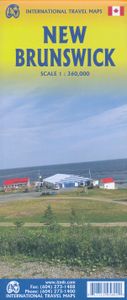
Wegenkaart - landkaart New Brunswick (Canada) | ITMB

Een degelijke kaart met aanduidingen van o.a. nationale parken, vliegveld, benzinepomp, dirt-roads en kleine plattegrond van hoofdstad. Als overzichtskaart goed te gebruiken. The Canadian province of New Brunswick, called Acadia by its original French settlers, is perhaps best known for being the source of the famous epic poem Evangeline. It is als...
13,95

Webshops met dit product

Webshop
Bezorging
Prijs

Anderen bekeken ook

Wegenkaart - landkaart New Brunswick (Canada) | ITMB
Een degelijke kaart met aanduidingen van o.a. nationale parken, vliegveld, benzinepomp, dirt-roads en kleine plattegrond van hoofdstad. Als overzichtskaart goed te gebruiken. The Canadian province of New Brunswick, called Acadia by its original French settlers, is perhaps best known for being the source of the famous epic poem Evangeline. It is also the home of the Cajun people. The British, unfairly regarding the Acadians (Cajuns), expelled thousands of them to French-controlled Louisiana in the mid-1750s. Some Acadians made the long trek back to the land they considered ‘home’, while many others re-built their lives in New Orleans. Today, the province is an industrious mix of French and English Canadians, sharing a land steeped in history. NB, for short, is the link between Central Canada and the Maritime Provinces. Historic Fredericton, Saint John, and St. Stephen retain many of the buildings built by loyalists fleeing the terror of the colonial revolution in what was to become the …
13,95
Wegenkaart - landkaart Atlantic Canada | ITMB
The first edition was published in 2000 using artwork under licence. This edition uses original ITMB artwork. Side 1 covers Nova Scotia, New Brunswick, and Prince Edward Island as well as Quebec s Magdalen Islands at a scale of 1:800,000. This side also includes the Top 10 Attractions of the three provinces. The second side is devoted to the Canadian Province of Newfoundland and Labrador, with the much smaller island portion being a half-page inset at 1:150,000 scale and the larger mainland portion being at 1:1,700,000. The northernmost tip of Quebec/Labrador belongs to Nunavut. St. Pierre et Miquelon, a French overseas possession just south of Newfoundland Island, is also included, as well as the map s only urban inset, historic St. John s, one of North America s oldest cities. The map also includes a listing of 9 Top Attractions. ITMB also publishes maps of the individual provinces, but the advantage of this regional map is that it combines together four interesting parts of Canada o…
13,95
Wegenkaart - landkaart Western Canada | ITMB
Een degelijke kaart met aanduidingen van o.a. nationale parken, vliegveld, benzinepomp, dirt-roads. Als overzichtskaart goed te gebruiken. This is actually our second attempt at mapping the western portion of Canada; the first covered everything from northwestern Ontario to the Pacific Ocean and, while it was an excellent map, the scale that such a huge area covered necessitated severe problems. In this version, all of British Columbia, Alberta, and the Yukon have been mapped from fresh digital data and presented at 1:1.4T scale. This would have been impossible when we prepared the first map. The Northwest Territories portion had to be compressed in two ways; first, the scale is 1:2M; second, only the portion with roads is shown. This is still an extremely large area. One has to consider the actual size of Canada when designing a map. Most countries in Europe would fit into this area, which only covers 20% of Canada. The Fort McMurray forest fire of a year ago covered an area larger th…
13,95
Wegenkaart - landkaart Canada | ITMB
Een degelijke kaart met aanduidingen van o.a. nationale parken, vliegveld, benzinepomp, dirt-roads en kleine plattegrond van hoofdstad. Well, it’s about time, eh?!? ITMB, after only thirty years on the go, finally gets around to publishing a map of Canada. When we first started mapping, there was a pressing need for good maps of Central and South America, then of Africa, then etc etc and we never found time to concentrate on our own country until fairly recently. This map was prepared by Natural Resources Canada and is, as a result, as accurate a map as one could hope to have. We are very proud of it, and very pleased to be able to use such top-rate cartography. The map covers all of the land mass of Canada, from its southernmost point to the top of Ellesmere Island and from the Atlantic coast to the Pacific. It’s an excellent map, but I’m going to give one proviso. Canada is the second-largest country on the face of the planet and there is no way that a single-sided sheet can portray …
13,95
Wegenkaart - landkaart Ontario | ITMB
Een degelijke kaart voor Ontario met aanduidingen van o.a. nationale parken, vliegveld, benzinepomp, dirt-roads en kleine plattegrond van Toronto, Sault Ste. Marie. Als overzichtskaart goed te gebruiken. Ontario and Quebec form the portion of Canada known as Central Canada. Ontario is the industrial heartland of the country, and the southern portion is the most densely-populated and urbanized part of Canada. Toronto is a city of 2.8M people and the heartland of an economic region serving 100,000,000 people in two countries. Southern Ontario is also home for six million residents, some of the most historic sites in the country, and major recreational land masses (Algonquin Park, Bruce Trail, Muskoka/Haliburton). Northern Ontario, on the other side of the map, occupies the bulk of the land area of the province, and is dominated by the Canadian Shield (a pre-Cambrian rock formation that is the oldest land on earth, rich in mineral wealth). The North is dominated by recreational activities…
13,95
Wegenkaart - landkaart Saskatchewan | ITMB
The Canadian province of Saskatchewan (pron sas kat CHEW wan) was formed in 1905 out of the Northwest Territories, the same as Alberta and Manitoba. It is the middle of the three prairie provinces. The southern portion is farmland, with a few areas of original prairie grasslands preserved as a national park. The rolling landscape produces much of the world’s wheat, and enormous deposits of phosphates provides the raw materials for much of the world’s fertilizers. There are two main cities – Regina and Saskatoon – and both have inset maps on the south side. Naturally, all towns and roads are included, as well as physical features. The other side of the paper shows the northern part of Sask. This is largely wilderness still, with few roads but thousands of lakes, and is a dream come true for any outdoors person – camping, fishing, hunting (in season). The province is also the headquarters of the famed RCMP, and the main training camp for police across Canada, and is also the birthplace o…
13,95

Klanten-reviews van Wegenkaart - landkaart New Brunswick (Canada) | ITMB

Er zijn nog geen beoordelingen voor dit productBen jij de eerste die een review plaatst?

Meer over Wegenkaart - landkaart New Brunswick (Canada) | ITMB

Productomschrijving

Een degelijke kaart met aanduidingen van o.a. nationale parken, vliegveld, benzinepomp, dirt-roads en kleine plattegrond van hoofdstad. Als overzichtskaart goed te gebruiken. The Canadian province of New Brunswick, called Acadia by its original French settlers, is perhaps best known for being the source of the famous epic poem Evangeline. It is also the home of the Cajun people. The British, unfairly regarding the Acadians (Cajuns), expelled thousands of them to French-controlled Louisiana in the mid-1750s. Some Acadians made the long trek back to the land they considered ‘home’, while many others re-built their lives in New Orleans. Today, the province is an industrious mix of French and English Canadians, sharing a land steeped in history. NB, for short, is the link between Central Canada and the Maritime Provinces. Historic Fredericton, Saint John, and St. Stephen retain many of the buildings built by loyalists fleeing the terror of the colonial revolution in what was to become the USA. The Bay of Fundy tidal bore and the amazing ‘magnetic’ hill that ‘tows’ cars uphill (go see for yourself) are two of the attractions of this interesting part of Canada. This map also completes our ITM mapping of each of the ten provinces and three territories of Canada. This map is double-sided. Legend Includes: Roads by classification, airfield, points of interests, national park, lakes, museum, fishing, picnic areas, camping, ski area, golf courses, gas stations, tourist information, and more.

Productspecificaties

Artikelnummer(s)
Brand
ITMB
Shopblog.nl maakt gebruik van cookies. Ga je verder op onze website, ga dan akkoord met het plaatsen van cookies en de verwerking van deze data door ons en vermelde partners.