shopblog.nl
Categorieën
  Sluiten

Meer ITMB

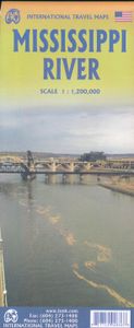
Wegenkaart - landkaart Mississippi river | ITMB

This is the third River map that we have published (the Amazon and Nile having been in print for several years). Old Miss’ is one of America’s paramount features. Starting from its delta in New Orleans, side one covers the states of Louisiana, Mississippi, and Arkansas as it passes Memphis and St. Louis, where it intersects with Route 66. The secon...
13,95

Webshops met dit product

Webshop
Bezorging
Prijs

Anderen bekeken ook

Wegenkaart - landkaart Mississippi river | ITMB
This is the third River map that we have published (the Amazon and Nile having been in print for several years). Old Miss’ is one of America’s paramount features. Starting from its delta in New Orleans, side one covers the states of Louisiana, Mississippi, and Arkansas as it passes Memphis and St. Louis, where it intersects with Route 66. The second side continues north through Illinois, Iowa, Wisconsin, and Minnesota to Minneapolis to its origins near Grand Rapids. This is essentially the area passed over to the Americans by Napoleon Bonaparte in exchange for money he desperately needed to carry on his wars to dominate Europe. The Louisiana Purchase tripled the size of the United States in 1803 and ended the strife that had bedevilled British North American realities from the 1740s. As a result, this map represents the true heartland of America, replete with history and the American dream. Coverage is from the Canadian border to the Gulf of Mexico and from Chicago west to Kansas City.…
13,95
Wegenkaart - landkaart New Orleans - Mississippi River Basin | ITMB
New Orleans stadsplattegrond met schaal 1:15.000, bijzonder uitgebreid. ITMB is pleased to continue its detailed coverage of the USA with its first-ever map of the historic City of New Orleans. The urban area was settled by the French, and was the capital of the vast Louisiana Territory for many years. Napoleon, needing money to fight his many wars, sold the colony to the USA, in 1803, doubling the size of the new American nation overnight. The French Quarter, with buildings dating back 300 years, is the heart of the city and home to dozens of jazz emporiums. The British expulsion of the Acadians from what is now the Canadian provinces of Nova Scotia and New Brunswick, added a vibrant component to the city, creating the concept of the Cajuns. The oldest cathedral in the USA, St Louis, has dominated the city's skyline since 1794, opened just as the French Revolution was at its height. The city offers much more than just music, however, The Louisiana State Museum is where the agreement t…
13,95
Wegenkaart - landkaart Liechtenstein & Oostenrijk West | ITMB
Europe is dotted with mini-states that exist solely for historic reasons but are fiercely independent. Liechtenstein, surrounded by Switzerland on its west and south and Austria on its other borders, is such a state. It is larger and more diverse than many imagine and is quite a popular ski resort region. Side 1 is a detailed map of the principality, framed on the west by the Rhine River and a bit of Switzerland and on the east by Austria. Most development occurs in the Rhine Valley in a north-south direction, dominated by the capital city of Vaduz. There are five access points from Switzerland across the Rhine, one from the south, and two from Austria in the north. The ski haven of Malbun is prominently shown, and the scale of the map is detailed enough to name every major street. This also enabled us the opportunity to include schools, shopping areas, post offices, and churches, as well as a wide range of eating establishments. Walking/hiking trails have also been included. This is t…
14,95
Wegenkaart - landkaart Litouwen & Letland | ITMB
ITMB is very pleased to release its first-ever map of the Baltic country of Lithuania, which occupies Side 1 of this double-sided map. It is bordered by Latvia on its north, the Russian enclave of Kalingrad on its southeast, and Poland and Belarus on its south and east. It is now on the front lines of tension between Russia and its neighbours, as are all the Baltic states. It is also a valued member of both NATO and the EU, and as such is easy to access from either Poland or Latvia. Lithuania fronts on to the Baltic Sea with a major port at Klaipeda (formerly Memel), with its capital being Vilnius. Historically, the country has suffered German and Russian invasions during the 20th century, the last of which resulted in the country losing its independence completely by being absorbed into the Russian Empire in the latter stages of WW2. It regained its independence in 1991, with the collapse of the USSR and shortly thereafter applied to join both the European Union and NATO. Touristicall…
14,95
Wegenkaart - landkaart Portland & Oregon | ITMB
This is a brand new title from ITMB. Portland is the largest city in the American state of Oregon. It is not the capital; that distinction belongs to Salem, about 50 miles to the south, but Portland is an actual sea-going port, although it is a hundred miles away from the ocean. It is situated on the majestic Columbia River, which at one time formed the border between British-controlled Canada and the emerging United States. That changed after 1842, with the Oregon Treaty, under which both governments agreed to "share" the territory. At that time, the British capital was Astoria, a lovely town at the mouth of the Columbia, but the Governor, realizing that sharing with the Americans meant capitulation to the Americans, moved the capital north to Victoria, on what was then designated a separate colony. Regardless, today both Portland and the State of Oregon present some of the nicest scenery in America. Our portrayal of the city goes from the Northwest Freemont Bridge in the north (the I…
13,95
Wegenkaart - landkaart Guam - West Pacific Cruising | ITMB
Een degelijke kaart met aanduidingen van o.a. nationale parken, vliegveld, benzinepomp, dirt-roads. Als overzichtskaart goed te gebruiken. Certainly, this is the only map of Guam by any major cartographic publishing house. Here are some details: Guam is a north-south island considerably north of New Guinea, and forms part of the American-held group of islands known as the Northern Marianas. Its capital is Hagatna, and the main town is called Tamuning. The island has a well-developed international airport in the middle portion of the island, with a large US military airbase in the northeast corner. The vast majority of the island is touristic, and well worth a visit. The island was "discovered" by Ferdinand Magellan in 1521, and Hagatna is the oldest "European" city in the Pacific, dating from 1686. The town of Inarajan retains a decidedly Spanish appearance to this day. Other attractions include Tumon Beach and its many resorts, the Piti Underwater Observatory, and the famous Cocos Isl…
13,95

Klanten-reviews van Wegenkaart - landkaart Mississippi river | ITMB

Er zijn nog geen beoordelingen voor dit productBen jij de eerste die een review plaatst?

Meer over Wegenkaart - landkaart Mississippi river | ITMB

Productomschrijving

This is the third River map that we have published (the Amazon and Nile having been in print for several years). Old Miss’ is one of America’s paramount features. Starting from its delta in New Orleans, side one covers the states of Louisiana, Mississippi, and Arkansas as it passes Memphis and St. Louis, where it intersects with Route 66. The second side continues north through Illinois, Iowa, Wisconsin, and Minnesota to Minneapolis to its origins near Grand Rapids. This is essentially the area passed over to the Americans by Napoleon Bonaparte in exchange for money he desperately needed to carry on his wars to dominate Europe. The Louisiana Purchase tripled the size of the United States in 1803 and ended the strife that had bedevilled British North American realities from the 1740s. As a result, this map represents the true heartland of America, replete with history and the American dream. Coverage is from the Canadian border to the Gulf of Mexico and from Chicago west to Kansas City. A list of Top Attractions is included.

Productspecificaties

Artikelnummer(s)
Brand
ITMB
Shopblog.nl maakt gebruik van cookies. Ga je verder op onze website, ga dan akkoord met het plaatsen van cookies en de verwerking van deze data door ons en vermelde partners.