shopblog.nl
Categorieën
  Sluiten

Meer Freytag & Berndt
Meer Freytag & Berndt in Literatuur boeken

Wegenkaart - landkaart Midden Europa - Centraal Europa - Central Europ

Explore Central Europe with this Freytag & Berndt road map. The best way to plan your trip, prepare your itinerary, and to travel independently in this part of Europe. This map covers Germany, Poland, the Czech and Slovak Republics, Hungary, Austria, Liechtenstein, Slovenia, Croatie, Bosnia Herzegovina, Serbia, Kosovo, Montenegro, Albania, Italy, S...
14,95

Webshops met dit product

Webshop
Bezorging
Prijs

Anderen bekeken ook

Wegenkaart - landkaart Midden Europa - Centraal Europa - Central Europ
Explore Central Europe with this Freytag & Berndt road map. The best way to plan your trip, prepare your itinerary, and to travel independently in this part of Europe. This map covers Germany, Poland, the Czech and Slovak Republics, Hungary, Austria, Liechtenstein, Slovenia, Croatie, Bosnia Herzegovina, Serbia, Kosovo, Montenegro, Albania, Italy, Switzerland, Grand-Duchy of Luxembourg, Belgium, Netherlands, Denmark, as well as the east part of France, Corsica, and southern Sweden. Main roads such as motorways, dual-carriageways and highways are shown, as are some minor roads. National boundaries are clearly marked, with railways, airports, ferry routes all clearly marked. Intermediate driving distances between locations are shown in kilometres alongside the road. This map is ideal for route-planning, the legend is in several languages including English.
14,95
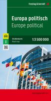
Wegenkaart - landkaart Europa politiek | Freytag & Berndt
Explore Europe with this Freytag & Berndt one-sided road map. The best way to plan your trip, prepare your itinerary, and to travel independently in the European continent. This is a political map, so each country has its own colour.   Main roads such as motorways, dual-carriageways and highways are shown, as are some minor roads. National boundaries are clearly marked, with railways, airports, ferry routes all clearly marked. Intermediate driving distances between locations are shown in kilometres alongside the road.   This map is ideal for route-planning, the legend is in several languages including English.
14,95
Wegenkaart - landkaart Europa politiek | Freytag & Berndt
Explore Europe with this Freytag & Berndt one-sided road map. The best way to plan your trip, prepare your itinerary, and to travel independently in the European continent. This is a political map, so each country has its own colour.   Main roads such as motorways, dual-carriageways and highways are shown, as are some minor roads. National boundaries are clearly marked, with railways, airports, ferry routes all clearly marked. Intermediate driving distances between locations are shown in kilometres alongside the road.   This map is ideal for route-planning, the legend is in several languages including English.
14,95
Wegenkaart - landkaart 738 Roemenië - Roemenie | Michelin
Zoals je van Michelin mag verwachten is deze kaart zeer overzichtelijk en heeft een duidelijk helder kaartbeeld. De kaart geeft uitgebreid toeristische informatie weer. Met register, afstanden en reistijden. Wegen worden naar verschillende klasse ingedeeld en - mooi van Michelin - de interessante mooie routes worden gemarkeerd met een groene streep.    Hindernissen voor automobilisten met caravans zijn gemarkeerd: steile hellingen, bergpassen of een anderzins moeilijke route. Bezienswaardigheden als een kasteel, religieus gebouw, ruine of grot is door een symbool goed te vinden.   The Michelin national road map of Romania at 1:750,000 scale is best suited to trip & route planning. The map gives comprehensive coverage of national road networks showing major motorways, dual carriageways, national & regional main roads and some smaller local roads. Unsurfaced roads and tracks and some major footpaths are also shown. The map shows useful motoring information for motorways and major roads -…
11,95
Wegenkaart - landkaart Africa east & central - Afrika oost en centraal
This is the latest map from our growing digital data base on Africa. One side of this map concentrates on the five countries of what is generally known as East Africa - Kenya, Uganda, Tanzania, Rwanda, Burundi, with bits of neighboring countries thrown in. The second side covers what has always been called Central Africa, probably because it was once British Central Africa. This is Zambia,Zimbabwe, and Malawi, with the northern half of Mozambique and the Okavango delta included, as well as a bit of DEM Congo. The map covers a vast portion of the African continent and includes a diverse ethnic and geographic reality. We have tried to categorize roads by condition, but the reality of Africa is that some main roads are in pretty poor condition. Some secondary roads are not shown as being as good as they probably are, but verifying data for Africa is difficult. This is our first map of this part of the world based on GIS Data. As such, it is much more precisely accurate than anything done …
13,95
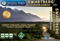
Wegenkaart - landkaart South Africa: Swartberg & Klein-Karoo | Slingsb
All roads from National Highways to minor gravel roads are shown; the many classifications that indi- cate the quality of each road help you plan your route No less than 28 mountain passes are shown — all are public roads! Distances are clearly shown; comprehensive 4 x 4 information GPS coordinates in DD MM SS format are provided for every road-junction All tourism facilities and accommodation establishments are shown in the out-of-town areas; there are insets of the major towns The map links to our maps of the Baviaanskloof, the Garden Route, Overberg and the Tankwa-Karoo Additional info:   Swartberg and Klein-Karoo region on a contoured and GPS compatible, double-sided, waterproof and   tear-resistant map at 1:160,000 from Slingsby Maps, with excellent topographic detail and plenty of tourist information, including street plans of ten main towns.   The map provides a very detailed picture of this mountainous terrain, with altitude colouring, shading, con- tours at 20m intervals and n…
29,95
Wegenkaart - landkaart 717 Luxemburg 2024 | Michelin
Zoals je van Michelin mag verwachten is deze kaart zeer overzichtelijk en heeft een duidelijk helder kaartbeeld. De kaart geeft uitgebreid toeristische informatie weer. Met stadsplattegrond van de hoofdstad. The Michelin National road map of the Grand Duchy of Luxembourg at 1:150,000 scale is ideal for trip & route planning and touring. The map gives comprehensive coverage of national road networks showing all major motorways, dual carriageways, national & regional main roads and some single-lane roads. Also shows unsurfaced roads, tracks, and major footpaths. The map is divided by grid showing latitude and longitude. Distances between major locations are marked along roads, with total distance and several intermediate distances shown. A quick-reference chart of distances & driving times between major locations is also included. The map also includes a grid-referenced index of principal place names.   Clear, easy-to read cartography shows roads in reds, yellows and white with black out…
11,95
Wegenkaart - landkaart 563 Centraal Italië - Toscane, Umbrië, San Mari
Zoals je van Michelin mag verwachten zijn het onmisbare overzichtskaarten van een uitstekende kwaliteit: een duidelijk en goed leesbaar kaartbeeld.  Vrijwel alle berijdbare wegen staan er op ingetekend, in kleur verschillend voor grote en kleine wegen. Andere weginformatie omvat bijvoorbeeld kilometer-afstanden, tolwegen, helling-aanduiding, winterafsluitingen, tankstations maar ook de bekende groene routes: de mooiste wegen om te rijden.   Daarnaast geeft de kaart toeristische informatie met symbolen weer: bezienswaardigheden als kastelen, kloosters, musea, maar ook campings (niet allemaal overigens). De kaart is voorzien van een 4-talige legenda.   Toch hebben de makers door een beperkt gebruik van symbolen geen drukke kaart gemaakt. De kracht zit hem dan ook in de combinatie van meer dan voldoende informatie en goede leesbaarheid.  Part of the orange regional series from Michelin, this Italy  map shows this part of Italy in excellent detail. Primary & secondary road networks are cle…
11,95

Klanten-reviews van Wegenkaart - landkaart Midden Europa - Centraal Europa - Central Europ

Er zijn nog geen beoordelingen voor dit productBen jij de eerste die een review plaatst?

Meer over Wegenkaart - landkaart Midden Europa - Centraal Europa - Central Europ

Productomschrijving

Explore Central Europe with this Freytag & Berndt road map. The best way to plan your trip, prepare your itinerary, and to travel independently in this part of Europe. This map covers Germany, Poland, the Czech and Slovak Republics, Hungary, Austria, Liechtenstein, Slovenia, Croatie, Bosnia Herzegovina, Serbia, Kosovo, Montenegro, Albania, Italy, Switzerland, Grand-Duchy of Luxembourg, Belgium, Netherlands, Denmark, as well as the east part of France, Corsica, and southern Sweden. Main roads such as motorways, dual-carriageways and highways are shown, as are some minor roads. National boundaries are clearly marked, with railways, airports, ferry routes all clearly marked. Intermediate driving distances between locations are shown in kilometres alongside the road. This map is ideal for route-planning, the legend is in several languages including English.

Productspecificaties

Artikelnummer(s)
Brand
Freytag & Berndt

Verken gerelateerde categorieën

Shopblog.nl maakt gebruik van cookies. Ga je verder op onze website, ga dan akkoord met het plaatsen van cookies en de verwerking van deze data door ons en vermelde partners.