shopblog.nl
Categorieën
  Sluiten

Meer TerraQuest

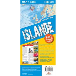
Wegenkaart - landkaart Map & Guide ijsland / Islande | TerraQuest

Een wegenkaart van IJsland met schaal 1:615.000. De kracht zit hem in het feit dat deze kaart in delen is geplastificeerd en daardoor ook - ondanks de plastic laag - makkelijk in delen is te vouwen.    Inclusief kleine plattegronden van Reykjavik en Akureyri en op de achterzijde van de kaart een kleine reisgids met de top bezienswaardigheden en pra...
12,50

Webshops met dit product

Webshop
Bezorging
Prijs

Anderen bekeken ook

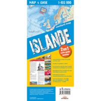
Wegenkaart - landkaart Map & Guide ijsland / Islande | TerraQuest
Een wegenkaart van IJsland met schaal 1:615.000. De kracht zit hem in het feit dat deze kaart in delen is geplastificeerd en daardoor ook - ondanks de plastic laag - makkelijk in delen is te vouwen.    Inclusief kleine plattegronden van Reykjavik en Akureyri en op de achterzijde van de kaart een kleine reisgids met de top bezienswaardigheden en praktische informatie.     Une carte routière de l'Islande à l'échelle 1:615 000. Sa force réside dans le fait que cette carte est plastifiée en plusieurs parties et donc - malgré la couche de plastique - facile à plier en plusieurs parties.   Y compris de petites cartes de Reykjavik et d'Akureyri et au dos de la carte un petit guide de voyage avec les principaux sites touristiques et des informations pratiques.
12,50
Wegenkaart - landkaart 750 IJsland | Michelin
Zoals je van Michelin mag verwachten is deze kaart zeer overzichtelijk en heeft een duidelijk helder kaartbeeld. De kaart geeft uitgebreide toeristische informatie weer. De perfecte overzichtskaart! Deze wegenkaart uit de serie van Michelin heeft een schaal van 1:500.000. Met een plaatsnamenregister, afstandstabel, toeristische bezienswaardigheden en stadsplattegronden van Reykjavik en Akureyri.  Akureyri, Egilsstaðir, Höfn, Ísafjörður, Islande, Reykjavik
11,95
Wegenkaart - landkaart Adventure map Iceland - IJsland | TerraQuest
De kracht zit hem in het feit dat deze kaart in delen is geplastificeerd en daardoor ook - ondanks de plastic laag - makkelijk in delen is te vouwen.  Van het gebeid Skogar - Landmannalaugar is een detailkaart 1:75.000 ingevoegd. Terraquest say 'TerraQuest maps are designed and developed primarily for tourists preparing for treks to remote corners of the world. Our proven map laminating technology allows you to freely use the maps even in harsh conditions, while appreciating the clear and easy-to-read information compiled by our team of qualified cartographers. The distinctive feature of terraQuest laminated maps is the manufacturing method. Due to a special lamination process and patented map joining techniques, the maps easily adjust to your choice of format , even for one-hand use only. They are exceptionally durable and may be folded repeatedly. You can also add and erase your own notes directly onto the map with an erasable pen without damage to the map'
12,50
Wegenkaart - landkaart 617 Plages du Débarquement | Invasiestranden D-
Toeristische wegenkaart van een deel van Fraknrijk. Op de ene zijde een een Michelin kaart afgebeeld op een schaal van ca. 1:200.000, het gaat hier om de originele Michelin wegenkaart met alle postieve aspecten die hier bij horen: duidelijk kaarttbeeld met toch veel detail. Daarnaast enkele plattegronden (het centrum) van de belangrijkste steden in dat gebied. Op de achterzijde (in het Frans) vindt u beknopt de hoogetepunten beschreven van de streek met leuke dingen om te doen of te zien.   Deze kaart is gedrukt op speciaal papier en is daardoor scheur- en watervast: een duurzame kaart! NOUVELLE carte routière et touristique MICHELIN : l évasion à la carte ! Lisible et détaillée, la NOUVELLE carte Plages du débarquement - Presqu’île du Cotentin au 1 / 200 000 (1cm = 2 km) contient les informations essentielles pour partir à la découverte de la région : les sites étoilés du Guide Vert visibles en un coup d'oeil, les incontournables et les coups de coeur des éditeurs, les routes pittores…
10,50
Wegenkaart - landkaart Adventure map Cuba | TerraQuest
De kracht zit hem in het feit dat deze kaart in delen is geplastificeerd en daardoor ook - ondanks de plastic laag - makkelijk in delen is te vouwen.  Inclusief gedetailleerde plattegronden van Havana (1:17.000) en Varadero (1:50.000) Terraquest say 'TerraQuest maps are designed and developed primarily for tourists preparing for treks to remote corners of the world. Our proven map laminating technology allows you to freely use the maps even in harsh conditions, while appreciating the clear and easy-to-read information compiled by our team of qualified cartographers. The distinctive feature of terraQuest laminated maps is the manufacturing method. Due to a special lamination process and patented map joining techniques, the maps easily adjust to your choice of format , even for one-hand use only. They are exceptionally durable and may be folded repeatedly. You can also add and erase your own notes directly onto the map with an erasable pen without damage to the map'
12,50
Wegenkaart - landkaart 3302 Adventure Map Iceland - IJsland | National
Wegenkaart van IJsland met vermelding van veel bezienswaardigheden, nationale parken en attrakties. Watervast en scheurvast. Juist door deze vermeldingen onderscheidt de kaart zich van andere wegenkaarten. National Geographic's Iceland Adventure Map is designed to meet the unique needs of adventure travelers—detailed, durable, and accurate. Iceland includes the locations of thousands of cities and towns with an index for easily locating them, plus a clearly marked road network complete with distances and designations for expressways, motorways, and more. Transportation within and beyond the country is made easier with the locations of airports, airfields, railroads, ferry routes, and lighthouses. What sets National Geographic Adventure Maps apart from traditional road maps are the hundreds of points of interest that highlight the diverse and unique destinations within Iceland. Outdoor activities abound on the island and activity symbols note popular locations to ski, golf, camp, fish, …
17,50
Wegenkaart - landkaart 758 Turkije | Michelin
Zoals je van Michelin mag verwachten is deze kaart zeer overzichtelijk en heeft een duidelijk helder kaartbeeld. De kaart geeft uitgebreid toeristische informatie weer. Met register, afstanden en reistijden.   Wegen worden naar verschillende klasse ingedeeld en - mooi van Michelin - de interessante mooie routes worden gemarkeerd met een groene streep. Hindernissen voor automobilsiten met caravans zijn gemarkeerd: steile hellingen, bergpassen of een anderzins moeilijke route. Bezienswaardigheden als een kasteel, religieus gebouw, ruine of grot is door een symbool goed te vinden.   Van de uitgever Une carte routière et touristique Michelin pour être maître de votre itinéraire : • Mise à jour régulièrement • Une vue d'ensemble claire de la Turquie • Une cartographie précise et ultra lisible • Echelle : 1/1 000 000 (1cm = 10km) • Les plus : tableau des distances et des temps de parcours, index des localités, légende intuitive • Plans : Ankara et Istanbul Pensez à utiliser en complément not…
11,95

Klanten-reviews van Wegenkaart - landkaart Map & Guide ijsland / Islande | TerraQuest

Er zijn nog geen beoordelingen voor dit productBen jij de eerste die een review plaatst?

Meer over Wegenkaart - landkaart Map & Guide ijsland / Islande | TerraQuest

Productomschrijving

Een wegenkaart van IJsland met schaal 1:615.000. De kracht zit hem in het feit dat deze kaart in delen is geplastificeerd en daardoor ook - ondanks de plastic laag - makkelijk in delen is te vouwen.    Inclusief kleine plattegronden van Reykjavik en Akureyri en op de achterzijde van de kaart een kleine reisgids met de top bezienswaardigheden en praktische informatie.     Une carte routière de l'Islande à l'échelle 1:615 000. Sa force réside dans le fait que cette carte est plastifiée en plusieurs parties et donc - malgré la couche de plastique - facile à plier en plusieurs parties.   Y compris de petites cartes de Reykjavik et d'Akureyri et au dos de la carte un petit guide de voyage avec les principaux sites touristiques et des informations pratiques.

Productspecificaties

Artikelnummer(s)
Brand
TerraQuest
Shopblog.nl maakt gebruik van cookies. Ga je verder op onze website, ga dan akkoord met het plaatsen van cookies en de verwerking van deze data door ons en vermelde partners.