shopblog.nl
Categorieën
  Sluiten

Meer ITMB

Wegenkaart - landkaart Denver and Colorado | ITMB

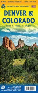
Een degelijke kaart met aanduidingen van o.a. nationale parken, vliegveld, benzinepomp, dirt-roads en kleine plattegrond van hoofdstad. Als overzichtskaart goed te gebruiken. This is a brand new title for ITMB. Denver, the ‘mile-high’ city on the eastern slopes of the Rocky Mountains, is a vibrant, fairly modern city. It is the state capital, and t...
13,95

Webshops met dit product

Webshop
Bezorging
Prijs

Anderen bekeken ook

Wegenkaart - landkaart Denver and Colorado | ITMB
Een degelijke kaart met aanduidingen van o.a. nationale parken, vliegveld, benzinepomp, dirt-roads en kleine plattegrond van hoofdstad. Als overzichtskaart goed te gebruiken. This is a brand new title for ITMB. Denver, the ‘mile-high’ city on the eastern slopes of the Rocky Mountains, is a vibrant, fairly modern city. It is the state capital, and the gold-coated dome of the legislative building highlights the wealth and strength of the state. The Denver Zoo is becoming one of the great attractions of the city, as are the Center for Performing Arts and the Museum of Science and Nature. Larimer Square is the focal point for entertainment, and Coors Field for sports. Our map shows a wide-ranging number of accommodations and eateries, and notes all points of interest. The State of Colorado map fills the reverse side of the sheet and, due to the positioning of the state’s boundaries, nicely fills the 40x28 sheet size of the map. Small portions of neighbouring states show around the edges, b…
13,95
Wegenkaart - landkaart Yellowstone National Park and Wyoming | ITMB
The USA is a vast and wonderful land to explore. ITMB is steadily increasing our coverage of this important travel destination and this month concentrates on the State of Wyoming, with a detailed travel map on one side, including small portions of adjacent states of Utah, Colorado, Nebraska, South Dakota, Montana, and Idaho. The state is lightly populated, with Cheyanne as its capital and main city. Interstates 80 and 90 both traverse the state, with Interstate 25 being the only north-south motorway. Yellowstone National Park occupies the northwest corner of the state and also occupies the second side of the sheet with an extremely detailed map. Yellowstone is the first area in the world to be proclaimed as a national protected area (Banff was second), and Yellowstone remains the paramount preserved wilderness environment in the world. There are several small urban areas within the park for accommodations and servicing, such as West Thumb, Canyon City, and Mammoth Hot Springs. The main…
13,95
Wegenkaart - landkaart Brisbane & Queensland | ITMB
Australia is a very large country. It is also very unevenly populated, with most of the people living close to the eastern coast. Brisbane is the second-largest city in Australia, and the preferred landing spot for most international flights. This makes Brisbane an attractive point of entry to Australia for visitors. The city has several attractions, which are noted on the map, several transit lines, also noted, and an interesting ferry boat system along the Brisbane River. The city is also the capital of Queensland, which occupies the north-east quarter of the continent and fills the second side of the map. Our map of the state stretches from the northern tip of Cape York to beyond the southern boundary of the state to just south of Sydney, in New South Wales. An inset map of central Sydney is included, but the strength of the map is the fact that Queensland is covered in excellent detail. ITMB also has a separate map of Sydney.   Legend Includes: Roads by classification, Rivers and L…
13,95
Wegenkaart - landkaart Tasmania & Victoria | ITMB
Een degelijke wegenkaart van Tasmanie & Victoria, schaal 1:1.800.000, en Tasmanië, schaal 1:800.000 met aanduidingen van o.a. nationale parken, vliegveld, benzinepomp, dirt-roads. Als overzichtskaart goed te gebruiken. The island of Tasmania is Australia’s smallest state, but is packed with touristic delights. Hobart is the capital and a charming Victorian city in the south of the island. Much of the west coast is a large nature preserve with limited access and most development is close to the northern shore, centred on Devonport and its ferry connections with Melbourne, in Victoria State. Tasmania also administers several offshore islands, such as King, Flinders, and Bruny. We have included a Top Attractions listing for the reader to enjoy. The other side of the sheet is the Australian mainland state of Victoria, best known as the home of Melbourne and the beautiful coastal highway to Adelaide. A basic inset map of Melbourne is included, but the focus of the map is on the recreational…
13,95
Wegenkaart - landkaart Muscat / Oman | ITMB
The very name Muscat and Oman entices one! The peninsula at the access point to the Persian/Arabian Gulf sounds very exotic – and it is! This double-sided map focuses on the city and region of Muscat on side one at a detailed scale, noting the Grand Mosque, the Mutrah Souk, and the Royal Opera House as well as showing hotels, shopping areas, and other sites of touristic interest. Muscat used to be a British protectorate, but is now part of Oman, albeit physically separated from it by a portion of the UAE. The country fills side 2. Oman is portrayed as a north-south alignment, as it is long and not particularly wide, and nicely fills the sheet, with an inset of Salalah, close to the Yemeni border. Connections to nearby Abu Dhabi and Dubai are also shown. Oman is a haven of peaceful co-existence, and tourists are welcome, so this map is designed to encourage visitors
13,95
Wegenkaart - landkaart USA Verenigde Staten | ITMB
Een degelijke kaart met aanduidingen van o.a. nationale parken, vliegveld, benzinepomp, dirt-roads en kleine plattegrond van hoofdstad. Als overzichtskaart goed te gebruiken. United States of America (USA) Travel Reference Map has been mapped before, but the USA is a huge country, extremely developed, and almost impossible to show on a map without over-simplification. Most commercial maps use small sheets of paper and print single-sided, making it impossible to show this vast country to advantage. Well, Lan’s been hard at work developing a ‘proper’ traveller’s aid to navigating around the USA, and here it is. We printed it on an exceptionally large sheet of paper, 39” tall by 54” wide (our normal printing size is 27”x39”). To do this, we merged our four existing databases into one, then split them so that the west side is on one side and the east side on the other. What results is a very large sheet, but a map at a VERY good scale. We were able to fit in 6,765 urban areas, all the Inte…
13,95

Klanten-reviews van Wegenkaart - landkaart Denver and Colorado | ITMB

Er zijn nog geen beoordelingen voor dit productBen jij de eerste die een review plaatst?

Meer over Wegenkaart - landkaart Denver and Colorado | ITMB

Productomschrijving

Een degelijke kaart met aanduidingen van o.a. nationale parken, vliegveld, benzinepomp, dirt-roads en kleine plattegrond van hoofdstad. Als overzichtskaart goed te gebruiken. This is a brand new title for ITMB. Denver, the ‘mile-high’ city on the eastern slopes of the Rocky Mountains, is a vibrant, fairly modern city. It is the state capital, and the gold-coated dome of the legislative building highlights the wealth and strength of the state. The Denver Zoo is becoming one of the great attractions of the city, as are the Center for Performing Arts and the Museum of Science and Nature. Larimer Square is the focal point for entertainment, and Coors Field for sports. Our map shows a wide-ranging number of accommodations and eateries, and notes all points of interest. The State of Colorado map fills the reverse side of the sheet and, due to the positioning of the state’s boundaries, nicely fills the 40x28 sheet size of the map. Small portions of neighbouring states show around the edges, but the focal point is definitely north-south Interstate 25 and east-west Interstate 70. Denver is, by far, the largest urban area in the state, but other familiar cities show well – Boulder, Colorado Springs, the ski resort of Vail, Kit Carson’s home town of Burlington, and the old mining town of Silverton. The map shows all motorways and highways and, as far as we can determine, every road going anywhere. Hundreds of wilderness campsites are shown, as well as RV parks, parks, ancient ruins, and natural features. Legend Includes: Major Highway, Trail, Railway, Attraction, Park, Lake, Point of interest, Notable Building, Hotel, Restaurant, Railway Station, Car Park, Zoo, Golf Course etc.

Productspecificaties

Artikelnummer(s)
Brand
ITMB
Shopblog.nl maakt gebruik van cookies. Ga je verder op onze website, ga dan akkoord met het plaatsen van cookies en de verwerking van deze data door ons en vermelde partners.