shopblog.nl
Categorieën
  Sluiten

Meer Goldeneye

Wegenkaart - landkaart Cotswolds map and guide | Goldeneye

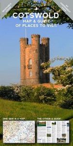
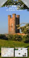
Detailkaart op schaal 1:126.000 van de Cotswolds. Veel detail, met veel symbolen worden ook de toeristische hoogtepunten weergegeven.  This was the first publication I produced. A Map-Guide close to my heart, and one that I believe improves with age. It was the acorn that set off my oak tree and remains to this day, my favourite publication. It i...
15,95

Webshops met dit product

Webshop
Bezorging
Prijs

Anderen bekeken ook

Wegenkaart - landkaart Cotswolds map and guide | Goldeneye
Detailkaart op schaal 1:126.000 van de Cotswolds. Veel detail, met veel symbolen worden ook de toeristische hoogtepunten weergegeven.  This was the first publication I produced. A Map-Guide close to my heart, and one that I believe improves with age. It was the acorn that set off my oak tree and remains to this day, my favourite publication. It is the simple combination of the Map and the Guide that makes exploring the Cotswolds such a pleasure.   • Where to Go, What to See, What to Do... and Where to Eat & Drink... • The ideal publication for a short break, a long weekend, or your first-ever visit to the Cotswolds... • Save time and money by choosing this practical combination of a Leisure Map, backed up by a Travel Guide with 5 Scenic Drives (car tours) described and highlighted on the Map   The Leisure Map • The ideal scale for touring @ 1:126,720 (2 miles to 1 inch) • Tourist Attractions/Inns With Rooms/Hotels are illustrated • Altitude Layering indicates the topography …
15,95
Wegenkaart - landkaart Cornwall | Goldeneye
Cornwall Map and Guide of Places to Visit is the ideal guide to the very best of Cornwall. Cornwall remains Britain's Number 1 holiday destination for a week or a fortnight's break. Our Goldeneye Cornwall Leisure Map & Travel Guide has been researched, compiled and published in Cornwall by Cornish locals.   Our team knows Cornwall like no other organisation! Our Cornwall Map & Guide presents Cornwall's multiple attractions in an accessible, easy-to-read and follow, format. In fact, we've been producing this publication for over 30 years and it is firmly part of our DNA. The Cornwall Map and Guide is in the format of a fold-out map and has a detailed visitor map on one side and visitor information on the other: Cornwall Visitor MapAn unbelievably detailed map on one side with lots of additional visitor informationThe ideal scale for touring at 1:126,720 (2 miles to 1 inch)Tourist attractions like beaches & surfing, gardens, harbours & National Trust properties are clearly highlightedCle…
16,50
Wegenkaart - landkaart Planning Map Oxford & the Cotswolds | Lonely Pl
Durable and waterproof, with a handy slipcase and an easy-fold format, Lonely Planet's Oxford & the Cotswolds Planning Maphelps you get around with ease.   Get more from your map and your trip with images and information about top attractions, itinerary suggestions, a transport guide, planning information, themed lists and practical travel tips.   Durable and waterproof Easy-fold format and convenient size Handy slipcase Full colour and easy to use Before-you-go info Beautiful imagery Tailored itineraries Can't-miss regional highlights Detailed town index Transport planner Themed lists Covers Oxford, the Cotswolds and more   Looking for more coverage? Check out Lonely Planet's Pocket Oxford & the Cotswolds, our small, handy-sized guide featuring the best sights and experiences for a short trip or weekend visit.   About Lonely Planet: Lonely Planet is a leading travel media company and the world's number one travel guidebook brand, providing both inspiring and trustworthy information fo…
10,95
Wegenkaart - landkaart State Guide Map Tennessee | National Geographic
Makkelijk leesbare kaart aan 2 zijden bedrukt. De ene kan met informatie en beperkte stadsplattegronden, de andere met de daadwerkelijke kaart. De kaart is geplastificeerd en dus watervast! National Geographic's Tennessee Guide Map is the ultimate ultimate travel companion to "The Volunteer State," combining a comprehensive road map with an expertly research travel guide. The road network contains designations for free access and toll highways; U.S., state and country routes; paved and unpaved roads; and scenic byways. Mileage markers are shown on major highways and scenic routes have pinpointed wayside stops. An index of cities, towns and counties along with a chart of driving distances will aid in your finding your destination and planning your route.   Found on the map are hundreds of points of interest, such as national and state parks, national forests, campgrounds, visitor centers, airports, hospitals, ski areas and much more. City inset maps provide extra detail of Knoxville, Ch…
12,95
Reisgids The Cotswolds Guide Book | Goldeneye
The definitive guide to The Cotswolds. In this fully revised and updated Cotswolds guide book, Cotswold specialist, William Fricker, provides his insightful advice on what to see and where to stay in this wonderful area of England. Offering a unique perspective on this glorious corner of Britain, William reveals little-known corners of the Cotswolds that will delight and surprise. Discover the most beautiful villages and valleys in this Area of Outstanding Natural Beauty. Experience a full range of activities from visiting gardens to exploring the brilliant architecture of the country houses, barns and churches. Enjoy a wide range of interesting and luxurious places to stay, from B&B's to country houses to inns and restaurants with rooms. Immerse yourself in the best variety of eateries, from delis and coffee shops, to dining pubs and traditional hostelries, as well as the best local craftspeople, and art galleries. Includes over 340 photographs and illustrations really bringing your t…
26,50
Wegenkaart - landkaart Planning Map Oxford & the Cotswolds | Lonely Pl
Durable and waterproof, with a handy slipcase and an easy-fold format, Lonely Planet's Oxford & the Cotswolds Planning Maphelps you get around with ease.   Get more from your map and your trip with images and information about top attractions, itinerary suggestions, a transport guide, planning information, themed lists and practical travel tips.   Durable and waterproof Easy-fold format and convenient size Handy slipcase Full colour and easy to use Before-you-go info Beautiful imagery Tailored itineraries Can't-miss regional highlights Detailed town index Transport planner Themed lists Covers Oxford, the Cotswolds and more   Looking for more coverage? Check out Lonely Planet's Pocket Oxford & the Cotswolds, our small, handy-sized guide featuring the best sights and experiences for a short trip or weekend visit.   About Lonely Planet: Lonely Planet is a leading travel media company and the world's number one travel guidebook brand, providing both inspiring and trustworthy information fo…
10,95
Wegenkaart - landkaart State Guide Map Tennessee | National Geographic
Makkelijk leesbare kaart aan 2 zijden bedrukt. De ene kan met informatie en beperkte stadsplattegronden, de andere met de daadwerkelijke kaart. De kaart is geplastificeerd en dus watervast! National Geographic's Tennessee Guide Map is the ultimate ultimate travel companion to "The Volunteer State," combining a comprehensive road map with an expertly research travel guide. The road network contains designations for free access and toll highways; U.S., state and country routes; paved and unpaved roads; and scenic byways. Mileage markers are shown on major highways and scenic routes have pinpointed wayside stops. An index of cities, towns and counties along with a chart of driving distances will aid in your finding your destination and planning your route.   Found on the map are hundreds of points of interest, such as national and state parks, national forests, campgrounds, visitor centers, airports, hospitals, ski areas and much more. City inset maps provide extra detail of Knoxville, Ch…
12,95
Wegenkaart - landkaart Mallorca -Island map and birdwatching guide | D
Kaart van het hele eiland waarop interessante locaties zijn weergegeven voor het observeren van vogels. Als overzichtskaart goed te bruiken, maar de toevoeging van het thema vogels geeft deze kaart net iets extra. Gedrukt op scheur- en watervast papier.  Mallorca Super-Durable Map and Bird Watching Guide combines the latest island map with a full colour Bird Watching Guide. Navigate to your destination then turn over your map to identify the birds you see there.Mallorca Super-Durable Map is a large (125k) scale topographical map of the island detailing all the major, secondary and minor tarmacked roads plus walking trails suitable for bird watching. Printed on a 840mm by 640mm Super-Durable map sheet which folds to a pocketable 220mm by 120mm using a specialist 'concertina map' fold which ensures easy opening, and more importantly easy refolding. Super-Durable Maps come with a 2 year adventurous use wear and tear guarantee, see Discovery Walking Guides website for details. Altitude bac…
15,95

Klanten-reviews van Wegenkaart - landkaart Cotswolds map and guide | Goldeneye

Er zijn nog geen beoordelingen voor dit productBen jij de eerste die een review plaatst?

Meer over Wegenkaart - landkaart Cotswolds map and guide | Goldeneye

Productomschrijving

Detailkaart op schaal 1:126.000 van de Cotswolds. Veel detail, met veel symbolen worden ook de toeristische hoogtepunten weergegeven.  This was the first publication I produced. A Map-Guide close to my heart, and one that I believe improves with age. It was the acorn that set off my oak tree and remains to this day, my favourite publication. It is the simple combination of the Map and the Guide that makes exploring the Cotswolds such a pleasure.   • Where to Go, What to See, What to Do... and Where to Eat & Drink... • The ideal publication for a short break, a long weekend, or your first-ever visit to the Cotswolds... • Save time and money by choosing this practical combination of a Leisure Map, backed up by a Travel Guide with 5 Scenic Drives (car tours) described and highlighted on the Map   The Leisure Map • The ideal scale for touring @ 1:126,720 (2 miles to 1 inch) • Tourist Attractions/Inns With Rooms/Hotels are illustrated • Altitude Layering indicates the topography • 5 Scenic Drives (Car tours) overprinted • Clear and easy-to-follow...easy to fold and unfold The Travel Guide • Opening Times to Attractions: gardens, country houses, art galleries • Foodie pubs and tearooms selected on merit • Lavishly illustrated with colour photographs • 3 Scenic Drives (car tours) described • So easy to plan your day, your week...your holiday   The Ideal Companion for exploring the Cotswolds scenic villages, ‘Wool’ towns, river valleys and, atypical English landscape.

Productspecificaties

Artikelnummer(s)
Brand
Goldeneye
Shopblog.nl maakt gebruik van cookies. Ga je verder op onze website, ga dan akkoord met het plaatsen van cookies en de verwerking van deze data door ons en vermelde partners.