shopblog.nl
Categorieën
  Sluiten

Meer ITMB
Meer ITMB in Literatuur boeken

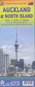
Wegenkaart - landkaart Auckland & North Island - Nieuw Zeeland | ITMB

Scale 1:12,500/1:950,000, This new ITMB map should really be called Auckland, Wellington, Christchurch and the North Island of New Zealand, but that’s too long a title. However, in addition to Auckland, the cities of Wellington and Christchurch are included on one side of the map (NZ urban areas don’t tend to be huge). The other side is a very deta...
13,95

Webshops met dit product

Webshop
Bezorging
Prijs

Anderen bekeken ook

Wegenkaart - landkaart Auckland & North Island - Nieuw Zeeland | ITMB
Scale 1:12,500/1:950,000, This new ITMB map should really be called Auckland, Wellington, Christchurch and the North Island of New Zealand, but that’s too long a title. However, in addition to Auckland, the cities of Wellington and Christchurch are included on one side of the map (NZ urban areas don’t tend to be huge). The other side is a very detailed map of North Island, the main island of the country. This map will be perfect for both finding one’s way around Auckland’s waterfront and for exploring the highways and byways, communing with woolies; printed double-sided on paper
13,95
Wegenkaart - landkaart Nieuw - Zeeland | Borch
Mooie geplasticieerde kaart van Nieuw - Zeeland. Deze kaart biedt een goed overzicht van het land met detailkaarten.   Our soft-laminated map of New Zealand includes: North Island 1:1 300 000, South Island 1:1 300 000, Auckland 1:20 000, Christchurch 1:20 000, Dunedin 1:15 000,  Nelson 1:15 000, Rotorua 1:15 000, Queenstown 1:15 000, Wellington 1:20 000, New Zealand administrative & time zones, interesting statistics, conversion chart for temperatures, weights and measures, climate chart with temperatures, sunshine hours, precipitation and humidity and much more.   "4 million inhabitants and 60 million sheep" does not do justice to the charm and natural diversity of this beautiful country. Lush meadows and fertile soils are only some of the natural resources with which New Zealand is endowed, the real natural wealth of this island state in the middle of the South Pacific lies in its incredibly diverse landscape: snow-covered mountains, dense forests, lush green lowlands, crystal-clear …
11,50
Wegenkaart - landkaart New Zealand North Island | ITMB
ITMB is very pleased to be expanding our coverage of New Zealand with the release of this fourth title (the others being the country map, the South Island, and Auckland). At this expanded scale, it takes both sides of the sheet to show off the attractions of the northern half of NZ, but the shape of the island provides ample space for a large inset of Auckland and more modest ones of the city region and of New Zealand’s public transport network on side one. Side two has an excellent inset map of Wellington and includes the northernmost portion of South Island, with the ferry connection linking the two islands. At this scale, the place names and road network are very readable, and there is lots of room to show attractions and touristic points of interest. The map also includes our Top Attractions list of must-sees, such as Napier Rotorua, and the Hobbitown Movie Set of Lord of the Rings fame.
13,95
Wegenkaart - landkaart New Zealand - South Island | ITMB
Een degelijke kaart met aanduidingen van o.a. nationale parken, vliegveld, benzinepomp, dirt-roads en kleine plattegrond van hoofdstad. Als overzichtskaart goed te gebruiken.   All of New Zealand is a travel paradise, but we particularly enjoy the larger and more wild South Island as a travel adventure. One side of the map covers the far south – Invercargill and Dunedin, Stewart Island, Milford Sound, north to Mount Cook in the Southern Alps. The other side continues north through Christchurch to Nelson on the north Coast and shows the ferry crossing to Wellington, on North Island. This side also includes a large and detailed inset map of Christchurch, which is still rebuilding after the horrific earthquake of a few years ago.   Legend Includes: Roads by classification, Railways, Airports, Lakes, Glaciers, Diving areas, Museums, Tourist information, Movie sets, zoos and much more.
13,95
Wegenkaart - landkaart New Zealand - Nieuw Zeeland | Nelles Verlag
Goede kaart van Nieuw Zeeland. Aan beide kanten bedrukt. Met veel toeristische aanduidingen als nationale parken en culturele bezienswaardigheden. Prima leesbare kaart. Auckland Environs 1 : 100.000 Christchurch Environs 1 : 100.000 Dunedin Environs 1 : 100.000 Wellington Environs 1 : 100.000 Auckland Centre 1 : 25.000 Wellington Centre 1 : 25.000 Folded road and tourist map of New Zealand at 1:1 250 000 scale. Places of interest, national parks, and recreation areas are all highlighted and shaded-relief colouring clearly depicts the topography.   The map includes insets showing the environs of Auckland at 1:100 000, Wellington at 1:100 000, Christchurch at 1:100 000 and Dunedin at 1:100 000 and city center detail for Auckland and Wellington at 1:25 000. The legend is in English, French and German.   For over 20 years Nelles maps have been renowned throughout the world for their quality, faithfulness to detail and up-to-dateness.    So that streets, ferry links, railway lines, etc are…
11,95
Wegenkaart - landkaart 3500 Adventure Map New Zealand - Nieuw Zeeland
Wegenkaart van Nieuw Zeeland met vermelding van veel bezienswaardigheden, nationale parken en attrakties. Watervast en scheurvast. Juist door deze vermeldingen onderscheidt de kaart zich van andere wegenkaarten. National Geographic's New Zealand Adventure Map is designed to meet the unique needs of adventure travelers—detailed, durable, and accurate. The map includes the locations of thousands of major cities and towns with an index for easily locating them, plus a clearly marked road network complete with distances and designations for major highways, toll roads, limited access highways and more.   What sets National Geographic Adventure Maps apart from traditional road maps are the hundreds of points-of-interest that highlight the diverse, unique, and exotic destinations within New Zealand including National Parks and Preserves, World Heritage Sites, Archeological sites, ski areas, beaches, golf courses, camping areas, waterfalls, natural points of interest and important travel aids …
17,50

Klanten-reviews van Wegenkaart - landkaart Auckland & North Island - Nieuw Zeeland | ITMB

Er zijn nog geen beoordelingen voor dit productBen jij de eerste die een review plaatst?

Meer over Wegenkaart - landkaart Auckland & North Island - Nieuw Zeeland | ITMB

Productomschrijving

Scale 1:12,500/1:950,000, This new ITMB map should really be called Auckland, Wellington, Christchurch and the North Island of New Zealand, but that’s too long a title. However, in addition to Auckland, the cities of Wellington and Christchurch are included on one side of the map (NZ urban areas don’t tend to be huge). The other side is a very detailed map of North Island, the main island of the country. This map will be perfect for both finding one’s way around Auckland’s waterfront and for exploring the highways and byways, communing with woolies; printed double-sided on paper

Productspecificaties

Artikelnummer(s)
Brand
ITMB

Verken gerelateerde categorieën

Shopblog.nl maakt gebruik van cookies. Ga je verder op onze website, ga dan akkoord met het plaatsen van cookies en de verwerking van deze data door ons en vermelde partners.