shopblog.nl
Categorieën
  Sluiten

Meer ITMB

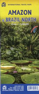
Wegenkaart - landkaart Amazon & Brazil North | ITMB

We first mapped the Amazon River Basin for a rainforest protection conference many years ago, preparing what we thought was a pretty good rendition until we arrived at a conference full of experts who were able to add so much more data that we re-did the map before publishing it. We have updated it repeatedly as more information has come to light a...
13,95

Webshops met dit product

Webshop
Bezorging
Prijs

Anderen bekeken ook

Wegenkaart - landkaart Amazon & Brazil North | ITMB
We first mapped the Amazon River Basin for a rainforest protection conference many years ago, preparing what we thought was a pretty good rendition until we arrived at a conference full of experts who were able to add so much more data that we re-did the map before publishing it. We have updated it repeatedly as more information has come to light and are pleased to release this sixth version, which does something that we have wanted to do for some time - it adds a detailed map of the northern half of Brazil/Brasil to a river map that covers portions of seven different countries. The map is printed on revolutionary stone paper (tear-resistant, waterproof, friendly to the environment, and bio-degradable as well as extremely durable), and has two different cover pictures, so it can be marketed either as a map of Brasil or of the Amazon Basin - or both! It is also the only map of the river basin in print. As the world emerges from the era of Covid, this part of the world will once again do…
13,95
Wegenkaart - landkaart New Orleans - Mississippi River Basin | ITMB
New Orleans stadsplattegrond met schaal 1:15.000, bijzonder uitgebreid. ITMB is pleased to continue its detailed coverage of the USA with its first-ever map of the historic City of New Orleans. The urban area was settled by the French, and was the capital of the vast Louisiana Territory for many years. Napoleon, needing money to fight his many wars, sold the colony to the USA, in 1803, doubling the size of the new American nation overnight. The French Quarter, with buildings dating back 300 years, is the heart of the city and home to dozens of jazz emporiums. The British expulsion of the Acadians from what is now the Canadian provinces of Nova Scotia and New Brunswick, added a vibrant component to the city, creating the concept of the Cajuns. The oldest cathedral in the USA, St Louis, has dominated the city's skyline since 1794, opened just as the French Revolution was at its height. The city offers much more than just music, however, The Louisiana State Museum is where the agreement t…
13,95
Wegenkaart - landkaart Kongo - CAR, Democratic Republic of Congo & Cen
Een degelijke kaart met aanduidingen van o.a. nationale parken, vliegveld, benzinepomp, dirt-roads en kleine plattegrond van hoofdstad. Als overzichtskaart goed te gebruiken.   This is a really exciting map, in that an area as large as Europe has been added to ITMB's Africa series. We have been working on this artwork for over three years. It covers all of the Democratic Republic of Congo (the former Congo-Kinshasa, or Zaire), all of the People's Republic of the Congo (known as Congo-Brazzaville or French Congo), and the Central African Republic to the north. This is in reality a map of the vast rain forest known as the Congo River Basin, and matches our equally complicated map of the Amazon River Basin and the Mekong, Mississippi/Missouri, Nile, and Mackenzie maps that we have published previously. A word of warning: the road network in the Congo is primitive - that means largely non-existent or in such poor condition as to wreck army trucks. We show the roads, and tried to classify t…
13,95
Wegenkaart - landkaart Cambodia & Mekong Delta | ITMB
Een degelijke kaart met aanduidingen van o.a. nationale parken, vliegveld, benzinepomp, dirt-roads en kleine plattegronden van de hoofdsteden.   Tourism to Cambodia is growing so quickly that we felt it necessary to bring back the country as its own map, instead of being combined with Laos. However, the entire country fits very nicely on one side of a map sheet, so we have combined it with neighboring Vietnam's Mekong Delta map. There are two treasures in Cambodia: the Angkor Wat complex of temples near Siem Riep, and the Capital of Phnom Penh. Cambodia became extremely destabilized by the Vietnam War in the 1960s, leading to a rebellion that placed the murderous Khmer Rouge in charge. This led to massive atrocities and de-populated all towns, killing millions. Siem Riep is a thriving touristic city, and UNESCO manages the Angkor complex very well. The capital has mostly recovered, but still retains the sleepy colonial atmosphere of the French era. River boats ply the Mekong River and …
13,95
Wegenkaart - landkaart Kongo - CAR, Democratic Republic of Congo & Cen
Een degelijke kaart met aanduidingen van o.a. nationale parken, vliegveld, benzinepomp, dirt-roads en kleine plattegrond van hoofdstad. Als overzichtskaart goed te gebruiken.   This is a really exciting map, in that an area as large as Europe has been added to ITMB's Africa series. We have been working on this artwork for over three years. It covers all of the Democratic Republic of Congo (the former Congo-Kinshasa, or Zaire), all of the People's Republic of the Congo (known as Congo-Brazzaville or French Congo), and the Central African Republic to the north. This is in reality a map of the vast rain forest known as the Congo River Basin, and matches our equally complicated map of the Amazon River Basin and the Mekong, Mississippi/Missouri, Nile, and Mackenzie maps that we have published previously. A word of warning: the road network in the Congo is primitive - that means largely non-existent or in such poor condition as to wreck army trucks. We show the roads, and tried to classify t…
13,95
Wegenkaart - landkaart Egypt & Cairo | ITMB
Following the so-called Arab spring of a few years ago, northern Africa experienced much turbulence. Egypt experienced the overthrow of the government, the installation of a radical religious-oriented replacement, and the installation of military governance. Tourism plummeted. Most map publishers discontinued their maps of the country. Five years later, Egypt has stabilized and tourism is growing. We feel that the time is right to re-introduce our ITMB map of Egypt. This version focuses on the portions of the country that have been re-opened for tourism, which means from the Mediterranean coastline south to the Aswan Dam. The portion further south remains closed for the moment, as is the border crossing with Sudan. We have also been forced to leave off the Great Sand Sea and the Western Desert portions for the same reason of unrest, as the border areas with Libya remain very unstable. However, we have provided a large inset map of Egypt, covering everything, in the area of desert. We h…
13,95
Wegenkaart - landkaart Canada | ITMB
Een degelijke kaart met aanduidingen van o.a. nationale parken, vliegveld, benzinepomp, dirt-roads en kleine plattegrond van hoofdstad. Well, it’s about time, eh?!? ITMB, after only thirty years on the go, finally gets around to publishing a map of Canada. When we first started mapping, there was a pressing need for good maps of Central and South America, then of Africa, then etc etc and we never found time to concentrate on our own country until fairly recently. This map was prepared by Natural Resources Canada and is, as a result, as accurate a map as one could hope to have. We are very proud of it, and very pleased to be able to use such top-rate cartography. The map covers all of the land mass of Canada, from its southernmost point to the top of Ellesmere Island and from the Atlantic coast to the Pacific. It’s an excellent map, but I’m going to give one proviso. Canada is the second-largest country on the face of the planet and there is no way that a single-sided sheet can portray …
13,95

Klanten-reviews van Wegenkaart - landkaart Amazon & Brazil North | ITMB

Er zijn nog geen beoordelingen voor dit productBen jij de eerste die een review plaatst?

Meer over Wegenkaart - landkaart Amazon & Brazil North | ITMB

Productomschrijving

We first mapped the Amazon River Basin for a rainforest protection conference many years ago, preparing what we thought was a pretty good rendition until we arrived at a conference full of experts who were able to add so much more data that we re-did the map before publishing it. We have updated it repeatedly as more information has come to light and are pleased to release this sixth version, which does something that we have wanted to do for some time - it adds a detailed map of the northern half of Brazil/Brasil to a river map that covers portions of seven different countries. The map is printed on revolutionary stone paper (tear-resistant, waterproof, friendly to the environment, and bio-degradable as well as extremely durable), and has two different cover pictures, so it can be marketed either as a map of Brasil or of the Amazon Basin - or both! It is also the only map of the river basin in print. As the world emerges from the era of Covid, this part of the world will once again dominate demand for South American explorers.

Productspecificaties

Artikelnummer(s)
Brand
ITMB
Shopblog.nl maakt gebruik van cookies. Ga je verder op onze website, ga dan akkoord met het plaatsen van cookies en de verwerking van deze data door ons en vermelde partners.