shopblog.nl
Categorieën
  Sluiten

Meer Michelin

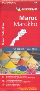
Wegenkaart - landkaart 742 Maroc - Marokko | Michelin

Kaart van beroemde kaartenmakers en voor Marokko weer een hele goede. Uitermate goed leesbaar, prettig kleurgebruik. Onder Marokko-gangers staat deze kaart zeer goed bekend. Zoals je van Michelin mag verwachten is deze kaart zeer overzichtelijk en heeft een duidelijk helder kaartbeeld. De kaart geeft uitgebreid toeristische informatie weer. Met reg...
12,95

Webshops met dit product

Webshop
Bezorging
Prijs

Anderen bekeken ook

Wegenkaart - landkaart 742 Maroc - Marokko | Michelin
Kaart van beroemde kaartenmakers en voor Marokko weer een hele goede. Uitermate goed leesbaar, prettig kleurgebruik. Onder Marokko-gangers staat deze kaart zeer goed bekend. Zoals je van Michelin mag verwachten is deze kaart zeer overzichtelijk en heeft een duidelijk helder kaartbeeld. De kaart geeft uitgebreid toeristische informatie weer. Met register, afstanden en reistijden. Wegen worden naar verschillende klasse ingedeeld en - mooi van Michelin - de interessante mooie routes worden gemarkeerd met een groene streep.    Hindernissen voor automobilisten met caravans zijn gemarkeerd: steile hellingen, bergpassen of een anderzins moeilijke route. Bezienswaardigheden als een kasteel, religieus gebouw, ruine of grot is door een symbool goed te vinden.   Morocco at 1:1,000,000 on a road map from Michelin, with enlargements showing in greater detail four of the country’s most visited areas, including the High Atlas around Marrakesh and Jbel Toubkal, plus an additional map of the whole coun…
12,95
Wegenkaart - landkaart Morocco - Marokko | Marco Polo
Duidelijke wegenkaart van Marco Polo: alle wegen, zowel de verharde als belangrijke onverharde wegen zijn weergegeven.  Mooie toeristisch interessante wegen die de moeite waard zijn, zijn groen gearceerd. Veel toeristische informatie is toegevoegd zoals de nationale parken, campings, kastelen en vliegvelden. Afstanden tussen belangrijke steden en benzinestations staan ook op de kaart. Een plaatsnamenregister ontbreekt niet.   ---   This Marco Polo map of Morocco features really easy to read cartography. Topography is highlighted with relief shading and loads of spot heights and the road network is clearly shown with roads ranging from motorways all the way through to minor secondary roads. The map also clearly indicates airports, places of interest, scenic/tourist routes, view points etc.   The map includes a booklet attached to the cover that contains some useful information and a very extensive index that covers locations, places of interest and geographical features. Also included a…
14,95
Wegenkaart - landkaart 738 Roemenië - Roemenie | Michelin
Zoals je van Michelin mag verwachten is deze kaart zeer overzichtelijk en heeft een duidelijk helder kaartbeeld. De kaart geeft uitgebreid toeristische informatie weer. Met register, afstanden en reistijden. Wegen worden naar verschillende klasse ingedeeld en - mooi van Michelin - de interessante mooie routes worden gemarkeerd met een groene streep.    Hindernissen voor automobilisten met caravans zijn gemarkeerd: steile hellingen, bergpassen of een anderzins moeilijke route. Bezienswaardigheden als een kasteel, religieus gebouw, ruine of grot is door een symbool goed te vinden.   The Michelin national road map of Romania at 1:750,000 scale is best suited to trip & route planning. The map gives comprehensive coverage of national road networks showing major motorways, dual carriageways, national & regional main roads and some smaller local roads. Unsurfaced roads and tracks and some major footpaths are also shown. The map shows useful motoring information for motorways and major roads -…
11,95
Wegenkaart - landkaart 3203 Adventure Map Morocco - Marokko | National
Wegenkaart van Marokko met vermelding van veel bezienswaardigheden, nationale parken en attrakties. Watervast en scheurvast. Juist door deze vermeldingen onderscheidt de kaart zich van andere wegenkaarten. National Geographic's Morocco Adventure Map is designed to meet the unique needs of adventure travelers—detailed, durable, and accurate. Morocco includes the locations of thousands of cities and towns with an index for easily locating them, plus a clearly marked road network complete with distances and designations for motorways, dual carriageways, major roadways, and more. Transportation within and beyond the country is made easier with the location of airports, airfields, railroads, ferry routes, river crossings, lighthouses, harbors, border crossings, and petrol stations. What sets National Geographic Adventure Maps apart from traditional road maps are the hundreds of points of interest that highlight the diverse, unique, and exotic destinations within Morocco. In addition to typi…
17,50
Wegenkaart - landkaart Marokko | Freytag & Berndt
Gedetailleerde, tweezijdige landkaart van Marokko, prima geschikt voor planning en rondtrekken over alle eilanden. De berijdbare wegen zijn goed weergeven, zowel de hoofdwegen als provinciale en lokale wegen; wegnummers worden vermeld. Afstanden tussen plaatsen zijn in kilometers op de kaart ingetekend, daarnaast worden ook op belangrijke plekken benzinepompen gemarkeerd. Morocco at 1:800,000 with the Western Sahara at 1:2,000,000 on a large map from Freytag and Berndt with an index booklet attached to the cover providing street plans of central Casablanca, Fès, Marrakesh, Rabat/Salé and Tangier. Relief shading with spot heights, graphics for sandy or rocky deserts, swamps, seasonal streams, etc. show the topography. Road network includes desert tracks and indicates distances on main routes. Railway lines are included and local airports are marked. Places of interest including the country’s UNESCO World Heritage sites are highlighted.
14,95
Wegenkaart - landkaart 732 Hongarije | Michelin
Zoals je van Michelin mag verwachten is deze kaart zeer overzichtelijk en heeft een duidelijk helder kaartbeeld. De kaart geeft uitgebreid toeristische informatie weer. Met register, afstanden en reistijden. Wegen worden naar verschillende klasse ingedeeld en - mooi van Michelin - de interessante mooie routes worden gemarkeerd met een groene streep.    Hindernissen voor automobilisten met caravans zijn gemarkeerd: steile hellingen, bergpassen of een anderzins moeilijke route. Bezienswaardigheden als een kasteel, religieus gebouw, ruine of grot is door een symbool goed te vinden.   The Michelin National road map of Hungary at 1:400,000 scale is ideal for route planning. The map gives comprehensive coverage of national road networks showing all major motorways, dual carriageways, national & regional main roads and some single-lane roads. [[Also shows unsurfaced roads and tracks and major footpaths.   Distances between major locations are marked along roads, with total distance and severa…
11,95
Wegenkaart - landkaart 730 Oostenrijk 2024 | Michelin
Zoals je van Michelin mag verwachten is deze kaart zeer overzichtelijk en heeft een duidelijk helder kaartbeeld. De kaart geeft uitgebreid toeristische informatie weer. Met register, afstanden en reistijden. Wegen worden naar verschillende klasse ingedeeld en - mooi van Michelin - de interessante mooie routes worden gemarkeerd met een groene streep.    Hindernissen voor automobilisten met caravans zijn gemarkeerd: steile hellingen, bergpassen of een anderzins moeilijke route. Bezienswaardigheden als een kasteel, religieus gebouw, ruine of grot is door een symbool goed te vinden. The Michelin National road map of Austria at 1:400,000 scale is ideal for route planning and touring. The map gives comprehensive coverage of national road networks showing all major motorways, dual carriageways, national & regional main roads and some single-lane roads. Also shows unsurfaced roads and tracks and major footpaths. The map is divided by grid showing latitude and longitude.   Distances between maj…
11,95

Klanten-reviews van Wegenkaart - landkaart 742 Maroc - Marokko | Michelin

Er zijn nog geen beoordelingen voor dit productBen jij de eerste die een review plaatst?

Meer over Wegenkaart - landkaart 742 Maroc - Marokko | Michelin

Productomschrijving

Kaart van beroemde kaartenmakers en voor Marokko weer een hele goede. Uitermate goed leesbaar, prettig kleurgebruik. Onder Marokko-gangers staat deze kaart zeer goed bekend. Zoals je van Michelin mag verwachten is deze kaart zeer overzichtelijk en heeft een duidelijk helder kaartbeeld. De kaart geeft uitgebreid toeristische informatie weer. Met register, afstanden en reistijden. Wegen worden naar verschillende klasse ingedeeld en - mooi van Michelin - de interessante mooie routes worden gemarkeerd met een groene streep.    Hindernissen voor automobilisten met caravans zijn gemarkeerd: steile hellingen, bergpassen of een anderzins moeilijke route. Bezienswaardigheden als een kasteel, religieus gebouw, ruine of grot is door een symbool goed te vinden.   Morocco at 1:1,000,000 on a road map from Michelin, with enlargements showing in greater detail four of the country’s most visited areas, including the High Atlas around Marrakesh and Jbel Toubkal, plus an additional map of the whole country with Western Sahara.   Morocco itself is covered at 1:1,000,000 with detailed classification of the road network characteristic of Michelin’s road maps: width, surface, usability in bad weather, difficult or dangerous sections, gradients, seasonal closures due to snow, entry restrictions, load and height limits, etc. The map also indicates locations with fuel supplies and vehicle repair facilities. Scenic routes and viewpoints are prominently highlighted. Railway lines are included and ferry connections with Spain and Gibraltar are marked.   Towns or villages and other sights worth visiting are highlighted. The map also indicates which locations have tourist accommodation. Symbols mark locations of other places of interest including historical, cultural and religious sites, industrial location such as mineral mines or the oil/gas pipelines, etc.    Topography is very effectively presented by relief shading with plenty of names of mountain ranges, peaks, etc. Surprisingly, the map has no geographical coordinates and is not indexed. Map legend includes English.   Enlargements at 1:600,000 show in greater detail the High Atlas between Marrakesh and Ouarzazate, the Middle Atlas range, the coastal area between Rabat and Casablanca, plus The Rif mountains with Fès and Meknès. Another large inset covers Morocco with Western Sahara at 1:4,000,000 with less detailed presentation of the road network. Also provided is a glossary of Berber terns used on the map, plus climate information for selected locations.   Agadir, Casablanca . Fès, Maroc, Marrakech, Meknès, Ouarzazatz, Oujda, Rabat, Tanger

Productspecificaties

Artikelnummer(s)
Brand
Michelin
Shopblog.nl maakt gebruik van cookies. Ga je verder op onze website, ga dan akkoord met het plaatsen van cookies en de verwerking van deze data door ons en vermelde partners.