shopblog.nl
Categorieën
  Sluiten

Meer National Geographic

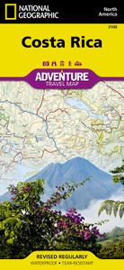
Wegenkaart - landkaart 3100 Adventure Map Costa Rica | National Geogra

Zeer gedetailleerde kaart van Costa Rica met stadsplattegrond van de hoofdstad van Costa Rica. Misschien wel de beste kaart! Gedrukt op scheur- en watervast papier. Double-sided, waterproof, tear-resistant and with a street plan of central San José, the NGS Costa Rica Adventure Map was produced in cooperation with the Instituto Geográfico Nacional,...
17,50

Webshops met dit product

Webshop
Bezorging
Prijs

Anderen bekeken ook

Wegenkaart - landkaart 3100 Adventure Map Costa Rica | National Geogra
Zeer gedetailleerde kaart van Costa Rica met stadsplattegrond van de hoofdstad van Costa Rica. Misschien wel de beste kaart! Gedrukt op scheur- en watervast papier. Double-sided, waterproof, tear-resistant and with a street plan of central San José, the NGS Costa Rica Adventure Map was produced in cooperation with the Instituto Geográfico Nacional, Costa Rica’s national survey organization. The country is divided east/west, with a generous overlap between the two sides. Topography is shown by contours at 100m intervals, enhanced by relief shading and spot heights. Along the coast reefs, rocks and shallow water areas are marked. The map indicates various types of vegetation: forests, palm forest, mangrove, and fresh or salt water swamps. Road network includes gravel tracks and indicates roads passable only in summer. Railways and local airstrips are marked, as well as the country’s internal administrative boundaries together with names of the provinces. The map highlights seven differen…
17,50
Wegenkaart - landkaart Costa Rica | Borch
Mooie geplasticieerde kaart van Costa Rica. Deze kaart biedt een goed overzicht van het land met detailkaarten.   Our soft-laminated folded map of Costa Rica shows: Costa Rica 1:650 000, Cocos Island 1:150 000, San Jose 1:20 000, Meseta Central 1:300 000, Costa Rica administrative and time zones. Borch maps are easy to fold, durable and water-repellent with a wipeable surface. Borch Maps show hotels, museums, monuments, markets, public transport, top sights and points of interest, useful statistics, conversion charts for temperatures, weights and measurements, climate charts showing temperatures, sunshine hours, precipitation and humidity, overview maps, time zones, and much more...   The Republic of Costa Rica ("rich coast") is bordered by Nicaragua, Panama, the Pacific Ocean and the Caribbean Sea. Costa Rica abolished its army in 1949 and is an oasis of peace and tranquility in Central America. Democracy, a policy of neutrality and exemplary environmental standards (approx. 25% of th…
11,50
Reisgids Costa Rica | Rough Guides
Zeer goede reisgids voor zowel de georganiseerde maar vooral voor de zelfstandige reiziger. Boordevol informatie over reizen, slapen, eten, maar ook musea en cultuur. Voor veel landen meestal completer en beter dan de Lonely Planet! Practical travel guide to Costa Rica with a free eBook featuring points-of-interest structured lists of all sights and off-the-beaten-track treasures, with detailed colour-coded maps, practical details about what to see and to do in Costa Rica, how to get there and around, pre-departure information, as well as top time-saving tips, like a visual list of things not to miss in Costa Rica, expert author picks and itineraries to help you plan your trip.   The Rough Guide to Costa Rica covers: San José, The Valle Central and the highlands, Limón Province and the Caribbean coast, The Zona Norte, Guanacaste, The Central Pacific and southern Nicoya, The Zona Sur   Inside this travel guide you'll find:   RECOMMENDATIONS FOR EVERY TYPE OF TRAVELLER Experience…
24,95
Wegenkaart - landkaart 3009 Adventure Map China West | National Geogra
Wegenkaart van West China met vermelding van veel bezienswaardigheden, nationale parken en attrakties. Watervast en scheurvast.   National Geographic's China West Adventure Map is designed to meet the unique needs of adventure travelers with its durability and detailed, accurate information. The map includes the locations of thousands of cities and towns with a user-friendly index, plus a clearly marked road network complete with distances and designations for major highways, major routes and secondary roads. The China Adventure Map is printed in the United States on a durable synthetic paper, making it waterproof, tear-resistant and tough—capable of withstanding the rigors of international travel.   The China West Adventure Map differs from a traditional road map for it includes hundreds of points of interest that highlight diverse and unique destinations in the region. UNESCO World Heritage sites, national parks and reserves, archaeological sites, temples, mosques, museums, ruins, ca…
17,50
Wegenkaart - landkaart 3000 Adventure Map Nepal | National Geographic
Wegenkaart van Nepal met vermelding van veel bezienswaardigheden, nationale parken en attrakties. Watervast en scheurvast. National Geographic's Nepal Adventure Map is the most authoritative map for touring the country. Each waterproof and tear-resistant map provides travelers with the perfect combination of detail and perspective, highlighting points of interest for those venturing outside city centers.   This durable, folded map includes the locations of cities and towns with a user-friendly index, plus a clearly marked road network complete with distances and designations for major highways, main roads, and tracks and trails for those seeking to explore more remote regions.   The front side offers a detailed topographic and trekking map of central and eastern Nepal, including border regions with China and India. Mountaineers will stay on course with marked trails through the Himalayan Range, including Everest (the tallest mountain in the world), and the surrounding national parks an…
17,50
Reisboek Eyewitness Travel Costa Rica | Dorling Kindersley
Prachtig geillustreerde reisgids met o.a. 3D tekeningen, fraaie kaarten en geweldige foto’s. Daarnaast uitgebreide achtergrondbeschrijvingen. Echt om in de stemming te komen! Groot formaat gids. Engelstalig Whether you want to spy elusive jaguars in the wild, savour a world-class cup of coffee or walk through cloud-drenched tree canopies, your DK Eyewitness travel guide makes sure you experience all that Costa Rica has to offer. An ecotourism haven, Costa Rica is unmatched in biodiversity - here you can help sea turtle hatchlings make it to the sea or wake up to the sounds of howler monkeys. But this Central American country doesn't just offer wildlife in abundance. In the capital of San José, characterful food joints serve up tasty local cuisine, while on the laid-back coasts, surfers and yogis unwind beside the beaches. Our updated guide brings Costa Rica to life, transporting you there like no other travel guide does with expert-led insights, trusted travel advice, detailed breakdow…
22,50

Klanten-reviews van Wegenkaart - landkaart 3100 Adventure Map Costa Rica | National Geogra

Er zijn nog geen beoordelingen voor dit productBen jij de eerste die een review plaatst?

Meer over Wegenkaart - landkaart 3100 Adventure Map Costa Rica | National Geogra

Productomschrijving

Zeer gedetailleerde kaart van Costa Rica met stadsplattegrond van de hoofdstad van Costa Rica. Misschien wel de beste kaart! Gedrukt op scheur- en watervast papier. Double-sided, waterproof, tear-resistant and with a street plan of central San José, the NGS Costa Rica Adventure Map was produced in cooperation with the Instituto Geográfico Nacional, Costa Rica’s national survey organization. The country is divided east/west, with a generous overlap between the two sides. Topography is shown by contours at 100m intervals, enhanced by relief shading and spot heights. Along the coast reefs, rocks and shallow water areas are marked. The map indicates various types of vegetation: forests, palm forest, mangrove, and fresh or salt water swamps. Road network includes gravel tracks and indicates roads passable only in summer. Railways and local airstrips are marked, as well as the country’s internal administrative boundaries together with names of the provinces. The map highlights seven different types of protected areas: national wildlife refuges, protection zones, wetlands, national parks, forest reserves, biological reserves, and absolute nature reserves, plus national monuments, all listed in a special index. A UTM grid is printed on the map, plus latitude and longitude margin ticks at 10' intervals. The map includes a street plan of central San José, naming principal streets and districts, and highlighting various places of interest to visitors. Also included are enlargements for Isla del Coco, Isla del Caño, an overview map of Central America, and an index of selected towns.

Productspecificaties

Artikelnummer(s)
Brand
National Geographic
Shopblog.nl maakt gebruik van cookies. Ga je verder op onze website, ga dan akkoord met het plaatsen van cookies en de verwerking van deze data door ons en vermelde partners.