shopblog.nl
Categorieën
  Sluiten

Wegenatlas Traveller's Atlas Southern Africa - Zuidelijk Afrika | A3-Formaat | Ringband | Tracks4Africa

Deze atlas omvat tien landen in zuidelijk Afrika en is speciaal gericht op reizigers die zelf rijden. De betrokken landen zijn: Angola, Botswana, Lesotho, Malawi, Mozambique, Namibië, Zuid-Afrika, Swaziland, Zambia en Zimbabwe.   De Atlas bevat 223 kaartpagina's met hetzelfde vertrouwde kaartdetail waarvoor Tracks4Africa bekend is.   De wegenatlas ...
79,95

Webshops met dit product

Webshop
Bezorging
Prijs

Anderen bekeken ook

Wandkaart Southern Africa - Zuid Afrika | 130 x 98 cm | Tracks4Africa
Our SOUTHERN AFRICA WALL MAP is printed at a scale of 1:2.5 million and laminated on both sides. The size of the final map is 1300 X 980 mm.   The map covers South Africa, Lesotho, eSwatini, Zimbabwe, Botswana and Namibia in full.  It also includes the majority of Mozambique up to Nampula.  A small section of southern Angola up to Lubango is included and the southern part of Zambia is covered up to Kabwe.  The southern tip of Malawi up to where the lake starts is also included.   Perfect for macro planning of road trips across Southern Africa up to Southern Angola.   Printed in full colour, all major and secondary roads are shown with national parks, towns, country borders, international airports and major tourist attractions are clearly visible. Includes a good number of tracks in remote areas.   Individually packaged in carton tube 1000x75mm with plastic caps on both ends  
89,95
Wegenatlas Glovebox South Africa - Zuid-Afrika | A5-Formaat | Ringband | MapStudio
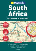
Handzame pocket atlas, A5 formaat, voor Zuid Afrika. Schaal 1 op 1.500.000 en in handige ringband.   This wiro bound Road Atlas South Africa Glovebox is a revised and updated compact atlas.   It includes: Detailed and continuous map section Highlights seven major tourist areas Features eleven street maps Freeways National roads Route numbers Nature reserves and parks Places of interest Tourist information Index to place names and GPS co-ordinates   This edition also features GPS co-ordinates at main interchanges.   COVERAGE: Includes a detailed map of South Africa at a scale of 1 : 1 500 000. The 7 major tourist areas of the Cape Peninsula, South Western Cape and Overberg Region, Garden Route, Gauteng, Kruger National Park, Drakensberg and Kwazulu-Natal coast. The 11 street maps are of Pietermaritzburg, Durban, Nelspruit, Polokwane, Pretoria, Johannesburg, Bloemfontein, Kimberley, East London, Port Elizabeth and Cape Town.  
18,95
Wegenatlas Australië - Great Desert Tracks Atlas & Guide | Hema Maps
Whether you're a desert lover or just looking to tackle some of Australia's favourite 4WD destinations, the Hema Great Desert Tracks Atlas & Guide - Edition 5 is an indispensable companion to this country's arid centre. The complete atlas contains Hema's entire Great Desert Tracks map series. The guide features 25 4WD tracks, each with its own detailed map inset showing the route taken, with GPS location and points of interest featured. All of the tracks are colour-coded to make it simple to find the treks that suit your type of vehicle and handy symbols show towing suitability also! The track descriptions are written by some of Australia's top four-wheel driving enthusiasts and experienced travel writers. Each track's notes contain all the information you need to plan for the trip, including permits and contact details. There's also plenty of essential pre-trip reading on how to prepare for your trek, safety in the outback and driving techniques!   Features Contains Hema's entire G…
55,95
Wegenatlas Big Atlas Britain & Ireland 2023 A3-Formaat | Philip's Maps
Goede gedetailleerde wegenatlas van Groot-Brittannië, schaal 1:200.000 met een overzichtskaart van Ierland, schaal 1:1.000.000. Groot formaat, A3, en in ringband. Philip's is No. 1 in the UK for clear maps and brings you the latest large spiral-bound format Big Road Atlas Britain and Ireland 2024 with fully updated maps from the Philip's digital database. 'Good balance between detail and clarity with excellent town maps' What Car?* Main scale of maps: 3 miles to 1 inch = 1:200,000 - all fully updated* Latest highway code information* Practical 'more to view per page' A3 lie-flat format* Smart motorways and electric cars explained* Great for planning and driving long journeys or short hops* Philip's: Britain's clearest maps for motorists* Completely updated and revised for 2024 with information on Smart Motorways and electric cars* Map of scenic Britain and a map highlighting railways, airports and ferry ports - Plan your route in advance - 6-page route-planning section - 64 fully inde…
22,50
Wegenatlas Adventure Edition USA - Amerika - Canada - Mexico - Puerto Rico | A3-Formaat | Ringband | National Geographic
Duidelijk leesbare wegenatlas van de USA, Mexico, Canada, en Puerto Rico, met groot register en ook kleine plattegronden van centra van belangrijke steden. Ook met informatie over nationale parken en avontuurlijke bestemmingen. Duidelijke kaarten in stevig ringband model.   National Geographic's Road Atlas: Adventure Edition, is the ideal companion for the next time you hit the road. Includes up-to-date road maps for all 50 U.S. States, plus Canada, Mexico, and Puerto Rico. Major cities and metropolitan areas are shown in detail with inset maps that include popular attractions, infrastructure and points-of-interest.   Setting this atlas apart from all other road atlases are the inclusion of detailed maps and guidebook-like recommendations on the top 100 destinations for adventure, plus the top 24 most visited National Parks. An additional resources section provides contact information for local tourism offices, plus a place name index to help easily locate a specific city.   The R…
32,95
Reisgids Africa Overland - Afrika | Bradt Travel Guides
Bradt's Africa Overland is the result of over 40 years' experience on the roads of Africa, Asia and South America, combining everything you need to know about the Africa with all the practical advice needed for tackling long-distance journeys under often challenging conditions, be it by 4X4 or public transport. A massive amount of background detail is included, from suggested routes for reaching Africa - including via Asia or Saudi Arabia - to selecting and shipping your vehicle, budgeting, equipment and spares, organised tours, public transport, red tape and heaps of information about issues likely to arise on the road: driving and recovery techniques, maintenance, motorbike driving, bureaucracy, borders and police checks. This new, fully updated edition covers over 50 countries, as well as offering a focus on aspects such as geography, vegetation and climate, natural history and conservation, cultural interaction, religion and festivals.   There's lots of guidance about where to find…
27,95
Wegenatlas Big Road Atlas Britain and Northern Ireland 2025 | A3 | Ringband | Collins
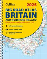
Grote wegenatlas, a3-formaat in ringband. The ultimate 3.2 miles to 1 inch scale large-format, spiral-bound road atlas of Britain, featuring Collins’ popular and well established road mapping, and designed for exceptional clarity and ease of use.   The atlas has a wide range of urban area maps at even larger scale and 64 detailed town centre street plans.   This fully updated road atlas covers the whole of Britain with each scale of mapping colour-coded for ease of use. The smallest scale maps are great for long distance route planning and the street plans help you locate your final destination.   Main features:   Easy to use, clear road maps at a scale of 3.2 miles to 1 inch of England, Wales and Southern Scotland. Northern Scotland is shown at 5 miles to 1 inch Route planning section including maps at a scale of 15.8 miles to 1 inch, motorway services information and a handy distance calculator 22 urban area approach maps at 1 mile to 1 inch which clearly show the best rou…
20,95
Wegenkaart - landkaart Mozambique and Malawi | Tracks4Africa
Uitstekende wegenkaart van Mozambique en Malawi, gemaakt door gerenommeerde kaartenmaker Tracks4Africa in Afrika. Met afstanden en reistijden tussen steden en op alle wegen vermeld. GPS via hun website te downloaden.  The integrated Tracks4Africa Mozambique and Malawi map is designed to be used in conjunction with the T4A GPS Map of Mozambique and Malawi. It is the largest available map at 1:1,000,000 scale, offering you the perfect trip planning tool for your next trip through Mozambique and Malawi. This T4A paper map series are probably the first comprehensive country maps in the world, offering travel time information for the entire road network, be it on tar, gravel or sand! The roads, tracks, places of interest as well as the distance data and travel time estimates on the map reflect the collective travel experience of the Tracks4Africa community of travellers over the past 10 years, with every single road being GPS recorded and verified by this community. No need to transfer GPS …
27,50
Wegenatlas Navigator Camping and Caravanning - Atlas of Britain | Philip's Maps
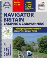
THE MUST-HAVE ATLAS OF BRITAIN FOR CAMPING, CARAVANNING AND MOTORHOMES'A map that beats all others' - The Daily Telegraph'Scale, accuracy and clarity are without parallel' - Driving Magazine'No. 1 in the UK for clear maps' - Independent research surveyThe lure of the open road and British countryside has never waned and the appeal of independent exploration has surely grown in recent years. However, the adventurous need practical information about what lies ahead - from bridge heights, widths and weights to places to stop and enjoy.   Philip's Navigator Camping and Caravanning Atlas of Britain is the No. 1 Choice of Road Atlas for the independent travelling motorist and camper van owner. * Scale: 1.5 miles to 1 inch = 1:100,000 (Northern Scotland: 3 miles to 1 inch = 1:200,000)* Over 1,880 approved campsites located, plus essential advice from The Camping and Caravanning Club* Includes essential information for caravanning motorists: 6000 bridge height limits, 1500 bridge weight limits…
37,50
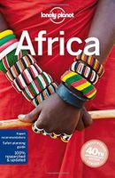
Reisgids Africa - Afrika | Lonely Planet
Superdikke gids van alle landen van Afrika: ideale gids voor een trekking door het hele continent, met de jeep door Afrika heen of gewoon als naslagwerk thuis. De perfecte reisgids voor zowel de georganiseerde als de zelfstandige reiziger. Naast een algemene inleiding van het land / streek vol met praktische informatie over hoe je er het beste kunt reizen: slapen, eten, vervoer, excursies ... alles kun je er in vinden. Engelstalig. Lonely Planet This guide covers: North Africa: Algeria, Egypt, Libya, Morocco, Sudan, Tunisia West Africa: Benin, Burkina Faso, Cameroon, Côte D'Ivoire, The Gambia, Ghana, Guinea, Guinea-Bissau, Liberia, Mali, Mauritani, Niger, Nigeria, Senegal, Sierra Leone, Togo Central Africa: Central African Republic, Chad, Congo (Zaire), Democratic Republic of Congo, Equatorial Guinea, Gabon, São Tomé & Príncipe East Africa: Burundi, Djibouti, Eritrea, Ethiopia, Kenya, Rwanda, Tanzania, Uganda, Somaliland, Puntland & Somalia Southern Africa: Angola, Botswana, Lesotho, M…
27,95

Klanten-reviews van Wegenatlas Traveller's Atlas Southern Africa - Zuidelijk Afrika | A3-Formaat | Ringband | Tracks4Africa

Er zijn nog geen beoordelingen voor dit productBen jij de eerste die een review plaatst?

Meer over Wegenatlas Traveller's Atlas Southern Africa - Zuidelijk Afrika | A3-Formaat | Ringband | Tracks4Africa

Productomschrijving

Deze atlas omvat tien landen in zuidelijk Afrika en is speciaal gericht op reizigers die zelf rijden. De betrokken landen zijn: Angola, Botswana, Lesotho, Malawi, Mozambique, Namibië, Zuid-Afrika, Swaziland, Zambia en Zimbabwe.   De Atlas bevat 223 kaartpagina's met hetzelfde vertrouwde kaartdetail waarvoor Tracks4Africa bekend is.   De wegenatlas is afgedrukt in A3 formaat, weegt 2750g, heeft een stevige omslag, spiraal gebonden en de pagina's zijn afgedrukt op dik papier.   Bigger coverage than ever before: 1:4m maps for Southern and Eastern Africa – ideal for macro planning. 1:1m maps for Southern Africa, covering the following countries: Angola, Botswana, eSwatini, Lesotho, Malawi, Mozambique, Namibia, South Africa, Zambia and Zimbabwe. 1:500k maps for South Africa, Malawi, most part of Zambia and the area around Moremi/Chobe in Botswana. Road coverage: This Atlas is designed for overland travel and compiled from the same data used on our famous GPS maps. Use it for trip planning or on the road as a companion for your GPS navigation system. The detailed road network covers 518 350km. All major and secondary routes feature distances and travel times (1m and 500k maps only). Each country page features a table with the times and distances between major towns. Vital information needed for planning an extended self-drive trip: Per country information includes legal requirements for your vehicle, road conditions, traffic rules, signals used by locals as well as general tips such as fuel availability. Comprehensive information of what you need to transit borders. Featuring 127 border posts with opening times. Valuable information while on the road:   This Atlas is jam-packed with as much detail as possible on protected areas, major and minor attractions, places to stay and activities. You can also see which services like fuel, bank/ATM, shopping, restaurant, hospital, police or auto repair are available in each town.   The Atlas features 223 map pages with the same trusted map detail for which Tracks4Africa is renowned.   Map features include: Map scales include 1:4000 000, 1:1000 000; 1:500 000 518 350km of off-road tracks and major roads. Distance and travel time between towns. Essential facilities available in towns. Camping and lodging. Tourist attractions. All border crossings, with opening times. All international airports, with IATA/ICAO codes. Protected areas. The first section of the Atlas includes valuable travel information about each of the ten countries. The information about border crossings and top tourist attractions will help you to be well-prepared for your trip and the sections on driving conditions will assist you while on the road.  
Shopblog.nl maakt gebruik van cookies. Ga je verder op onze website, ga dan akkoord met het plaatsen van cookies en de verwerking van deze data door ons en vermelde partners.