shopblog.nl
Categorieën
  Sluiten

Meer ITMB
Meer ITMB in Geschiedenis & politiek boeken

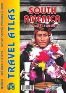
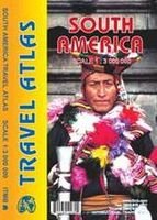
Wegenatlas Travel Atlas South America - Zuid Amerika | ITMB

De eerste gedegen wegenatlas van Zuid Amerika: handig boekje met slappe kaft op A5 formaat. This is unique! ALL of the continent of South America is now available in an easy-to-read, easy-to-use, easy-to-store road atlas at a superb scale. In addition to showing each country systematically, logically, and in great detail, physical features, points ...
16,50

Webshops met dit product

Webshop
Bezorging
Prijs

Anderen bekeken ook

Wegenatlas Travel Atlas South America - Zuid Amerika | ITMB
De eerste gedegen wegenatlas van Zuid Amerika: handig boekje met slappe kaft op A5 formaat. This is unique! ALL of the continent of South America is now available in an easy-to-read, easy-to-use, easy-to-store road atlas at a superb scale. In addition to showing each country systematically, logically, and in great detail, physical features, points of interest, beaches, reefs, parks and reserves, major airports, and roads are shown. The atlas is 5 1/2" wide by 8 1/2" high (15cmx22cm), the same size as our Mexico Road Atlas. This atlas is 112 pages in length, is fully indexed, and has a hard card cover, and a spine. The advantage of this book format is that visitors to more than one country can save money and gain ease of use through a conveniently-sized and attractively presented book format. There is nothing equivalent to this in the world!
16,50
Wegenatlas Travel Atlas Indian Subcontinent | ITMB
Handzame wegenatlas op A5 formaat, helaas geen spiraalbinding. Maar voor deze regio is er op dit moment geen andere atlas beschikbaar.   This is our biggest atlas ever, with 152 pages of maps and 51 pages of place names indexing. The Indian Sub-Continent consists of Pakistan, India, Nepal, Bhutan, Bangladesh, Sri Lanka and Kashmir. Each country (Kashmir being considered shared) is presented as an entity, so Pakistan occupies 30 pages at 1:1,200,000 scale, and Nepal occupies 32 pages at 1:530,000 scale. In short, each country is shown in detail, but at scales appropriate for each country. The amount of detail on each page is impressive; equal to buying six maps at $12.95 each. The market is the traveller to the region, visiting several of these areas and wanting a compact way to have detailed mapping without having to carry half a dozen maps or spend a large amount of money on maps. Eleven city inset maps are included, as well as basic insets for the Andaman and Nicobar island chains. T…
16,50
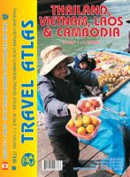
Wegenatlas Travel Atlas Thailand, Vietnam, Laos & Cambodia | ITMB
Atlas, gebonden, A5 formaat The Indochina Region consists of five countries, including that portion of Burma that sweeps down the western part of the Malay Peninsula. The four other countries form a cohesive entity for travel, especially now that border and visa requirements for travel have been reduced. Thailand itself is definitely the Number One reason for visiting the region. The first portion of the atlas is devoted to Thailand, including detailed page-size maps of Bangkok, Chiang Mai, and Pattaya. Vietnam is the next most-popular destination and is shown in great detail, with inset maps of Hanoi, Hoi An, Hue, Da Nang, Da Lat, Can Tho, and the central Saigon portion of Ho Chi Minh City. Laos and Cambodia are shown with the same degree of attention to detail, including insets of Vientiane, Phnom Penh, and two maps concentrating on Angkor Wat. This is a compact and convenient way for visitors to the region to have everything they need in one format - easy to catty, easy to use Legen…
16,50
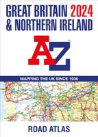
Wegenatlas Great Britain and Northern Ireland Road Atlas 2024 | A-Z Ma
A full-colour, paperback road atlas of Great Britain, now fully revised and updated. Clear detailed road mapping at a scale of 3.5 miles to 1 inch. Presented in a large, easy to read A3 format. This essential road atlas includes the following; 11 pages of main route mapping covering Greater London, Birmingham and Manchester Mileage chart with average journey times Information on motorway junctions with limited interchanges 70 city and town centre street plans 16 port and airport plans Channel Tunnel terminus maps Map reference information also in French and German Also included is a full index to cities, towns, villages, hamlets, major destinations and selected places of interest with postcodes for sat-nav use. Instantly recognisable and easy to use, the road mapping has been specifically tailored for the smaller scale featuring: clear standard road classification colours for easy identification, motorway junction symbols, under construction and proposed roads, primary route des…
18,95
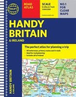
Wegenatlas Handy Road Atlas Britain A5-Formaat | Philip's Maps
"The perfect atlas for planning a trip anywhere in the UK and Ireland"The essential handy road atlas for planning a trip in Britain and Ireland. Keep it in the glove box or your travel bag for quick and easy reference. This gem of a glove-box sized atlas has all the core information you need for driving around the British Isles.   It includes all the motorways, primary roads and A Roads and they are clearly shown - ideal for route planning. There is a separate 4-page road map of Ireland for easy use. Alongside that, this handy atlas includes a key map, a distance table and useful counties map.   All the towns and villages listed within are indexed and all the information comes in a handy glove-box size format with practical, lie-flat spiral binding. With the scale at a user-friendly 8 miles to 1 inch / 1:500,000 (Ireland 19 miles to 1 inch /1:1,200,000) and fully up-to-date using Philip's clear mapping, you will never be at a loss to establish the best route. Keep in the car or sling i…
9,95
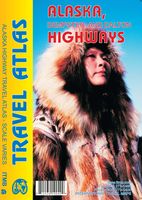
Wegenatlas Travel Atlas Alaska Highway | ITMB
A5 boekvorm   This booklet is the same size as all other ITMB atlases and is designed to fit comfortably in a user's backpack, purse, or car door storage bin. The famous Alaska Highway of WW2 fame has been largely paved and straightened by now, but is still one of the paramount exploration adventures in the world and is far more accessible than the Karakoram or mid-Australia routes. The original highway, from Dawson Creek in northern British Columbia to close to Fairbanks, Alaska, has been supplemented by several off-shoots: the Dempster Highway leading to Inuvik, in Canada's Northwest Territories, the Dalton Highway, leading north to the high Arctic at Prudhoe Bay in Alaska, and the Stewart Highway leading south through the Coastal Mountains to Prince Rupert, BC are all closely integrated with the traditional Alaska Highway. All of these are shown in great detail in this atlas. Road conditions, distances, campgrounds, convenient hiking trails, heights of land, parks, and everything el…
13,95

Klanten-reviews van Wegenatlas Travel Atlas South America - Zuid Amerika | ITMB

Er zijn nog geen beoordelingen voor dit productBen jij de eerste die een review plaatst?

Meer over Wegenatlas Travel Atlas South America - Zuid Amerika | ITMB

Productomschrijving

De eerste gedegen wegenatlas van Zuid Amerika: handig boekje met slappe kaft op A5 formaat. This is unique! ALL of the continent of South America is now available in an easy-to-read, easy-to-use, easy-to-store road atlas at a superb scale. In addition to showing each country systematically, logically, and in great detail, physical features, points of interest, beaches, reefs, parks and reserves, major airports, and roads are shown. The atlas is 5 1/2" wide by 8 1/2" high (15cmx22cm), the same size as our Mexico Road Atlas. This atlas is 112 pages in length, is fully indexed, and has a hard card cover, and a spine. The advantage of this book format is that visitors to more than one country can save money and gain ease of use through a conveniently-sized and attractively presented book format. There is nothing equivalent to this in the world!

Productspecificaties

Artikelnummer(s)
Brand
ITMB

Verken gerelateerde categorieën

Shopblog.nl maakt gebruik van cookies. Ga je verder op onze website, ga dan akkoord met het plaatsen van cookies en de verwerking van deze data door ons en vermelde partners.