shopblog.nl
Categorieën
  Sluiten

Meer ITMB
Meer ITMB in Literatuur boeken

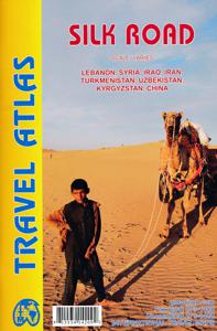
Wegenatlas Travel Atlas Silk Road - Zijderoute | ITMB

Kleine, handzame wegenatlas van de oorspronkelijke zijderoute van Libanon tot en met het westen van China. Handig met index, stadsplattegronden, goede legenda en behoorlijk gedetaillerde kaarten. A5 formaat, gebonden. De schaal van de kaarten verschilt per land. The Great Silk Road has been the traditional trading route between Europe and China for...
16,50

Webshops met dit product

Webshop
Bezorging
Prijs

Anderen bekeken ook

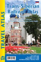
Wegenatlas Trans-Siberian Railroad | ITMB
Klein formaat wegenatlas (A5) van de Trans-Siberische spoorlijn, uitgebracht door ITMB. It is not often that one can publish a map that has never been done before. I seem to say that rather frequently! The Trans Siberian is one of the great railway trips of all time, crossing vast areas of steppe land and tundra as it wends its way from Moscow to Vladivostok. There are actually two routes for much of the western portion, and branch off lines to Mongolia and northern China in the east, as well as a very unusual route across the top of Lake Baikal called the Amur, or BAM, line. The only effective way to show east west rail networks this diverse is via an atlas and that is just what we have done. The entire route, with an extra page for those starting in St. Petersburg is covered nicely, with inset pages showing St. Petersburg, Moscow, and the heritage cities of Sergiev Posad and Suzdal. Both branches of the Trans-Siberian are shown and most of the Baikal Amur (BAM) line. This type of map…
16,50
Wegenatlas Travel Atlas Indian Subcontinent | ITMB
Handzame wegenatlas op A5 formaat, helaas geen spiraalbinding. Maar voor deze regio is er op dit moment geen andere atlas beschikbaar.   This is our biggest atlas ever, with 152 pages of maps and 51 pages of place names indexing. The Indian Sub-Continent consists of Pakistan, India, Nepal, Bhutan, Bangladesh, Sri Lanka and Kashmir. Each country (Kashmir being considered shared) is presented as an entity, so Pakistan occupies 30 pages at 1:1,200,000 scale, and Nepal occupies 32 pages at 1:530,000 scale. In short, each country is shown in detail, but at scales appropriate for each country. The amount of detail on each page is impressive; equal to buying six maps at $12.95 each. The market is the traveller to the region, visiting several of these areas and wanting a compact way to have detailed mapping without having to carry half a dozen maps or spend a large amount of money on maps. Eleven city inset maps are included, as well as basic insets for the Andaman and Nicobar island chains. T…
16,50
Wegenatlas Trans-Siberian Railroad | ITMB
Klein formaat wegenatlas (A5) van de Trans-Siberische spoorlijn, uitgebracht door ITMB. It is not often that one can publish a map that has never been done before. I seem to say that rather frequently! The Trans Siberian is one of the great railway trips of all time, crossing vast areas of steppe land and tundra as it wends its way from Moscow to Vladivostok. There are actually two routes for much of the western portion, and branch off lines to Mongolia and northern China in the east, as well as a very unusual route across the top of Lake Baikal called the Amur, or BAM, line. The only effective way to show east west rail networks this diverse is via an atlas and that is just what we have done. The entire route, with an extra page for those starting in St. Petersburg is covered nicely, with inset pages showing St. Petersburg, Moscow, and the heritage cities of Sergiev Posad and Suzdal. Both branches of the Trans-Siberian are shown and most of the Baikal Amur (BAM) line. This type of map…
16,50
Wegenatlas Travel Atlas Indian Subcontinent | ITMB
Handzame wegenatlas op A5 formaat, helaas geen spiraalbinding. Maar voor deze regio is er op dit moment geen andere atlas beschikbaar.   This is our biggest atlas ever, with 152 pages of maps and 51 pages of place names indexing. The Indian Sub-Continent consists of Pakistan, India, Nepal, Bhutan, Bangladesh, Sri Lanka and Kashmir. Each country (Kashmir being considered shared) is presented as an entity, so Pakistan occupies 30 pages at 1:1,200,000 scale, and Nepal occupies 32 pages at 1:530,000 scale. In short, each country is shown in detail, but at scales appropriate for each country. The amount of detail on each page is impressive; equal to buying six maps at $12.95 each. The market is the traveller to the region, visiting several of these areas and wanting a compact way to have detailed mapping without having to carry half a dozen maps or spend a large amount of money on maps. Eleven city inset maps are included, as well as basic insets for the Andaman and Nicobar island chains. T…
16,50
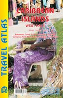
Wegenatlas Travel Atlas Caribbean Island West Half | ITMB
Wegenatlas voor de westelijke Caraïbische eilanden - verschillende schalen : Bahamas, Turks- en Caicoseilanden, Cuba, Kaaimaneilanden, Jamaica, Dominikaanse Republiek, Puerto Rico. Met inzetjes van Freeport, Nassau, Havana, Varadero, Georgetown, Kingston, Port-au-Prince, Santo Domingo, San Juan   The Caribbean is a particularly difficult part of the world to map effectively. It is a combination of larger islands in the west and a string of small islands in the east. Some can be shown as separate maps, but others are too small (or too lacking in market appeal) to be mapped adequately as folded paper maps. This atlas covers the Bahamas and the Turks and Caicos Islands in the north with Cuba, the Cayman Islands, Jamaica, the Dominican Republic, and Puerto Rico in scales ranging from 1:18,000 for Puerto Rico to 1:600,000 for Cuba The atlas is the same size as all ITM atlases (8''x5'' or 21x13.5cm) and has a straight spine edge with title for displaying spine outwards on store shelves, if d…
16,50
Wegenkaart - landkaart 3008 Adventure Map China East - Oost | National
Wegenkaart van Oost China  met vermelding van veel bezienswaardigheden, nationale parken en attrakties. Watervast en scheurvast.   National Geographic's China East Adventure Map is designed to meet the unique needs of adventure travelers with its durability and detailed, accurate information. The map includes the locations of thousands of cities and towns with a user-friendly index, plus a clearly marked road network complete with distances and designations for major highways, major routes and secondary roads. The China Adventure Map is printed in the United States on a durable synthetic paper, making it waterproof, tear-resistant and tough—capable of withstanding the rigors of international travel.   The China East Adventure Map differs from a traditional road map for it includes hundreds of points of interest that highlight diverse and unique destinations in the region. UNESCO World Heritage sites, national parks and reserves, archaeological sites, temples, caves and points of in…
17,50
Wegenatlas Travel Atlas Caribbean Island West Half | ITMB
Wegenatlas voor de westelijke Caraïbische eilanden - verschillende schalen : Bahamas, Turks- en Caicoseilanden, Cuba, Kaaimaneilanden, Jamaica, Dominikaanse Republiek, Puerto Rico. Met inzetjes van Freeport, Nassau, Havana, Varadero, Georgetown, Kingston, Port-au-Prince, Santo Domingo, San Juan   The Caribbean is a particularly difficult part of the world to map effectively. It is a combination of larger islands in the west and a string of small islands in the east. Some can be shown as separate maps, but others are too small (or too lacking in market appeal) to be mapped adequately as folded paper maps. This atlas covers the Bahamas and the Turks and Caicos Islands in the north with Cuba, the Cayman Islands, Jamaica, the Dominican Republic, and Puerto Rico in scales ranging from 1:18,000 for Puerto Rico to 1:600,000 for Cuba The atlas is the same size as all ITM atlases (8''x5'' or 21x13.5cm) and has a straight spine edge with title for displaying spine outwards on store shelves, if d…
16,50
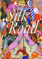
Reisgids Silk Road (China) - Monks, Warriors & Merchants | Odyssey
To the modern reader, the Silk Road conjures up images of fabled cities and exotic lands, of long-gone empires and great conquerors. Place names such as Samarkand, Bukhara, Khotan or Chang'an continue to fascinate with the richness of their past. In this authoritative book, Luce Boulnois explores the encounter between East and West across the vast continental expanse that separates the Mediterranean world from the Chinese one. She unravels in a clear and compelling way the complex threads that make up the history of these great overland trade routes, which allowed the transmission across the world of ideas and beliefs, techniques and works of art, helping to shape the civilizations that flourished along the way. How did the Romans, following in the footsteps of the Greeks, discover these far-flung regions? What did the Chinese know of the European world? How did they manage to keep the secret of silk manufacture safe for centuries? Did Marco Polo really go to China, or was he just a cl…
25,50

Klanten-reviews van Wegenatlas Travel Atlas Silk Road - Zijderoute | ITMB

Er zijn nog geen beoordelingen voor dit productBen jij de eerste die een review plaatst?

Meer over Wegenatlas Travel Atlas Silk Road - Zijderoute | ITMB

Productomschrijving

Kleine, handzame wegenatlas van de oorspronkelijke zijderoute van Libanon tot en met het westen van China. Handig met index, stadsplattegronden, goede legenda en behoorlijk gedetaillerde kaarten. A5 formaat, gebonden. De schaal van de kaarten verschilt per land. The Great Silk Road has been the traditional trading route between Europe and China for two thousand years. Starting in Xi’an in the east and ending at Antioch in the west. Much of the Silk Road still exists and can be visited.   This 73-page atlas follows the route from west to east, starting in ancient Tyre (now Sour, in southern Lebanon) and in Samandag in Turkey, heading eastward through Syria and Iraq (with a two-page inset map of Damascus and a six-page spread for fabled Baghdad) before heading north of the Kavir Desert to Tehran (another four-page spread) and eastward into Afghanistan to follow either the northern or southern routes through modern-day Samarkand and Tashkent (more insets) before moving on to the Urumqi region of far-western China and eventually ending at Xi’an. The atlas is fully indexed and can be used east to west as easily as west to east.

Productspecificaties

Artikelnummer(s)
Brand
ITMB

Verken gerelateerde categorieën

Shopblog.nl maakt gebruik van cookies. Ga je verder op onze website, ga dan akkoord met het plaatsen van cookies en de verwerking van deze data door ons en vermelde partners.