shopblog.nl
Categorieën
  Sluiten

Meer Xploreit Maps
Meer Xploreit Maps in Literatuur boeken

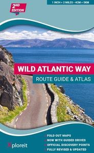
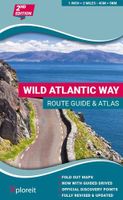
Wegenatlas The Wild Atlantic Way Ierland | Xploreit Maps

Yvonne Gordon provides an essential guide to Ireland's epic coastal driving route - the Wild Atlantic Way. In this newly revised and updated edition she divides the route into 16 easy-to-follow scenic drives from Kinsale, in south Cork, all the way to the little village of Muff in the far north of the island. Each drive can be comfortably completed...
24,95

Webshops met dit product

Webshop
Bezorging
Prijs

Anderen bekeken ook

Wegenatlas The Wild Atlantic Way Ierland | Xploreit Maps
Yvonne Gordon provides an essential guide to Ireland's epic coastal driving route - the Wild Atlantic Way. In this newly revised and updated edition she divides the route into 16 easy-to-follow scenic drives from Kinsale, in south Cork, all the way to the little village of Muff in the far north of the island. Each drive can be comfortably completed in one day and includes an overview map with photographs to illustrate the text. Information is provided on mileage, directions, official discovery points and numerous additional attractions, including the many towns and villages dotted along the way. The generous fold-out maps can be used to follow the guided route or to design custom itineraries. 31 handy fold-out maps. 16 easy-to-follow drives. Official Discovery Points highlighted. Additional recommendations and tips. Route planning maps for the national road network. Distance charts for towns and villages. Yvonne Gordon is an award-winning travel writer who writes about Ireland for publ…
24,95
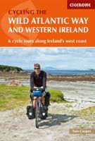
Fietsgids The Wild Atlantic Way and Western Ireland - Ierland | Cicero
Uitstekende fietsgids van Cicerone over de westkust van Ierland. De routes zijn goed beschreven, met veel praktische informatie. Kaartmateriaal is redelijk, om echt op te fietsen wat summier.  Boasting deserted beaches, towering sea-cliffs and tiny harbours - not to mention rich cultural and historical interest - the west of Ireland has much to entice the visitor, and with many miles of quiet roads, it's a cyclist's paradise. The Wild Atlantic Way is a driving route along Ireland's Atlantic seaboard, covering over 2,350km of coastline and showcasing the region's breathtaking landscapes. This guide adapts the route for cyclists - and throws in a couple of other highlights (such as the Aran Islands and Killarney) for good measure. Since relatively few people are likely to have seven weeks to spare for a full Wild Atlantic Way tour, the book presents six self-contained cycle tours, each offering 7-10 days of riding. For the full Wild Atlantic Way experience, these distinct routes can be …
20,95
Wegenkaart - landkaart - Fietskaart Donegal | Xploreit Maps
Zeer goed leesbare deelkaart van Ierland. Alle wegen, alle dorpen en steden en veel topografische details staan er op: daardoor zowel als wegenkaart ook als fietskaart goed te gebruiken. Naast de algemene kaartdetails zijn ook de bezienswaardigheden en historische monumenten goed ingetekend en makkelijk te vinden. Campings en jeugdherbergen maken het compleet.  This convenient and informative paper travel map is specifically designed for visitors to Donegal – the northernmost county in Ireland. With a heady mix of peninsulas, promontories and sandy beaches, Donegal’s  long, indented coastline includes some of the most spectacular scenery in the country. Further inland, the attractions are just as enticing and include Glenveagh National Park – an all-time favourite destination. This new map covers all of County Donegal and highlights local walking trails, cycle routes and scenic drives. The road network shown includes local roads and driving distances are indicated on the main routes. P…
21,95
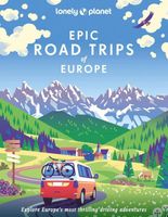
Reisgids Epic Road Trips of Europe | Lonely Planet
Buckle up for the next installment in our Epic series and the follow-up to Epic Drives of the World. Showcasing 50 of Europe's greatest road trips, from classic drives such as Route Napoleon through the south of France to longer trips including Ireland's Wild Atlantic Way or taking a campervan through Finnish Lapland in the Arctic summer. We cover a huge variety of themes and experiences across drives that range from a few hours to a week or more. Each of the featured drives include: First-person accounts from writers who have completed the drive Challenge level grading: easy / harder / epic Inspirational photography, maps and practical information to follow the writer's journey Driving factbox: when is the best time to drive, vehicle hire information, how to get there, what to take Expert travel advice: where to stay, recommended detours, the best places to eat Suggestions for similar drives 50 epic drives across Europe, including: Coast to the Edge of Alps (Albania) Grossgl…
37,95
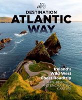
Reisgids Destination Atlantic Way | Destination Earth
Destination Atlantic Way Guidebook Features   In-depth, relatable, and picturesque: Destination Atlantic Way guidebook is 280 pages of the most in-depth, relatable, and picturesque guidebook on the market. It will help you to plan a road trip around Ireland's most scenic landscape, the Wild Atlantic Way, offering a guide to the best and most popular sights along the route, as well as the hidden gems that most overlook.     Must-know Details:   - Detailing campervan facility locations, the best restaurants, cafes, and bars, accommodation options across the route, from hotels to campsites, and over 110 of the best sights to see on the Wild Atlantic Way. - Produced with care: During the production of this guidebook, the authors spent two months living on the Wild Atlantic Way route, turning over every rock and leaf to ensure that all the best-hidden sights and attractions that the WAW has to offer are included. - Reliable and detailed: Maps of each region of the route, detailing the exact…
31,95
Wegenkaart - landkaart - Fietskaart Donegal | Xploreit Maps
Zeer goed leesbare deelkaart van Ierland. Alle wegen, alle dorpen en steden en veel topografische details staan er op: daardoor zowel als wegenkaart ook als fietskaart goed te gebruiken. Naast de algemene kaartdetails zijn ook de bezienswaardigheden en historische monumenten goed ingetekend en makkelijk te vinden. Campings en jeugdherbergen maken het compleet.  This convenient and informative paper travel map is specifically designed for visitors to Donegal – the northernmost county in Ireland. With a heady mix of peninsulas, promontories and sandy beaches, Donegal’s  long, indented coastline includes some of the most spectacular scenery in the country. Further inland, the attractions are just as enticing and include Glenveagh National Park – an all-time favourite destination. This new map covers all of County Donegal and highlights local walking trails, cycle routes and scenic drives. The road network shown includes local roads and driving distances are indicated on the main routes. P…
21,95
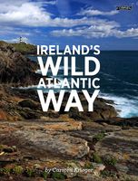
Fotoboek Ireland's Wild Atlantic Way | O'Brien Press
Take a photographic journey down Ireland's Atlantic coast from Donegal in the north to Cork in the south. This beautiful book showcases the west coast in all its wild beauty: dramatic views, abundant nature and wildlife, lighthouses, harbours and quaint seaside villages, as well as heritage, history and people. The Wild Atlantic Way is a fully-signposted route along the west coast of Ireland that brings the visitor to some of Ireland's most spectacular scenery and liveliest towns: from surfing in Rossknowlagh to birdwatching at the magnificent cliffs of Moher, from the boats in Galway Bay to traditional music in Doolin, from dolphins in Kerry to castles in Cork there's something for everyone on the wild west coast. Over 200 wonderful photographs. Maps showing each section of the Wild Atlantic Way: Donegal-Mayo, Mayo-Clare, Clare-Kerry, Kerry to Cork. 'a sumptuous book in which the magnificent colour photographs speak for themselves' Books Ireland on Ireland's Coast
15,95
Reisgids Destination Atlantic Way | Destination Earth
Destination Atlantic Way Guidebook Features   In-depth, relatable, and picturesque: Destination Atlantic Way guidebook is 280 pages of the most in-depth, relatable, and picturesque guidebook on the market. It will help you to plan a road trip around Ireland's most scenic landscape, the Wild Atlantic Way, offering a guide to the best and most popular sights along the route, as well as the hidden gems that most overlook.     Must-know Details:   - Detailing campervan facility locations, the best restaurants, cafes, and bars, accommodation options across the route, from hotels to campsites, and over 110 of the best sights to see on the Wild Atlantic Way. - Produced with care: During the production of this guidebook, the authors spent two months living on the Wild Atlantic Way route, turning over every rock and leaf to ensure that all the best-hidden sights and attractions that the WAW has to offer are included. - Reliable and detailed: Maps of each region of the route, detailing the exact…
31,95

Klanten-reviews van Wegenatlas The Wild Atlantic Way Ierland | Xploreit Maps

Er zijn nog geen beoordelingen voor dit productBen jij de eerste die een review plaatst?

Meer over Wegenatlas The Wild Atlantic Way Ierland | Xploreit Maps

Productomschrijving

Yvonne Gordon provides an essential guide to Ireland's epic coastal driving route - the Wild Atlantic Way. In this newly revised and updated edition she divides the route into 16 easy-to-follow scenic drives from Kinsale, in south Cork, all the way to the little village of Muff in the far north of the island. Each drive can be comfortably completed in one day and includes an overview map with photographs to illustrate the text. Information is provided on mileage, directions, official discovery points and numerous additional attractions, including the many towns and villages dotted along the way. The generous fold-out maps can be used to follow the guided route or to design custom itineraries. 31 handy fold-out maps. 16 easy-to-follow drives. Official Discovery Points highlighted. Additional recommendations and tips. Route planning maps for the national road network. Distance charts for towns and villages. Yvonne Gordon is an award-winning travel writer who writes about Ireland for publications around the globe including the Irish Independent, The Guardian, Lonely Planet, The Washington Post, National Geographic Travel, BBC Travel and Hemispheres magazine. She is the author of Frommer’s Ireland, co-author of Back Roads Ireland and Lonely Planet Experience Ireland and her awards include Irish Travel Writer of the Year. Based in Dublin, she explores the Wild Atlantic Way regularly, finding something new and fascinating on each journey.

Productspecificaties

Artikelnummer(s)
Brand
Xploreit Maps

Verken gerelateerde categorieën

Shopblog.nl maakt gebruik van cookies. Ga je verder op onze website, ga dan akkoord met het plaatsen van cookies en de verwerking van deze data door ons en vermelde partners.