shopblog.nl
Categorieën
  Sluiten

Meer Jana Seta
Meer Jana Seta in Literatuur boeken

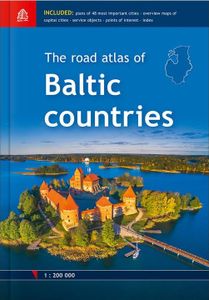
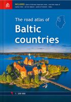
Wegenatlas The Road atlas of Baltic countries - Baltische Staten | Ja

Mooie wegenatlas op schaal 1:200.000 van de Baltische landen op A-4 formaat in gebonden hardcover versie. Edition 2018 Latvia, Estonia and Lithuania road maps in scale 1:200'000 Atlas base map is supplemented with plans of the 48 largest cities in scale 1:20'000 Tallinn, Riga and Vilnius vicinity maps in scale 1:85'000 Information about points...
51,50

Webshops met dit product

Webshop
Bezorging
Prijs

Anderen bekeken ook

Wegenatlas The Road atlas of Baltic countries 2018 - Baltische Staten
Mooie wegenatlas op schaal 1:200.000 van de Baltische landen op A-4 formaat in gebonden hardcover versie. Edition 2018 Latvia, Estonia and Lithuania road maps in scale 1:200'000 Atlas base map is supplemented with plans of the 48 largest cities in scale 1:20'000 Tallinn, Riga and Vilnius vicinity maps in scale 1:85'000 Information about points of interest and tourism services Index of place names Size 21,5 x 30,6 cm 254 pages Hardback
51,50
Wegenkaart - landkaart 781 Baltische Staten | Michelin
Zoals je van deze landkaart van Michelin mag verwachten is deze wegenkaart Baltische Staten zeer overzichtelijk en heeft een duidelijk helder kaartbeeld. De kaart geeft uitgebreid toeristische informatie weer. This Baltic States map from Michelin is part of their red national map series. These are perfect for route planning as well as getting around by car once you're there. They clearly mark out major roads and also show many of the more important minor roads. The map covers Estonia, Latvia, and Lithuania and includes several insets showing Tallinn at 1:10 000, Riga at 1:10 000 and Vinius at 1:10 000.   The map's simple folding design with durable paper cover, allows it to be read like a book and easily folded back together. Road numbers and intermediate distances are clearly displayed with the more scenic routes highlighted in green.   The map also features:   Political boundaries Regional and National Parks Important sights such as castles, ruins, and churches Driving Times and Dist…
11,95
Reisgids Eyewitness Travel Estonia, Latvia and Lithuania - Estland, Le
Prachtig geillustreerde reisgids met o.a. 3D tekeningen, fraaie kaarten en geweldige foto’s. Daarnaast uitgebreide achtergrondbeschrijvingen. Echt om in de stemming te komen! Groot formaat gids. Engelstalig Discover the rich culture and stunning scenery of the Baltic States with your indispensable guide to this beautiful part of the world. DK Eyewitness Travel Guide Estonia, Latvia and Lithuania includes comprehensive coverage of the historic capital cities of Tallinn, Riga and Vilnius; the dramatic rural regions dotted with breathtaking lakes and wetlands; medieval villages steeped in tradition and the many folklore festivals. Lose yourself in the labyrinthine streets of Vilnius Old Town, step back in time at Lativia's 18th-century Rundale Palace or explore the quirky cafes and galleries of Užupis, Lithuania's artists' republic. Accurate maps and comprehensive practical information help you to navigate each country, whilst stunning photography and insider tips make this your ultimate …
22,95
Wegenkaart - landkaart Litouwen & Letland | ITMB
ITMB is very pleased to release its first-ever map of the Baltic country of Lithuania, which occupies Side 1 of this double-sided map. It is bordered by Latvia on its north, the Russian enclave of Kalingrad on its southeast, and Poland and Belarus on its south and east. It is now on the front lines of tension between Russia and its neighbours, as are all the Baltic states. It is also a valued member of both NATO and the EU, and as such is easy to access from either Poland or Latvia. Lithuania fronts on to the Baltic Sea with a major port at Klaipeda (formerly Memel), with its capital being Vilnius. Historically, the country has suffered German and Russian invasions during the 20th century, the last of which resulted in the country losing its independence completely by being absorbed into the Russian Empire in the latter stages of WW2. It regained its independence in 1991, with the collapse of the USSR and shortly thereafter applied to join both the European Union and NATO. Touristicall…
14,95
Wegenatlas Big Road Atlas Britain and Northern Ireland 2025 | A3 | Rin
Grote wegenatlas, a3-formaat in ringband. The ultimate 3.2 miles to 1 inch scale large-format, spiral-bound road atlas of Britain, featuring Collins’ popular and well established road mapping, and designed for exceptional clarity and ease of use.   The atlas has a wide range of urban area maps at even larger scale and 64 detailed town centre street plans.   This fully updated road atlas covers the whole of Britain with each scale of mapping colour-coded for ease of use. The smallest scale maps are great for long distance route planning and the street plans help you locate your final destination.   Main features:   Easy to use, clear road maps at a scale of 3.2 miles to 1 inch of England, Wales and Southern Scotland. Northern Scotland is shown at 5 miles to 1 inch Route planning section including maps at a scale of 15.8 miles to 1 inch, motorway services information and a handy distance calculator 22 urban area approach maps at 1 mile to 1 inch which clearly show the best rou…
20,95
Wegenatlas Lietuvos Autokeliu Atlasas - Litouwen | Jana Seta
Lithuania Road Atlas from the Riga based Jana Seta, in handy glovebox paperback format with street plans of 19 towns, including an enlargement for city centre of Vilnius, The whole country is covered at 1:200,000, showing detailed classification of road network with petrol stations, and railway lines with stops. Boundaries of national parks and other protected areas are marked and a range of symbols indicate tourist accommodations, campsites, various places of interest, etc. Picturesque towns and villages are highlighted. Colouring and graphics show forested areas and swamps and the atlas also shows the country’s administrative divisions. Latitude lines are at intervals of 5’ intervals and longitude at 10’. The atlas has an extensive index of localities.   The atlas also includes street plans of 19 towns at 1:20,000 or 1:25,000, annotated with places of interest and various facilities. For Vilnius the atlas has a plan of its central districts, plus a road map of the surrounding area hi…
24,50

Klanten-reviews van Wegenatlas The Road atlas of Baltic countries - Baltische Staten | Ja

Er zijn nog geen beoordelingen voor dit productBen jij de eerste die een review plaatst?

Meer over Wegenatlas The Road atlas of Baltic countries - Baltische Staten | Ja

Productomschrijving

Mooie wegenatlas op schaal 1:200.000 van de Baltische landen op A-4 formaat in gebonden hardcover versie. Edition 2018 Latvia, Estonia and Lithuania road maps in scale 1:200'000 Atlas base map is supplemented with plans of the 48 largest cities in scale 1:20'000 Tallinn, Riga and Vilnius vicinity maps in scale 1:85'000 Information about points of interest and tourism services Index of place names Size 21,5 x 30,6 cm 254 pages Hardback

Productspecificaties

Artikelnummer(s)
Brand
Jana Seta

Verken gerelateerde categorieën

Shopblog.nl maakt gebruik van cookies. Ga je verder op onze website, ga dan akkoord met het plaatsen van cookies en de verwerking van deze data door ons en vermelde partners.