shopblog.nl
Categorieën
  Sluiten

Meer A-Z Map Company
Meer A-Z Map Company in Elektra

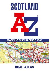
Wegenatlas Scotland - Schotland | A-Z Map Company

Handzame gedetailleerde wegenatlas van Schotland. Navigate your way around Scotland with this detailed, full-colour and easy-to-use A-Z Road Atlas. From the border to the north coast, the mainland pages scale is 3.5 miles to 1 inch and the Western Isles, Shetland Islands and Orkney Islands scale is 4.5 miles to 1 inch.   Covering the entire cou...
13,50

Webshops met dit product

Webshop
Bezorging
Prijs

Anderen bekeken ook

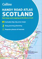
Wegenatlas Handy Road Atlas Scotland - Schotland | Collins
Handzame A% wegenatlas van Schotland met register en stadsplattegronden. Discover new places with handy road atlases from Collins. Your ideal companion for navigating around Scotland. It has extremely clear, route planning maps of Scotland, detailed city plans of the major cities and towns and fits neatly into your glovebox, briefcase or bag.   Main featuresClear, attractive route planning maps of the whole of Scotland supported by comprehensive, fully indexed city centre street maps of Aberdeen, Dundee, Edinburgh, Glasgow, Inverness and Perth. Scale of main maps: 1:625,000 (9.9 miles to 1 inch). Also includes* Places of tourist interest are highlighted* Attractive layer colouring showing land height* Road network fully classified and colour coded* Detailed street mapping of Edinburgh, including the Royal Mile with all its attractions clearly marked, Leith and Holyrood Park* Detailed street mapping of Glasgow, including the West End, city centre and M74 extension* Detailed street mappi…
9,95
Wegenkaart - landkaart Touring Map of Scotland - Schotland | Collins
Best-selling map of Scotland. More than 1,000 places of tourist interest plotted and named on the map. The features have been plotted onto an up-to-date and attractive Collins map of Scotland.   A clear, easy to follow road map with colour classified roads. Ideal for tourists with hundreds of distinctive tourist symbols and tourist information centres all shown.   This map includes: • The whole of Scotland on a double sided sheet at 5 miles to 1 inch • Over 25 categories of tourist information shown on the map including youth hostels, picnic sites and ferries as well as the more obvious tourist sites such as castles, wildlife parks and museums • Detailed town centre maps of Edinburgh, Glasgow, Aberdeen, Dundee, Inverness and Perth • New places of interest including Japanese Garden (near Dollar), Macallan Distillery Centre, Moat Brae (Dumfries) and Scottish Submarine Centre (Helensburgh) • Road updates include the new Dalry bypass, Maybole bypass under construction, A9 dualling sections…
9,95
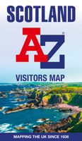
Wegenkaart - landkaart Visitors map Scotland - Schotland | A-Z Map Com
xplore the whole of Scotland from Dumfries and Galloway in the South to the Orkney Islands in the North. With detailed road mapping and illustrated town plans of major cities, this feature rich, helpful tourist guide is ideal for touring around Scotland. Published at a clear 8.7 miles to 1 inch scale (5.51 cm to 1 km), this handy map is a detailed and informative exploration of what Scotland has to offer.   Highlights include: 8 inset street maps to major cities and popular destinations, including: Edinburgh, Glasgow, Stirling, and Cairngorms National Park, with detailed descriptions and places of interestLocations of visitor centres and tourist information sitesUseful key to map symbols making it a clear and easy readMore than 700 places of interest The perfect map for exploring Scotland whether you are a tourist or a local.
11,50
Wegenatlas Handy Road Atlas Scotland - Schotland | Collins
Handzame A% wegenatlas van Schotland met register en stadsplattegronden. Discover new places with handy road atlases from Collins. Your ideal companion for navigating around Scotland. It has extremely clear, route planning maps of Scotland, detailed city plans of the major cities and towns and fits neatly into your glovebox, briefcase or bag.   Main featuresClear, attractive route planning maps of the whole of Scotland supported by comprehensive, fully indexed city centre street maps of Aberdeen, Dundee, Edinburgh, Glasgow, Inverness and Perth. Scale of main maps: 1:625,000 (9.9 miles to 1 inch). Also includes* Places of tourist interest are highlighted* Attractive layer colouring showing land height* Road network fully classified and colour coded* Detailed street mapping of Edinburgh, including the Royal Mile with all its attractions clearly marked, Leith and Holyrood Park* Detailed street mapping of Glasgow, including the West End, city centre and M74 extension* Detailed street mappi…
9,95
Wegenkaart - landkaart Visitors map Scotland - Schotland | A-Z Map Com
xplore the whole of Scotland from Dumfries and Galloway in the South to the Orkney Islands in the North. With detailed road mapping and illustrated town plans of major cities, this feature rich, helpful tourist guide is ideal for touring around Scotland. Published at a clear 8.7 miles to 1 inch scale (5.51 cm to 1 km), this handy map is a detailed and informative exploration of what Scotland has to offer.   Highlights include: 8 inset street maps to major cities and popular destinations, including: Edinburgh, Glasgow, Stirling, and Cairngorms National Park, with detailed descriptions and places of interestLocations of visitor centres and tourist information sitesUseful key to map symbols making it a clear and easy readMore than 700 places of interest The perfect map for exploring Scotland whether you are a tourist or a local.
11,50
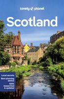
Reisgids Scotland - Schotland | Lonely Planet
Lonely Planet Schotland De lonley planet Schotland is de perfecte reisgids voor Schotland voor zowel de georganiseerde als de zelfstandige reiziger voor Schotland. Naast een algemene inleiding van het land / streek vol met praktische informatie over hoe je er het beste kunt reizen: slapen, eten, vervoer, excursies ... alles kun je er in vinden. Lonely Planet's Scotland is our most comprehensive guide that extensively covers all the country has to offer, with recommendations for both popular and lesser-known experiences. Get your culture fix in Edinburgh, take in astounding views from the top of Ben Nevis and sample mouth-watering whisky on Islay; all with your trusted travel companion. Inside Lonely Planet's Scotland Travel Guide: Lonely Planet's Top Picks - a visually inspiring collection of the destination's best experiences and where to have themItineraries help you build the ultimate trip based on your personal needs and interestsLocal insights give you a richer, more rewarding tr…
22,50
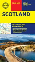
Wegenkaart - landkaart Philip's Scotland Road Map | Philip's Maps
'THE CLEAREST AND MOST DETAILED MAPS OF EUROPE' David Williams MBE, former CEO Gem Motoring Assist The bestselling fold-out road map for navigating in Scotland has been updated for all travellers wanting to go places in the lowlands, highlands and islands, including the Western Isles, the Orkney and Shetland Islands. Whether driving through the most spectacular scenic routes the country has to offer in the Highlands or planning your trip from Edinburgh to Inverness, this handy map has all you need. - Super-clear mapping scale 1:330,000 (5.25 miles to 1 inch) - Key driving information: motorways, railways, ferry routes, road numbers, plus distances between towns - Fully revised and up-to-date with the latest tourist and leisure information - Scenic routes clearly highlighted - Places of interest added: from castles, heritage sites, beaches and national parks to theme parks, places of worship and ancient monuments - Includes the islands and sights of the Western Isles and the Orkney and …
9,95
Historische Kaart Tartans Map of Scotland | Collins
Discover Scotland with this authoritative guide to tartans and their origins. This popular touring map has a huge amount of detail with over 1,000 places of tourist interest plotted and named on the map. The features have been plotted onto an up-to-date and attractive Collins map of Scotland.   A clear, easy to follow road map with colour classified roads. Ideal for tourists with hundreds of distinctive tourist symbols and tourist information centres all shown. This map includes:* The whole of Scotland on a double sided sheet at 5 miles to 1 inch* Over 25 categories of tourist information shown on the map including youth hostels, picnic sites and ferries as well as the more obvious tourist sites such as castles, wildlife parks and museums* Detailed town centre maps of Edinburgh, Glasgow, Aberdeen, Dundee, Inverness and Perth* Distances on the map along major routes Scale: 1:316,800 (5 miles to 1 inch).   There is a comprehensive index to both place names and places of tourist interest.
8,50

Klanten-reviews van Wegenatlas Scotland - Schotland | A-Z Map Company

Er zijn nog geen beoordelingen voor dit productBen jij de eerste die een review plaatst?

Meer over Wegenatlas Scotland - Schotland | A-Z Map Company

Productomschrijving

Handzame gedetailleerde wegenatlas van Schotland. Navigate your way around Scotland with this detailed, full-colour and easy-to-use A-Z Road Atlas. From the border to the north coast, the mainland pages scale is 3.5 miles to 1 inch and the Western Isles, Shetland Islands and Orkney Islands scale is 4.5 miles to 1 inch.   Covering the entire country, this road atlas includes the following features: • Motorways with full junction detail, primary routes and destinations, A & B roads, under construction and proposed roads, service areas, tolls, mileages, national, county and unitary authority boundaries • Cairngorms and Loch Lomond & The Trossachs National Park boundaries • Selected places of interest and tourist information centres   20 city and town street maps are included for Aberdeen, Aviemore, Ayr, Dumfries, Dundee, Dunfermline, Edinburgh, Glasgow, Falkirk, Fort William, Hamilton, Inverness, Kilmarnock, Kirkcaldy, Motherwell, Oban, Paisley, Perth, St Andrews and Stirling. Also included is a comprehensive index to cities, towns, villages, hamlets and locations. Also included are 20 city and town plans for:   Aberdeen Aviemore Ayr Dumfries Dundee Dunfermline Edinburgh Glasgow Falkirk Fort William Hamilton Inverness Kilmarnock Kirkcaldy Motherwell Oban Paisley Perth St Andrews Stirling   There is a comprehensive index to cities, towns, villages, hamlets and locations.

Productspecificaties

Artikelnummer(s)
Brand
A-Z Map Company

Verken gerelateerde categorieën

Shopblog.nl maakt gebruik van cookies. Ga je verder op onze website, ga dan akkoord met het plaatsen van cookies en de verwerking van deze data door ons en vermelde partners.