shopblog.nl
Categorieën
  Sluiten

Meer Michelin
Meer Michelin in Literatuur boeken

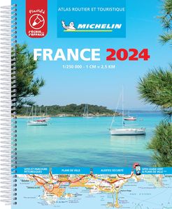
Wegenatlas Routier et Touristique France - Frankrijk 2024 | A4-Formaat

Geplastificeerde waterafstotende en scheurvaste wegenatlas van Frankrijk 1:250.000 Michelin A4 Formaat, Spiraal rug. Met uitgebreid register.   Michelin's France 100% laminated A4 atlas offers, in addition of Michelin's clear and accurate mapping, an enhanced view of your journey thanks to its scale 1/250,000. Convenient and easy to use thanks to i...
26,95

Webshops met dit product

Webshop
Bezorging
Prijs

Anderen bekeken ook

Wegenatlas Routier et Touristique France - Frankrijk 2024 | A4-Formaat
Geplastificeerde waterafstotende en scheurvaste wegenatlas van Frankrijk 1:250.000 Michelin A4 Formaat, Spiraal rug. Met uitgebreid register.   Michelin's France 100% laminated A4 atlas offers, in addition of Michelin's clear and accurate mapping, an enhanced view of your journey thanks to its scale 1/250,000. Convenient and easy to use thanks to its spiral bound cover, this atlas comes with extra-resistant laminated pages on which you can trace and erase your journey. The route planner as well as the time distance charts will help you plan and optimise journey. Michelin's new safety alerts warn you about dangerous driving areas and zones subjet to tighter speed checks. Michelin's laminated France atlas also includes information on tourist sights, leisure facilities and scenic routes, as well as service areas to add pleasure and comfort to your journey. Michelin's France laminated tourist and motorist atlas features: * Scale 1/250,000: for an enhanced view of your journey * Extra resis…
26,95
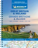
Wegenatlas Great Britain and Ireland 2024 - Main Roads Atlas (A4-Spira
Full of practical features, the Michelin Great Britain & Ireland 2024 - Main Roads Atlas (A4-Spiral) is the perfect companion for your everyday journey and holiday planning. Updated every year, it gives you clear and accurate information for a safe and enjoyable journey thanks to a detailed mapping scale of 1/300 000. The route planner as well as the time and distance charts will help you plan and optimise your journey. Michelin's safety alerts warn you about dangerous driving areas, such as steep hills, level crossing as well as risk zone subject to tighter speed check. The Great Britain & Ireland 2024 - Main Roads Atlas (A4-Spiral) also shows tourist sights, leisure facilities, as well as scenic routes so that you can make the most of your journey. The Michelin Great Britain & Ireland 2024 - Main Roads Atlas (A4-Spiral) features: Detailed mapping with a scale 1/300 000 (4.75 miles to 1 inch) Mileage chart and journey times to help you plan your journey Key to Map Pages to quickl…
19,95
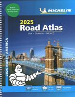
Wegenatlas Road Atlas USA Canada Mexico 2025 | A4-Formaat | Ringband |
De beroemde wegenatlas van Rand McNally nu als Michelin atlas. Super handige atlas van Michelin in A4 formaat met stevige ringband. Let op: Canada en Mexico staan er zeer beperkt in. For inspiring road trips and scenic drives, Michelin's updated, spiral-bound North America Road Atlas 2024 suggests 52 routes. The tiled atlas, with its clear, accurate mapping, complements online navigation while its big picture and road details aid in advance planning and en route decisions. For outdoor fun and adventure, look for inspiration among the highlights from national and provincial parks, including the parks' GPS coordinates.   Rely with confidence on Michelin's deluxe atlas to get you there. Covers USA, Canada and Mexico. Scale 1:625,000 - 1:9,018,000.   Spiral bound for lay-flat convenience. More than 240 large-scale city maps for navigating in and around urban areas. Bonus Northeast Corridor maps provide extra detail between Boston and Washington DC for easier driving.   Six-page trav…
21,95
Reisgids road trips France - Frankrijk | Eyewitness
There's nothing like a road trip through France to make you appreciate the diversity of the country! From the lavender fields in Provence to the Riviera beaches and the wine in Saint-Émilion, it's easy to understand why taking a French road trip tops so many bucket lists around the world. Let this DK Eyewitness travel book be your guide through this beautiful country. Inside the pages of this France road guide, you'll discover: - 24 easy-to-follow scenic driving tours, each lasting one to five days. - A laminated pull-out road map of France helps you navigate with ease. - Information on the French rules of the road. - GPS navigation tips, plus helpful advice on road conditions, speed limits and parking. - Hotels, restaurants, shops and vineyards where you can savor superb local food and wine - Best experiences along each route: Get active on walks, boat trips, bike rides and hikes, or discover fine art and architecture through the ages. Visit the land of love and croissants Explore Fr…
20,95
Wegenatlas Routier et Touristique France - Frankrijk 2024 - A4 | Miche
Gebonden versie van de Atlas Routier 2024, een meer uitgebreide versie van de gewone Michelin atlas Frankrijk. Met 95 stadsplattegronden; info voor zakenmensen; kaart met servicestations langs autosnelwegen en hun dienstverlening. SSécurité & fiabilité : Une cartographie au 1/200000, lisible et précise, mise à jour chaque année. Les Alertes Sécurité Michelin (fortes pentes, parcours dangereux...). Des fiches pratiques, pour préparer et vivre votre voyage en toute sérénité. Pratique & efficace : dans l'atlas, grâce à une carte de situation reprise sur chaque page. Des pages "Plans de Ville" hyper-pratiques avec la carte des environs, le plan du centre-ville et un QR Code pour vous piloter sur les derniers kilomètres grâce à votre smartphone ! Toutes les informations utiles pour circuler sur autoroutes avec les aires de service et les prestations proposées à proximité, kilomètres et temps de parcours détaillés.  La sélection Michelin des routes les plus pittoresques, pour sortir des sent…
26,95
Wegenatlas Traveller's Atlas Southern Africa - Zuidelijk Afrika | A3-F
Deze atlas omvat tien landen in zuidelijk Afrika en is speciaal gericht op reizigers die zelf rijden. De betrokken landen zijn: Angola, Botswana, Lesotho, Malawi, Mozambique, Namibië, Zuid-Afrika, Swaziland, Zambia en Zimbabwe.   De Atlas bevat 223 kaartpagina's met hetzelfde vertrouwde kaartdetail waarvoor Tracks4Africa bekend is.   De wegenatlas is afgedrukt in A3 formaat, weegt 2750g, heeft een stevige omslag, spiraal gebonden en de pagina's zijn afgedrukt op dik papier.   Bigger coverage than ever before: 1:4m maps for Southern and Eastern Africa – ideal for macro planning. 1:1m maps for Southern Africa, covering the following countries: Angola, Botswana, eSwatini, Lesotho, Malawi, Mozambique, Namibia, South Africa, Zambia and Zimbabwe. 1:500k maps for South Africa, Malawi, most part of Zambia and the area around Moremi/Chobe in Botswana. Road coverage: This Atlas is designed for overland travel and compiled from the same data used on our famous GPS maps. Use it for trip pl…
79,95
Reisgids Mini Rough Guide Frankrijk (France) | Rough Guides
This pocket-sized travel guide to France is a convenient, quick-reference companion to discovering what to do, what to see and how to get around the destination. It covers top attractions like Provence, as well as hidden gems, including Perigord. Our France guide book will save you time and enhance your exploration of this fascinating country.   This France travel guide has been fully updated post-COVID-19. This Mini Rough Guide to FRANCE covers: Ile de France, The Northeast, The Southeast, The Southwest. In this guide book to France you will find: RECOMMENDATIONS FOR EVERY TYPE OF TRAVELLER Experiences selected for every kind of trip to France, from cultural explorations in The French Alps to family activities in child-friendly places, like Versailles or chilled-out breaks in popular tourist areas, like Paris.   TOP TEN ATTRACTIONSThis France travel guide covers the destination's top ten attractions not to miss, including The Eiffel Tower, the Cote d'Azur, Versailles, Disneyland Paris…
12,50

Klanten-reviews van Wegenatlas Routier et Touristique France - Frankrijk 2024 | A4-Formaat

Er zijn nog geen beoordelingen voor dit productBen jij de eerste die een review plaatst?

Meer over Wegenatlas Routier et Touristique France - Frankrijk 2024 | A4-Formaat

Productomschrijving

Geplastificeerde waterafstotende en scheurvaste wegenatlas van Frankrijk 1:250.000 Michelin A4 Formaat, Spiraal rug. Met uitgebreid register.   Michelin's France 100% laminated A4 atlas offers, in addition of Michelin's clear and accurate mapping, an enhanced view of your journey thanks to its scale 1/250,000. Convenient and easy to use thanks to its spiral bound cover, this atlas comes with extra-resistant laminated pages on which you can trace and erase your journey. The route planner as well as the time distance charts will help you plan and optimise journey. Michelin's new safety alerts warn you about dangerous driving areas and zones subjet to tighter speed checks. Michelin's laminated France atlas also includes information on tourist sights, leisure facilities and scenic routes, as well as service areas to add pleasure and comfort to your journey. Michelin's France laminated tourist and motorist atlas features: * Scale 1/250,000: for an enhanced view of your journey * Extra resistant pages: to draw/erase your journey as you go along * Key to map pages: to quickly access the region of your interest * A complete town index: To easily indentify to destination of your choice * Distance and time chart: to help you plan your trip * 6 major town plans: Paris, Bordeaux, Lille, Lyon, Marseille & Nantes * Michelin's danger alers: to help you identify zones at risks for drivers and controlled speed areas * In English language: Keys, indexes and information

Productspecificaties

Artikelnummer(s)
Brand
Michelin

Verken gerelateerde categorieën

Shopblog.nl maakt gebruik van cookies. Ga je verder op onze website, ga dan akkoord met het plaatsen van cookies en de verwerking van deze data door ons en vermelde partners.