shopblog.nl
Categorieën
  Sluiten

Meer Ferdakort

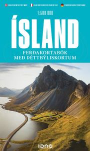
Wegenatlas IJsland met stadsplattegronden | Ferdakort

Super handige kleine wegenatlas van IJsland (schaal 1:500.000) met vooral een enorme hoeveelheid plattegronden van steden en dorpen, enkele themakaarten en een groot register. De kaarten zijn uitstekend leesbaar en de atlas in in een mooie ringband uitgevoerd.  Road Atlas of Iceland at 1:500,000 from Ferðakort, published in a handy 15x25cm spiral-b...
30,95

Webshops met dit product

Webshop
Bezorging
Prijs

Anderen bekeken ook

Wegenatlas IJsland met stadsplattegronden | Ferdakort
Super handige kleine wegenatlas van IJsland (schaal 1:500.000) met vooral een enorme hoeveelheid plattegronden van steden en dorpen, enkele themakaarten en een groot register. De kaarten zijn uitstekend leesbaar en de atlas in in een mooie ringband uitgevoerd.  Road Atlas of Iceland at 1:500,000 from Ferðakort, published in a handy 15x25cm spiral-bound format, with an index of over 3,000 entries, a comprehensive distance table, 46 street plans including Reykjavik and several thematic map sincluding cultural heritage and geology.   The whole of Iceland is covered at 1:500,000 with the road network distinguishing between paved and gravel roads, and showing which small local roads are maintained by the country’s government. Fords, locations of petrol stations, driving distances and car ferry routes are marked. National parks and other protected areas are highlighted and symbols mark locations of various places of interest: different types of tourist accommodations including campsites, ref…
30,95
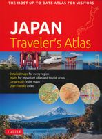
Wegenatlas Japan Traveler's Atlas | Tuttle Publishing
Finding your way around the various regions of Japan is a breeze with this handy Tuttle Japan Traveler's Atlas. Designed for the adventurous traveler and containing all the maps you'll need on your explorations, this atlas includes many views that are not available anywhere else.   The atlas is conveniently divided into the major regions of Japan: Tokyo Mt. Fuji & Around Tokyo Central Honshu Kyoto Kansai Hiroshima & Western Honshu Northern Honshu Hokkaido Shikoku Kyushu Okinawa & the Southwest Islands   Each of the 148 maps in this atlas is presented in a logical, easy-to-follow manner, with emphasis on the most frequently-visited areas. All cities, towns, villages, places of interest including nature reserves are indexed for quick reference.   Comprehensive: detailed insets are given for all the major cities, travel destinations and business hubs in Japan. Informative: Precise locations are indicated for all popular sights, hotels, restaurants, temples, shopping malls and…
19,95
Wegenatlas IJsland | Ferdakort
Gedetailleerde wegenatlas van IJsland, met duidelijke en gedetailleerde wegenkaarten van de topografische dienst op een schaal van 1:200.000. This road atlas is based on a map database on a scale of 1:250 000. In addition to 50 pages of road maps, the Road Atlas contains several theme maps covering accommodation, camping sites, museums, swimming pools and golf courses. There is also a comprehensive place-name index with over 15,500 entries. The format of the atlas makes it very easy for use in a car: it unfolds to a width of about 60 cm that gives an excellent overview of a large tract of land. The Road Atlas comes in a handy box. Scale: 1:200 000   Published: 2021   Size: 31 x 16 cm / Weight: 448 g / Pages: 86   Languages: Icelandic, English, German and French
42,50
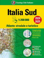
Wegenatlas Atlante Stradale d'Italia Sud | Touring Club Italiano
Atlas van de Italiaanse ANWB, goed kaartbeeld. Wel met omgevingskaarten van belangrijke steden en stadsplattegronden. Kaarten vanaf Rome naar het zuiden. Wegenatlas met gedetaileerde wegenkaarten van zuidelijk Italië, ten zuiden van Rome en met Sicilie, snelwegkaarten met afritten, toeristische informatie, plattegronden van steden, de kaarten zijn ook geschikt om op te fietsen Southern Italy at 1:200,000 in a series of three excellent road atlases from the Touring Club Italiano, each with enlargements of the environs of main cities, numerous superb indexed street plans, plus a very comprehensive distance table.   The atlases are in a paperback format, slightly larger than A4. Cartography is the same as in TCI’s 1:200,000 series of regional maps, with subtle but very effective relief shading plus spot heights to present the topography. Numerous names of mountain ranges, valleys, peaks, etc. are shown and national parks and other protected areas are prominently highlighted.   Road ne…
24,95
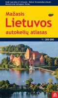
Wegenatlas Lietuvos Autokeliu Atlasas - Litouwen | Jana Seta
Lithuania Road Atlas from the Riga based Jana Seta, in handy glovebox paperback format with street plans of 19 towns, including an enlargement for city centre of Vilnius, The whole country is covered at 1:200,000, showing detailed classification of road network with petrol stations, and railway lines with stops. Boundaries of national parks and other protected areas are marked and a range of symbols indicate tourist accommodations, campsites, various places of interest, etc. Picturesque towns and villages are highlighted. Colouring and graphics show forested areas and swamps and the atlas also shows the country’s administrative divisions. Latitude lines are at intervals of 5’ intervals and longitude at 10’. The atlas has an extensive index of localities.   The atlas also includes street plans of 19 towns at 1:20,000 or 1:25,000, annotated with places of interest and various facilities. For Vilnius the atlas has a plan of its central districts, plus a road map of the surrounding area hi…
24,50
Wegenatlas IJsland | Ferdakort
Gedetailleerde wegenatlas van IJsland, met duidelijke en gedetailleerde wegenkaarten van de topografische dienst op een schaal van 1:200.000. This road atlas is based on a map database on a scale of 1:250 000. In addition to 50 pages of road maps, the Road Atlas contains several theme maps covering accommodation, camping sites, museums, swimming pools and golf courses. There is also a comprehensive place-name index with over 15,500 entries. The format of the atlas makes it very easy for use in a car: it unfolds to a width of about 60 cm that gives an excellent overview of a large tract of land. The Road Atlas comes in a handy box. Scale: 1:200 000   Published: 2021   Size: 31 x 16 cm / Weight: 448 g / Pages: 86   Languages: Icelandic, English, German and French
42,50
Wegenatlas Atlante Stradale d'Italia Sud | Touring Club Italiano
Atlas van de Italiaanse ANWB, goed kaartbeeld. Wel met omgevingskaarten van belangrijke steden en stadsplattegronden. Kaarten vanaf Rome naar het zuiden. Wegenatlas met gedetaileerde wegenkaarten van zuidelijk Italië, ten zuiden van Rome en met Sicilie, snelwegkaarten met afritten, toeristische informatie, plattegronden van steden, de kaarten zijn ook geschikt om op te fietsen Southern Italy at 1:200,000 in a series of three excellent road atlases from the Touring Club Italiano, each with enlargements of the environs of main cities, numerous superb indexed street plans, plus a very comprehensive distance table.   The atlases are in a paperback format, slightly larger than A4. Cartography is the same as in TCI’s 1:200,000 series of regional maps, with subtle but very effective relief shading plus spot heights to present the topography. Numerous names of mountain ranges, valleys, peaks, etc. are shown and national parks and other protected areas are prominently highlighted.   Road ne…
24,95
Wegenatlas Australië - Great Desert Tracks Atlas & Guide | Hema Maps
Whether you're a desert lover or just looking to tackle some of Australia's favourite 4WD destinations, the Hema Great Desert Tracks Atlas & Guide - Edition 5 is an indispensable companion to this country's arid centre. The complete atlas contains Hema's entire Great Desert Tracks map series. The guide features 25 4WD tracks, each with its own detailed map inset showing the route taken, with GPS location and points of interest featured. All of the tracks are colour-coded to make it simple to find the treks that suit your type of vehicle and handy symbols show towing suitability also! The track descriptions are written by some of Australia's top four-wheel driving enthusiasts and experienced travel writers. Each track's notes contain all the information you need to plan for the trip, including permits and contact details. There's also plenty of essential pre-trip reading on how to prepare for your trek, safety in the outback and driving techniques!   Features Contains Hema's entire G…
55,95

Klanten-reviews van Wegenatlas IJsland met stadsplattegronden | Ferdakort

Er zijn nog geen beoordelingen voor dit productBen jij de eerste die een review plaatst?

Meer over Wegenatlas IJsland met stadsplattegronden | Ferdakort

Productomschrijving

Super handige kleine wegenatlas van IJsland (schaal 1:500.000) met vooral een enorme hoeveelheid plattegronden van steden en dorpen, enkele themakaarten en een groot register. De kaarten zijn uitstekend leesbaar en de atlas in in een mooie ringband uitgevoerd.  Road Atlas of Iceland at 1:500,000 from Ferðakort, published in a handy 15x25cm spiral-bound format, with an index of over 3,000 entries, a comprehensive distance table, 46 street plans including Reykjavik and several thematic map sincluding cultural heritage and geology.   The whole of Iceland is covered at 1:500,000 with the road network distinguishing between paved and gravel roads, and showing which small local roads are maintained by the country’s government. Fords, locations of petrol stations, driving distances and car ferry routes are marked. National parks and other protected areas are highlighted and symbols mark locations of various places of interest: different types of tourist accommodations including campsites, refuges and emergency shelters, museums and cultural centres, sport and recreational facilities, local airfields, hydro-electric and thermal power stations, etc. The maps have relief shading with spot heights and plenty of names of various geographical features. Lava fields and glaciers are shown and hot springs are prominently marked. The maps have latitude and longitude lines at intervals of 20’ and 30’ respectively. Comprehensive index of over 3,000 place names includes geographical features such as mountain ranges, volcanoes, etc.   The atlas includes street plans of 46 towns, highlighting places of interest and various facilities; Reykjavik is covered on 10 pages with an additional enlargement for the town centre. Also provided are a comprehensive distance table and several thematic maps: protected natural areas, historical heritage, orientation table for viewing the surrounding landscape, administrative divisions, radio reception areas, geology, and vegetation, etc. Map legend and all the text include English.

Productspecificaties

Artikelnummer(s)
Brand
Ferdakort
Shopblog.nl maakt gebruik van cookies. Ga je verder op onze website, ga dan akkoord met het plaatsen van cookies en de verwerking van deze data door ons en vermelde partners.