shopblog.nl
Categorieën
  Sluiten

Wegenatlas IJsland | Ferdakort

Gedetailleerde wegenatlas van IJsland, met duidelijke en gedetailleerde wegenkaarten van de topografische dienst op een schaal van 1:200.000. This road atlas is based on a map database on a scale of 1:250 000. In addition to 50 pages of road maps, the Road Atlas contains several theme maps covering accommodation, camping sites, museums, swimming po...
42,50

Webshops met dit product

Webshop
Bezorging
Prijs

Anderen bekeken ook

Wegenatlas IJsland met stadsplattegronden | Ferdakort
Super handige kleine wegenatlas van IJsland (schaal 1:500.000) met vooral een enorme hoeveelheid plattegronden van steden en dorpen, enkele themakaarten en een groot register. De kaarten zijn uitstekend leesbaar en de atlas in in een mooie ringband uitgevoerd.  Road Atlas of Iceland at 1:500,000 from Ferðakort, published in a handy 15x25cm spiral-bound format, with an index of over 3,000 entries, a comprehensive distance table, 46 street plans including Reykjavik and several thematic map sincluding cultural heritage and geology.   The whole of Iceland is covered at 1:500,000 with the road network distinguishing between paved and gravel roads, and showing which small local roads are maintained by the country’s government. Fords, locations of petrol stations, driving distances and car ferry routes are marked. National parks and other protected areas are highlighted and symbols mark locations of various places of interest: different types of tourist accommodations including campsites, ref…
30,95
Wegenatlas Big Atlas Britain & Ireland 2023 A3-Formaat | Philip's Maps
Goede gedetailleerde wegenatlas van Groot-Brittannië, schaal 1:200.000 met een overzichtskaart van Ierland, schaal 1:1.000.000. Groot formaat, A3, en in ringband. Philip's is No. 1 in the UK for clear maps and brings you the latest large spiral-bound format Big Road Atlas Britain and Ireland 2024 with fully updated maps from the Philip's digital database. 'Good balance between detail and clarity with excellent town maps' What Car?* Main scale of maps: 3 miles to 1 inch = 1:200,000 - all fully updated* Latest highway code information* Practical 'more to view per page' A3 lie-flat format* Smart motorways and electric cars explained* Great for planning and driving long journeys or short hops* Philip's: Britain's clearest maps for motorists* Completely updated and revised for 2024 with information on Smart Motorways and electric cars* Map of scenic Britain and a map highlighting railways, airports and ferry ports - Plan your route in advance - 6-page route-planning section - 64 fully inde…
22,50
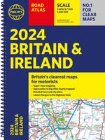
Wegenatlas Road Atlas Britain and Ireland 2024 | Philip's Maps
PHILIP'S - Market leaders and No. 1 in the UK for clear maps'Good balance between detail and clarity with excellent town maps' What Car? * Super-clear mapping at a scale of 3 miles to 1 inch = 1:200,000* Includes the latest highway code requirements* Completely updated and revised for 2024* New map showing Smart Motorways- Practical spiral bound, lie-flat format- 160 pages of fully updated super-clear road maps - 10 pages of detailed route-planning maps - plan your route in advance - 88 indexed town-centre maps - 14 pages of city approach maps with named arterial roads - 2 page road map of Ireland- Map of scenic Britain and a map highlighting railways, airports and ferry ports Philip's 2024 Road Atlas Britain and Ireland is the top-of-the-range spiral road atlas featuring the latest maps from the Philip's digital database. Voted Britain's clearest and most detailed in an independent consumer survey, the mapping is super-clear.   Philip's 2024 Road Atlas Britain and Ireland contains 160…
23,95
Wegenatlas Traveller's Atlas Southern Africa - Zuidelijk Afrika | A3-Formaat | Ringband | Tracks4Africa
Deze atlas omvat tien landen in zuidelijk Afrika en is speciaal gericht op reizigers die zelf rijden. De betrokken landen zijn: Angola, Botswana, Lesotho, Malawi, Mozambique, Namibië, Zuid-Afrika, Swaziland, Zambia en Zimbabwe.   De Atlas bevat 223 kaartpagina's met hetzelfde vertrouwde kaartdetail waarvoor Tracks4Africa bekend is.   De wegenatlas is afgedrukt in A3 formaat, weegt 2750g, heeft een stevige omslag, spiraal gebonden en de pagina's zijn afgedrukt op dik papier.   Bigger coverage than ever before: 1:4m maps for Southern and Eastern Africa – ideal for macro planning. 1:1m maps for Southern Africa, covering the following countries: Angola, Botswana, eSwatini, Lesotho, Malawi, Mozambique, Namibia, South Africa, Zambia and Zimbabwe. 1:500k maps for South Africa, Malawi, most part of Zambia and the area around Moremi/Chobe in Botswana. Road coverage: This Atlas is designed for overland travel and compiled from the same data used on our famous GPS maps. Use it for trip pl…
79,95
Reisgids Iceland Road Guide | Vegahandbokin
Anders dan de titel doet vermoeden is deze gids een reisgids en geen wegenatlas. Met veel beschrijving, kaarten en foto's! A complete road and reference guide:  The Iceland Road Guide has been travelling for 40 years in the vehicles of Icelanders and foreigners alike, and has been steadily improved and updated with every new edition. Texts, figures, photos and maps will guide you on your travels around the country, adding to your memories when returning home.   Iceland Road Guide App is included:  In the new 2019 edition, Iceland Road Guide App is included. The App reflects the book and it''s with a map browser.   Easy - to - use atlas:  This edition now includes a detailed 24-page atlas, on a scale of 1:500 000. This is above all a road atlas, using information from the Icelandic Road Administration, it also shows places which offer accommodation, camping, swimming, natural baths, golfing and skiing, as well as museums, exhibitions, tourist information, other public centres and a…
39,90
Wegenatlas Navigator Scotland | A4-Formaat | Ringand | Philip's Maps
Duidelijke en gedetailleerde atlas van Schotland met enkele stadsplattegronden en register. Zuid Schotland is van schaal 1:100.000 en het noorden met schaal 1:200.000   Philip's Navigator Scotland is part of the Navigator brand, the UK's best-selling road atlases. The Navigator maps provide highly detailed coverage of the Scotland's road network, including minor country lanes and rural tracks. Most of the Central Lowlands and Scottish Borders are shown at the unique Navigator scale of 1.5 miles to 1 inch, Northern Scotland at 3 miles to 1 inch.   Navigator Scotland offers so much more than road maps: hundreds of individually named farms, houses and hamlets, airports, airfields, stations, ferries, canals, marinas, tourist information centres, and a wide range of places of interest. The atlas has a comprehensive index and includes indexed town plans of major regional centres. The front of the atlas contains a 15-page guide to regional leisure facilities and listings of a wide variety …
14,95
Wegenatlas Travel Atlas Indian Subcontinent | ITMB
Handzame wegenatlas op A5 formaat, helaas geen spiraalbinding. Maar voor deze regio is er op dit moment geen andere atlas beschikbaar.   This is our biggest atlas ever, with 152 pages of maps and 51 pages of place names indexing. The Indian Sub-Continent consists of Pakistan, India, Nepal, Bhutan, Bangladesh, Sri Lanka and Kashmir. Each country (Kashmir being considered shared) is presented as an entity, so Pakistan occupies 30 pages at 1:1,200,000 scale, and Nepal occupies 32 pages at 1:530,000 scale. In short, each country is shown in detail, but at scales appropriate for each country. The amount of detail on each page is impressive; equal to buying six maps at $12.95 each. The market is the traveller to the region, visiting several of these areas and wanting a compact way to have detailed mapping without having to carry half a dozen maps or spend a large amount of money on maps. Eleven city inset maps are included, as well as basic insets for the Andaman and Nicobar island chains. T…
16,50
Wegenatlas Road Atlas USA Canada Mexico 2024 | A4-Formaat | Ringband | Michelin
De beroemde wegenatlas van Rand McNally nu als Michelin atlas. Super handige atlas van Michelin in A4 formaat met stevige ringband. Let op: Canada en Mexico staan er zeer beperkt in. For inspiring road trips and scenic drives, Michelin's updated, spiral-bound North America Road Atlas 2024 suggests 52 routes. The tiled atlas, with its clear, accurate mapping, complements online navigation while its big picture and road details aid in advance planning and en route decisions. For outdoor fun and adventure, look for inspiration among the highlights from national and provincial parks, including the parks' GPS coordinates.   Rely with confidence on Michelin's deluxe atlas to get you there. Covers USA, Canada and Mexico. Scale 1:625,000 - 1:9,018,000.   Spiral bound for lay-flat convenience. More than 240 large-scale city maps for navigating in and around urban areas. Bonus Northeast Corridor maps provide extra detail between Boston and Washington DC for easier driving.   Six-page trav…
20,95
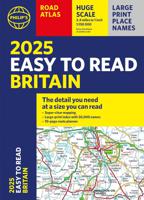
Wegenatlas Easy to Read Road Atlas Britain 2025 | Philip's Maps
"The detail you need at a size you can read". The latest 2025 Philip's Easy to Read Road Atlas of Britain from the best-selling Road Atlas range has over 350 pages packed with exceptionally clear mapping and everything you need for exploring Britain. Now available as a practical paperback, it will enhance any trip.   · Clear maps packed with extra details for a better journey · Huge 1:150,000 scale (approx 2.4 miles to 1 inch) · Large print place names · Large print index · Super-clear 10-page route planner to create the best journeys · Thousands of attractions clearly mapped, including castles, theme parks, gardens, zoos and more. · London's expanded ULEZ clearly shown on approach mapping   At last, a road atlas that everyone can read easily, in or out of the car, no matter what the conditions. With up-to-date mapping technology, your travels have never been easier to plan. This edition contains a wealth of useful information, including tourist attractions, to ensure the best possible…
22,50
Wandelkaart Adventure Atlas Hadrian's Wall Path | A-Z Map Company
AZ heeft de meest gedetailleerde wandelkaarten van het Hadrian's Wall Path gebundeld in een atlasje. Daardoor is het heel handig qua formaat. De kaarten zelf zijn perfect voor het wandelen. Schaal 1:25.000 The A-Z Adventure Series of maps combines the best of OS and A-Z, creating the perfect companion for walkers, off-road cyclists, horse riders and anyone wishing to explore the great outdoors. Hadrian's Wall Path is a National Trail which follows the line of Hadrian's Wall from coast-to-coast. The 84 mile (135km) path weaves through beautiful countryside, encountering historic remains of Roman forts and milecastles, splendid bridges, views from the Whin Sill escarpment and Solway salt marshes. Starting in Wallsend in Newcastle and ending in Bowness-on-Solway, the route on the map is clearly highlighted in yellow with mileage markers added to guage distances when planning sections of the walk to enjoy. This official National Trail Map of Hadrian's Wall Path features 38 pages of continu…
12,95

Klanten-reviews van Wegenatlas IJsland | Ferdakort

Er zijn nog geen beoordelingen voor dit productBen jij de eerste die een review plaatst?

Meer over Wegenatlas IJsland | Ferdakort

Productomschrijving

Gedetailleerde wegenatlas van IJsland, met duidelijke en gedetailleerde wegenkaarten van de topografische dienst op een schaal van 1:200.000. This road atlas is based on a map database on a scale of 1:250 000. In addition to 50 pages of road maps, the Road Atlas contains several theme maps covering accommodation, camping sites, museums, swimming pools and golf courses. There is also a comprehensive place-name index with over 15,500 entries. The format of the atlas makes it very easy for use in a car: it unfolds to a width of about 60 cm that gives an excellent overview of a large tract of land. The Road Atlas comes in a handy box. Scale: 1:200 000   Published: 2021   Size: 31 x 16 cm / Weight: 448 g / Pages: 86   Languages: Icelandic, English, German and French
Shopblog.nl maakt gebruik van cookies. Ga je verder op onze website, ga dan akkoord met het plaatsen van cookies en de verwerking van deze data door ons en vermelde partners.