shopblog.nl
Categorieën
  Sluiten

Meer Touring Club Italiano

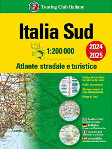
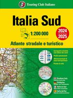
Wegenatlas Atlante Stradale d'Italia Sud | Touring Club Italiano

Atlas van de Italiaanse ANWB, goed kaartbeeld. Wel met omgevingskaarten van belangrijke steden en stadsplattegronden. Kaarten vanaf Rome naar het zuiden. Wegenatlas met gedetaileerde wegenkaarten van zuidelijk Italië, ten zuiden van Rome en met Sicilie, snelwegkaarten met afritten, toeristische informatie, plattegronden van steden, de kaarten zijn ...
24,95

Webshops met dit product

Webshop
Bezorging
Prijs

Anderen bekeken ook

Wegenatlas Atlante Stradale d'Italia Sud | Touring Club Italiano
Atlas van de Italiaanse ANWB, goed kaartbeeld. Wel met omgevingskaarten van belangrijke steden en stadsplattegronden. Kaarten vanaf Rome naar het zuiden. Wegenatlas met gedetaileerde wegenkaarten van zuidelijk Italië, ten zuiden van Rome en met Sicilie, snelwegkaarten met afritten, toeristische informatie, plattegronden van steden, de kaarten zijn ook geschikt om op te fietsen Southern Italy at 1:200,000 in a series of three excellent road atlases from the Touring Club Italiano, each with enlargements of the environs of main cities, numerous superb indexed street plans, plus a very comprehensive distance table.   The atlases are in a paperback format, slightly larger than A4. Cartography is the same as in TCI’s 1:200,000 series of regional maps, with subtle but very effective relief shading plus spot heights to present the topography. Numerous names of mountain ranges, valleys, peaks, etc. are shown and national parks and other protected areas are prominently highlighted.   Road ne…
24,95
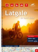
Wegenatlas Letland oost - Latgale | Jana Seta
Bijzonder gedetailleerde wegenatlas van een deel van Letland. Uitvoering in ringband en op geplastificeerd papier. Inclusief stadplattegronden van Balvi, Daugavpils, Kraslava, Livani, Ludza, Preili en Rezekne. Jana Seta’s adventure atlases in this series have topography shown by contour lines at 10m intervals, with colouring and/or graphics for orchards, forests, swamps, etc; boundaries of national parks and other protected area are clearly marked. The mapping provides a very detail presentation of the road network, from main roads to “difficult to travel” unsurfaced local roads. Locations of petrol stations are marked and driving distances are shown on many local routes. The atlases also show cycling routes. Railway lines are shown with stations. Interesting locations are highlighted and symbols indicate campsites and other tourist accommodation, museums, etc. In each title a selection of best sights is cross-referenced to their descriptions (in Latvian only). Latitude and longitude l…
37,50
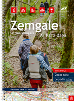
Wegenatlas Letland zuid Zemgale - Vidusdaugava | Jana Seta
Bijzonder gedetailleerde wegenatlas van een deel van Letland. Uitvoering in ringband en op geplastificeerd papier. Inclusief stadplattegronden van Aizkraukle, Auce, Bauska, Dobele. Iecava, Jekabplis, Jeglava, Lielvarde, Plavinas en Tukums. Jana Seta’s adventure atlases in this series have topography shown by contour lines at 10m intervals, with colouring and/or graphics for orchards, forests, swamps, etc; boundaries of national parks and other protected area are clearly marked. The mapping provides a very detail presentation of the road network, from main roads to “difficult to travel” unsurfaced local roads. Locations of petrol stations are marked and driving distances are shown on many local routes. The atlases also show cycling routes. Railway lines are shown with stations. Interesting locations are highlighted and symbols indicate campsites and other tourist accommodation, museums, etc. In each title a selection of best sights is cross-referenced to their descriptions (in Latvian o…
37,50
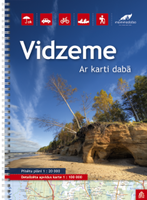
Wegenatlas Letland noord - Vidzeme | Jana Seta
Bijzonder gedetailleerde wegenatlas van een deel van Letland. Uitvoering in ringband en op geplastificeerd papier. Inclusief stadplattegronden van Aluksne, Cesis, Gulbene, Limbaži, Madona, Ogre, Sigulda, Valka, en Valmiera.   Jana Seta’s adventure atlases in this series have topography shown by contour lines at 10m intervals, with colouring and/or graphics for orchards, forests, swamps, etc; boundaries of national parks and other protected area are clearly marked. The mapping provides a very detail presentation of the road network, from main roads to “difficult to travel” unsurfaced local roads. Locations of petrol stations are marked and driving distances are shown on many local routes. The atlases also show cycling routes. Railway lines are shown with stations. Interesting locations are highlighted and symbols indicate campsites and other tourist accommodation, museums, etc. In each title a selection of best sights is cross-referenced to their descriptions (in Latvian only). Latitude…
37,50
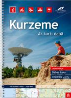
Wegenatlas Letland west - Kurzeme | Jana Seta
Bijzonder gedetailleerde wegenatlas van een deel van Letland. Uitvoering in ringband en op geplastificeerd papier. Inclusief stadplattegronden van Aizpute, Kandava, Kuldiga, Liepaja, Saldus, Talsi, Tukums en Ventspils. Jana Seta’s adventure atlases in this series have topography shown by contour lines at 10m intervals, with colouring and/or graphics for orchards, forests, swamps, etc; boundaries of national parks and other protected area are clearly marked. The mapping provides a very detail presentation of the road network, from main roads to “difficult to travel” unsurfaced local roads. Locations of petrol stations are marked and driving distances are shown on many local routes. The atlases also show cycling routes. Railway lines are shown with stations. Interesting locations are highlighted and symbols indicate campsites and other tourist accommodation, museums, etc. In each title a selection of best sights is cross-referenced to their descriptions (in Latvian only). Latitude and lo…
37,50
Wegenatlas Letland oost - Latgale | Jana Seta
Bijzonder gedetailleerde wegenatlas van een deel van Letland. Uitvoering in ringband en op geplastificeerd papier. Inclusief stadplattegronden van Balvi, Daugavpils, Kraslava, Livani, Ludza, Preili en Rezekne. Jana Seta’s adventure atlases in this series have topography shown by contour lines at 10m intervals, with colouring and/or graphics for orchards, forests, swamps, etc; boundaries of national parks and other protected area are clearly marked. The mapping provides a very detail presentation of the road network, from main roads to “difficult to travel” unsurfaced local roads. Locations of petrol stations are marked and driving distances are shown on many local routes. The atlases also show cycling routes. Railway lines are shown with stations. Interesting locations are highlighted and symbols indicate campsites and other tourist accommodation, museums, etc. In each title a selection of best sights is cross-referenced to their descriptions (in Latvian only). Latitude and longitude l…
37,50
Wegenatlas Letland noord - Vidzeme | Jana Seta
Bijzonder gedetailleerde wegenatlas van een deel van Letland. Uitvoering in ringband en op geplastificeerd papier. Inclusief stadplattegronden van Aluksne, Cesis, Gulbene, Limbaži, Madona, Ogre, Sigulda, Valka, en Valmiera.   Jana Seta’s adventure atlases in this series have topography shown by contour lines at 10m intervals, with colouring and/or graphics for orchards, forests, swamps, etc; boundaries of national parks and other protected area are clearly marked. The mapping provides a very detail presentation of the road network, from main roads to “difficult to travel” unsurfaced local roads. Locations of petrol stations are marked and driving distances are shown on many local routes. The atlases also show cycling routes. Railway lines are shown with stations. Interesting locations are highlighted and symbols indicate campsites and other tourist accommodation, museums, etc. In each title a selection of best sights is cross-referenced to their descriptions (in Latvian only). Latitude…
37,50
Wegenatlas Letland west - Kurzeme | Jana Seta
Bijzonder gedetailleerde wegenatlas van een deel van Letland. Uitvoering in ringband en op geplastificeerd papier. Inclusief stadplattegronden van Aizpute, Kandava, Kuldiga, Liepaja, Saldus, Talsi, Tukums en Ventspils. Jana Seta’s adventure atlases in this series have topography shown by contour lines at 10m intervals, with colouring and/or graphics for orchards, forests, swamps, etc; boundaries of national parks and other protected area are clearly marked. The mapping provides a very detail presentation of the road network, from main roads to “difficult to travel” unsurfaced local roads. Locations of petrol stations are marked and driving distances are shown on many local routes. The atlases also show cycling routes. Railway lines are shown with stations. Interesting locations are highlighted and symbols indicate campsites and other tourist accommodation, museums, etc. In each title a selection of best sights is cross-referenced to their descriptions (in Latvian only). Latitude and lo…
37,50
Wegenkaart - landkaart 742 Maroc - Marokko | Michelin
Kaart van beroemde kaartenmakers en voor Marokko weer een hele goede. Uitermate goed leesbaar, prettig kleurgebruik. Onder Marokko-gangers staat deze kaart zeer goed bekend. Zoals je van Michelin mag verwachten is deze kaart zeer overzichtelijk en heeft een duidelijk helder kaartbeeld. De kaart geeft uitgebreid toeristische informatie weer. Met register, afstanden en reistijden. Wegen worden naar verschillende klasse ingedeeld en - mooi van Michelin - de interessante mooie routes worden gemarkeerd met een groene streep.    Hindernissen voor automobilisten met caravans zijn gemarkeerd: steile hellingen, bergpassen of een anderzins moeilijke route. Bezienswaardigheden als een kasteel, religieus gebouw, ruine of grot is door een symbool goed te vinden.   Morocco at 1:1,000,000 on a road map from Michelin, with enlargements showing in greater detail four of the country’s most visited areas, including the High Atlas around Marrakesh and Jbel Toubkal, plus an additional map of the whole coun…
12,95

Klanten-reviews van Wegenatlas Atlante Stradale d'Italia Sud | Touring Club Italiano

Er zijn nog geen beoordelingen voor dit productBen jij de eerste die een review plaatst?

Meer over Wegenatlas Atlante Stradale d'Italia Sud | Touring Club Italiano

Productomschrijving

Atlas van de Italiaanse ANWB, goed kaartbeeld. Wel met omgevingskaarten van belangrijke steden en stadsplattegronden. Kaarten vanaf Rome naar het zuiden. Wegenatlas met gedetaileerde wegenkaarten van zuidelijk Italië, ten zuiden van Rome en met Sicilie, snelwegkaarten met afritten, toeristische informatie, plattegronden van steden, de kaarten zijn ook geschikt om op te fietsen Southern Italy at 1:200,000 in a series of three excellent road atlases from the Touring Club Italiano, each with enlargements of the environs of main cities, numerous superb indexed street plans, plus a very comprehensive distance table.   The atlases are in a paperback format, slightly larger than A4. Cartography is the same as in TCI’s 1:200,000 series of regional maps, with subtle but very effective relief shading plus spot heights to present the topography. Numerous names of mountain ranges, valleys, peaks, etc. are shown and national parks and other protected areas are prominently highlighted.   Road network is presented in great detail, from motorways to dirt tracks navigable only with difficulty. Minor roads are very clear and easy to read and, where necessary, are drawn without generalizing their course, showing the twists and turns across the mountainous terrain. Steep roads are annotated with three levels of gradient markings. Motorways have the usual features such as toll barriers, services, etc. Scenic routes are highlighted. Railway network shows stations and level crossings and, where appropriate, ferry routes are marked. In mountainous areas refuges, cable car lines, chair lifts, etc, are included. Towns, villages and other places of particular interest are highlighted, with symbols indicating various monuments, castes, churches, etc. The maps have no geographical co-ordinates.    Each volume includes enlargements at 1:80,000 for environs of main cities, plus numerous superb street plans, each with an index of sights and streets.

Productspecificaties

Artikelnummer(s)
Brand
Touring Club Italiano
Shopblog.nl maakt gebruik van cookies. Ga je verder op onze website, ga dan akkoord met het plaatsen van cookies en de verwerking van deze data door ons en vermelde partners.