shopblog.nl
Categorieën
  Sluiten

Meer National Geographic

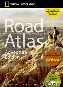
Wegenatlas Adventure Edition USA - Amerika - Canada - Mexico - Puerto

Duidelijk leesbare wegenatlas van de USA, Mexico, Canada, en Puerto Rico, met groot register en ook kleine plattegronden van centra van belangrijke steden. Ook met informatie over nationale parken en avontuurlijke bestemmingen. Duidelijke kaarten in stevig ringband model.   National Geographic's Road Atlas: Adventure Edition, is the ideal companio...
32,95

Webshops met dit product

Webshop
Bezorging
Prijs

Anderen bekeken ook

Wegenatlas Adventure Edition USA - Amerika - Canada - Mexico - Puerto
Duidelijk leesbare wegenatlas van de USA, Mexico, Canada, en Puerto Rico, met groot register en ook kleine plattegronden van centra van belangrijke steden. Ook met informatie over nationale parken en avontuurlijke bestemmingen. Duidelijke kaarten in stevig ringband model.   National Geographic's Road Atlas: Adventure Edition, is the ideal companion for the next time you hit the road. Includes up-to-date road maps for all 50 U.S. States, plus Canada, Mexico, and Puerto Rico. Major cities and metropolitan areas are shown in detail with inset maps that include popular attractions, infrastructure and points-of-interest.   Setting this atlas apart from all other road atlases are the inclusion of detailed maps and guidebook-like recommendations on the top 100 destinations for adventure, plus the top 24 most visited National Parks. An additional resources section provides contact information for local tourism offices, plus a place name index to help easily locate a specific city.   The R…
32,95
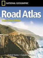
Wegenatlas USA Canada Mexico Road Atlas | A4-Formaat | National Geogra
National Geographic's Road Atlas: Scenic Drives Edition, is the ideal companion for the next time you hit the road for an unforgettable road trip. Includes up-to-date road maps for all 50 U.S. States, plus Canada, Mexico, and Puerto Rico. Major cities and metropolitan areas are shown in detail with inset maps that include popular attractions, infrastructure and points-of-interest. Setting this atlas apart from all others is the inclusion of selection of 20 carefully researched scenic drives to help you plan the road trip of a lifetime. A map and guide section is also included for the 20 most popular National Parks. Take the guesswork out of traveling and trip planning with a comprehensive index, mileage charts, and cross-referenced pages. The Road Atlas: Scenic Drives Edition is printed in North America and it is a convenient letter-size format that fits comfortably into glove compartments or car side door pockets.
17,95
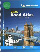
Wegenatlas Road Atlas USA Canada Mexico 2025 | A4-Formaat | Ringband |
De beroemde wegenatlas van Rand McNally nu als Michelin atlas. Super handige atlas van Michelin in A4 formaat met stevige ringband. Let op: Canada en Mexico staan er zeer beperkt in. For inspiring road trips and scenic drives, Michelin's updated, spiral-bound North America Road Atlas 2024 suggests 52 routes. The tiled atlas, with its clear, accurate mapping, complements online navigation while its big picture and road details aid in advance planning and en route decisions. For outdoor fun and adventure, look for inspiration among the highlights from national and provincial parks, including the parks' GPS coordinates.   Rely with confidence on Michelin's deluxe atlas to get you there. Covers USA, Canada and Mexico. Scale 1:625,000 - 1:9,018,000.   Spiral bound for lay-flat convenience. More than 240 large-scale city maps for navigating in and around urban areas. Bonus Northeast Corridor maps provide extra detail between Boston and Washington DC for easier driving.   Six-page trav…
21,95
Reisgids Puerto Rico | Insight Guides
This Insight Guide is a lavishly illustrated inspirational travel guide to Puerto Rico and a beautiful souvenir of your trip. Perfect for travellers looking for a deeper dive into the destination's history and culture, it's ideal to inspire and help you plan your travels. With its great selection of places to see and colourful magazine-style layout, this Puerto Rico guidebook is just the tool you need to accompany you before or during your trip.   Whether it's deciding when to go, choosing what to see or creating a travel plan to cover key places like Old San Juan, El Yunque National Forest, it will answer all the questions you might have along the way. It will also help guide you when you'll be exploring Rio Camuy Cave Park or discovering Rio Abajo Forest Reserve on the ground. Our Puerto Rico travel guide was fully-updated post-COVID-19.   The Insight Guide PUERTO RICO covers: Old San Juan, Metropolitan San Juan, The Northeast, The Southeast, The North, The West, The South, Cordiller…
23,95
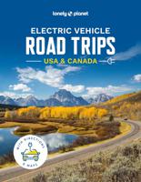
Reisgids Electric Vehicle Road Trips USA & Canada | Lonely Planet
Charge up an electric vehicle for your next road trip and discover the United States and Canada in sustainable style.   Whether you take your trusty electric vehicle for a spin or you hire a high-end model, this comprehensive travel guide is packed with irresistible road trips itineraries, all of which will guide you to a convenient station at the end of each day.   Inside Electric Vehicle Road Trips USA & Canada:   Explore 60 magnificent road trip routes around the USA and Canada featuring a drive overview, total distance, duration, plan & prepare guide, and accurate map that shows the route and key overnight charging stations Essential trip planning information on where to stay (with chargers on site or nearby), when to go, tips for EV drivers, further details such as road signage and Highway Code rules Fun travel experiences and must-see landmarks to enjoy on route including visits to historical monuments, picturesque hikes, fascinating museums, unforgettable landscapes and views, o…
47,50
Campinggids - Campergids 50 States - 500 Campgrounds USA en Canada |
Plan your next getaway to the great outdoors with this one-of-a-kind resource for campgrounds across North America. In this comprehensive sequel to the best-selling 50 States, 5,000 Ideas, you'll discover the top tent and cabin campsites, as well as RV resorts and glamping destinations around the United States and Canada. Along with destination information--location, contact info, open seasons, and amenities--along with expert recommendations for activities including hiking, biking, and water sports; the best restaurants for days you need a break from the camp stove; and nearby attractions--from sights within nearby national and state parks to local museums. Choose from 10 sites in each state, Western and Eastern Canada, the U.S. Virgin Islands, and Puerto Rico, including a cabin at Yogi Bear's Delaware Beaches Jellystone Park Camp Resort; a tent near the stunning waterfall at the Grand Canyon's Havasupai Campground; or a cozy yurt in the Rocky Mountains of Colorado. Whatever your camp…
29,95
Wegenkaart - landkaart US Virgin Islands & Puerto Rico | ITMB
Puerto Rico: schaal 1:190.000 US Virgin Islands: schaal 1:50.000   We are really pleased with this new edition of Puerto Rico. We spent part of August, 2020, touring the island and geo-referencing its many highways. The island is bigger and more densely road-networked than we thought, so we'll have to complete the job on our next visit, but the roads are now much more precisely shown accurately than was possible before satellite imagery. The map looks great on an Ipad screen as well. The map also shows updated inset maps of San Juan, Ponce, Mayaguez, Aguadilla, and Arecibo. Puerto Rico is part of the United States, so has all the benefits, but is internally self-governing. With this edition we are including a map of the other US colonial territory, the US Virgin Islands. The Danish West Indies was purchased from Denmark in 1917 and is an integral part of the USA, with all its benefits, but is, like Puerto Rico, neither fish nor fowl. It is internally self-governing and a great retireme…
13,95

Klanten-reviews van Wegenatlas Adventure Edition USA - Amerika - Canada - Mexico - Puerto

Er zijn nog geen beoordelingen voor dit productBen jij de eerste die een review plaatst?

Meer over Wegenatlas Adventure Edition USA - Amerika - Canada - Mexico - Puerto

Productomschrijving

Duidelijk leesbare wegenatlas van de USA, Mexico, Canada, en Puerto Rico, met groot register en ook kleine plattegronden van centra van belangrijke steden. Ook met informatie over nationale parken en avontuurlijke bestemmingen. Duidelijke kaarten in stevig ringband model.   National Geographic's Road Atlas: Adventure Edition, is the ideal companion for the next time you hit the road. Includes up-to-date road maps for all 50 U.S. States, plus Canada, Mexico, and Puerto Rico. Major cities and metropolitan areas are shown in detail with inset maps that include popular attractions, infrastructure and points-of-interest.   Setting this atlas apart from all other road atlases are the inclusion of detailed maps and guidebook-like recommendations on the top 100 destinations for adventure, plus the top 24 most visited National Parks. An additional resources section provides contact information for local tourism offices, plus a place name index to help easily locate a specific city.   The Road Atlas: Adventure Edition is printed in the United States and features a heavy duty spiral binding and Travel Tough plastic cover for durability and lay-flat reading.

Productspecificaties

Artikelnummer(s)
Brand
National Geographic
Shopblog.nl maakt gebruik van cookies. Ga je verder op onze website, ga dan akkoord met het plaatsen van cookies en de verwerking van deze data door ons en vermelde partners.