shopblog.nl
Categorieën
  Sluiten

Meer Collins

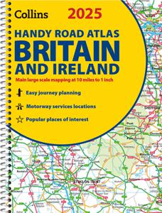
Wegenatlas 2025 Collins Handy Road Atlas Britain and Ireland | Collins

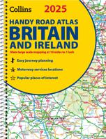
Handzame A5 wegenatlas van Engeland, Wales, Schotland en Ierland met register en stadsplattegronden This easy-to-use, handy A5 sized road atlas with popular lie-flat spiral binding features extremely clear route planning maps of Britain and Ireland and fits neatly into your glove box or bag. The maps of Britain are at 10 miles to 1 inch (1:625,000)...
9,95

Webshops met dit product

Webshop
Bezorging
Prijs

Anderen bekeken ook

Wegenatlas 2025 Collins Handy Road Atlas Britain and Ireland | Collins
Handzame A5 wegenatlas van Engeland, Wales, Schotland en Ierland met register en stadsplattegronden This easy-to-use, handy A5 sized road atlas with popular lie-flat spiral binding features extremely clear route planning maps of Britain and Ireland and fits neatly into your glove box or bag. The maps of Britain are at 10 miles to 1 inch (1:625,000) and the whole of Ireland is covered at 15.8 miles to 1 inch (1:1,000,000). There are also a selection of more detailed urban area maps at 4.5 miles to 1 inch (1:285,000) to aid route planning in these busy areas.   Main features: Road maps that focus on the main roads, motorways and settlementsMore detailed maps of London, Manchester, Merseyside and West MidlandsPark & Ride locations (for bus and rail)Handy distance calculator chart highlighting distances between the major towns
9,95
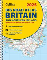
Wegenatlas Big Road Atlas Britain and Northern Ireland 2025 | A3 | Rin
Grote wegenatlas, a3-formaat in ringband. The ultimate 3.2 miles to 1 inch scale large-format, spiral-bound road atlas of Britain, featuring Collins’ popular and well established road mapping, and designed for exceptional clarity and ease of use.   The atlas has a wide range of urban area maps at even larger scale and 64 detailed town centre street plans.   This fully updated road atlas covers the whole of Britain with each scale of mapping colour-coded for ease of use. The smallest scale maps are great for long distance route planning and the street plans help you locate your final destination.   Main features:   Easy to use, clear road maps at a scale of 3.2 miles to 1 inch of England, Wales and Southern Scotland. Northern Scotland is shown at 5 miles to 1 inch Route planning section including maps at a scale of 15.8 miles to 1 inch, motorway services information and a handy distance calculator 22 urban area approach maps at 1 mile to 1 inch which clearly show the best rou…
20,95
Wegenatlas Road Atlas Britain and Ireland 2024 | Philip's Maps
PHILIP'S - Market leaders and No. 1 in the UK for clear maps'Good balance between detail and clarity with excellent town maps' What Car? * Super-clear mapping at a scale of 3 miles to 1 inch = 1:200,000* Includes the latest highway code requirements* Completely updated and revised for 2024* New map showing Smart Motorways- Practical spiral bound, lie-flat format- 160 pages of fully updated super-clear road maps - 10 pages of detailed route-planning maps - plan your route in advance - 88 indexed town-centre maps - 14 pages of city approach maps with named arterial roads - 2 page road map of Ireland- Map of scenic Britain and a map highlighting railways, airports and ferry ports Philip's 2024 Road Atlas Britain and Ireland is the top-of-the-range spiral road atlas featuring the latest maps from the Philip's digital database. Voted Britain's clearest and most detailed in an independent consumer survey, the mapping is super-clear.   Philip's 2024 Road Atlas Britain and Ireland contains 160…
23,95
Wegenatlas Road Atlas Britain and Ireland 2024 | Philip's Maps
Let op! Ierland en een gedeelte van Schotland hebben een andere schaal dan de rest van de atlas.   PHILIP'S - Market leaders and No. 1 in the UK for clear maps'Good balance between detail and clarity with excellent town maps' What Car? * Super-clear mapping at a scale of 3 miles to 1 inch = 1:200,000* Includes the latest highway code requirements* Completely updated and revised for 2024* New map showing Smart Motorways- Practical spiral bound, lie-flat format- 160 pages of fully updated super-clear road maps - 10 pages of detailed route-planning maps - plan your route in advance - 88 indexed town-centre maps - 14 pages of city approach maps with named arterial roads - 2 page road map of Ireland- Map of scenic Britain and a map highlighting railways, airports and ferry ports Philip's 2024 Road Atlas Britain and Ireland is the top-of-the-range spiral road atlas featuring the latest maps from the Philip's digital database. Voted Britain's clearest and most detailed in an independent consu…
23,95
Wegenatlas Handy Road Atlas Britain A5-Formaat | Philip's Maps
"The perfect atlas for planning a trip anywhere in the UK and Ireland"The essential handy road atlas for planning a trip in Britain and Ireland. Keep it in the glove box or your travel bag for quick and easy reference. This gem of a glove-box sized atlas has all the core information you need for driving around the British Isles.   It includes all the motorways, primary roads and A Roads and they are clearly shown - ideal for route planning. There is a separate 4-page road map of Ireland for easy use. Alongside that, this handy atlas includes a key map, a distance table and useful counties map.   All the towns and villages listed within are indexed and all the information comes in a handy glove-box size format with practical, lie-flat spiral binding. With the scale at a user-friendly 8 miles to 1 inch / 1:500,000 (Ireland 19 miles to 1 inch /1:1,200,000) and fully up-to-date using Philip's clear mapping, you will never be at a loss to establish the best route. Keep in the car or sling i…
9,95
Wegenatlas Big Atlas Britain & Ireland 2024 A3-Formaat | Philip's Map
Goede gedetailleerde wegenatlas van Groot-Brittannië, schaal 1:200.000 met een overzichtskaart van Ierland, schaal 1:1.000.000. Groot formaat, A3, en in ringband. 'Good balance between detail and clarity with excellent town maps' What Car? PHILIP'S is No. 1 in the UK for clear maps. The latest 2025 Philip's Big Road Atlas of Britain and Ireland, in a supersize large format, has fully updated mapping from the Philip's digital database alongside all the detail and information needed for successful travel.   * Top driving tips for safety and skill including how to parallel park * The best scenic routes, natural features and landscape highlighted for enhanced travelling * Practical 'more to view per page' A3 size * Main scale of maps: 3 miles to 1 inch = 1:200,000 for ease of use * Route-planning section for the easiest navigation * Special wide-vehicle access indicators for rural areas * 64 fully indexed and detailed town and city plans * City approach maps with named roads for…
23,50
Wegenatlas Essential Road Atlas Britain 2025 | A4 | Ringband | Collins
This A4 road atlas with lie-flat spiral binding provides clear and detailed road mapping for England, Wales and Southern Scotland at a scale of 3.2 miles to 1 inch (1:200,000). For Northern Scotland the mapping is at a scale of 4.2 miles to 1 inch (1:266,000), with land height shown by different layers of colouring. Main features: Route planning section including maps at a scale of 22 miles to 1 inch for long distance route planning, motorway services information, and a handy distance calculator chart26 urban area approach maps at a larger scale which clearly show the best routes through and into the busiest built-up-areas 64 street maps focused on town centres showing places of interest, car park locations and one-way streets.   All the street maps are fully indexedOver 30 categories of places of interest including castles, theme parks, sports venues, universities, mountain bike trails and surfing beachesThe top 1000 most visited places of interest are indexed with full postcodes to a…
20,95
Wegenatlas Handy Road Atlas Ireland - Ierland | Collins
Handzame wegenatlas op A5 formaat van Ierland. Vrij grove schaal maar heel handig door formaat en goed kaartbeeld.  Met enkele stadsplattegronden en een paar pagina's met hoogtepunten van het land.  Explore Ireland with this handy format route-planning atlas in full colour, complete with information on places of tourist interest. There are also fully indexed town centre plans of Belfast, Cork, Dublin, Galway, Limerick and Londonderry. Now with places of interest marked including famous film locations. This atlas, at A5 size, contains mapping of the whole of Ireland at 9 miles to 1 inch (1:570,240). The mapping is beautifully designed with colour classified roads and subtle layered height tinting. The atlas is ideal for residents, visitors and tourists alike. Key features of the atlas include:* All Ireland route planning maps* Town centre plans* Places of interest including TV and film locations such as Game of Thrones, Star Wars and Harry Potter* Blue Flag and Green Coast beaches map* …
8,95

Klanten-reviews van Wegenatlas 2025 Collins Handy Road Atlas Britain and Ireland | Collins

Er zijn nog geen beoordelingen voor dit productBen jij de eerste die een review plaatst?

Meer over Wegenatlas 2025 Collins Handy Road Atlas Britain and Ireland | Collins

Productomschrijving

Handzame A5 wegenatlas van Engeland, Wales, Schotland en Ierland met register en stadsplattegronden This easy-to-use, handy A5 sized road atlas with popular lie-flat spiral binding features extremely clear route planning maps of Britain and Ireland and fits neatly into your glove box or bag. The maps of Britain are at 10 miles to 1 inch (1:625,000) and the whole of Ireland is covered at 15.8 miles to 1 inch (1:1,000,000). There are also a selection of more detailed urban area maps at 4.5 miles to 1 inch (1:285,000) to aid route planning in these busy areas.   Main features: Road maps that focus on the main roads, motorways and settlementsMore detailed maps of London, Manchester, Merseyside and West MidlandsPark & Ride locations (for bus and rail)Handy distance calculator chart highlighting distances between the major towns

Productspecificaties

Artikelnummer(s)
Brand
Collins
Shopblog.nl maakt gebruik van cookies. Ga je verder op onze website, ga dan akkoord met het plaatsen van cookies en de verwerking van deze data door ons en vermelde partners.