shopblog.nl
Categorieën
  Sluiten

Meer National Geographic

Wandkaart The Balkans - Balkan landen, 77 x 60 cm | National Geographi

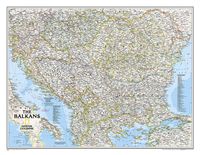
Study the countries of the Balkans with our new map featuring the classic National Geographic reference styling. Features thousands of place names, accurate political boundaries, national parks, and major infrastructure networks such as roads, canals, ferry routes, and railroads. The countries of the Balkans Classic map shows it's diverse terrain a...
21,95

Webshops met dit product

Webshop
Bezorging
Prijs

Anderen bekeken ook

Wandkaart The Balkans - Balkan landen, 77 x 60 cm | National Geographi
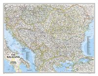
Study the countries of the Balkans with our new map featuring the classic National Geographic reference styling. Features thousands of place names, accurate political boundaries, national parks, and major infrastructure networks such as roads, canals, ferry routes, and railroads. The countries of the Balkans Classic map shows it's diverse terrain as detailed through accurate shaded relief, coastal bathymetry, and symbolism for water features and other landforms. Elevations of major peaks as well as depth soundings are expressed in meters.   Map coverage includes the countries of: Albania, Austria, Bosnia and Herzegovina, Bulgaria, Croatia, Hungary, Kosovo, Macedonia, Moldova, Montenegro, Romania, Slovenia, Vojvodina, as well as the outlying border countries of Greece, Italy, Slovakia, Turkey and Ukraine. Map features also includes listings for the counties of Hungary and Romania along with their respective capitals and the administrative divisions of Bosnia and Herzegovina.
31,95
Wandkaart The Balkans - Balkan landen, 77 x 60 cm | National Geographi
Study the countries of the Balkans with our new map featuring the classic National Geographic reference styling. Features thousands of place names, accurate political boundaries, national parks, and major infrastructure networks such as roads, canals, ferry routes, and railroads. The countries of the Balkans Classic map shows it's diverse terrain as detailed through accurate shaded relief, coastal bathymetry, and symbolism for water features and other landforms. Elevations of major peaks as well as depth soundings are expressed in meters.   Map coverage includes the countries of: Albania, Austria, Bosnia and Herzegovina, Bulgaria, Croatia, Hungary, Kosovo, Macedonia, Moldova, Montenegro, Romania, Slovenia, Vojvodina, as well as the outlying border countries of Greece, Italy, Slovakia, Turkey and Ukraine. Map features also includes listings for the counties of Hungary and Romania along with their respective capitals and the administrative divisions of Bosnia and Herzegovina.
21,95
Wandkaart The Balkans - Balkan landen, 77 x 60 cm | National Geographi
Study the countries of the Balkans with our new map featuring the classic National Geographic reference styling. Features thousands of place names, accurate political boundaries, national parks, and major infrastructure networks such as roads, canals, ferry routes, and railroads. The countries of the Balkans Classic map shows it's diverse terrain as detailed through accurate shaded relief, coastal bathymetry, and symbolism for water features and other landforms. Elevations of major peaks as well as depth soundings are expressed in meters.   Map coverage includes the countries of: Albania, Austria, Bosnia and Herzegovina, Bulgaria, Croatia, Hungary, Kosovo, Macedonia, Moldova, Montenegro, Romania, Slovenia, Vojvodina, as well as the outlying border countries of Greece, Italy, Slovakia, Turkey and Ukraine. Map features also includes listings for the counties of Hungary and Romania along with their respective capitals and the administrative divisions of Bosnia and Herzegovina.
31,95
Wegenkaart - landkaart 3327 Adventure Map Western Balkans - Westelijke
Wegenkaart van de Westelijke Balkan met vermelding van veel bezienswaardigheden en attrakties. Watervast en scheurvast. Juist door deze vermeldingen onderscheidt de kaart zich van andere wegenkaarten. Landen: Slovenië, Kroatië, Bosnië Herzegovina, Montenegro, Albanië, Servië,  Kosovo, and Macedonië.   The Western Balkans region, an adventure playground and rising star of Europe, is loaded with Old World traditions, slow food culture, ancient towns, and rarely visited villages. The area stretches from the Adriatic Sea in the west, up and over mountain ranges, raging rivers, tectonic lakes, steep gorges, and thousands of miles of paths, trails, and routes. Discover eight countries—all with their special brand of Balkan magic: Slovenia, Croatia, Bosnia and Herzegovina, Montenegro, Albania, Serbia, Kosovo, and Macedonia.   National Geographic's Western Balkans Adventure Map will meet the needs of travelers with its detailed and accurate information. The map includes the locations of UNESCO…
17,50
Wegenkaart - landkaart Balkan - Zuidoost Europa | Freytag & Berndt
A nicely detailed travelers map of Southeast Europe from Prague east to Odessa and south to Italy, Greece and western Turkey, including the Danube, Romania, Bulgaria and the Black Sea from Odessa to Istanbul. At a scale of 1:2,000,000.  Explore the Balkans and South-East Europe with this Freytag & Berndt road map - the best way to prepare your trip, to plan your itinerary, and to travel independently.    This map covers the following countries: Greece, Albania, FYROM, Bulgaria, Kosovo, Serbia, Montenegro, Bosnia Herzegocina, Croatia, Slovenia, Hungary, Romania, Moldova, the Czech & Slovak Republics, Western Turkey, Western Ukraine, Austria, and Southern Italy.   The map includes a localities index and more detailed city maps of Athens, Belgrade, Bratislava, Bucarest, Budapest, Chisinau, Istanbul, Kiev, Ljubljana, Podgorica, Prague, Pristina, Sarajevo, Skopje, Sofija, Tirana, Vienna, and Zagreb.
14,95
Wandelgids Via Dinarica | Bradt Travel Guides
Bijzondere wandelgids : het beschrijft de wandelroute in Bosnie Herzegovina van de Via Dinarica, the White trail. Veel praktische informatie, redelijk kaartmateriaal en een goede beschrijving van de route.  This is the first detailed guide to the Bosnian part of the new Via Dinarica hiking trail that carves its way through the Dinaric Alps, one of Europe's least explored mountain ranges and last true wilderness frontiers, connecting the seven nations of Slovenia, Croatia, Bosnia and Herzegovina, Montenegro, Serbia, Kosovo, and Albania. In total, this trail system will span over 1,350km, 333km of which is in Bosnia Herzegovina. The Via Dinarica consists of three routes - White, Green and Blue - and this guide focuses primarily on the White Trail through Bosnia and Herzegovina, following the natural flow of the highest peaks of the Dinaric Alps. Detailed descriptions of each of the 12 stages of the White Trail through Bosnia and Herzegovina are included, along with maps, altitude charts …
20,95
Wegenkaart - landkaart Bosnië en Montenegro | ITMB
For some reason, Bosnia Herzegovina has never attracted the attention of firms publishing maps. Understandably, since the breakup of Yugoslavia, the entire region has been somewhat unattractive for visitors. Also, Bosnia by itself is difficult to map, due to its shape. However, we have visited the country several times and find it to be interesting, friendly, and attractive. We were particularly impressed by Montenegro. Since it broke away from Serbia, this country has moved forward quickly. It uses the Euro as a currency, has lovely Mediterranean Sea resorts along its coast, and is a progressive country tying its future to the rest of Europe as a future EU member. The roads in both countries are good, and the damage done by civil in-fighting largely a thing of the past. Both countries are well-worth a visit. The map also includes Kosovo. Ethnically, it is probably more tied to Albania than to Bosnia, but geographically, Bosnia is closer and Kosovo is shown in good detail on this doubl…
13,95

Klanten-reviews van Wandkaart The Balkans - Balkan landen, 77 x 60 cm | National Geographi

Er zijn nog geen beoordelingen voor dit productBen jij de eerste die een review plaatst?

Meer over Wandkaart The Balkans - Balkan landen, 77 x 60 cm | National Geographi

Productomschrijving

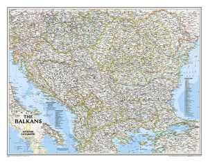
Study the countries of the Balkans with our new map featuring the classic National Geographic reference styling. Features thousands of place names, accurate political boundaries, national parks, and major infrastructure networks such as roads, canals, ferry routes, and railroads. The countries of the Balkans Classic map shows it's diverse terrain as detailed through accurate shaded relief, coastal bathymetry, and symbolism for water features and other landforms. Elevations of major peaks as well as depth soundings are expressed in meters.   Map coverage includes the countries of: Albania, Austria, Bosnia and Herzegovina, Bulgaria, Croatia, Hungary, Kosovo, Macedonia, Moldova, Montenegro, Romania, Slovenia, Vojvodina, as well as the outlying border countries of Greece, Italy, Slovakia, Turkey and Ukraine. Map features also includes listings for the counties of Hungary and Romania along with their respective capitals and the administrative divisions of Bosnia and Herzegovina.

Productspecificaties

Artikelnummer(s)
Brand
National Geographic
Shopblog.nl maakt gebruik van cookies. Ga je verder op onze website, ga dan akkoord met het plaatsen van cookies en de verwerking van deze data door ons en vermelde partners.