shopblog.nl
Categorieën
  Sluiten

Wandkaart Southern Africa - Zuid Afrika | 130 x 98 cm | Tracks4Africa

Our SOUTHERN AFRICA WALL MAP is printed at a scale of 1:2.5 million and laminated on both sides. The size of the final map is 1300 X 980 mm.   The map covers South Africa, Lesotho, eSwatini, Zimbabwe, Botswana and Namibia in full.  It also includes the majority of Mozambique up to Nampula.  A small section of southern Angola up to Lubango is includ...
89,95

Webshops met dit product

Webshop
Bezorging
Prijs

Anderen bekeken ook

Wandkaart Africa - Afrika Zuid | 98 x 130 | Tracks4Africa
Our AFRICA WALL MAP is printed at a scale of 1:4 million and laminated on both sides. The size of the final map is 1300 X 980 mm.   The map includes countries from South Africa in the south to Ethiopia in the north.   Perfect for macro planning of self-drive trips through Southern and Eastern Africa and even to West Africa up to Gabon.   Printed in full colour, all major and secondary roads are shown with national parks and country borders clearly visible.   The Tracks4Africa Wall Map is printed to a scale of 1:4million and provides a surprising amount of detail to the self-drive traveller.  The map is perfect for macro planning of extended road trips across the African continent up to Ethiopia in the east and Gabon in west.  The map indicates major and secondary roads, parks, towns and a good number of tracks in remote areas.  Major tourist attractions are indicated  where space allows for it. International airports and country borders suitable for vehicle crossings are indicated.  …
89,95
Wegenatlas Traveller's Atlas Southern Africa - Zuidelijk Afrika | A3-Formaat | Ringband | Tracks4Africa
Deze atlas omvat tien landen in zuidelijk Afrika en is speciaal gericht op reizigers die zelf rijden. De betrokken landen zijn: Angola, Botswana, Lesotho, Malawi, Mozambique, Namibië, Zuid-Afrika, Swaziland, Zambia en Zimbabwe.   De Atlas bevat 223 kaartpagina's met hetzelfde vertrouwde kaartdetail waarvoor Tracks4Africa bekend is.   De wegenatlas is afgedrukt in A3 formaat, weegt 2750g, heeft een stevige omslag, spiraal gebonden en de pagina's zijn afgedrukt op dik papier.   Bigger coverage than ever before: 1:4m maps for Southern and Eastern Africa – ideal for macro planning. 1:1m maps for Southern Africa, covering the following countries: Angola, Botswana, eSwatini, Lesotho, Malawi, Mozambique, Namibia, South Africa, Zambia and Zimbabwe. 1:500k maps for South Africa, Malawi, most part of Zambia and the area around Moremi/Chobe in Botswana. Road coverage: This Atlas is designed for overland travel and compiled from the same data used on our famous GPS maps. Use it for trip pl…
79,95
Wegenkaart - landkaart Africa central and south - Afrika zuid en centraal | ITMB
This title is in our series of regional titles for Africa at 1:3,400,000 scale. All of Africa is available as a continental sheet at 1:5M scale and as regional titles at 1:3.8M and 1:3.4M, based on GIS data. This is a milestone for ITMB and the realization of a dream that began in 1993. However, the work is still only in its early stages. This map covers that portion of the continent that old Africa hands always referred to as 'central', meaning the Rhodesias and Nyasaland � now known as Zambia, Malawi, and Zimbabwe.   By its shape, generous portions of the southern portions of DEM Congo, the eastern third of Angola, the northern half of Mozambique, and Botswana's Okavunga Delta are included on the one side. The second side covers South Africa, Lesotho, Swaziland, the rest of Botswana, and southern Namibia in great detail. This is an excellent map for anyone visiting the larger region of the southern third of Africa. As with our other regional titles, this is a work in progress. The ne…
13,95
Wegenkaart - landkaart Africa Southern - zuidelijk Afrika | ITMB
met extra kaarten van Johannesburg - Kapstad - Victoria Falls - Okavango Delta   This map is the updated version of our previous map, which was called Southern Africa, covering the southernmost portion of Africa. It is also the most developed part of the continent, with the densest road network and number of urban areas on the continent. This edition was started a year ago and incorporates an innovative approach to data portrayal by essentially over-lapping our very detailed South Africa artwork over top of the southern Africa artwork. The result is a much more detailed regional map than was possible previously.   Legend Includes: Road by classification, Major Road, Highway, Railway, Ferry, Lake, River, National Park, Beach, Diving, World Heritage, Waterfall, Cave, Monument, Camping Site and much more...
13,95
Wegenkaart - landkaart 3204 Adventure Map South Africa - Zuid Afrika | National Geographic
Wegenkaart van Zuid Afrika met vermelding van veel bezienswaardigheden, nationale parken en attrakties. Watervast en scheurvast. Juist door deze vermeldingen onderscheidt de kaart zich van andere wegenkaarten. National Geographic’s South Africa Adventure Map is designed to meet the unique needs of adventure travelers—detailed, durable, and accurate. It includes the locations of thousands of major cities and towns with an index for easily locating them, plus a clearly marked road network complete with distances and designations for major highways, limited access highways, and more. Both paved and unpaved roads, tracks, and trails are marked for those adventurers who wish to explore less traveled routes.   What sets National Geographic Adventure Maps apart from traditional road maps are the hundreds of points-of-interest that highlight the diverse, unique, and exotic destinations within South Africa including national parks and reserves, sanctuaries, World Heritage sites, archeological s…
17,50
Wegenkaart - landkaart Zuid Afrika - South Africa | ITMB
Uitstekende wegenkaart van Zuid Afrika met zowel de toeristische informatie als Nationale Parken en bezienswaardigheden, maar ook de topografische details en afstanden. Gedrukt op 'waterproof' papier. Double-sided map of South Africa printed on waterproof and tear-resistant synthetic paper, with plans of Cape Town, Johannesburg and Pretoria. The map divides the country east/west with a small overlap between the two sides. Elevation tinting in feet shows the general relief. Mountain passes are marked, but there are no spot heights. Road network includes selected local tracks, gives driving distances on major and secondary roads and indicates border crossings. Railways, major ferry connections and local airports are also shown. National parks and protected areas are marked and symbols highlight various places of interest, campsites or huts, rest houses and other tourist accommodation, beaches and diving sites, etc. Presentation of Lesotho and Swaziland is the same as for South Africa. La…
13,95
Wegenkaart - landkaart Africa - Afrika | National Geographic
  • Waterproof • Tear-Resistant • Reference Map   Expertly researched and designed, National Geographic's Africa Flags & Facts Map is the authoritative map of Africa by which other reference maps are measured. The map side includeds a political map showing countries, cities and other landmarks and a physical map shows the landforms such as mountain ranges and rivers.   Clearly defined boundaries, major cities, and physical features Hundreds of place names carefully placed to maintain legibility in heavily populated areas Includes Africa and adjacent regions within Europe and Asia Detailed physical map of Africa with mountain ranges, plains, lakes, and rivers Flags and facts with detailed information about cultural and physcial attributes Printed in the U.S.A. on extremely durable, waterproof, and tear-resistant material This Reference Map is printed on durable synthetic paper, making it waterproof, tear-resistant and tough — capable of withstanding the rigors of any kind of use in the …
17,50
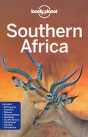
Reisgids Southern Africa - zuidelijk Afrika - Botswana, Lesotho, Malawi, Mozambique, Namibië, Zambia, South Africa, Zimbabwe | Lonely Planet
De perfecte reisgids voor zowel de georganiseerde als de zelfstandige reiziger. Naast een algemene inleiding van het land / streek vol met praktische informatie over hoe je er het beste kunt reizen: slapen, eten, vervoer, excursies ... alles kun je er in vinden. Engelstalig. An astonishingly diverse region fused by its prolific wildlife, breathtaking landscapes and remnants of ancient culture, Southern Africa is Africa at its most memorable. Lonely Planet will get you to the heart of Southern Africa, with amazing travel experiences and the best planning advice.   Lonely Planet Southern Africa is your passport to the most relevant, up-to-date advice on what to see and skip, and what hidden discoveries await you. Clamber up the world’s oldest sand dunes in Sossusvlei, step back in time on Mozambique Island, or enjoy world-class wildlife-watching in Etosha National Park; all with your trusted travel companion. Get to the heart of Southern Africa and begin your journey now!   Inside Lonely…
24,95
Wegenkaart - landkaart 3314 Adventure Map Southern France - Zuid Frankrijk | National Geographic
Wegenkaart van Frankrijk Zuid met vermelding van veel bezienswaardigheden, nationale parken en attrakties. Watervast en scheurvast. Juist door deze vermeldingen onderscheidt de kaart zich van andere wegenkaarten. National Geographic's Southern France Adventure Map is designed to meet the unique needs of adventure travelers with its durability and accurate information. Each folded map provides global travelers with the perfect combination of detail and perspective, highlighting the area’s terrain and best locations for adventure activities like snorkeling, surfing, fishing, and more. Adventure Maps include hundreds of points of interest that highlight diverse and unique destinations within the region. The map includes the locations of thousands of cities and towns with a user-friendly index, plus a clearly marked road network complete with distances and designations for major highways, main roads, and tracks and trails for those seeking to explore more remote regions.   The front side o…
17,50
Wegenkaart - landkaart Western Africa - Afrika westen | ITMB
Een degelijke kaart met aanduidingen van o.a. nationale parken, vliegveld, benzinepomp, dirt-roads en kleine plattegrond van hoofdstad. Als overzichtskaart goed te gebruiken.   This map, at 1:3,400,000 scale is ideal for travellers crossing Africa from Europe to central and southern parts of Africa by land. It covers from the southern tip of Spain through Morocco and western Algeria on one side to Mauritania and the Bight of Benin states of West Africa, as far east as western Nigeria. As a regional map, the detail provided is unsurpassed by any other map of this part of the world. It is the most detailed map to date of the West African states of Guinea, Guinea-Bissau, Liberia, and Sierra Leone. As is always the case with Africa, road information is presented in practical terms of road quality, not road designation. This is a practical map for travellers, so information has been provided with the greatest degree of accuracy possible, given that reliable information can be extremely diff…
13,95

Klanten-reviews van Wandkaart Southern Africa - Zuid Afrika | 130 x 98 cm | Tracks4Africa

Er zijn nog geen beoordelingen voor dit productBen jij de eerste die een review plaatst?

Meer over Wandkaart Southern Africa - Zuid Afrika | 130 x 98 cm | Tracks4Africa

Productomschrijving

Our SOUTHERN AFRICA WALL MAP is printed at a scale of 1:2.5 million and laminated on both sides. The size of the final map is 1300 X 980 mm.   The map covers South Africa, Lesotho, eSwatini, Zimbabwe, Botswana and Namibia in full.  It also includes the majority of Mozambique up to Nampula.  A small section of southern Angola up to Lubango is included and the southern part of Zambia is covered up to Kabwe.  The southern tip of Malawi up to where the lake starts is also included.   Perfect for macro planning of road trips across Southern Africa up to Southern Angola.   Printed in full colour, all major and secondary roads are shown with national parks, towns, country borders, international airports and major tourist attractions are clearly visible. Includes a good number of tracks in remote areas.   Individually packaged in carton tube 1000x75mm with plastic caps on both ends  
Shopblog.nl maakt gebruik van cookies. Ga je verder op onze website, ga dan akkoord met het plaatsen van cookies en de verwerking van deze data door ons en vermelde partners.