shopblog.nl
Categorieën
  Sluiten

Meer Maps International
Meer Maps International in Woontextiel

Wandkaart Middle East - Midden Oosten, 120 x 100 cm | Maps Internation

Maps International's Middle East wall map shows the whole of the Middle East area.    Middle East Map Details: This political wall map of the Middle East features countries marked in different colours, with international borders clearly shown. The map's key shows a panel of flags from each of the countries displayed in this Middle East map. This po...
27,95

Webshops met dit product

Webshop
Bezorging
Prijs

Anderen bekeken ook

Wandkaart Middle East - Midden Oosten, 120 x 100 cm | Maps Internation
Maps International's Middle East wall map shows the whole of the Middle East area.    Middle East Map Details: This political wall map of the Middle East features countries marked in different colours, with international borders clearly shown. The map's key shows a panel of flags from each of the countries displayed in this Middle East map. This political wall map of Africa also contains population detail, capital cities and all the major towns and cities in this continent.    Middle East Map uses: As with most of our maps, the Middle East political wall map, is available in a range of finishes from paper and laminated finishes to wooden style frames. Ideal size for an office or classroom.
44,95
Wandkaart Middle East - Midden Oosten, 120 x 100 cm | Maps Internation
Maps International's Middle East wall map shows the whole of the Middle East area.    Middle East Map Details: This political wall map of the Middle East features countries marked in different colours, with international borders clearly shown. The map's key shows a panel of flags from each of the countries displayed in this Middle East map. This political wall map of Africa also contains population detail, capital cities and all the major towns and cities in this continent.    Middle East Map uses: As with most of our maps, the Middle East political wall map, is available in a range of finishes from paper and laminated finishes to wooden style frames. Ideal size for an office or classroom.
37,95
Wandkaart Middle East - Midden Oosten, 120 x 100 cm | Maps Internation
Maps International's Middle East wall map shows the whole of the Middle East area.    Middle East Map Details: This political wall map of the Middle East features countries marked in different colours, with international borders clearly shown. The map's key shows a panel of flags from each of the countries displayed in this Middle East map. This political wall map of Africa also contains population detail, capital cities and all the major towns and cities in this continent.    Middle East Map uses: As with most of our maps, the Middle East political wall map, is available in a range of finishes from paper and laminated finishes to wooden style frames. Ideal size for an office or classroom.
27,95
Wandkaart Middle East - Midden Oosten, 120 x 100 cm | Maps Internation
Maps International's Middle East wall map shows the whole of the Middle East area.    Middle East Map Details: This political wall map of the Middle East features countries marked in different colours, with international borders clearly shown. The map's key shows a panel of flags from each of the countries displayed in this Middle East map. This political wall map of Africa also contains population detail, capital cities and all the major towns and cities in this continent.    Middle East Map uses: As with most of our maps, the Middle East political wall map, is available in a range of finishes from paper and laminated finishes to wooden style frames. Ideal size for an office or classroom.
37,95
Wandkaart Middle East - Midden Oosten 76 x 58 cm | National Geographic
Wandkaart van het Midden Oosten, met o.a. Afghanistan - Pakistan - National Geographic wandkaart geplastificeerd - Afmeting ca 76 x 58 cm  National Geographic Maps' recently updated wall map of the Middle East region, formerly titled Afghanistan/Pakistan and the Middle East. Includes updated place names and the addition of significant locations currently in the news, such as Marjah, Afghanistan. This wall map covers a broad geographic area ranging from northern Africa through the Middle East to the western edge of China and India.   Includes complete coverage of Afghanistan, Pakistan, Tajikistan, Iran, Iraq, Kuwait, Syria, Israel, Jordan, Lebanon, Saudi Arabia, Qatar, Bahrain, United Arab Emirates, Yemen, Oman, Cyprus, and Eritrea.   Also includes parts of India, China, Kyrgyzstan, Uzbekistan, Turkmenistan, Azerbaijan, Armenia, Turkey, Egypt, Sudan, Ethiopia, and Djibouti. Features thousands of place names, accurate political boundaries, archeological sites, and major infrastructure ne…
31,95
Magneetbord Middle East - Midden Oosten | National Geographic
Magneetbord - Wandkaart van het Midden Oosten, met o.a. Afghanistan - Pakistan - National Geographic wandkaart geplastificeerd - Afmeting ca 76 x 58cm    National Geographic Maps' recently updated wall map of the Middle East region, formerly titled Afghanistan/Pakistan and the Middle East.   Includes updated place names and the addition of significant locations currently in the news, such as Marjah, Afghanistan. This wall map covers a broad geographic area ranging from northern Africa through the Middle East to the western edge of China and India.   Includes complete coverage of Afghanistan, Pakistan, Tajikistan, Iran, Iraq, Kuwait, Syria, Israel, Jordan, Lebanon, Saudi Arabia, Qatar, Bahrain, United Arab Emirates, Yemen, Oman, Cyprus, and Eritrea.   Also includes parts of India, China, Kyrgyzstan, Uzbekistan, Turkmenistan, Azerbaijan, Armenia, Turkey, Egypt, Sudan, Ethiopia, and Djibouti. Features thousands of place names, accurate political boundaries, archeological sites, and major …
189,-
Wandkaart Azië Politiek, 120 x 100 cm | Maps International
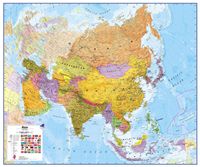
Fraaie politieke kaart van het continent, waarbij vooral de politieke aspecten heel duidelijk te lezen zijn. Alle landen hebben verschillende kleuren, steden en belangrijke verbindingen zijn goed te vinden. Papieren versie, geen ophangsysteem. Maps International's political wall map of Asia shows all countries from Turkey in the West to Japan in the East, down to Indonesia in the South of Asia. The largest and most populated continent, Asia has a lot to fit onto a map! Rest assured though, with Maps International's high quality of mapping nothing is missed out! This political wall map of Asia features countries marked in different colours, with international borders clearly shown. The map's key shows the flags from the countries displayed in this map. This Asia physical wall map also contains city population detail, capital cities and all the major towns and cities in this continent of Asia.
27,95

Klanten-reviews van Wandkaart Middle East - Midden Oosten, 120 x 100 cm | Maps Internation

Er zijn nog geen beoordelingen voor dit productBen jij de eerste die een review plaatst?

Meer over Wandkaart Middle East - Midden Oosten, 120 x 100 cm | Maps Internation

Productomschrijving

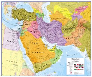
Maps International's Middle East wall map shows the whole of the Middle East area.    Middle East Map Details: This political wall map of the Middle East features countries marked in different colours, with international borders clearly shown. The map's key shows a panel of flags from each of the countries displayed in this Middle East map. This political wall map of Africa also contains population detail, capital cities and all the major towns and cities in this continent.    Middle East Map uses: As with most of our maps, the Middle East political wall map, is available in a range of finishes from paper and laminated finishes to wooden style frames. Ideal size for an office or classroom.

Productspecificaties

Artikelnummer(s)
Brand
Maps International

Verken gerelateerde categorieën

Shopblog.nl maakt gebruik van cookies. Ga je verder op onze website, ga dan akkoord met het plaatsen van cookies en de verwerking van deze data door ons en vermelde partners.