shopblog.nl
Categorieën
  Sluiten

Meer National Geographic

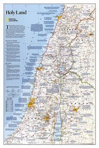
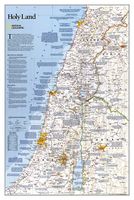
Wandkaart Holy Land - Israël, 53 x 80 cm | National Geographic

National Geographic Wall Maps offer a special glimpse into current and historical events, and they inform about the world and environment. Offered in a variety of styles and formats, these maps are excellent reference tools and a perfect addition to any home, business or school. There are a variety of map options to choose from, including the world...
31,95

Webshops met dit product

Webshop
Bezorging
Prijs

Anderen bekeken ook

Wandkaart Brazil - Brazilië, 104 x 97 cm | National Geographic
National Geographic Wall Maps offer a special glimpse into current and historical events, and they inform about the world and environment. Offered in a variety of styles and formats, these maps are excellent reference tools and a perfect addition to any home, business or school. There are a variety of map options to choose from, including the world, continents, countries and regions, the United States, history, nature and space. This wall map of Brazil contains thousands of place names and accurate political boundaries including Brazil's 26 states. Major and minor cities, superhighways, roads, passenger rail lines, and national parks are clearly depicted. Brazil's diverse terrain is represented through accurate shaded relief and hydrographic symbology. Elevations and depths are in meters.
37,50
Wandkaart Scandinavië en Ijsland, 60 x 77 cm | National Geographic
National Geographic Wall Maps offer a special glimpse into current and historical events, and they inform about the world and environment. Offered in a variety of styles and formats, these maps are excellent reference tools and a perfect addition to any home, business or school. There are a variety of map options to choose from, including the world, continents, countries and regions, the United States, history, nature and space.
31,95
Wereldkaart 85 Politiek, 278 x 194 cm | National Geographic
Een bijzonder grote wereldkaart van National Geographic. Deze kaart is politiek van opbouw: alle landen worden met duidelijke grenzen heel goed zichtbaar. Daarnaast staan er veel plaatsen op en worden ook de dieptes van de verschillende oceanen, golfstromen en heersende windrichtingen weergegeven.   Een prachtige kaart aan de muur, aan de zijkanten afgewerkten met een mooie rand en een heldere maar tegelijk ook vrij zachte, niet overheersende kleurstelling. Deze kaart wordt gemaakt in drie delen - te groot om in 1 keer te fabriceren met kans op beschadigingen - die vervolgens zeer nauwkeurig aan elkaar worden geplakt.    De kaart wordt verzonden in een grote stevige kartonnen koker. Bedenk wel dat DHL deze kaart afleverd en dat u zelf moet zorgen dat er op dat adres iemand aanwezig is op moment van levering. Kijk ook de kaart na op eventuele gebreken.   Bedenk dat ophangen van zo'n formaat kaart niet eenvoudig is. Voor het beste resulataat moet de kaart worden verlijmd op een vlakke on…
126,95
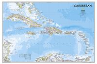
Wandkaart Caribbean - Caraïben, 91 x 61 cm | National Geographic
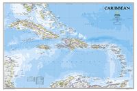
Completely redesigned and updated, National Geographic Maps' Caribbean Classic wall map is one of the most authoritative maps for the islands of the Caribbean Sea. This new edition shows the entire region in exceptional detail, with coverage extending from the tip of Florida to the northern extents of Colombia and Venezuela, east to Barbados, and west to the eastern edge of Honduras, Costa Rica, and Nicaragua. Updated bathymetry reveals the remarkable seafloor variation of the Caribbean including the Puerto Rico Trench, the deepest point in the Atlantic Ocean at 8,605 meters (28,232 feet).   Caribbean Classic is a perfect tool for business or education reference, and a beautiful addition to any décor. Shown on the map are over 1,000 named places including country capitals, primary and secondary towns; political boundaries, important infrastructure, and all key landforms. Useful and informative notes about the region's history and unique geography are spread throughout the map, providin…
28,95
Wandkaart Caribbean - Caraïben, 91 x 61 cm | National Geographic
Completely redesigned and updated, National Geographic Maps' Caribbean Classic wall map is one of the most authoritative maps for the islands of the Caribbean Sea. This new edition shows the entire region in exceptional detail, with coverage extending from the tip of Florida to the northern extents of Colombia and Venezuela, east to Barbados, and west to the eastern edge of Honduras, Costa Rica, and Nicaragua. Updated bathymetry reveals the remarkable seafloor variation of the Caribbean including the Puerto Rico Trench, the deepest point in the Atlantic Ocean at 8,605 meters (28,232 feet).   Caribbean Classic is a perfect tool for business or education reference, and a beautiful addition to any décor. Shown on the map are over 1,000 named places including country capitals, primary and secondary towns; political boundaries, important infrastructure, and all key landforms. Useful and informative notes about the region's history and unique geography are spread throughout the map, providin…
32,95

Klanten-reviews van Wandkaart Holy Land - Israël, 53 x 80 cm | National Geographic

Er zijn nog geen beoordelingen voor dit productBen jij de eerste die een review plaatst?

Meer over Wandkaart Holy Land - Israël, 53 x 80 cm | National Geographic

Productomschrijving

National Geographic Wall Maps offer a special glimpse into current and historical events, and they inform about the world and environment. Offered in a variety of styles and formats, these maps are excellent reference tools and a perfect addition to any home, business or school. There are a variety of map options to choose from, including the world, continents, countries and regions, the United States, history, nature and space.

Productspecificaties

Artikelnummer(s)
Brand
National Geographic
Shopblog.nl maakt gebruik van cookies. Ga je verder op onze website, ga dan akkoord met het plaatsen van cookies en de verwerking van deze data door ons en vermelde partners.