shopblog.nl
Categorieën
  Sluiten

Meer Gizi Map

Wandelkaart - Wegenkaart - landkaart St Helena & Dependencies | Gizi M

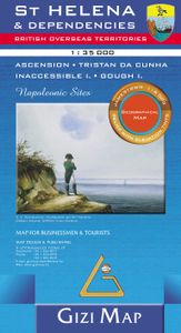
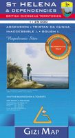
Met name door het kleurgebruik een mooie kaart: heel duidelijk wordt het landschap weergegeven. Daarnaast veel topografische details.  St. Helena at 1:35,000 from Gizi Map, with the other islands of the British Overseas Territories in the Atlantic: Tristan da Cunha, plus Ascension, Inaccessible and Gough Islands at 1:75,000, with superb cartography...
15,95

Webshops met dit product

Webshop
Bezorging
Prijs

Anderen bekeken ook

Wandelkaart - Wegenkaart - landkaart St Helena & Dependencies | Gizi M
Met name door het kleurgebruik een mooie kaart: heel duidelijk wordt het landschap weergegeven. Daarnaast veel topografische details.  St. Helena at 1:35,000 from Gizi Map, with the other islands of the British Overseas Territories in the Atlantic: Tristan da Cunha, plus Ascension, Inaccessible and Gough Islands at 1:75,000, with superb cartography and places of interest.    The map excellently presents the topography of all the islands, with bright colouring and vivid relief shading, accompanied by spot heights and names of many peaks, valleys and other geographic features. Small settlements and many individual buildings are shown, roads and local tracks are marked. On St. Helena hiking trails are also highlighted and local administrative boundaries are marked.    The map indicates locations with tourist accommodation and prominently shows various places of interest. Special highlighting marks sites associated with Napoleon’s exile on St Helena and the map also shows the boundary of t…
15,95
Reisgids St Helena, Ascension, Tristan da Cunha | Bradt Travel Guides
Voor vele landen net zo goed, zo niet beter dan de Planet. Beduidend soberder uitgevoerd, maar ook met veel informatie voor backpackers en met veel kaartmateriaal. Een aanrader! This fully revised fourth edition of Bradt’s St Helena, Ascension and Tristan da Cunha remains the only guide to these three British Overseas Territories, tiny volcanic islands that are virtual specks in the middle of the Atlantic Ocean and which thanks to the opening of a new airport in 2017 are more accessible than ever before. Rugged, volcanic and very remote, as Napoleon’s place of exile following the Battle of Waterloo, St Helena has gained a notoriety that assures its place in the travel lexicon. This fully revised edition includes all the most recent information, from the latest details of how to get there to expanded practical information on the airport, more detail on several of the Post Box walks and the mountain bike trail, and more in-depth information about what to do and where to go in Ascension. …
26,50
Wandelkaart - Wegenkaart - landkaart 308 Tinos | Terrain maps
Gedetailleerde wegenkaart en wandelkaart met alle kleine wegen, wandelpaden, hoogtelijnen en toeristische informatie aangegeven. Alle tekst is tweetalig in Engels en Grieks en de waterproof kaart is geschikt voor gebruik met GPS. This is a great map of Tinos because:   •    It is waterproof and rip-proof. You can fold and unfold it a thousand times, fold it in irregular ways, dunk it in the sea or leave it out in the rain. This map is indestructible!    •    It is the first time the island’s entire coastline is mapped. Cartography was done with TERRAIN’s specially equipped and staffed cartographic vessel. This means that you can locate all beaches of the island, down to the tiniest cove! In fact, the special features of every single beach are recorded: whether it is sandy or pebbled, whether it features natural tree shade, water, a beach bar or organized water sports, whether the seabed in front of the beach is sandy or rocky (so that you will know where to anchor).    •    It features…
12,50
Wegenkaart - landkaart South Pacific Cruising & Samoa | ITMB
Een overzichtskaart van de zuidelijke Stille Oceaan met de cruise routes tussen de verschillende eilanden aangegeven. Op de achterzijde een overzichtskaart van Samoa This is a new venture for ITMB. Cruising is a rapidly-growing segment of the travel industry, experiencing double-digit growth rates annually. Obviously, this is a thriving market. In conjunction with several cruise ship lines, we have prepared a map of the South Pacific Ocean, which extends southwards from Hawai'i to the southern tip of New Zealand and eastwards from central Australia/Papua New Guinea to the Pitcairn Islands. Thus, it does not include the popular South East Asia and China coast routes. We think this has to change at a time when 25,000,000 people are travelling by cruise ships. At the same time, we must keep coverage area relevant for those end users of the artwork. Even at 1:12M, most of the area covered is water, with island countries such as Fiji, Tonga, Kiribati, Tahiti, and the Cook Islands being visi…
13,95
Wegenkaart - landkaart Lesser Antilles - Caraibisch gebied - Antillen
Goede wegenkaart van van een groot aantal eilanden. Aan beide kanten bedrukt. Met veel toeristische aanduidingen als nationale parken en culturele bezienswaardigheden. Prima leesbare kaart en zeker als overzichtskaart goed te gebruiken. Folded road and tourist map of the Lesser Antilles Caribbean island chain at 1:2 500 000 scale. Places of interest, national parks, and beaches are all highlighted and shaded-relief colouring clearly depicts the topography.   The map includes insets showing Trinidad and Tobago at 1:500 000, the Virgin Islands at 1:250 000, Anegada at 1:250 000, St. Croix at 1:300 000, Anguilla and St. Martin at 1:300 000, St. Kitts and Nevis at 1:300 000, St. Barts at 1:300 000, Saba at 1:300 000, St. Eustatius at 1:300 000, Montserrat at 1:300 000, Aruba at 1:150 000, Curacao at 1:300 000, Bonaire at 1:300 000, Barbados at 1:300 000, The Grenadines at 1:300 000, Grenada at 1:300 000, St. Vincent and The Grenadines at 1:300 000, Canouan at 1:300 000, Barbuda at 1:300…
11,95
Wegenkaart - landkaart St Lucia | Gizi Map
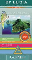
Lovely indexed road map of St. Lucia, with street plans of central Castries and the holiday complex at Anse Chastanet. Bright altitude colouring and vivid relief shading provide an excellent picture of the islands topography. Mangroves and coral reefs are marked. Road network includes minor local roads and tracks. The map also shows the country’s administrative divisions. Protected nature areas and animal watching locations are marked and the map highlights hotels and tourist accommodation, waymarked hiking trails, sites for scuba diving, watersports and deep see fishing, golf courses, various places of interest and natural curiosities, etc. The map has a 2’ latitude/longitude grid and is indexed. Also included are street plans of central Castries and the holiday complex at Anse Chastenet, plus an overview map of the southern Caribbean.
15,95

Klanten-reviews van Wandelkaart - Wegenkaart - landkaart St Helena & Dependencies | Gizi M

Er zijn nog geen beoordelingen voor dit productBen jij de eerste die een review plaatst?

Meer over Wandelkaart - Wegenkaart - landkaart St Helena & Dependencies | Gizi M

Productomschrijving

Met name door het kleurgebruik een mooie kaart: heel duidelijk wordt het landschap weergegeven. Daarnaast veel topografische details.  St. Helena at 1:35,000 from Gizi Map, with the other islands of the British Overseas Territories in the Atlantic: Tristan da Cunha, plus Ascension, Inaccessible and Gough Islands at 1:75,000, with superb cartography and places of interest.    The map excellently presents the topography of all the islands, with bright colouring and vivid relief shading, accompanied by spot heights and names of many peaks, valleys and other geographic features. Small settlements and many individual buildings are shown, roads and local tracks are marked. On St. Helena hiking trails are also highlighted and local administrative boundaries are marked.    The map indicates locations with tourist accommodation and prominently shows various places of interest. Special highlighting marks sites associated with Napoleon’s exile on St Helena and the map also shows the boundary of the territory assigned to the deposed emperor. Also provided is a street plan of Jamestown.    The remaining islands: Tristan da Cunha, Ascension Island, Gough Island and Inaccessible Island are all presented as separate insets at 1:75,000, with similar cartography and additional information. All the maps have latitude and longitude lines: St Helena at 1’ intervals, the other islands at 2’. There is no index. Map legend includes English and French.

Productspecificaties

Artikelnummer(s)
Brand
Gizi Map
Shopblog.nl maakt gebruik van cookies. Ga je verder op onze website, ga dan akkoord met het plaatsen van cookies en de verwerking van deze data door ons en vermelde partners.