shopblog.nl
Categorieën
  Sluiten

Meer TerraQuest
Meer TerraQuest in Thrillers & fantasy boeken

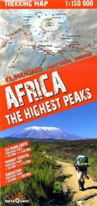
Wandelkaart Trekking map Africa - the highest peaks | TerraQuest

Gedetailleerde en stevig gelamineerde trekkingkaart / klimkaart met schalen tussen de 1:50.000 en 1:175.000 voor enkele van de belangrijkste bergen in Oost Afrika voor o.a. Mt. Kilimanjaro, Mt. Kenya en de Ruwenzori Mountains in Kenia, Tanzania en Oeganda.   Africa: The Highest Peaks - Detailed trekking map of the higest peaks in Africa.   There is...
18,50

Webshops met dit product

Webshop
Bezorging
Prijs

Anderen bekeken ook

Wandelkaart Trekking map Africa - the highest peaks | TerraQuest
Gedetailleerde en stevig gelamineerde trekkingkaart / klimkaart met schalen tussen de 1:50.000 en 1:175.000 voor enkele van de belangrijkste bergen in Oost Afrika voor o.a. Mt. Kilimanjaro, Mt. Kenya en de Ruwenzori Mountains in Kenia, Tanzania en Oeganda.   Africa: The Highest Peaks - Detailed trekking map of the higest peaks in Africa.   There is a 1:150,000 map of Kilimanjaro and meru and a 1:50,000 scale map of Kilimanjaro - Kobo peak.    A 1:175,000 overview of Mount Kenya and the surronds and a 1:50,000 map of Batian & Nelion.   A 1:100,000 overview of the Rwenzori area with a 1:50,000 detailed map of the Margherita & Alexandra peaks.    Terraquest say 'TerraQuest maps are designed and developed primarily for tourists preparing for treks to remote corners of the world. Our proven map laminating technology allows you to freely use the maps even in harsh conditions, while appreciating the clear and easy-to-read information compiled by our team of qualified cartographers. The distin…
18,50
Wandelkaart Trekking map Central Pyrenees - Pyreneeën | TerraQuest
Uitstekende wandelkaart van een deel van de Pyreneën. Alle noodzakelijke gegevens staan er op, de kaart is gebaseerd op topografische kaarten en voorzien van ingetekende wandelroutes. De kaart is geplastificeerd. Voor een uitsnede welk gebied deze kaart dekt. This is the 1:50,000 trekking map for the Central Pyrenees covering Lourdes, Trebons and Capvern on the north edge of the map and down to Monte Perdido in the south.   Terraquest say 'TerraQuest maps are designed and developed primarily for tourists preparing for treks to remote corners of the world. Our proven map laminating technology allows you to freely use the maps even in harsh conditions, while appreciating the clear and easy-to-read information compiled by our team of qualified cartographers. The distinctive feature of terraQuest laminated maps is the manufacturing method. Due to a special lamination process and patented map joining techniques, the maps easily adjust to your choice of format , even for one-hand use only. T…
18,50
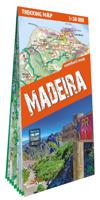
Wandelkaart Trekking map Madeira | TerraQuest
De kracht zit hem in het feit dat deze kaart in delen is geplastificeerd en daardoor ook - ondanks de plastic laag - makkelijk in delen is te vouwen. Deze kaart is gericht op het wandelen met de ingetekende wandelroutes in rood en groen.  Terraquest say 'TerraQuest maps are designed and developed primarily for tourists preparing for treks to remote corners of the world. Our proven map laminating technology allows you to freely use the maps even in harsh conditions, while appreciating the clear and easy-to-read information compiled by our team of qualified cartographers. The distinctive feature of terraQuest laminated maps is the manufacturing method. Due to a special lamination process and patented map joining techniques, the maps easily adjust to your choice of format , even for one-hand use only. They are exceptionally durable and may be folded repeatedly. You can also add and erase your own notes directly onto the map with an erasable pen without damage to the map'
12,50
Wandelkaart Trekking map Rila - Pirin | TerraQuest
De kracht zit hem in het feit dat deze kaart in delen is geplastificeerd en daardoor ook - ondanks de plastic laag - makkelijk in delen is te vouwen. Deze kaart is gericht op het wandelen met de ingetekende wandelroutes in rood en groen. Op de ene kant staat het Pirin geberhte en op de andere zijde her Rila gebergte.   Terraquest say 'TerraQuest maps are designed and developed primarily for tourists preparing for treks to remote corners of the world. Our proven map laminating technology allows you to freely use the maps even in harsh conditions, while appreciating the clear and easy-to-read information compiled by our team of qualified cartographers. The distinctive feature of terraQuest laminated maps is the manufacturing method. Due to a special lamination process and patented map joining techniques, the maps easily adjust to your choice of format , even for one-hand use only. They are exceptionally durable and may be folded repeatedly. You can also add and erase your own notes direc…
18,50
Wandelkaart Trekking map Annapurna Dhaulagiri | TerraQuest
De kracht zit hem in het feit dat deze kaart in delen is geplastificeerd en daardoor ook - ondanks de plastic laag - makkelijk in delen is te vouwen. Deze kaart is gericht op de trekkings in het gebied die nauwkeurig staan ingetekend, zo ook de mogelijke campsites onderweg.  Terraquest say 'TerraQuest maps are designed and developed primarily for tourists preparing for treks to remote corners of the world. Our proven map laminating technology allows you to freely use the maps even in harsh conditions, while appreciating the clear and easy-to-read information compiled by our team of qualified cartographers. The distinctive feature of terraQuest laminated maps is the manufacturing method. Due to a special lamination process and patented map joining techniques, the maps easily adjust to your choice of format , even for one-hand use only. They are exceptionally durable and may be folded repeatedly. You can also add and erase your own notes directly onto the map with an erasable pen without…
18,50
Wandelkaart Trekking map Rila - Pirin | TerraQuest
De kracht zit hem in het feit dat deze kaart in delen is geplastificeerd en daardoor ook - ondanks de plastic laag - makkelijk in delen is te vouwen. Deze kaart is gericht op het wandelen met de ingetekende wandelroutes in rood en groen. Op de ene kant staat het Pirin geberhte en op de andere zijde her Rila gebergte.   Terraquest say 'TerraQuest maps are designed and developed primarily for tourists preparing for treks to remote corners of the world. Our proven map laminating technology allows you to freely use the maps even in harsh conditions, while appreciating the clear and easy-to-read information compiled by our team of qualified cartographers. The distinctive feature of terraQuest laminated maps is the manufacturing method. Due to a special lamination process and patented map joining techniques, the maps easily adjust to your choice of format , even for one-hand use only. They are exceptionally durable and may be folded repeatedly. You can also add and erase your own notes direc…
18,50
Wandelkaart Trekking map Lake Como - Lago di Como | TerraQuest
Uitstekende wandelkaart van het gebied rond het Comomeer. Alle noodzakelijke gegevens staan er op, de kaart is gebaseerd op topografische kaarten en voorzien van ingetekende wandelroutes. De kaart is geplastificeerd. terraQuest maps are designed and developed primarily for tourists preparing for treks to remote corners of the world. Our proven map laminating technology allows you to freely use the maps even in harsh conditions, while appreciating the clear and easy-to-read information compiled by our team of qualified cartographers. The distinctive feature of terraQuest laminated maps is the manufacturing method. Due to a special lamination process and patented map joining techniques, the maps easily adjust to your choice of format , even for one-hand use only. They are exceptionally durable and may be folded repeatedly. You can also add and erase your own notes directly onto the map with an erasable pen without damage to the map.
18,50
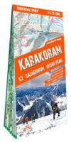
Wandelkaart Karakoram | TerraQuest
Een serie speciaal ontworpen voor liefhebbers van grote reizen en bergwandelingen. Een gedetailleerde schaal en complete toeristische informatie om u te helpen bij het plannen van uw trekking. Dankzij het gelamineerde oppervlak en het flex-vouwen, zullen de Trekking-kaarten van TerraQuest je overal begeleiden, zelfs in de meest extreme omstandigheden. U kunt uw eigen notities op de kaarten maken en ze wissen zonder de kaarten te beschadigen.   Belangrijke kenmerken:  • Rijk aan toeristische informatie (trekking routes, toeristische infrastructuur, natuurlijke bezienswaardigheden en andere interessante sites) • Het reliëf wordt plastisch voorgesteld met behulp van schaduwtechnieken • GPS compatibel, er wordt gebruik gemaakt van het WGS84 systeem • Legende in 6 talen: Engels, Frans, Duits, Spaans, Italiaans, Pools   Terraquest say 'TerraQuest maps are designed and developed primarily for tourists preparing for treks to remote corners of the world. Our proven map laminating techno…
20,95

Klanten-reviews van Wandelkaart Trekking map Africa - the highest peaks | TerraQuest

Er zijn nog geen beoordelingen voor dit productBen jij de eerste die een review plaatst?

Meer over Wandelkaart Trekking map Africa - the highest peaks | TerraQuest

Productomschrijving

Gedetailleerde en stevig gelamineerde trekkingkaart / klimkaart met schalen tussen de 1:50.000 en 1:175.000 voor enkele van de belangrijkste bergen in Oost Afrika voor o.a. Mt. Kilimanjaro, Mt. Kenya en de Ruwenzori Mountains in Kenia, Tanzania en Oeganda.   Africa: The Highest Peaks - Detailed trekking map of the higest peaks in Africa.   There is a 1:150,000 map of Kilimanjaro and meru and a 1:50,000 scale map of Kilimanjaro - Kobo peak.    A 1:175,000 overview of Mount Kenya and the surronds and a 1:50,000 map of Batian & Nelion.   A 1:100,000 overview of the Rwenzori area with a 1:50,000 detailed map of the Margherita & Alexandra peaks.    Terraquest say 'TerraQuest maps are designed and developed primarily for tourists preparing for treks to remote corners of the world. Our proven map laminating technology allows you to freely use the maps even in harsh conditions, while appreciating the clear and easy-to-read information compiled by our team of qualified cartographers. The distinctive feature of terraQuest laminated maps is the manufacturing method. Due to a special lamination process and patented map joining techniques, the maps easily adjust to your choice of format , even for one-hand use only. They are exceptionally durable and may be folded repeatedly. You can also add and erase your own notes directly onto the map with an erasable pen without damage to the map'

Productspecificaties

Artikelnummer(s)
Brand
TerraQuest

Verken gerelateerde categorieën

Shopblog.nl maakt gebruik van cookies. Ga je verder op onze website, ga dan akkoord met het plaatsen van cookies en de verwerking van deze data door ons en vermelde partners.