shopblog.nl
Categorieën
  Sluiten

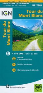
Wandelkaart Tour du Mont Blanc | IGN - Institut Géographique National

Goede, handzame, tweezijdig bedrukte kaart van de Tour du Mont Blanc Tour (TMB) met hoogte profielen en ingetekende route. 3 landen: Frankrijk, Italië en Zwitserland totale lengte 170 kilometer Inclusief 10.000 meter hoogteverschil Schaal 1: 50.000 (1 cm = 500 m) Een onmisbare hulp bij de voorbereiding van de route: de etappen, accommodaties...
11,95

Webshops met dit product

Webshop
Bezorging
Prijs

Anderen bekeken ook

Wandelkaart Tour du Mont Blanc | IGN - Institut Géographique National
Goede, handzame, tweezijdig bedrukte kaart van de Tour du Mont Blanc Tour (TMB) met hoogte profielen en ingetekende route. 3 landen: Frankrijk, Italië en Zwitserland totale lengte 170 kilometer Inclusief 10.000 meter hoogteverschil Schaal 1: 50.000 (1 cm = 500 m) Een onmisbare hulp bij de voorbereiding van de route: de etappen, accommodaties, Veiligheid, advies, trailomstandigheden Hoogteprofiel van de routes Van de uitgever Une carte à l’échelle du 1 : 50 000 (1cm = 500m) incontournable pour parcourir le mythique GR TMB® Tour du Mont Blanc.   Le Tour du Mont Blanc est une randonnée spectaculaire qui se développe autour du massif du Mont-Blanc et qui traverse 3 pays (l'Italie, la Suisse et la France), 170 kilomètres de randonnée cumulant 10 000 mètres de dénivelé.   En plus du parcours représenté de façon très précise, cette carte est également une aide précieuse dans la planification des étapes grâce aux informations et liens touristiques (ou manger, ou dormir, quoi visiter…)…
11,95
Wandelkaart 3630OTR Chamonix-Mont-Blanc | IGN - Institut Géographique
Geplastificeerde versie! De wandelkaart die de perfectie benadert! Werkelijk alle topografische details zijn er op te vinden; van hoogtelijnen tot aan bruggetjes en allerlei wandelpaden. Daarnaast hebben de makers een flinke dosis toeristische informatie op de kaart verwerkt: campings, gites d étape, restaurants en ingetekende doorgaande wandelpaden, de grandes randonnées. Het kleurgebruik is geweldig met schaduwzijdes, bos, weiland, etc goed te onderscheiden. De kaart is uitgevoerd met raster van graden, dus deze is GPS - toepasbaar!   De TOP 25 kaarten (kaart nummers die eindigen op "T") hebben betrekking op gebieden van bijzonder toeristisch belang zoals de Alpen, de Pyreneeën,De Cevennes, de Vogezen, de Provence, en de Atlantische en Middellandse zeekusten. De kaarten hebben een opdruk en benadrukken zo de lokale wandelpaden, lange afstand GR routes en, in voorkomend geval, ski routes. Andere toeristische informatie omvat campings, paardensport of kanocentra, hutten, berghutten, et…
21,95
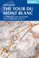
Wandelatlas Tour du Mont Blanc | Cicerone
A booklet of all the mapping needed to complete the Tour du Mont Blanc (TMB), a spectacular circuit around Mont Blanc, Western Europe's highest mountain. Covering 170km (105 miles), the TMB takes around 11 days to walk from its official start at Les Houches (France), passing through Courmayeur (Italy) and Champex (Switzerland) before returning to France via the Chamonix valley. A well-serviced introduction to high-level mountain trekking for walkers with good levels of fitness, it can also be run, fastpacked or hiked in 5–9 days.   The full route line is shown on 1:25,000 IGN maps The map booklet can be used to walk the TMB in either direction Handy facilities planner, route summary tables and accommodation listings help you plan your itinerary Includes urban maps of Les Houches, Les Contamines, Courmayeur, Champex and Chamonix Alternative stages via Col de Tricot (Stage 1A) and Fenêtre d'Arpette (Stage 8A) are also provided An accompanying Cicerone guidebook – Trekking the Tour du Mon…
21,95
Wandelkaart Tour du Mont Blanc Guidemap | Vertebrate Publishing
The white dome of Mont Blanc looms over France, Italy and Switzerland, and it is no wonder that the 169-kilometre Tour du Mont Blanc (TMB) has captured the public imagination to become one of Europe's most popular long-distance trails. The TMB appeals to people who have different levels of experience and travel at all speeds, and this Vertebrate Publishing Guidemap is unique in that it caters for four categories of user, providing custom itineraries for walkers, trekkers, fastpackers and trail runners. This lightweight, waterproof, durable and easy-to-use folding map features all the essential information for a successful TMB, including 1:40,000-scale mapping for the anticlockwise route starting and finishing in the town of Les Houches, south of Chamonix.   It also includes nine route variations, a detailed elevation profile and route planner, safety advice, terrain information and an accommodation directory, and a link to a GPX file download.
24,50
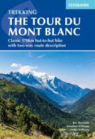
Wandelgids Trekking the Tour du Mont Blanc | Cicerone
Uitstekende wandelgids die in etappes de route nauwkeurig beschijft; ook de zijtakken en alternatieve routes koman aan bod. Kaarten zijn schetsmatig en in onze ogen onvoldoende bij slechte weersomstandigheden. Wij raden dan ook om er losse kaarten bij te kopen. A guidebook to hiking the Tour du Mont Blanc (TMB), a spectacular circuit around Mont Blanc, Western Europe's highest mountain. Covering 170km (105 miles), the TMB takes around 11 days to walk from its official start at Les Houches (France), passing through Courmayeur (Italy) and Champex (Switzerland) before returning to France via the Chamonix valley. A well-serviced introduction to high-level mountain trekking for walkers with good levels of fitness, it can also be run, fastpacked or hiked in 5–9 days.   The route is described in both directions in 11 daily stages between 7 and 21km (5–13 miles) in length. Variant routes and alternative stages are also provided, giving the option of visiting cols, refuges and viewpoints not…
25,95
Wandelkaart - Topografische kaart 3630OT Chamonix-Mont-Blanc | IGN - I
De wandelkaart die de perfectie benadert! Werkelijk alle topografische details zijn er op te vinden; van hoogtelijnen tot aan bruggetjes en allerlei wandelpaden. Daarnaast hebben de makers een flinke dosis toeristische informatie op de kaart verwerkt: campings, gites d étape, restaurants en ingetekende doorgaande wandelpaden, de grandes randonnées. Het kleurgebruik is geweldig met schaduwzijdes, bos, weiland, etc goed te onderscheiden. De kaart is uitgevoerd met raster van graden, dus deze is GPS - toepasbaar!   De TOP 25 kaarten (kaart nummers die eindigen op "T") hebben betrekking op gebieden van bijzonder toeristisch belang zoals de Alpen, de Pyreneeën,De Cevennes, de Vogezen, de Provence, en de Atlantische en Middellandse zeekusten. De kaarten hebben een opdruk en benadrukken zo de lokale wandelpaden, lange afstand GR routes en, in voorkomend geval, ski routes. Andere toeristische informatie omvat campings, paardensport of kanocentra, hutten, berghutten, etc. Elke "TOP 25" kaart be…
16,95
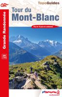
Wandelgids 028 Tour du Mont Blanc | FFRP
Uitstekende routegids met gedetailleerde kaarten en een routebeschrijving. Fout lopen wordt op deze manier wel erg moeilijk. Met symbolen is weergegeven welke voorzieningen (openbaar vervoer / winkels / overnachtingen) er zijn langs of bij de route. De gids bevat een lijst met overnachtingsadressen inclusief telefoonnummers, websites en mailadressen. Route, zie kaartje. Le Tour du Mont-Blanc n'a pas fini d'attirer à lui de nouvelles générations de marcheurs dans l'un des sites naturels les plus prestigieux de la planète. La force des paysages glaciaires surprend toujours le randonneur. Nul besoin d'une longue marche d'approche himalayenne pour venir tutoyer ici des glaciers toujours en mouvement : craquement des séracs, chutes de piliers, imposants fronts glaciaires.   Cet univers de glace mêlé à celui du granit donne au massif son visage de faces rocheuses verticales. Mais le Mont-Blanc sait offrir aussi un décor pastoral fait de vastes alpages pour les troupeaux de vaches tarines à l…
18,50

Klanten-reviews van Wandelkaart Tour du Mont Blanc | IGN - Institut Géographique National

Er zijn nog geen beoordelingen voor dit productBen jij de eerste die een review plaatst?

Meer over Wandelkaart Tour du Mont Blanc | IGN - Institut Géographique National

Productomschrijving

Goede, handzame, tweezijdig bedrukte kaart van de Tour du Mont Blanc Tour (TMB) met hoogte profielen en ingetekende route. 3 landen: Frankrijk, Italië en Zwitserland totale lengte 170 kilometer Inclusief 10.000 meter hoogteverschil Schaal 1: 50.000 (1 cm = 500 m) Een onmisbare hulp bij de voorbereiding van de route: de etappen, accommodaties, Veiligheid, advies, trailomstandigheden Hoogteprofiel van de routes Van de uitgever Une carte à l’échelle du 1 : 50 000 (1cm = 500m) incontournable pour parcourir le mythique GR TMB® Tour du Mont Blanc.   Le Tour du Mont Blanc est une randonnée spectaculaire qui se développe autour du massif du Mont-Blanc et qui traverse 3 pays (l'Italie, la Suisse et la France), 170 kilomètres de randonnée cumulant 10 000 mètres de dénivelé.   En plus du parcours représenté de façon très précise, cette carte est également une aide précieuse dans la planification des étapes grâce aux informations et liens touristiques (ou manger, ou dormir, quoi visiter…).

Verken gerelateerde categorieën

Shopblog.nl maakt gebruik van cookies. Ga je verder op onze website, ga dan akkoord met het plaatsen van cookies en de verwerking van deze data door ons en vermelde partners.