shopblog.nl
Categorieën
  Sluiten

Meer National Geographic
Meer National Geographic in Auto-onderdelen

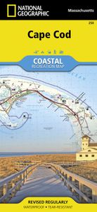
Wandelkaart - Topografische kaart 250 Cape Cod | National Geographic

Prachtige geplastificeerde topografische wandel- en vaarkaart van het Cape Cod kustgebied. Met alle recreatieve voorzieningen als campsites, stranden, en watersport maar ook met topografische details en wandelroutes ed. Door uitgekiend kleurgebruik zeer prettig in gebruik. Scheur en watervast! National Geographic's Cape Cod Coastal Recreation map i...
16,95

Webshops met dit product

Webshop
Bezorging
Prijs

Anderen bekeken ook

Wandelkaart - Topografische kaart 250 Cape Cod | National Geographic
Prachtige geplastificeerde topografische wandel- en vaarkaart van het Cape Cod kustgebied. Met alle recreatieve voorzieningen als campsites, stranden, en watersport maar ook met topografische details en wandelroutes ed. Door uitgekiend kleurgebruik zeer prettig in gebruik. Scheur en watervast! National Geographic's Cape Cod Coastal Recreation map is the ideal companion for adventures along shore and on the water.National Geographic's new family of Coastal Recreation maps are two-sided, waterproof maps designed specifically for recreation along America's most beautiful shorelines. These hybrid maps strike the perfect balance between professional boating charts and detailed topographic maps for land. There is no other map in the market today that provides as much versatility for coastal recreation as National Geographic's Coastal Recreation series. For paddlers, sail, and power boaters these maps are ideal for planning, cover waters up to three nautical miles off-shore, conveniently size…
16,95
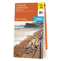
Wandelkaart - Topografische kaart OL44 OS Explorer Map Torquay & Dawli
Met zijn 4cm voor 1 km (2 ½ cm voor 1 mijl) schaal, is de OS Explorer kaartenserie de ideale en meest gedetailleerde kaartenreeks voor mensen die graag outdoor-activiteiten zoals fietsen, wandelen, paardrijden, klimmen en watersporten. Deze kaart is nog gedetailleerder dan de 'gewone' Landranger maps. Voor- en achterzijde bedrukt! Zeker op de moors en andere natuurgebieden van onschatbare waarden met echt alle aspecten van het landschap op de kaart ingetekend. Zeer goede detailkaart met topografische ondergrond. Hierop zijn toeristische symbolen van bezienswaardigheden ingetekend, daarnaast staan bijvoorbeeld campings en jeugdherbergen vermeld en - voor wandelaars het belangrijkst - alle right of way paden en Lange afstands Wandelpaden zijn er op te vinden. De ideale kaart voor het wandelen in Engeland, Wales of Schotland. Ingetekende Langeafstandswandelroute South west coast Path Map sheet OL 44 Map is the perfect map for exploring the Eastern edge of Dartmoor national park and the co…
19,50
Wandelkaart - Topografische kaart 150 OS Explorer Map Canterbury, Isle
Discover Canterbury, city of saints and kings, ancient heartland of England at the foot of the Kent Downs and the head of the River Stour Valley with its vineyards. Follow the river to the coast to discover unspoiled Deal, artistic Margate and picturesque Whitstable.  Starting in Canterbury, take the Stour Valley Walk to Sandwich and the long sweeping sand and shingle beach of Sandwich Bay  Walk the Long Rock from Whitstable to Herne Bay before taking the Thanet Coastal Path around the Isle of Thanet and its three famous Georgian and Victorian resorts of Margate, Ramsgate and Broadstairs   Take the National Trails of the England Coast Path and North Downs Way or choose from a lattice of other popular recreational paths  Met zijn 4cm voor 1 km (2 ½ cm voor 1 mijl) schaal, is de OS Explorer kaartenserie de ideale en meest gedetailleerde kaartenreeks voor mensen die graag outdoor-activiteiten zoals fietsen, wandelen, paardrijden, klimmen en watersporten. Deze kaart is nog gedetailleerd…
19,50
Wandelkaart 901 Banff North National Park | National Geographic
Prachtige geplastificeerde kaart van het bekende nationaal park. Met alle recreatieve voorzieningen als campsites, maar ook met topografische details en wandelroutes ed. Door uitgekiend kleurgebruik zeer prettig in gebruik. Scheur en watervast! The front side of the Banff North map details the south side of the national park, from Siffleur Wilderness Area to the north, to Kootenay National Park to the south. This side also covers survival tips, area trails, entry fees and details both Kootenay and Yoho Nationals Parks. The reverse side of the map details the north side of the park, extending from Siffleur Wilderness area to the south, to White Goat Wilderness to the North. Insets show safe travel in Bear Country, and all the recreation the park has to offer with backpacking, camping, biking, hiking and horseback riding.  National Geographic's Trails Illustrated map of Banff North is a two-sided, waterproof map designed to meet the needs of outdoor enthusiasts with unmatched durability …
17,95
Wandelkaart - Topografische kaart 245 OS Explorer Map National Forest
Met zijn 4cm voor 1 km (2 ½ cm voor 1 mijl) schaal, is de OS Explorer kaartenserie de ideale en meest gedetailleerde kaartenreeks voor mensen die graag outdoor-activiteiten zoals fietsen, wandelen, paardrijden, klimmen en watersporten. Deze kaart is nog gedetailleerder dan de 'gewone' Landranger maps. Voor- en achterzijde bedrukt! Zeker op de moors en andere natuurgebieden van onschatbare waarden met echt alle aspecten van het landschap op de kaart ingetekend. Zeer goede detailkaart met topografische ondergrond. Hierop zijn toeristische symbolen van bezienswaardigheden ingetekend, daarnaast staan bijvoorbeeld campings en jeugdherbergen vermeld en - voor wandelaars het belangrijkst - alle right of way paden en Lange afstands Wandelpaden zijn er op te vinden. De ideale kaart voor het wandelen in Engeland, Wales of Schotland.   These highly detailed maps show all the administrative boundaries, settlements as small as isolated farms, the road network down to unfenced roads and country trac…
19,50
Wegenkaart - landkaart 3127 United States Northeast | National Geograp
Mooie kaart van de bekende kaartenmaker National Geographic. Veel details door kleurgebruik. De wegen zijn met kleuren verdeeld in drukke en minder drukke, de wegnummers zijn goed terug te vinden. De kaart onderscheidt zich van andere series door de hoeveelheid topografische details als counties, plaatsnamen en waterwegen en het bevat een register waarin het eenvoudig zoeken is. Daarnaast is de kaart gedrukt op scheur- en watervast papier. The United States Northeast Adventure Map will guide you through the states of the Mid Atlantic region (Virginia, West Virginia, Maryland, Delaware and Pennsylvania, New York and New Jersey) and New England (Connecticut, Rhode Island, Massachusetts, Vermont, New Hampshire, and Maine). Each of these states is rich in history and nature and has its own distinct character, from the dramatic rocky shoreline of Maine's Acadia National Park and the beaches and dunes of Cape Cod Massachusetts, through the Adirondack Mountains of New York, the White and Gree…
17,50

Klanten-reviews van Wandelkaart - Topografische kaart 250 Cape Cod | National Geographic

Er zijn nog geen beoordelingen voor dit productBen jij de eerste die een review plaatst?

Meer over Wandelkaart - Topografische kaart 250 Cape Cod | National Geographic

Productomschrijving

Prachtige geplastificeerde topografische wandel- en vaarkaart van het Cape Cod kustgebied. Met alle recreatieve voorzieningen als campsites, stranden, en watersport maar ook met topografische details en wandelroutes ed. Door uitgekiend kleurgebruik zeer prettig in gebruik. Scheur en watervast! National Geographic's Cape Cod Coastal Recreation map is the ideal companion for adventures along shore and on the water.National Geographic's new family of Coastal Recreation maps are two-sided, waterproof maps designed specifically for recreation along America's most beautiful shorelines. These hybrid maps strike the perfect balance between professional boating charts and detailed topographic maps for land. There is no other map in the market today that provides as much versatility for coastal recreation as National Geographic's Coastal Recreation series. For paddlers, sail, and power boaters these maps are ideal for planning, cover waters up to three nautical miles off-shore, conveniently sized for use on-board a craft of anysize, packed with essentially boating information, and a valuable safety companion. Beach-goers, wildlife enthusiasts, and those that enjoy exploring coastal towns will find these maps an invaluable resource for local beaches, parks, wildlife viewing areas, lighthouses, and unique places of interest.   The Cape Cod Coastal Recreation map covers the Cape from the canal to Provincetown at a scale of 1:63,360 (one inch equals one mile). The front side of the map details the outer and part of the mid-cape from Provincetown to Dennis, including the Cape Cod National Seashore, Pleasant Bay, Wellfleet, Monomoy National Wildlife Refuge, Nantucket Sound, Truro, Eastham, Orleans, Chatham, Brewster, Harwich and Dennis. The reverse, with overlapping coverage, details the mid and upper cape including Nantucket Sound, Cape Cod Bay, Cape Cod Canal, Nickerson State Park, Brewster, Harwichport, Hyannis, Cotuit, Barnstable, and Sandwich.   The Cape Cod map is designed and printed in the United States on durable synthetic paper, making it waterproof, tear-resistant and capable of going anywhere you do. The map is two-sided, and is folded to a convenient size of 4.25" x 9.25" ; unfolded size is 26" x 38". These maps fit easily in lifejacket, center console, or glove box.

Productspecificaties

Artikelnummer(s)
Brand
National Geographic

Verken gerelateerde categorieën

Shopblog.nl maakt gebruik van cookies. Ga je verder op onze website, ga dan akkoord met het plaatsen van cookies en de verwerking van deze data door ons en vermelde partners.