shopblog.nl
Categorieën
  Sluiten

Meer Ordnance Survey

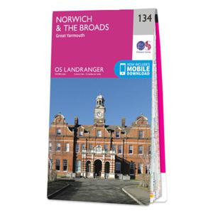
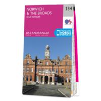
Wandelkaart - Topografische kaart 134 Landranger Norwich & The Broads,

Zeer goede detailkaart met topografische ondergrond. Kleurgebruik is goed over nagedacht: bijzonder goed leesbaar en helder kaartbeeld. Hierop zijn toeristische symbolen van bezienswaardigheden ingetekend, daarnaast staan bijvoorbeeld campings en jeugdherbergen vermeld en - voor wandelaars het belangrijkst - alle right of way paden en Lange afstand...
19,50

Webshops met dit product

Webshop
Bezorging
Prijs

Anderen bekeken ook

Wandelkaart - Topografische kaart 134 Landranger Norwich & The Broads,
Zeer goede detailkaart met topografische ondergrond. Kleurgebruik is goed over nagedacht: bijzonder goed leesbaar en helder kaartbeeld. Hierop zijn toeristische symbolen van bezienswaardigheden ingetekend, daarnaast staan bijvoorbeeld campings en jeugdherbergen vermeld en - voor wandelaars het belangrijkst - alle right of way paden en Lange afstands Wandelpaden zijn er op te vinden. De ideale kaart voor het wandelen in Engeland, Wales of Schotland. De kaarten zijn te gebruiken met GPS (UTM OSGB36), de legenda is in het Engels, Frans en Duits.    Plaatsen op deze kaart: Norwich, Great Yarmouth, Lowestoft, Beccles, Aylsham, Honing, Smallburgh, Buxton, Stalham, Eccles on Sea, Sea Palling, Horsey, Hickling, Winterton-on-Sea, Martham, How Hill, Caltishall, Horsford, Horning, Wroxham, Hemsby, Ormesby St Margaret, Filby, Spixworth, Sprowston, Blofield, Acle, Caister-on-Sea, Cringleford, Brundall, Halvergate, Swardeston, Poringland, Cantley, Burgh Castle, Belton, Reedham, Newton Flotman, Brook…
19,50
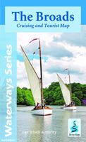
Wandelkaart The Broads | Heron Maps
A full colour map of the Broads suitable for both waterways and leisure users.   This map gives detailed coverage of the Broads with emphasis on the waterways and information useful and relevant to users of the waterways without neglecting other leisure users. The map detail is complimented by information panels and photographs.   Our cruising and tourist map of the Broads is at 1:50000 with detailed town plans at 1:12500 for Wroxham and Hoveton, Stalham, Horning, Potter Heigham, Norwich, Brundall, Beccles, Loddon, Great Yarmouth, Reedham and Oulton Broad.   A double side map with the map on one side and boating and vistor information of the other. The map shows navigation information, visitor moorings, boatyards, boat hire centres, facilities for the boat user and shops. Tourist information includes places of interest, pubs, nature reserves, windmills, churches, long distance paths, public toilets and caravan and camp sites. The reverse side has detailed boating information including …
9,95
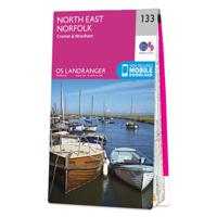
Wandelkaart - Topografische kaart 133 Landranger North East Norfolk, C
Zeer goede detailkaart met topografische ondergrond. Kleurgebruik is goed over nagedacht: bijzonder goed leesbaar en helder kaartbeeld. Hierop zijn toeristische symbolen van bezienswaardigheden ingetekend, daarnaast staan bijvoorbeeld campings en jeugdherbergen vermeld en - voor wandelaars het belangrijkst - alle right of way paden en Lange afstands Wandelpaden zijn er op te vinden. De ideale kaart voor het wandelen in Engeland, Wales of Schotland. De kaarten zijn te gebruiken met GPS (UTM OSGB36), de legenda is in het Engels, Frans en Duits.    Plaatsen op deze kaart: Sheringham, Cromer, Holt, Clay next the Sea, Roughton, Overstrand, Mundesley, Trunch, Matlaske, Briston, Erpingham, Walcott, Happisnurgh, North Walsham, Saxthorpe, Hindolveston, Foulsham, Cawston, Aylsham, Honing, Stalham, Smallburgh, Buxton, Reepham, Bawdeswell, Lyng, Attlebridge, Coltishall, Ludham, Horning, Spixworth, Sprowston, Horsford, Taverham, Honingham, Mattishall and Swanton Morley.
19,50
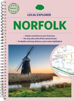
Wegenatlas Local Explorer Street Atlas Norfolk | Philip's Maps
Who hasn't explored and enjoyed their surrounding area in recent years and come to appreciate what is on our respective doorsteps? Philip's have created this new series for walkers, cyclists and local explorers at a scale that provides greener options to uncover all the nature and hidden gems in your local area.   Includes all the 20,000 streets in BECCLES, GREAT YARMOUTH, KING'S LYNN, Norwich, Thetford, Attleborough, Aylsham, Brundall, Bungay, Caister-on-Sea, Cromer, Dersingham, Diss, Downham Market, Fakenham, Harleston, Heacham, Hemsby, Hunstanton, Lakenheath, Loddon, North Walsham, Sheringham, Swaffham, Watton, Wells-next-the-Sea, Wisbech, Wymondham.   The detailed scale allows explorers, walkers and cyclists to avoid main roads and select pathways, bridleways and lanes for optimum enjoyment. Whether it's meandering through the local parks or historic houses, exploring neighbourhood nature spots or the local town, we have the clear mapping and information you need.   If you do have …
23,95
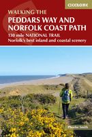
Wandelgids The Peddars Way and Norfolk Coast Path | Cicerone
Uitstekende wandelgids van de Peddars Way en de Norfolk Coast Path, waarbij naast alle noodzakelijke informatie ook gebruik gemaakt wordt van de echte topografische kaart. The Peddars Way and Norfolk Coast Path National Trail is an easy-to-follow 130-mile trail that combines the best of inland and coastal walking in Norfolk, and one that, being well waymarked, largely flat and within easy reach of public transport for most of its length, is ideal for people new to long-distance walks.   Described here in 11 stages, the route can be walked in just over a week but also easily split into day walks or over a series of weekends, with full information about access to start and finish points for each stage by public transport. This handy guidebook is illustrated throughout with extracts of OS 1:50,000 mapping and stunning photographs depicting the Trail in all seasons and describes points of interest along the way, including the Nofolk Songlines sculptures, and also facilities available in th…
18,50
Wandelkaart - Topografische kaart 122 Landranger Skegness & Horncastle
Zeer goede detailkaart met topografische ondergrond. Kleurgebruik is goed over nagedacht: bijzonder goed leesbaar en helder kaartbeeld. Hierop zijn toeristische symbolen van bezienswaardigheden ingetekend, daarnaast staan bijvoorbeeld campings en jeugdherbergen vermeld en - voor wandelaars het belangrijkst - alle right of way paden en Lange afstands Wandelpaden zijn er op te vinden. De ideale kaart voor het wandelen in Engeland, Wales of Schotland. De kaarten zijn te gebruiken met GPS (UTM OSGB36), de legenda is in het Engels, Frans en Duits.    Plaatsen op deze kaart: Skegness, Horncastle, Louth, Mablethorpe, Spilsby, Alford, Woodhall Spa, Mareham le Fen, Stockford, Tattershall, Frithville, Sibsey, Wrangle, Eastville, Friskney, Wainfleet All Saints, Little Steeping, Burgh le Marsh, Great Steeping, Ingoldmells, Chapel St Leonards, Hagworthingham, Willoughby, Mumby, Belchford, South Ormsby, Maltby le Marsh, Sutton on Sea, Manby, Legbourne, Baumer, Goulceby, Hainton and Ludford
19,50

Klanten-reviews van Wandelkaart - Topografische kaart 134 Landranger Norwich & The Broads,

Er zijn nog geen beoordelingen voor dit productBen jij de eerste die een review plaatst?

Meer over Wandelkaart - Topografische kaart 134 Landranger Norwich & The Broads,

Productomschrijving

Zeer goede detailkaart met topografische ondergrond. Kleurgebruik is goed over nagedacht: bijzonder goed leesbaar en helder kaartbeeld. Hierop zijn toeristische symbolen van bezienswaardigheden ingetekend, daarnaast staan bijvoorbeeld campings en jeugdherbergen vermeld en - voor wandelaars het belangrijkst - alle right of way paden en Lange afstands Wandelpaden zijn er op te vinden. De ideale kaart voor het wandelen in Engeland, Wales of Schotland. De kaarten zijn te gebruiken met GPS (UTM OSGB36), de legenda is in het Engels, Frans en Duits.    Plaatsen op deze kaart: Norwich, Great Yarmouth, Lowestoft, Beccles, Aylsham, Honing, Smallburgh, Buxton, Stalham, Eccles on Sea, Sea Palling, Horsey, Hickling, Winterton-on-Sea, Martham, How Hill, Caltishall, Horsford, Horning, Wroxham, Hemsby, Ormesby St Margaret, Filby, Spixworth, Sprowston, Blofield, Acle, Caister-on-Sea, Cringleford, Brundall, Halvergate, Swardeston, Poringland, Cantley, Burgh Castle, Belton, Reedham, Newton Flotman, Brooke, Loddon, Hopton on Sea, Corton, Haddiscoe, Hales, Hempnall, Woodton, Long Stratton and Ditchingham

Productspecificaties

Artikelnummer(s)
Brand
Ordnance Survey
Shopblog.nl maakt gebruik van cookies. Ga je verder op onze website, ga dan akkoord met het plaatsen van cookies en de verwerking van deze data door ons en vermelde partners.