shopblog.nl
Categorieën
  Sluiten

Meer Huber Verlag
Meer Huber Verlag in Reisgidsen & talen boeken

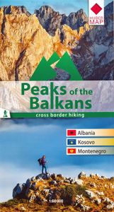
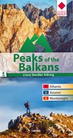
Wandelkaart Peaks of the Balkans | Huber Verlag

Wandelkaart van een speciaal gebied op de grens van Albanië, Kosovo en Montenegro. Ingetekend is de lange afstands wandelroute Peaks of the Balkans.  he transnational "Peaks of the Balkans Trail" guides through some of the most out of the way and wild mountain areas of the western Balkans. The "Peaks of the Balkans" walking map showing the trail th...
14,95

Webshops met dit product

Webshop
Bezorging
Prijs

Anderen bekeken ook

Wandelkaart Peaks of the Balkans | Huber Verlag
Wandelkaart van een speciaal gebied op de grens van Albanië, Kosovo en Montenegro. Ingetekend is de lange afstands wandelroute Peaks of the Balkans.  he transnational "Peaks of the Balkans Trail" guides through some of the most out of the way and wild mountain areas of the western Balkans. The "Peaks of the Balkans" walking map showing the trail through the mountains in the border region of Albania, Kosovo, Montenegro, and contains a detailed description of the various parts of the route including elevation profiles. Scale 1:60 000
14,95
Wandelgids Trekking the Peaks of the Balkans Trail | Cicerone
Uitstekende wandelgids van dit geweldige gebied. Goed beschreven met veel praktische informatie om de route te kunnen lopen, inclusief redelijke kaarten. This guide describes the Peaks of the Balkans Trail, a 192km circular route through the spectacularly wild and rugged borderlands of Montenegro, Albania and Kosovo in Europe, with around a third of the trek lying in each country. Developed to promote sustainable local tourism and transcend political borders, it winds its way through the spectacular scenery of the Prokletije mountains, taking in high passes and remote valleys. Since its launch, the trail's popularity has continued to rise: however, despite increasing visitor numbers, the area - off-limits to foreigners until comparatively recently - remains underdeveloped and unspoilt. The route can be hiked in around two weeks: it is presented in 10 daily stages and the guide also includes suggestions for excursions to bag neighbouring peaks and visit local sites of interest. While a …
24,95
Wegenkaart - landkaart 3327 Adventure Map Western Balkans - Westelijke
Wegenkaart van de Westelijke Balkan met vermelding van veel bezienswaardigheden en attrakties. Watervast en scheurvast. Juist door deze vermeldingen onderscheidt de kaart zich van andere wegenkaarten. Landen: Slovenië, Kroatië, Bosnië Herzegovina, Montenegro, Albanië, Servië,  Kosovo, and Macedonië.   The Western Balkans region, an adventure playground and rising star of Europe, is loaded with Old World traditions, slow food culture, ancient towns, and rarely visited villages. The area stretches from the Adriatic Sea in the west, up and over mountain ranges, raging rivers, tectonic lakes, steep gorges, and thousands of miles of paths, trails, and routes. Discover eight countries—all with their special brand of Balkan magic: Slovenia, Croatia, Bosnia and Herzegovina, Montenegro, Albania, Serbia, Kosovo, and Macedonia.   National Geographic's Western Balkans Adventure Map will meet the needs of travelers with its detailed and accurate information. The map includes the locations of UNESCO…
17,50
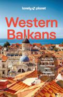
Reisgids Western Balkans | Lonely Planet
De perfecte reisgids voor zowel de georganiseerde als de zelfstandige reiziger. Naast een algemene inleiding van het land / streek vol met praktische informatie over hoe je er het beste kunt reizen: slapen, eten, vervoer, excursies ... alles kun je er in vinden.   Lonely Planet's Western Balkans is your passport to the most relevant, up-to-date advice on what to see and skip, and what hidden discoveries await you. Catch the cable car up Mt Srd for breathtaking views of Dubrovnik, Croatia; watch the beautiful people over the rim of a coffee cup in Budva's cobbled Old Town lanes in Montenegro; and trek around the stunning landscapes of Kosovo's Rugova Mountains. All with your trusted travel companion. Get to the heart of the Western Balkans and begin your journey now!   Coverage includes: Albania, Bosnia & Hercegovina, Croatia, Kosovo, Montenegro, North Macedonia, Serbia, Slovenia and more   Inside Lonely Planet's Western Balkans:   Full-colour maps and images throughout Highlightsand it…
25,95
Wandelgids Via Dinarica | Bradt Travel Guides
Bijzondere wandelgids : het beschrijft de wandelroute in Bosnie Herzegovina van de Via Dinarica, the White trail. Veel praktische informatie, redelijk kaartmateriaal en een goede beschrijving van de route.  This is the first detailed guide to the Bosnian part of the new Via Dinarica hiking trail that carves its way through the Dinaric Alps, one of Europe's least explored mountain ranges and last true wilderness frontiers, connecting the seven nations of Slovenia, Croatia, Bosnia and Herzegovina, Montenegro, Serbia, Kosovo, and Albania. In total, this trail system will span over 1,350km, 333km of which is in Bosnia Herzegovina. The Via Dinarica consists of three routes - White, Green and Blue - and this guide focuses primarily on the White Trail through Bosnia and Herzegovina, following the natural flow of the highest peaks of the Dinaric Alps. Detailed descriptions of each of the 12 stages of the White Trail through Bosnia and Herzegovina are included, along with maps, altitude charts …
20,95
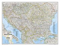
Wandkaart The Balkans - Balkan landen, 77 x 60 cm | National Geographi
Study the countries of the Balkans with our new map featuring the classic National Geographic reference styling. Features thousands of place names, accurate political boundaries, national parks, and major infrastructure networks such as roads, canals, ferry routes, and railroads. The countries of the Balkans Classic map shows it's diverse terrain as detailed through accurate shaded relief, coastal bathymetry, and symbolism for water features and other landforms. Elevations of major peaks as well as depth soundings are expressed in meters.   Map coverage includes the countries of: Albania, Austria, Bosnia and Herzegovina, Bulgaria, Croatia, Hungary, Kosovo, Macedonia, Moldova, Montenegro, Romania, Slovenia, Vojvodina, as well as the outlying border countries of Greece, Italy, Slovakia, Turkey and Ukraine. Map features also includes listings for the counties of Hungary and Romania along with their respective capitals and the administrative divisions of Bosnia and Herzegovina.
21,95
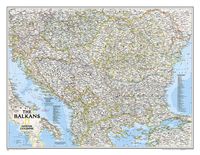
Wandkaart The Balkans - Balkan landen, 77 x 60 cm | National Geographi
Study the countries of the Balkans with our new map featuring the classic National Geographic reference styling. Features thousands of place names, accurate political boundaries, national parks, and major infrastructure networks such as roads, canals, ferry routes, and railroads. The countries of the Balkans Classic map shows it's diverse terrain as detailed through accurate shaded relief, coastal bathymetry, and symbolism for water features and other landforms. Elevations of major peaks as well as depth soundings are expressed in meters.   Map coverage includes the countries of: Albania, Austria, Bosnia and Herzegovina, Bulgaria, Croatia, Hungary, Kosovo, Macedonia, Moldova, Montenegro, Romania, Slovenia, Vojvodina, as well as the outlying border countries of Greece, Italy, Slovakia, Turkey and Ukraine. Map features also includes listings for the counties of Hungary and Romania along with their respective capitals and the administrative divisions of Bosnia and Herzegovina.
31,95

Klanten-reviews van Wandelkaart Peaks of the Balkans | Huber Verlag

Er zijn nog geen beoordelingen voor dit productBen jij de eerste die een review plaatst?

Meer over Wandelkaart Peaks of the Balkans | Huber Verlag

Productomschrijving

Wandelkaart van een speciaal gebied op de grens van Albanië, Kosovo en Montenegro. Ingetekend is de lange afstands wandelroute Peaks of the Balkans.  he transnational "Peaks of the Balkans Trail" guides through some of the most out of the way and wild mountain areas of the western Balkans. The "Peaks of the Balkans" walking map showing the trail through the mountains in the border region of Albania, Kosovo, Montenegro, and contains a detailed description of the various parts of the route including elevation profiles. Scale 1:60 000

Productspecificaties

Artikelnummer(s)
Brand
Huber Verlag

Verken gerelateerde categorieën

Shopblog.nl maakt gebruik van cookies. Ga je verder op onze website, ga dan akkoord met het plaatsen van cookies en de verwerking van deze data door ons en vermelde partners.