shopblog.nl
Categorieën
  Sluiten

Meer Freytag & Berndt

Wandelkaart Kilimanjaro & Arusha | Freytag & Berndt

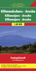
Uitstekende wandelkaart van de Kilimanjaro met wandelroutes, hutten en campingsplaatsen ingetekend. Explore Kilimanjaro & Arusha with this Freytag & Berndt map. The best way to plan your trip, prepare your itinerary, and to travel independently in this country. As with all Freytag & Berndt maps the cartography is clear and detailed with the topogra...
13,95

Webshops met dit product

Webshop
Bezorging
Prijs

Anderen bekeken ook

Wandelkaart - Wegenkaart - landkaart Chios - Hios | Freytag & Berndt
Freytag & Berndt kaarten op schaal 1:50.000 (of kleiner) zijn zeer overzichtelijk, wandelpaden werden erop ingekleurd, ze bevatten voldoende details om een wandeltocht in te schatten en worden meestal geleverd met een wandelgids waarin beknopte gegevens van wandelingen naar almen en hutten terug te vinden is alsook heel wat nuttige toeristische informatie en een tabel met GPS-punten. gedetailleerde landkaart met toeristische informatie, ook te gebuiken als fietskaart - met uitgebreide legenda en plaatsnamenregister.  Explore Chios with this Freytag & Berndt road map. The best way to plan your trip, prepare your itinerary, and to travel independently in this country.    As with all Freytag & Berndt maps the cartography is clear and detailed with the topography shown by relief shading with plenty of spot heights.   The map includes a detailed index and legend, along with tourist information and National Park information.   Distances between points are shown as well as indications of stee…
14,95
Stadsplattegrond Barcelona | Freytag & Berndt
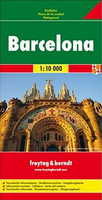
Stadsplattegrond met register. Helder kaartbeeld waarbij de naamgeving goed leesbaar is weergegeven. Met de toeristische bezienswaardigheden in symbolen weergeven: monumenten, musea, stadions e.a. Daarnaast handige zaken als postkantoren, parkeergarages en stations. Veelal ook met een openbaar vervoer of metro kaart als inzet. Explore Barcelona with this Freytag & Berndt map. The best way to plan your trip, prepare your itinerary, and to travel independently in this country. As with all Freytag & Berndt maps the cartography is clear and detailed with the topography shown by relief shading with plenty of spot heights.   One side features a detailed map of the city of Barcelona, as well as an inset of the greater area around the city in Spain. The flipside features the index for the map.    Freytag & Berndt maps make good use of an icon system. Icons show tourist information such as:   Places of interest Churches, museums and theatres Parks and gardens   Distances between points are show…
13,95
Wegenkaart - landkaart Côte d'Azur- Franse Riviera | Freytag & Berndt
Deze bijzonder gedetailleerde Freytag & Berndt Wegenkaart van de Cote d'Azur is aan één kant geprint en heeft een schaal van 1:150.000. Op deze kaart staan o.a. fietsroutes, lange afstandswandelpaden, toeristische wegen en bezienwaardigheden aangegeven. In de omslag van de kaart is een apart boekje geniet met een korte beschrijving van de TOP 10 van bezienswaardigheden, een uitgebreide index en plattegrondjes van enkele toeristische plaatsen. Explore the French Riviera with this Freytag & Berndt road map. The best way to plan your trip, prepare your itinerary, and to travel independently in this country. As with all Freytag & Berndt maps the cartography is clear and detailed with the topography shown by relief shading with plenty of spot heights.   This map includes detailed land information of the French Riviera area, and also insets of major towns including Nice, Toulon, Cannes, Monte Carlo and more. Also included is a booklet of top tips of what to do and see when visiting there.   …
14,95
Stadsplattegrond Barcelona | Freytag & Berndt
Stadsplattegrond met register. Helder kaartbeeld waarbij de naamgeving goed leesbaar is weergegeven. Met de toeristische bezienswaardigheden in symbolen weergeven: monumenten, musea, stadions e.a. Daarnaast handige zaken als postkantoren, parkeergarages en stations. Veelal ook met een openbaar vervoer of metro kaart als inzet. Explore Barcelona with this Freytag & Berndt map. The best way to plan your trip, prepare your itinerary, and to travel independently in this country. As with all Freytag & Berndt maps the cartography is clear and detailed with the topography shown by relief shading with plenty of spot heights.   One side features a detailed map of the city of Barcelona, as well as an inset of the greater area around the city in Spain. The flipside features the index for the map.    Freytag & Berndt maps make good use of an icon system. Icons show tourist information such as:   Places of interest Churches, museums and theatres Parks and gardens   Distances between points are show…
13,95
Wegenkaart - landkaart Nieuw Zeeland - New Zealand | Freytag & Berndt
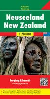
Gedetailleerde, tweezijdige landkaart van Nieuw Zeeland, prima geschikt voor planning en rondtrekken. De berijdbare wegen zijn goed weergeven, zowel de hoofdwegen als provinciale en lokale wegen; wegnummers worden vermeld. Afstanden tussen plaatsen zijn in kilometers op de kaart ingetekend, daarnaast worden ook op belangrijke plekken benzinepompen gemarkeerd. In het kaartbeeld wordt door middel van schaduw het reliëf weergegeven en soms enkele punten in het landschap met de daadwerkelijke hoogte. Provinciegrenzen zijn goed terug te vinden, nationale parken en reservaten ook. Met allerhande symbolen worden toeristische bezienswaardigheden weergegeven als monumenten, historisch belangrijke plekken, uitzichtpunten, hotels en campings. Ook luchthavens, treinverbindingen en havens vindt u er op!   Explore New Zealand with this Freytag & Berndt map. The best way to plan your trip, prepare your itinerary, and to travel independently in this country. As with all Freytag & Berndt maps the cart…
14,95
Wandelkaart WKI02 Cinque Terre - Portofino | Freytag & Berndt
Goede wandelkaart van het beroemde Cinque Terre. Fietsroutes, wandelroutes en enkele mountainbike-tochten staan er op ingetekend. GPS - bruikbaar.   Explore the Italian coastline known as Cinque Terre and the fishing village of Portofino with this Freytag & Berndt travel set. Inside the plastic sleeve, you will find a hiking and leisure map; as well as a guide. The best way to plan your trip, prepare your itinerary, and to travel independently on this region. As with all Freytag & Berndt maps, the cartography is clear and detailed with the topography shown with relief shading with plenty of spot heights.   The hiking and leisure map includes an inset of the village of Portofino. Tourist information is marked clearly using a range of icons and markings. Tourist information displayed includes:   Roadways, footpaths, bridle paths, railway, shipping routes, moutain biking paths and hiking trails Restaurants, churches, and other buildings of interest Camping sites, caves, golf courses, info…
13,95
Wegenkaart - landkaart Côte d'Azur- Franse Riviera | Freytag & Berndt
Deze bijzonder gedetailleerde Freytag & Berndt Wegenkaart van de Cote d'Azur is aan één kant geprint en heeft een schaal van 1:150.000. Op deze kaart staan o.a. fietsroutes, lange afstandswandelpaden, toeristische wegen en bezienwaardigheden aangegeven. In de omslag van de kaart is een apart boekje geniet met een korte beschrijving van de TOP 10 van bezienswaardigheden, een uitgebreide index en plattegrondjes van enkele toeristische plaatsen. Explore the French Riviera with this Freytag & Berndt road map. The best way to plan your trip, prepare your itinerary, and to travel independently in this country. As with all Freytag & Berndt maps the cartography is clear and detailed with the topography shown by relief shading with plenty of spot heights.   This map includes detailed land information of the French Riviera area, and also insets of major towns including Nice, Toulon, Cannes, Monte Carlo and more. Also included is a booklet of top tips of what to do and see when visiting there.   …
14,95

Klanten-reviews van Wandelkaart Kilimanjaro & Arusha | Freytag & Berndt

Er zijn nog geen beoordelingen voor dit productBen jij de eerste die een review plaatst?

Meer over Wandelkaart Kilimanjaro & Arusha | Freytag & Berndt

Productomschrijving

Uitstekende wandelkaart van de Kilimanjaro met wandelroutes, hutten en campingsplaatsen ingetekend. Explore Kilimanjaro & Arusha with this Freytag & Berndt map. The best way to plan your trip, prepare your itinerary, and to travel independently in this country. As with all Freytag & Berndt maps the cartography is clear and detailed with the topography shown by relief shading with plenty of spot heights.   This map features detailed land information on Kilimanjaro as well as an inset of Arusha.    Freytag & Berndt maps make good use of an icon system. Icons show tourist information such as:   UNESCO World Heritage Sites Mountain shelters Churches, temples and other monuments   Distances between points are shown as well as indications of steep gradients, all distances are in kilometres. The legend is in several languages including English.

Productspecificaties

Artikelnummer(s)
Brand
Freytag & Berndt
Shopblog.nl maakt gebruik van cookies. Ga je verder op onze website, ga dan akkoord met het plaatsen van cookies en de verwerking van deze data door ons en vermelde partners.