shopblog.nl
Categorieën
  Sluiten

Meer Editorial Alpina
Meer Editorial Alpina in Literatuur boeken

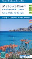
Wandelkaart - Fietskaart 72 Noord Mallorca | Editorial Alpina

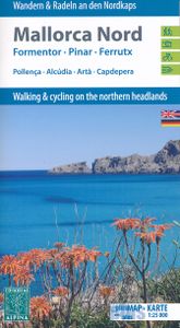
Formentor - Pinar - Ferrutx - Pollenca - Alcudia - Arta - Capdepera   Kaart met wandel-, MTB- en fietsroutes. Bijgevoegd is een boekje met in het Duits en Engels een korte beschrijving van een aantal van deze routes.   This is an area of great natural beauty, with protected areas - the Parque Natural de la Sierra Levante and the Natural Park of Alb...
16,95

Webshops met dit product

Webshop
Bezorging
Prijs

Anderen bekeken ook

Wandelkaart - Fietskaart 72 Noord Mallorca | Editorial Alpina
Formentor - Pinar - Ferrutx - Pollenca - Alcudia - Arta - Capdepera   Kaart met wandel-, MTB- en fietsroutes. Bijgevoegd is een boekje met in het Duits en Engels een korte beschrijving van een aantal van deze routes.   This is an area of great natural beauty, with protected areas - the Parque Natural de la Sierra Levante and the Natural Park of Albufereta.    The map includes the GR 221, all marked trails, mountain bike routes and bike paths, as well as location of all tourist services.
16,95
Wandelkaart 71 Mallorca - Caps del Nord (noordoosten) | Editorial Alpi
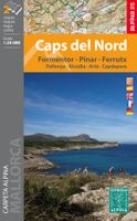
Kaartenset van 2 losse kaarten in één. Zeer gedetailleerde wandelkaart van een deel van de Mallorca. Met ingetekende wandelroutes en andere informatie. Spaanstalig, maar uitstekende kaart. Met symbolen voor campings, hutten. Coordinaten zijn weergegeven, dus GPS compatible met UTM grid. Gebied: Pollenca, Alcúdia, Artà, Capdepera, Cala Mesquida, Alcanada, Cap de Formentor, Cap de Pinar, Cap de Ferrutx, Cap de Vermell, Cap des Freu, Cap de Cataluny, Cap de Menorca. This is an area of great natural beauty, with protected areas - the Parque Natural de la Sierra Levante and the Natural Park of Albufereta.    The map includes the GR 221, all marked trails, mountain bike routes and bike paths, as well as location of all tourist services.
19,95
Reisgids Mini Rough Guide Mallorca | Rough Guides
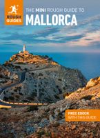
This pocket-sized travel guide to Mallorca is a convenient, quick-reference companion to discovering what to do, what to see and how to get around the destination. It covers top attractions like Palma Cathedral, Cala Deia, Platja de Formentor and Coves del Drac, as well as hidden gems, including Estellencs and Colonia de Sant Jordi. Our Mallorca guide book will save you time and enhance your exploration of this fascinating region.   This Mallorca travel guide has been fully updated post-COVID-19. This Mini Rough Guide to MALLORCA covers: Palma, Sineu, Petra, Serra de Tramuntana, Soller, Estellencs, Banyalbufar, Deia, Fornalutx, Valldemossa, Lluc, Pollenca, Port de Pollenca, Port d'Alcudia, Peninsula de Formentor, Serres de Llevant, Cala Ratjada, Porto Petro, Arta. In this guide book to Mallorca you will find: RECOMMENDATIONS FOR EVERY TYPE OF TRAVELLER Experiences selected for every kind of trip to Mallorca, from cultural explorations in Sineu to family activities in child-friendly pla…
12,50
Fietskaart 75 Bike Mallorca | Editorial Alpina
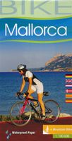
Handige geplastificeerde fietskaart van Mallorca, met ingetekende routes, helder kaartbeeld en extra informatie aan de hand van symbolen.   This is a waterproof, folded map to the cycling Mecca of Mallorca. The scale is 1:100,000 and has English description.    Bike shops are listed and bike-friendly taxi services. Other practical information includes average gradient symbols; routes graded for light/medium/heavy traffic; roads in bad repair; specific bike lanes; unpaved/dirt tracks. Suggested tours are highlighted, ranging from 36km to 110km, including height profiles.   Mountain bike routes are also marked on the map, most of which are unpaved and quite easy to follow.
9,95
Reisgids Mini Rough Guide Mallorca | Rough Guides
This pocket-sized travel guide to Mallorca is a convenient, quick-reference companion to discovering what to do, what to see and how to get around the destination. It covers top attractions like Palma Cathedral, Cala Deia, Platja de Formentor and Coves del Drac, as well as hidden gems, including Estellencs and Colonia de Sant Jordi. Our Mallorca guide book will save you time and enhance your exploration of this fascinating region.   This Mallorca travel guide has been fully updated post-COVID-19. This Mini Rough Guide to MALLORCA covers: Palma, Sineu, Petra, Serra de Tramuntana, Soller, Estellencs, Banyalbufar, Deia, Fornalutx, Valldemossa, Lluc, Pollenca, Port de Pollenca, Port d'Alcudia, Peninsula de Formentor, Serres de Llevant, Cala Ratjada, Porto Petro, Arta. In this guide book to Mallorca you will find: RECOMMENDATIONS FOR EVERY TYPE OF TRAVELLER Experiences selected for every kind of trip to Mallorca, from cultural explorations in Sineu to family activities in child-friendly pla…
12,50
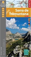
Wandelkaart 69 Serra de Tramuntana + GR-221 | Editorial Alpina
Kaartenset van 4 kaarten op stevig papier voor de hele Serra de Tramuntana met de GR221. Zeer gedetailleerde wandelkaart van een klein gebied. Met ingetekende wandelroutes en andere informatie. Spaanstalig, maar uitstekende kaart. Coordinaten zijn weergegeven, dus GPS compatible met UTM grid.    Op de topografische wandelkaart worden o.a. berghutten, campings aangeduid en hoogtelijnen, ingetekende wandelroutes en de GR paden (doorgaande langeafstandswandelpaden). De kaart is inclusief een Spaanstalig boekje met extra informatie over aanwezige voorzieningen en enkele routes.   Gebied: Andratx, Sóller, Estellencs, Banyalbufar, Lluc, Orient, Sa Calobra, Pollenca, Alcúdia, Deià, Valldemossa, Peguera, Puig Major, Puig Roig, Tomir, Puig de n'Ali, Puig de Galatzó.   Mallorca’s Serra de Tramuntana mountains presented by Editorial Alpina at 1:25,000 on a set of four light, contoured and GPS compatible maps with an overprint for local hiking trails, GR221 long-distance route, sites for various o…
28,95
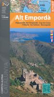
Wandelkaart 51 Alt Emporda | Editorial Alpina
Zeer gedetailleerde wandelkaart van een klein gebied. Met ingetekende wandelroutes en andere informatie. Spaanstalig, maar uitstekende kaart. Coordinaten zijn weergegeven, dus GPS compatible met UTM grid.    Dit is een 2-delige kaartenset. Op de topografische wandelkaart worden o.a. berghutten, campings aangeduid en hoogtelijnen, ingetekende wandelroutes en de GR paden (doorgaande langeafstandswandelpaden). De kaart is inclusief een Spaanstalig boekje met extra informatie over aanwezige voorzieningen en enkele routes.   Gebied: Roses, Cadaques, el Port de la Selva, Figueres, Banyoles, Castello d'Empuries, l'Escala, Llanca, Portbou, la Jonquera, Empuriabrava, Costoja, la Vajol, Borrassa, Santa Pau, Sadernes, Tortellá, Basalú, Peralada, Castellfollit de la Roca, Sant Llorenc de Cerdans / Saint-Laurent-de-Cerdans, Arles-sur-Tech, Cervera / Cerbère, Ceret, Biure, Banyuls-sur-Mer / Banyuls de la Marenda.   The Alt Empordà is a region of great contrasts of the northern Catalonia: the coa…
19,95

Klanten-reviews van Wandelkaart - Fietskaart 72 Noord Mallorca | Editorial Alpina

Er zijn nog geen beoordelingen voor dit productBen jij de eerste die een review plaatst?

Meer over Wandelkaart - Fietskaart 72 Noord Mallorca | Editorial Alpina

Productomschrijving

Formentor - Pinar - Ferrutx - Pollenca - Alcudia - Arta - Capdepera   Kaart met wandel-, MTB- en fietsroutes. Bijgevoegd is een boekje met in het Duits en Engels een korte beschrijving van een aantal van deze routes.   This is an area of great natural beauty, with protected areas - the Parque Natural de la Sierra Levante and the Natural Park of Albufereta.    The map includes the GR 221, all marked trails, mountain bike routes and bike paths, as well as location of all tourist services.

Productspecificaties

Artikelnummer(s)
Brand
Editorial Alpina

Verken gerelateerde categorieën

Shopblog.nl maakt gebruik van cookies. Ga je verder op onze website, ga dan akkoord met het plaatsen van cookies en de verwerking van deze data door ons en vermelde partners.