shopblog.nl
Categorieën
  Sluiten

Meer IT maps - Iskar
Meer IT maps - Iskar in Literatuur boeken

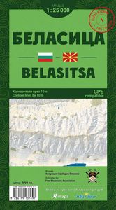
Wandelkaart Belasitsa | IT maps - Iskar

Goede duidelijke wandelkaart met een schaal van 1:25.000 van het grensgebied van Bulgarije - Griekeland - Noord Macedonie De kaart is gebaseerd op topografische kaarten met een opdruk van wandelroutes, hutten en andere handige informatie.    Hoogtelijnen (afstand 10 m), bergen, meren en rivieren staan er goed voor navigatie; de beschrijvingen en pl...
14,95

Webshops met dit product

Webshop
Bezorging
Prijs

Anderen bekeken ook

Wandelkaart Belasitsa | IT maps - Iskar
Goede duidelijke wandelkaart met een schaal van 1:25.000 van het grensgebied van Bulgarije - Griekeland - Noord Macedonie De kaart is gebaseerd op topografische kaarten met een opdruk van wandelroutes, hutten en andere handige informatie.    Hoogtelijnen (afstand 10 m), bergen, meren en rivieren staan er goed voor navigatie; de beschrijvingen en plaatsnamen zijn in het Latijn en Cyrillisch.   Met coordinaten-aanduiding, de kaart is hierdoor GPS-compatible.  Elke kaart bevat een kaarthoekmeter voor het bepalen van afstanden, de exacte positie en de hellingshoek.   Uitgever: The first, print edition of Belasitsa map is in map scale 1:25000 and contour lines by 10 meters, with many new details on topography, much improved design elements, for convenient and easy to read and all-new, very detailed terrain.   Reflected the boundaries of all protected areas within the area of the map, marked hiking trails, lodges, refuges, information centers, facilities ski areas and all details relevant to…
14,95
Wandelkaart Tour & Trail Tenerife | Discovery Walking Guides
Uitstekende wandelkaart, met ingetekende wandelroutes, voor specifieke wandelgebieden van Tenerife. Let op: dit is niet een kaart van het hele eiland, maar puur en alleen voor de wandelgebieden > daar is deze kaart de beste in! Our latest hiking research on Tenerife has resulted in new editions of Walk! Tenerife and Tenerife Hikers' Super-Durable Maps. Thanks to Jan Kostura's research we have several new hiking adventures described in detail in Walk! Tenerife. Jan's gps records of his research for new routes and updating of current routes has provided the detailed information to produce our new fourth edition of Tenerife Hiker's Super-Durable Maps. Note that Tenerife Hikers' Super-Durable Maps is a collection of four 30k scale map sections on a double sided sheet of 840mm by 600mm which folds up to 220mm by 120mm. It is not a map of all of Tenerife.  In this edition you will find 30k scale maps covering Valle de Orotava, West, Anaga and Adeje/Arona - Teide printed on a double sided …
17,95
Wandelkaart 04 Lake Louise & Yoho | Gem Trek Maps
Gedetailleerde kaart van dit prachtige gebied; deze kaart is geplastificeerd, scheur- en watervast. Gem Trek’s LAKE LOUISE & YOHO MAP is designed for visitors looking to explore one of North America’s premier day hiking destinations. Whether you are new to hiking or experienced in backcountry travel, you’ll find the waterproof and tear-resistant Lake Louise & Yoho Map to be an invaluable tool.   This map features detailed cartography, accurate hiking trails with distances, and details such as campgrounds, lodges, huts, teahouses, and picnic areas. On the reverse side of  the map are photos and trail descriptions of 11 recommended day hikes covered on the main map, ranging from easy lakeshore walks to more demanding hikes into alpine country. Four overnight or multi-day trips are also featured, along with contact information for two backcountry lodges, Skoki Lodge and Twin Falls Chalet.   Lake Louise & Yoho Map Coverage The Lake Louise & Yoho Map centres on Lake Louise, but also …
17,95
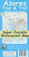
Wandelkaart Tour & Trail Azores - Azoren | Discovery Walking Guides
Gedetailleerde kaart van de Azoren. Met heel veel wandelroutes, al dan niet gemarkeerd. For the best adventures, use the best map. Azores Tour & Trail Super-Durable Map is the most detailed, accurate, toughest, large scale map of these 9 islands that you can buy.    1:60,000 scale for each island, Sao Miguel at 70,000 scale, produces a double sided map sheet of 960mm by 694mm; big enough to show masses of detail but compact enough to use in the car or on the trail. Faial, Pico, Santa Maria and Sao Jorge are on the facing sheet of the map with Corvo, Flores, Graciosa, Sao Miguel and Terceira are on the reverse side. Our special concertina map fold means your map is easy to unfold, and more importantly easy to refold back to its pocket size.   You get the most detailed map of the Azores islands that is produced including our 'Tour & Trail' level of detail ranging from major roads to secondary roads to minor roads to streets and narrow country roads, plus dirt roads and walking trails. We…
15,95
Wandelkaart 04 Lake Louise & Yoho | Gem Trek Maps
Gedetailleerde kaart van dit prachtige gebied; deze kaart is geplastificeerd, scheur- en watervast. Gem Trek’s LAKE LOUISE & YOHO MAP is designed for visitors looking to explore one of North America’s premier day hiking destinations. Whether you are new to hiking or experienced in backcountry travel, you’ll find the waterproof and tear-resistant Lake Louise & Yoho Map to be an invaluable tool.   This map features detailed cartography, accurate hiking trails with distances, and details such as campgrounds, lodges, huts, teahouses, and picnic areas. On the reverse side of  the map are photos and trail descriptions of 11 recommended day hikes covered on the main map, ranging from easy lakeshore walks to more demanding hikes into alpine country. Four overnight or multi-day trips are also featured, along with contact information for two backcountry lodges, Skoki Lodge and Twin Falls Chalet.   Lake Louise & Yoho Map Coverage The Lake Louise & Yoho Map centres on Lake Louise, but also …
17,95
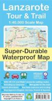
Wandelkaart Tour & Trail Lanzarote | Discovery Walking Guides
De Lanzarote Tour & Trail Super-Durable wandelkaart (4de editie) beslaat dit grote eiland op een schaal van 1: 40.000 wat resulteert in de meest gedetailleerde en sterkste kaart van Lanzarote die u kunt kopen.   For your best adventures, use the best map. Water-proof, split-proof, tear-proof, adventure-proof. Lanzarote Tour & Trail Super-Durable Map is simply the toughest, most accurate, easy to read, easy to use multipurpose map that you can get. A large 960mm by 694mm double sided map sheet covers Lanzarote and its neighbouring island La Graciosa at 1:40,000 scale. A generous overlap and an extra mini-map reduce the need of turning the map in use. Whether you plan to walk, or discover the island by car or the bus, this is the map for you. New for the 6th edition is a summary of Lanzarote bus system, with overview of bus lines and actual bus routes highlighted in the map. Also new is a summary and a mini-guide to main tourist attractions of Lanzarote, with tips for a successful vi…
18,95
Wandelkaart Tour & Trail La Gomera & El Hierro | Discovery Walking Gui
Super gedetailleerde kaart van het hele eiland. Met heel veel wandelroutes, al dan niet gemarkeerd. Quite simply La Gomera and El Hierro Tour & Trail Super-Durable Maps are the most detailed, accurate, toughest, easy to read, large scale maps of La Gomera and El Hierro that you can buy. Our map sheet is 840mm by 680mm. On the cover side you get the latest 35k scale 8th edition La Gomera Tour & Trail Super-Durable Map by David Brawn.   On the reverse side is our 35k scale 1st edition El Hierro Tour & Trail Super-Durable Map by Jan Kostura. Both maps are produced to our 'Tour & Trail' level of detail ranging from major roads to secondary roads to minor roads to streets and camino rural narrow country roads, plus dirt roads and walking trails. Walking trails are specially highlighted, GR (Gran Recorido trails in green) and Walk La Gomera (in red), making them easier to identify on the maps and easier to find on the ground.   Altitude background colouring is designed to clearly show t…
15,95

Klanten-reviews van Wandelkaart Belasitsa | IT maps - Iskar

Er zijn nog geen beoordelingen voor dit productBen jij de eerste die een review plaatst?

Meer over Wandelkaart Belasitsa | IT maps - Iskar

Productomschrijving

Goede duidelijke wandelkaart met een schaal van 1:25.000 van het grensgebied van Bulgarije - Griekeland - Noord Macedonie De kaart is gebaseerd op topografische kaarten met een opdruk van wandelroutes, hutten en andere handige informatie.    Hoogtelijnen (afstand 10 m), bergen, meren en rivieren staan er goed voor navigatie; de beschrijvingen en plaatsnamen zijn in het Latijn en Cyrillisch.   Met coordinaten-aanduiding, de kaart is hierdoor GPS-compatible.  Elke kaart bevat een kaarthoekmeter voor het bepalen van afstanden, de exacte positie en de hellingshoek.   Uitgever: The first, print edition of Belasitsa map is in map scale 1:25000 and contour lines by 10 meters, with many new details on topography, much improved design elements, for convenient and easy to read and all-new, very detailed terrain.   Reflected the boundaries of all protected areas within the area of the map, marked hiking trails, lodges, refuges, information centers, facilities ski areas and all details relevant to the scale.   To the edition, we have implemented a scale line with a graduated scale, for easy measurement of distance, a graduated scale from 1 decimal arc minute, for easy measurement of geographic coordinates and scale with distance between contour lines, for measure the angle of the slope, in degrees and percentage.   The new scaleline is transparent, for your convinience and has one more scale, for precisely measure the slope angle.

Productspecificaties

Artikelnummer(s)
Brand
IT maps - Iskar

Verken gerelateerde categorieën

Shopblog.nl maakt gebruik van cookies. Ga je verder op onze website, ga dan akkoord met het plaatsen van cookies en de verwerking van deze data door ons en vermelde partners.