shopblog.nl
Categorieën
  Sluiten

Meer Road Editions
Meer Road Editions in Literatuur boeken

Wandelkaart 37 Mount Agrafa | Road Editions

Mt Agrafa at 1:50,000 in a series of contoured maps from Road Editions covering popular hiking areas of Greece. All the maps have altitude coloring and spot heights - contour interval varies, as indicated in the descriptions of individual titles. Local footpaths are marked and, for road users the maps show picturesque routes, intermediate driving d...
5,25

Webshops met dit product

Webshop
Bezorging
Prijs

Anderen bekeken ook

Wandelkaart 37 Mount Agrafa | Road Editions
Mt Agrafa at 1:50,000 in a series of contoured maps from Road Editions covering popular hiking areas of Greece. All the maps have altitude coloring and spot heights - contour interval varies, as indicated in the descriptions of individual titles. Local footpaths are marked and, for road users the maps show picturesque routes, intermediate driving distances on minor roads, and locations of petrol stations and tyre repairs workshops. Boundaries of national parks and administrative regions are marked, and symbols show campsites, hotels and mountain refuges, and various landmarks and places of interest, e.g. archaeological sites, churches, etc. All place names are in both Greek and Latin alphabet. All the titles have latitude and longitude margin ticks, many also show GPS waypoints. Some maps come with a booklet or notes on the reverse side giving further information about the area and/or descriptions of hiking routes. Map legends include English. In this title: the Agrafa region, on the…
5,25
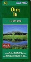
Wandelkaart 43 Iti | Road Editions
Mt Oiti/Iti at 1:50,000 in a series of contoured maps from Road Editions covering popular hiking areas of Greece. All the maps have altitude coloring and spot heights - contour interval varies, as indicated in the descriptions of individual titles. Local footpaths are marked and, for road users the maps show picturesque routes, intermediate driving distances on minor roads, and locations of petrol stations and tyre repairs workshops. Boundaries of national parks and administrative regions are marked, and symbols show campsites, hotels and mountain refuges, and various landmarks and places of interest, e.g. archaeological sites, churches, etc. All place names are in both Greek and Latin alphabet. All the titles have latitude and longitude margin ticks, many also show GPS waypoints. Some maps come with a booklet or notes on the reverse side giving further information about the area and/or descriptions of hiking routes. Map legends include English. In this title: Mount Oiti (Iti) and th…
7,95
Wandelkaart Cabo de Gata - Nijar | Editorial Alpina
Zeer gedetailleerde wandelkaart van een klein gebied. Met ingetekende wandelroutes en andere informatie. Spaanstalig, maar uitstekende kaart. Coordinaten zijn weergegeven, dus GPS compatible met UTM grid.    Op de topografische wandelkaart worden o.a. berghutten, campings aangeduid en hoogtelijnen, ingetekende wandelroutes en de GR paden (doorgaande langeafstandswandelpaden).  Cabo da Gata-Níjar Natural Park in an extensive and very popular series of walking maps from Editorial Alpina covering the Pyrenees, Catalonia and other selected hiking areas in Spain, including Picos de Europa, Sierra Nevada and parts of Andalucía, Majorca, etc. Scales vary from 1:50,000 to 1:10,000, with the majority of the titles at 1:25,000. The maps have contours, usually at 20m or 10m intervals, with additional hill shading and spot heights. An overprint highlights hiking trails, long-distance footpaths, campsites, mountain huts, refuges, etc. Many maps also show climbing sites, potholing caves, mountain bi…
16,95
Wandelkaart A15 Sarrabus da Costa Rei a Porto Corallo | Abies
Sarrabus is a territory that is not known by everybody yet. Here lies its charm and this has made possible to keep this environmental area out of big building speculations and also out of history. In fact it preserves little traces of the past, and paradoxically the remains from the prehistoric age are more meaningful than those back to more recent times. We can find traces from the most remote past not far from the State Road SS125, that from Muravera goes to Costa Rei, by visiting the nuraghe Murtas, the nuraghe S’Aqua Secis and the megalithic complexes of Scalas and Cuili Piras. They are about ten menhirs, almost fully intact, arranged in groups and fixed in the ground in the original orthostatic position. They have been put in relation with the position of the sun and the moon, at dawn and at sunset. In fact they were used as a very precise astronomic calendar but also for religious purposes since they represented both the masculine divinity and the fertility according to the worsh…
12,95
Wandelkaart Tatry Zachodnie | Sygnatura
Goede wandelkaart van het grote westelijke deel van het Tatra gebergte, zowel aan de Poolse als aan de SLowaakse kant. Wandelpaden, campings, hutten, alles staat er op.  Western Tatra Mountains in Poland and Slovakia at 1:25,000 on a contoured and GPS compatible map from CartoMedia highlighting waymarked hiking trails, mountain huts and campsites, places of interest, etc, Coverage extends from Zakopane westwards to Habovka. On the reverse are panels with an overview of the waymarked hiking trails for planning longer routes, a road map showing access to this part of the Tatra Mountains from both sides of the border, a directory of local mountain huts and other useful tourist information, etc.   Maps in the Cartomedia hiking series present topography is by contours at 20m intervals, enhanced by relief shading and, where appropriate, graphic relief for exposed rocky areas. Waymarked hiking trails indicate approximate walking times in both directions and possible danger points. Most titles…
9,95
Wandelkaart A06 Siniscola | Abies
Siniscola area at 1:25,000 in a series of contoured maps from Ed. Abies. Overprint highlights campsites and agriturismo accommodation, climbing sites, wild sheep and bird watching sites and archaeological remains. This title has no UTM grid. Main series at 1:60,000 (Nos. 1 to 12) The maps have contours at 100m intervals and colouring for woodlands and maquis shrubland. Local trails are highlighted, with additional overprint for selected hiking, mountain bike and kayaking routes listed on the reverse of the maps with brief notes and grading for the degree of difficulty. All the maps have a UTM grid for GPS users. Very extensive range of symbols highlight numerous places of interest and tourist facilities, including campsites and caravan parks, beaches, sport and recreational sites, archaeological remains and nuraghi, etc. The maps also indicate places where typical local products can be purchased. On the reverse each title has descriptions of its main places of interest, beaches, etc.…
12,95
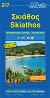
Wandelkaart 217 Skiathos | Road Editions
Gedetailleerde wegenkaart met aanduiding van de wandelwegen, lijst van hotels en toeristische informatie. Voor alle doeleinden een zeer geschikte kaart.   The features that make this and every other ROAD island map unique are: *The coastline, hydrography and precision geophysical background based on data provided by the Hellenic Military Geographic Service and electronically processed by us for clarity and legibility. We have highlighted the mountain masses in shades of brown between the contour lines (at 20m intervals on this map) to outline clearly the relief of the island. *The beaches are indicated by a special symbol next to which we have noted their names, as well as all the roads and footpaths leading to them (since most people primarily visit the islands for the beaches!). We have even included a short text in which the island’s best beaches are concisely referred to, to save you going on a wild goose hunt in search of them. *The road network is mapped out with impressive and e…
8,95

Klanten-reviews van Wandelkaart 37 Mount Agrafa | Road Editions

Er zijn nog geen beoordelingen voor dit productBen jij de eerste die een review plaatst?

Meer over Wandelkaart 37 Mount Agrafa | Road Editions

Productomschrijving

Mt Agrafa at 1:50,000 in a series of contoured maps from Road Editions covering popular hiking areas of Greece. All the maps have altitude coloring and spot heights - contour interval varies, as indicated in the descriptions of individual titles. Local footpaths are marked and, for road users the maps show picturesque routes, intermediate driving distances on minor roads, and locations of petrol stations and tyre repairs workshops. Boundaries of national parks and administrative regions are marked, and symbols show campsites, hotels and mountain refuges, and various landmarks and places of interest, e.g. archaeological sites, churches, etc. All place names are in both Greek and Latin alphabet. All the titles have latitude and longitude margin ticks, many also show GPS waypoints. Some maps come with a booklet or notes on the reverse side giving further information about the area and/or descriptions of hiking routes. Map legends include English. In this title: the Agrafa region, on the southern tip of the Pindos range. A booklet, in Greek and English, includes an index and general information about the area.

Productspecificaties

Artikelnummer(s)
Brand
Road Editions

Verken gerelateerde categorieën

Shopblog.nl maakt gebruik van cookies. Ga je verder op onze website, ga dan akkoord met het plaatsen van cookies en de verwerking van deze data door ons en vermelde partners.