shopblog.nl
Categorieën
  Sluiten

Meer Rucksack Readers
Meer Rucksack Readers in Literatuur boeken

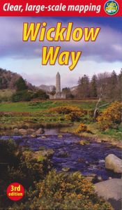
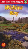
Wandelgids Wicklow Way | Rucksack Readers

Uitgevoerd in de vorm van een klapper, met ringband geeft deze gids een goede beschrijving van de lange afstands route. De kaarten zijn schetsmatig maar wel duidelijk. The Wicklow Way is Ireland’s first and most popular Waymarked Way, running between Marlay Park (Dublin) and Clonegal, 82 miles (132 km) to the south. It offers varied and scenic walk...
19,95

Webshops met dit product

Webshop
Bezorging
Prijs

Anderen bekeken ook

Wandelgids Wicklow Way | Rucksack Readers
Uitgevoerd in de vorm van een klapper, met ringband geeft deze gids een goede beschrijving van de lange afstands route. De kaarten zijn schetsmatig maar wel duidelijk. The Wicklow Way is Ireland’s first and most popular Waymarked Way, running between Marlay Park (Dublin) and Clonegal, 82 miles (132 km) to the south. It offers varied and scenic walking on the flanks of the rugged Wicklow mountains with loughs and waterfalls, passing historic buildings and hospitable villages. Much of the route lies over 1600 feet (500 metres) giving glorious views. Lower sections run through forests and farmland, over a mixture of tracks, roads and pathways rich in wildlife.   Our third edition is based on a research trip made in 2008, further revised in 2011, 2015, 2017 and 2019. It has many route updates, extra photographs and it explains new options for accommodation.   This guidebook contains all you need to plan and enjoy the Wicklow Way:   detailed route description, updated in 2019, with dist…
19,95
Wandelgids Cleveland Way | Rucksack Readers
“A testament to excellent research, writing and photography” - Malcolm Hodgson, Trail Manager   The Cleveland Way is one of England’s oldest and best-loved National Trails. It runs for 108 miles (174 km) around the North York Moors National Park, starting inland at Helmsley, offering panoramic views over the vales of York and Mowbray and from the Cleveland Hills. After reaching the coast at Saltburn, it heads south along the dramatic sea cliffs, with their tales of shipwrecks and smugglers, to end at Filey.   The route features ancient burial mounds, ruined castles, abbeys and Roman remains, with more recent traces of industrial history. Vast areas of heather moorland are host to a wide range of wildlife. The Cleveland Way is easily accessible by public transport and is divided into easy stages by villages of character with friendly pubs and accommodation. Above all, walkers are welcomed with warm Yorkshire hospitality.   Our new second edition has larger-scale mapping, several route u…
19,95
Wandelgids Walking the Wicklow Way | Cicerone
The Wicklow Way was the first long-distance walking trail to be established in Ireland. Coming in at 130km (81 miles), the route traverses the county of Wicklow, from Marlay Park on the outskirts of Dublin to Clonegal, just over the county border in neighbouring Carlow, and can be comfortably completed in a week. The guide also details several adjacent trails that can be interchanged with the main route, and short detours off-route (also described) lead to welcoming villages offering accommodation and a range of other facilities. The route is presented in seven stages, each with an overview followed by clear route description and mapping. There are elevation profiles and notes on local points of interest. In addition to background information about the county's history, geology, plants and wildlife, you will find all the information you need to walk the route, with helpful advice on transport, accommodation and kit. Accommodation listings, useful contacts and a glossary of Irish place-…
18,95
Wandelgids Forth to Farne Way | Rucksack Readers
This inspiring 70-mile pilgrim route starts from North Berwick on the Firth of Forth near Edinburgh, and continues via Whitekirk's 12th century church to Dunbar. It follows the North Sea coastline to the stunning scenery of St Abb's Head and visits Coldingham Priory, perhaps Scotland's most important Benedictine monastery. Enjoy impressive cliffs and dramatic sea stacks between visits to historic fishing villages. Cross the border and enter Berwick with its ramparts, walls and bridges across the River Tweed. The route culminates with a barefoot crossing of the Holy Island sands to Lindisfarne, where St Aidan founded a monastery in AD 635.Most people will complete the route within 5 to 8 days, staying in friendly B&Bs along the route, but it can also be done in several shorter expeditions using train and bus. This 72-page guidebook contains all you need to plan and enjoy the Forth to Farne Way: route detail in sections, with distance, terrain and refreshments where to find food and ac…
19,95
Wandelgids Annandale Way | Rucksack Readers
The Annandale Way is a charming long walk in a little-known, but very accessible, part of southern Scotland. Walked southward from source to the sea, it starts in the sheep town of Moffat, and runs for 56 miles (90 km) via Lochmaben, with superb views from the top of Almagill Hill. A slightly shorter branch of the route goes via Lockerbie and Eskrigg Nature Reserve. The two branches rejoin north of Annan to reach the Solway Firth at Newbiebarns.  This guidebook contains everything you need to plan and enjoy your trip:   detailed route description for walking from north to south foreword by broadcaster Stephen Jardine background on the history and economy of Annandale seven pages of habitats and wildlife with superb images planning information for transport and accommodation seven pages of detailed mapping of the route at 1:44,000 summary of each section showing distance, terrain and food/drink stops concise directions for those who prefer to walk south to north lavishly illust…
19,95
Wandelgids St. Cuthbert's Way | Rucksack Readers
Lange afstandswandelgids van de St. Cuthbert's Way wandeling. Wandelgids met kaarten en beschrijving. op waterbestendig papier, in spiraalbinding. Follow the footsteps of St Cuthbert in this easy-going walk of 63 miles (101 km) from Melrose Abbey in the Scottish Borders to the Holy Island of Lindisfarne in Northumberland. St Cuthbert's Way is one of Scotland's Great Trails, and it is also one of England's great trails. Starting from the ruins of Melrose Abbey, it winds alongside the River Tweed, and after about 31 miles you walk across the border into England on high ground.   The Way includes a section of Roman road and passes castles, hill forts and historic ruins along the way. Most people will complete it comfortably within 5 or 6 days. Its summit is Wideopen Hill (369m/1210ft), and its barefoot finale is the Pilgrim Way to Lindisfarne with its priory and castle.   The route is fully waymarked, the gradients are modest and it has welcoming B&Bs and pubs at strategic intervals.…
22,50

Klanten-reviews van Wandelgids Wicklow Way | Rucksack Readers

Er zijn nog geen beoordelingen voor dit productBen jij de eerste die een review plaatst?

Meer over Wandelgids Wicklow Way | Rucksack Readers

Productomschrijving

Uitgevoerd in de vorm van een klapper, met ringband geeft deze gids een goede beschrijving van de lange afstands route. De kaarten zijn schetsmatig maar wel duidelijk. The Wicklow Way is Ireland’s first and most popular Waymarked Way, running between Marlay Park (Dublin) and Clonegal, 82 miles (132 km) to the south. It offers varied and scenic walking on the flanks of the rugged Wicklow mountains with loughs and waterfalls, passing historic buildings and hospitable villages. Much of the route lies over 1600 feet (500 metres) giving glorious views. Lower sections run through forests and farmland, over a mixture of tracks, roads and pathways rich in wildlife.   Our third edition is based on a research trip made in 2008, further revised in 2011, 2015, 2017 and 2019. It has many route updates, extra photographs and it explains new options for accommodation.   This guidebook contains all you need to plan and enjoy the Wicklow Way:   detailed route description, updated in 2019, with distance, terrain and food and drink the secrets of how to book accommodation to avoid walking extra distances concise background on history, geology and wildlife extended 6-page feature on the monastic city of Glendalough planning information for travel by car, train, bus or plane in full colour, with 80 photographs. drop-down map of the Wicklow Way in five panels (1:100,000) on rainproof paper throughout.

Productspecificaties

Artikelnummer(s)
Brand
Rucksack Readers

Verken gerelateerde categorieën

Shopblog.nl maakt gebruik van cookies. Ga je verder op onze website, ga dan akkoord met het plaatsen van cookies en de verwerking van deze data door ons en vermelde partners.