shopblog.nl
Categorieën
  Sluiten

Meer Cicerone
Meer Cicerone in Literatuur boeken

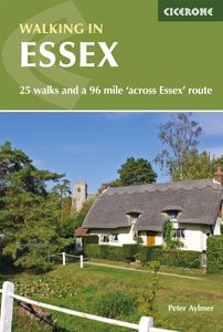
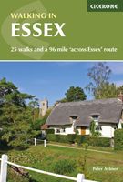
Wandelgids Walking in Essex | Cicerone

Wandelgids met 25 dagtochten en een meerdaagse tocht in Essex.  Goede omschrijvingen, veel praktische informatie. Redelijk kaartmateriaal   This guidebook describes 25 coastal and inland day walks covering the whole of the county of Essex, stretching from the Lea Valley in the west and the Thames in the south over to the North Sea and up to the Riv...
18,95

Webshops met dit product

Webshop
Bezorging
Prijs

Anderen bekeken ook

Wandelgids Walking in Essex | Cicerone
Wandelgids met 25 dagtochten en een meerdaagse tocht in Essex.  Goede omschrijvingen, veel praktische informatie. Redelijk kaartmateriaal   This guidebook describes 25 coastal and inland day walks covering the whole of the county of Essex, stretching from the Lea Valley in the west and the Thames in the south over to the North Sea and up to the River Stour in the north. Walks range from 4 to 18 miles and are mostly circular. Also included is a description of the Essex Way which crosses the county in 11 stages from Manor Park, on the fringes of London, to the port of Harwich - a distance of 96 miles. The walks are suitable for all abilities and there are shorter alternatives for many of the longer routes.   With a huge variety of scenery and walking landscapes, Essex surprises and delights in equal measure. It boasts a 350-mile coastline (which, away from the busy seaside resorts, is barely known), numerous estuaries and river valleys, great and ancient forests, and more green lanes tha…
18,95
Wandelgids Walking in Cornwall | Cicerone
40 half to full day rambles on the coasts and inland hills of Cornwall are explored in this guidebook.  Routes range from short, 2 mile strolls to long, wild walks of over 8 miles. With plenty of opportunities to combine routes together, this guide provides a wealth of variety for walkers of all abilities.   The guidebook is divided into 6 sections, including walks on Bodmin Moor (for which good navigational skills are required), the North Coast, Penwith and West Cornwall, the Inland Mining Districts, Land's End and the Lizard and Roseland Peninsulas.    Cornwall has a lot to offer walkers; stunning coastal scenery and long stretches of wild moorland, with quiet estuaries cutting through high and rocky headlands. Birdlife and wildlife, from choughs to falcons to seals are found throughout the county, as are historical sites from the neolithic, to Iron Age hill forts and a long history of mining. The towns and villages of Cornwall, from the popular spots such as St Ives, Newquay and Pad…
19,95
Wandelgids 44 Pathfinder Guides Essex | Ordnance Survey
Pathfinder Guide to Essex offers excellent lowland walking in the south-east of England. The routes are all circular exploring the finer countryside of the county, in a series of parkland, farmland, woodland and coastal and estuarine walks, visiting its places of historic interest, attractive towns and charming villages. Given the pleasant and undramatic nature of the terrain, routes only really vary in length in terms of difficulty and there is a general progression through the book from shortest to longest. Beginning with a short walk linking Laindon Common with Great and Little Burstead, encountering the infant River Crouch, the book progresses to a near 10-mile excursion across Bradwell Marsh, with its wide open horizons, and a visit to the isolated and tiny Saxon chapel of St Peter-on-the-Wall. Sea air can also be taken on walks from Walton-on-the-Naze, a circuit of the eastern end of Mersea Island, along St Osyth Creek, at Maldon, from Burnham-on-Crouch, and overlooking Benfleet …
18,50
Wandelgids Walking in the North Pennines | Cicerone
Uitstekende wandelgids van dit geweldige gebied. goed beschreven met veel praktische informatie om de route te kunnen lopen, inclusief redelijke kaarten. This guidebook describes 50 day walks across the North Pennines, England's remotest Area of Outstanding Natural Beauty taking in parts of Cumbria, County Durham and Northumberland. Most of the routes are circular and they range from 5 to 14 miles, with something to suit all abilities. Route descriptions are accompanied by 1:50K OS mapping. A guidebook to day walks in the North Pennines Area of Outstanding Natural Beauty (AONB), across Cumbria, County Durham and Northumberland. The book includes 50 walks exploring England’s ‘last wilderness’, ranging from 5 miles (8km) to 14 miles (23km). Most are circular, though there are some linear routes, and there is something to suit all abilities over a variety of terrain. Route descriptions are illustrated with OS mapping and colour photographs, and the book includes details of local transport…
19,95
Wandelgids Walking in Provence - West | Cicerone
This guide offers 30 circular day walks in the western half of Provence, the large sun-kissed coastal region of south-east France. Spanning from the Baronnies in the north to the Ste-Baume ridge in the south, the walks are set in the areas of the Drôme Provençale, Vaucluse and the Var. Provence’s sunshine and Mediterranean charm attract many visitors to its coast, yet the area also has much more to offer the walker. The countryside inland boasts a range of scenery from remote mountaintops to spectacular gorges. History is everywhere, in medieval villages, arcaded streets, abbeys, churches and castles.    This guide covers the western regions, with its companion volume, Walking in Provence: East, covering the rest of this fascinating and historic landscape. The walking is incredibly diverse; from the green waves of the Barronies hills in Drôme Provençale, to the unforgettable silhouette of Mont Ventoux giving way to limestone plateaux cut with ravines in the Vauclause. Further south lie…
21,95
Wandelgids Walking in Norfolk | Cicerone
This guidebook describes 40 circular walks in Norfolk, including walks along the coast and walks exploring the Fens and the Broads. From 4 to 12 miles, these mostly flat walks use footpaths, bridleways and quiet country lanes, and some involve parts of long-distance paths, including the Peddars Way, Norfolk Coast Path, Boudica's Way and Weavers Way. The walks are divided into five sections: walks on the northeast coast and the Broads; walks in south Norfolk, the Yare and Waveney; walks in North Norfolk and the Coast; walks in Central Norfolk and Breckland; and walks in West Norfolk and the Fens. All routes are easy to moderate and can be done by anyone of reasonable fitness and enjoyed all year round.   Each route is described step-by-step, illustrated with 1:40K OS map extracts and packed with historical, geological and other information about the landscape the route passes through. The Fenland region of Norfolk's far west is flat and low-lying, as are the marshes and waterways of th…
20,95

Klanten-reviews van Wandelgids Walking in Essex | Cicerone

Er zijn nog geen beoordelingen voor dit productBen jij de eerste die een review plaatst?

Meer over Wandelgids Walking in Essex | Cicerone

Productomschrijving

Wandelgids met 25 dagtochten en een meerdaagse tocht in Essex.  Goede omschrijvingen, veel praktische informatie. Redelijk kaartmateriaal   This guidebook describes 25 coastal and inland day walks covering the whole of the county of Essex, stretching from the Lea Valley in the west and the Thames in the south over to the North Sea and up to the River Stour in the north. Walks range from 4 to 18 miles and are mostly circular. Also included is a description of the Essex Way which crosses the county in 11 stages from Manor Park, on the fringes of London, to the port of Harwich - a distance of 96 miles. The walks are suitable for all abilities and there are shorter alternatives for many of the longer routes.   With a huge variety of scenery and walking landscapes, Essex surprises and delights in equal measure. It boasts a 350-mile coastline (which, away from the busy seaside resorts, is barely known), numerous estuaries and river valleys, great and ancient forests, and more green lanes than any other English county except Dorset.   Each walk is described step-by-step, illustrated with OS map extracts and packed with historical, and geological information about the landscape the route passes through   Steden en dorpen Chelmsford, Colchester, Harlow, Saffron Walden, Southend. Easy access also from neighbouring counties (including Kent by the Dartford crossing) and east and north London

Productspecificaties

Artikelnummer(s)
Brand
Cicerone

Verken gerelateerde categorieën

Shopblog.nl maakt gebruik van cookies. Ga je verder op onze website, ga dan akkoord met het plaatsen van cookies en de verwerking van deze data door ons en vermelde partners.