shopblog.nl
Categorieën
  Sluiten

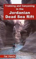
Wandelgids Trekking and Canyoning in the Jordanian Dead Sea Rift | Des

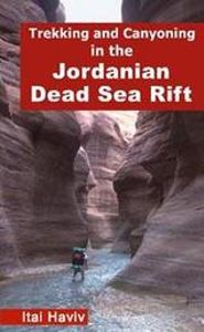
Erg volledige gids en enig in zijn soort, over dit prachtige gebied op de westgrens van Jordanië, vol canyons, kloven, bergen, woestijn, waterbronnen en watervallen. De eerste gids waarin deze hoeveelheid tochten staat in dit gebied. De tochten zijn zeer divers en zowel voor de beginnende als geoefende wandelaar / klimmer, zowel dagtochten als meer...
20,95

Webshops met dit product

Webshop
Bezorging
Prijs

Anderen bekeken ook

Wandelgids Trekking and Canyoning in the Jordanian Dead Sea Rift | Des
Erg volledige gids en enig in zijn soort, over dit prachtige gebied op de westgrens van Jordanië, vol canyons, kloven, bergen, woestijn, waterbronnen en watervallen. De eerste gids waarin deze hoeveelheid tochten staat in dit gebied. De tochten zijn zeer divers en zowel voor de beginnende als geoefende wandelaar / klimmer, zowel dagtochten als meerdaagse tochten. Soms is het aanbevolen een bedoein gids of een touw mee te nemen. The Jordanian Dead Sea Rift includes some of the world's most rugged and colorful desert landscapes. Its dramatic canyons are only now beginning to be revealed, offering the trekker untamed desert wilderness. Year-round streams, waterfalls and lush vegetation are all here to be found, dotting the desert with numerous oases. Rising above the canyons are mazes of sandstone domes and isolated cliffs with spectacular vistas. Bedouin nomads roam through the region, herding their goats and often still living in goat-hair tents, not far from world-famous archeological …
20,95
Wandelgids Sinai Trekking Guide | Trailblazer Guides
Bijzondere gids over fantastische tochten in de Sinai: wandelgids met goede schetskaarten, veel praktische informatie. Onmisbaar voor zo'n tocht! Trek with the Bedouin and their camels and discover one of the most exciting new trekking destinations in the world. Egypt's Sinai peninsula is the small tooth of land between Africa and Asia, and the fabled Biblical setting of The Exodus. It's a region of high mountains and sweeping deserts, home to crumbling Egyptian temples, Byzantine monasteries and more. The millions that visit Sinai each year come mostly for its beaches and reefs but for a true adventure, the best way to see Sinai is to trek with the Bedouin. Walking with their camels gives access to the most remote and waterless parts of the peninsula and no other mode of travel immerses you so fully in your surroundings nor gives such a close feel for the desert - its freedoms and hardships. Trekking is becoming ever-better established and it's perfectly possible to arrive and organis…
21,95
Wandelgids Walks and Scrambles in the Moroccan Anti-Atlas - Marokko |
Uitstekende wandelgids van dit geweldige gebied. goed beschreven met veel praktische informatie om de route te kunnen lopen, inclusief redelijke kaarten. The walks and scrambles in this guidebook explore the wild and rugged landscapes of the Anti-Atlas mountains of southern Morocco, with Tafraout and the Ameln Valley as the main base. 41 adventurous routes of between 3 and 40km include Jebel el Kest, Adra Mkorn and Ait Mansour, with an outline of a 1 week long-distance trek across the north-west Anti-Atlas. Walks are mainly moderate to difficult, and scrambles are Grade 1 to Grade 3+, with ropes being required for some sections. Often remote and challenging, the routes are suitable for confident walkers and scramblers with good navigation skills. Each route description is accompanied by mapping, with some photo topos to aid route finding in tricky sections. The guidebook also gives background information on the people, culture and history of the region, as well as a wealth of advice o…
24,95
Wandelgids Walking and Trekking in Iceland - IJsland | Cicerone
Wandelgids met beschrijvingen, kaarten en praktische informatie zoals bussen, overnachten, etc. voor meerdaagse wandelroutes en dagwandeltochten op IJsland. A country of extraordinary beauty, Iceland’s incredible variety of volcanic and glacial landscapes makes it a unique destination for walking and trekking holidays. Its three national parks include the mighty Vatnajökull, largest national park in Europe.   The wide range of routes in this book introduce walkers and backpackers to this ‘Land of Ice and Fire’. There are 100 days of walking in this guidebook, stretching over 1722km, split between 49 day walks and 10 multi-stage treks. They climb mountains, cross glaciers, pass lakes and explore coastlines and geothermal areas, and range from easy nature trails to challenging treks. So, there is enough variation to satisfy all kinds of walkers. The routes are spread all around Iceland, grouped into twelve regions. Detailed information is given at the start of each route or trekking stag…
26,95
Wandelgids Trekking in the Silvretta and Ratikon Alps | Cicerone
Aanbevolen wandelkaarten bij deze gids: Schaal 1:60.000 Wandelkaart 14 Unterengadin | Kümmerly & Frey Wandelkaart 13 Davos - Arosa | Kümmerly & Frey Of schaal 1:25.000 Wandelkaart 26 Alpenvereinskarte Silvrettagruppe This guide describes three treks, between 5 and 8 days, in the Silvretta and Rätikon Alps starting near Klosters, and 12 half-day hut-to-hut routes. These contrasting ranges form a line on the borders of Switzerland, Austria and Liechtenstein. The Tour of the Silvretta, the Prättigauer Höhenweg and the Rätikon Höhenweg. Straddling the borders of Austria, Switzerland and Liechtenstein, the limestone Rätikon Alps reach into the snow-bound and glacier-hung Silvretta Alps to provide a richly diverse series of landscapes. The Tour of the Silvretta, the Prättigauer Höhenweg and the Rätikon Höhenweg, all within easy reach of Klosters, have been devised to help trekkers explore the best of the region. Given sifficient time they can also be combined to create a continuous 2-week to…
25,95
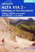
Wandelgids Alta Via 2 - Trekking in the Dolomites | Cicerone
Uitstekende wandelgids van een gerenommeerde Engelse uitgever. De tochten zijn met zorg beschreven en voorzien van allerhande nuttige informatie. Guidebook describing Alta Via 2, a challenging hut-to-hut trek through the Italian Dolomites. Stretching 174km from Bressanone (Brixen) to Feltre, the route involves some aided and exposed sections (although several can be bypassed) calling for a sure foot and a good head for heights. It can be walked in under a fortnight - although it is also possible to walk shorter chunks should you only have limited time, and the guide highlights potential exit routes and transport options. Also included are summaries of Alte Vie 3-6, which are more demanding and include remote terrain and stretches of via ferrata for which climbing experience is essential. On Alte Vie 3-6 some nights will be spent in unmanned bivouac huts, meaning trekkers must carry their own kit, although it is possible to walk shorter hut-to-hut sections. The easiest of the Alta Via r…
23,95

Klanten-reviews van Wandelgids Trekking and Canyoning in the Jordanian Dead Sea Rift | Des

Er zijn nog geen beoordelingen voor dit productBen jij de eerste die een review plaatst?

Meer over Wandelgids Trekking and Canyoning in the Jordanian Dead Sea Rift | Des

Productomschrijving

Erg volledige gids en enig in zijn soort, over dit prachtige gebied op de westgrens van Jordanië, vol canyons, kloven, bergen, woestijn, waterbronnen en watervallen. De eerste gids waarin deze hoeveelheid tochten staat in dit gebied. De tochten zijn zeer divers en zowel voor de beginnende als geoefende wandelaar / klimmer, zowel dagtochten als meerdaagse tochten. Soms is het aanbevolen een bedoein gids of een touw mee te nemen. The Jordanian Dead Sea Rift includes some of the world's most rugged and colorful desert landscapes. Its dramatic canyons are only now beginning to be revealed, offering the trekker untamed desert wilderness. Year-round streams, waterfalls and lush vegetation are all here to be found, dotting the desert with numerous oases. Rising above the canyons are mazes of sandstone domes and isolated cliffs with spectacular vistas. Bedouin nomads roam through the region, herding their goats and often still living in goat-hair tents, not far from world-famous archeological sites such as the Nabataean city of Petra. Treks in the Jordanian Dead Sea Rift include easy walks suitable for all, as well as challenging expeditions through remote areas, only rarely visited by either Bedouin or trekker. Descending several of the Rift's canyons requires abseiling skills and equipment. It is amazing that a region as spectacular as the Jordanian Dead Sea Rift remained unknown to hikers for so many years! The book describes 68 routes ranging from one to six days. Among the routes are easy walks for dayhikers as well as challenging treks. 12 canyoning routes demand abseiling skills. The book is 264 pages long including 35 detailed trekking maps, 3 true-color satellite images and 24 color pages. The vast majority of the routes were never described anywhere before! Voor meer informatie kunt u contact opnemen met De Zwerver.
Shopblog.nl maakt gebruik van cookies. Ga je verder op onze website, ga dan akkoord met het plaatsen van cookies en de verwerking van deze data door ons en vermelde partners.