shopblog.nl
Categorieën
  Sluiten

Meer Cicerone
Meer Cicerone in Literatuur boeken

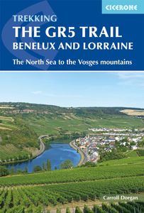
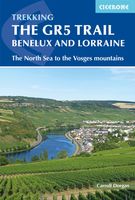
Wandelgids The GR5 Trail Benelux and Lorraine | Cicerone

Engelsetalige wandelgids van het noordelijke deel van het beroemde GR 5 pad. Dezse gids beschrijft de gehele route van de GR 5 van Hoek van Holland tot aan Schirmeck in de Vogezen. Goede beschrijvingen en informatie; kaartmateriaal is vrij beperkt. Guidebook to walking the northern section of the GR5 - 1000km starting in Hoek van Holland and passin...
24,95

Webshops met dit product

Webshop
Bezorging
Prijs

Anderen bekeken ook

Wandelgids The GR5 Trail Benelux and Lorraine | Cicerone
Engelsetalige wandelgids van het noordelijke deel van het beroemde GR 5 pad. Dezse gids beschrijft de gehele route van de GR 5 van Hoek van Holland tot aan Schirmeck in de Vogezen. Goede beschrijvingen en informatie; kaartmateriaal is vrij beperkt. Guidebook to walking the northern section of the GR5 - 1000km starting in Hoek van Holland and passing through the Netherlands, Belgium, Luxembourg and Lorraine to Schirmeck in France. A long-distance route covering a variety of cultures and landscapes. The full GR5 from the North Sea to the Mediterranean is one of the world's greatest trails. Guidebook to the northernmost section of the GR5 - from Hoek van Holland in the Netherlands, through Belgium and Luxembourg, to Schirmeck in the northeast of France. Described over 49 stages, this 1000 kilometre section of the GR5 is relatively easy and ideal for those who don't want to hike up and down steep mountains - or not just yet.   Clear route description is accompanied by 1:100K mapping, toget…
24,95
Wandelgids The GR5 Trail Vosges and Jura | Cicerone
Uitstekende wandelgids van dit geweldige gebied. goed beschreven met veel praktische informatie om de route te kunnen lopen, inclusief redelijke kaarten. This guidebook describes a long-distance walking route through the delightful Vosges and Jura. Situated in France near the eastern border, the three regional parks of the Ballons des Vosges, Northern Vosges and Jura Mountains boast verdant forests, striking rock features and low rounded summits offering spectacular views. Yet, in spite of their extensive network of well-maintained paths, they are not high profile tourist destinations. This walk offers a chance to uncover the hidden secrets of this fascinating area, from its rich wildlife to ancient ruins. Starting in Wissembourg at the northeastern tip of France, the route follows the GR53 southwest to Schirmeck, before picking up the central section of the much-celebrated GR5 (which runs from the Hook of Holland to Nice) between Schirmeck and Nyon on Lake Geneva. The scenery is as va…
23,95
Wandelgids The GR5 Trail - The Alps | Cicerone
Engelsetalige wandelgids van het beroemde GR 5 pad in de Franse Alpen. Dezse gids beschrijft de gehele route van de GR 5 van het meer van Geneve tot aan Nice en de Middellandse zee. Goede beschrijvingen en informatie; kaartmateriaal is vrij beperkt. An essential guidebook for walking the GR5, one of the world's most spectacular long-distance trails. The GR5 makes its way through the Alps from the shores of Lac Léman at Geneva to the Mediterranean at Nice. A route of 674km (420 miles), it can be trekked in a month, or split over a series of summer trips. The GR5 is well within the reach of fit and moderately experienced walkers and backpackers. There is good signposting and waymarking, and accommodation, food and drink are all available at regular intervals. The paths and tracks are generally well graded, while steep climbs are tackled on zigzag paths, so the overall gradient is not so severe. Every summer, thousands of walkers embark on this trek.   This guidebook also describes some s…
26,95
Wandelgids Wales: The Ceredigion and Snowdonia Coast Paths | Cicerone
As part of the Wales Coast Path, the Ceredigion Coast Path and Snowdonia Coast Path trace a curve of 233km (145 miles) of coastal and inland walking down Cardigan Bay. This guidebook describes a 16-stage guide to the walk from Porthmadog to St Dogmaels covering the trail between the Llyn Peninsula and the Pembrokeshire Coast Path. .In 16 day stages from Porthmadog to St Dogmaels, this guidebook offers all the information walkers need to complete the 233km (145 miles) section of the Wales Coast Path that curve down Cardigan Bay, passing through a range of contrasting landscapes.   Six days are spent on the Snowdonia Coast Path, two around the Dyfi Estuary, seven on the Ceredigion Coast Path and one from Cardigan to St Dogmaels.   Linking the Llyn Peninsula Coast Path with that of the Pembrokeshire Coastal Path, this section takes in Snowdonia National Park’s splendid coastal plains, leads inland through beautiful hill country around the Dyfi Estuary and follows some of the finest coastl…
18,50
Wandelgids The Slovene Mountain Trail | Cicerone
Uitstekende wandelgids van de Slovenska Planinska Pot. Goed beschreven met veel praktische informatie om de route te kunnen lopen, inclusief redelijke kaarten. A guidebook to trekking the Slovene Mountain Trail, crossing Slovenia from Austria to the Adriatic. The 550km route is presented in a series of 12 3 to 6-day treks of all levels of difficulty, all featuring start and finish points that can be accessed by public transport. They can be completed as single sections or linked to create a longer trip. Each day is graded: low-grade walking is mostly on tracks or lanes with no steep ascents, whereas the most difficult stages may involve steep and technical terrain including fixed protection or sections of via ferrata, for which a helmet, self-belaying equipment and the appropriate experience are required.   In addition to clear route description and mapping, the guide provides all the practical information you will need to plan your trip, covering transport, accommodation and safety…
23,95
Wandelgids Walking the John o' Groats Trail | Cicerone
Guide to the John o' Groats Trail, a 233km walking route linking Inverness with John o' Groats on the northeast tip of mainland Britain. Much of the walking is coastal, with the northern half characterised by its spectacular seacliffs; however, there is some inland walking too, and the scenery is varied, ranging from dunes and deserted sandy beaches to beautiful woodland. With rough ground and some exposed clifftop walking, the route is suited to experienced hikers.   It takes around a fortnight to complete. The route is described in 14 stages, each of which includes: an overview map; step-by-step route description illustrated with custom mapping; details of accommodation, facilities and transport links; and information on local points of interest. While the main route description is from south to north, notes are supplied for southbound walkers.   Also included is a bonus route linking the trail with the Great Glen, for the benefit of walkers undertaking the Land's End to John o' Groa…
23,95
Wandelgids The Slovene Mountain Trail | Cicerone
Uitstekende wandelgids van de Slovenska Planinska Pot. Goed beschreven met veel praktische informatie om de route te kunnen lopen, inclusief redelijke kaarten. A guidebook to trekking the Slovene Mountain Trail, crossing Slovenia from Austria to the Adriatic. The 550km route is presented in a series of 12 3 to 6-day treks of all levels of difficulty, all featuring start and finish points that can be accessed by public transport. They can be completed as single sections or linked to create a longer trip. Each day is graded: low-grade walking is mostly on tracks or lanes with no steep ascents, whereas the most difficult stages may involve steep and technical terrain including fixed protection or sections of via ferrata, for which a helmet, self-belaying equipment and the appropriate experience are required.   In addition to clear route description and mapping, the guide provides all the practical information you will need to plan your trip, covering transport, accommodation and safety…
23,95
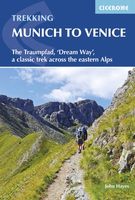
Wandelgids Munich to Venice, The Traumpfad | Cicerone
Uitstekende wandelgids die in etappes de route nauwkeurig beschijft. This guidebook describes the 570km (354 mile) Traumpfad or 'Dream Way', an Alpine trek from Munich's Mariënplatz to the Piazza San Marco in Venice. The route is broken into 30 stages of between 5hrs 30mins and 9hrs, graded according to difficulty, with 5 alternative stages and the option to spend a day traversing a section of Italy's famous via ferrata in the Dolomites. Previous experience of Alpine trekking is not necessary as the route is suitable for most able walkers: however, a head for heights is essential.    Known as 'Europe’s playground', the Alps boast an unrivalled walking infrastructure and breath-taking views of angular peaks, flower-strewn valleys and verdant slopes. Hugely popular with German trekkers but little-known in the English-speaking world, Der Traumpfad revels in this stunning scenery. The route passes through German Bavaria then Austria before entering the Italian Tyrol, taking advantage of th…
23,95

Klanten-reviews van Wandelgids The GR5 Trail Benelux and Lorraine | Cicerone

Er zijn nog geen beoordelingen voor dit productBen jij de eerste die een review plaatst?

Meer over Wandelgids The GR5 Trail Benelux and Lorraine | Cicerone

Productomschrijving

Engelsetalige wandelgids van het noordelijke deel van het beroemde GR 5 pad. Dezse gids beschrijft de gehele route van de GR 5 van Hoek van Holland tot aan Schirmeck in de Vogezen. Goede beschrijvingen en informatie; kaartmateriaal is vrij beperkt. Guidebook to walking the northern section of the GR5 - 1000km starting in Hoek van Holland and passing through the Netherlands, Belgium, Luxembourg and Lorraine to Schirmeck in France. A long-distance route covering a variety of cultures and landscapes. The full GR5 from the North Sea to the Mediterranean is one of the world's greatest trails. Guidebook to the northernmost section of the GR5 - from Hoek van Holland in the Netherlands, through Belgium and Luxembourg, to Schirmeck in the northeast of France. Described over 49 stages, this 1000 kilometre section of the GR5 is relatively easy and ideal for those who don't want to hike up and down steep mountains - or not just yet.   Clear route description is accompanied by 1:100K mapping, together with information on points of interest passed along the way. Background information on landscape, wildlife and history is included, as is practical information - everything from clothing, equipment, food, drink and waymarking to maps, money and staying in touch - making planning and executing a trip as easy as possible.   One of the world's best long distance walking trails, the GR5, in its entirety, covers an impressive 1423 miles (2290km) on its way from the North Sea to the Mediterranean. This northern stretch - before the trail hits the depth of the Vosges - is as much a cultural experience as it is a walk through nature. Walkers will discover different linguistic communities, culinary traditions and architecture. Those partial to museums will also be in for a treat - from tugboats to wine, salt to flint, the route passes by an impressive array of interesting cultural institutions.   End points: Hoek van Holland and Schirmeck; numerous cities between them: Bergen op Zoom, Diest, Maastricht, Spa, Vianden, Echternach, Metz.

Productspecificaties

Artikelnummer(s)
Brand
Cicerone

Verken gerelateerde categorieën

Shopblog.nl maakt gebruik van cookies. Ga je verder op onze website, ga dan akkoord met het plaatsen van cookies en de verwerking van deze data door ons en vermelde partners.