shopblog.nl
Categorieën
  Sluiten

Meer Cicerone

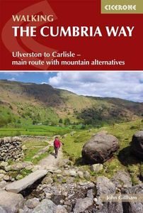
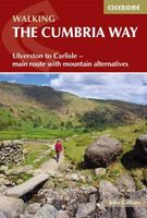
Wandelgids The Cumbria Way | Cicerone

A guidebook to the Cumbria Way, a 73-mile long distance path through the heart of the English Lake District from Ulverston to Carlisle. The route is largely low-level, and accessible to new trekkers, but this guide offers alternative mountain days to climb some of the famous fells en route.   The guide divides the route into 5 stages of between 12 ...
20,95

Webshops met dit product

Webshop
Bezorging
Prijs

Anderen bekeken ook

Wandelgids The Cumbria Way | Cicerone
A guidebook to the Cumbria Way, a 73-mile long distance path through the heart of the English Lake District from Ulverston to Carlisle. The route is largely low-level, and accessible to new trekkers, but this guide offers alternative mountain days to climb some of the famous fells en route.   The guide divides the route into 5 stages of between 12 and 16 miles, but there is plenty of opportunity to plan your itinerary for a more easy-going 7 to 8 days. The Lake District is a walkers paradise, and there is no better way to experience the fells, lakes and woodlands of the Lake District than by trekking through their midst.    This guidebook also provides useful information for every stage, from accommodation to available facilities en route, as well as an annotated OS map and details on points of interest. The result is a guidebook that enhances a walk on the Cumbria Way, as well as providing the walker with the tools to complete the trek.   Steden en Dorpen Ulverston, Torver, Coniston, …
20,95
Wandelgids Cumbria Way | Rucksack Readers
Lange afstandswandelgids van de Cumbria Way door het Lake district. Wandelgids met kaarten en beschrijving. op waterbestendig papier, in spiraalbinding. The Cumbria Way begins at Ulverston and heads north through the Lake District for 73 miles (123 km) through unspoiled dales, passing stone-built farms, going around charming lakes and running beneath rugged fells. Busy tourist towns and villages contrast with woodland, wild fellside, high passes and remote moorlands. The Way passes over the summit of High Pike (658 m/2158 ft) with panoramic views, and ends by descending to the historic border city of Carlisle.   This new edition covers various route updates (mostly near Ulverston), has larger scale mapping and includes many fresh photos. It is in our new, narrow format – more pocketable, with perfect binding sewn for extra robustness, lightweight and more rainproof than ever.   detailed description of the route from south to north Foreword by broadcaster Eric Robson geology, history…
19,95
Wandelgids The Pennine Way | Cicerone
Uitstekende wandelgids van de Pennine Way, waarbij naast alle noodzakelijke informatie ook gebruik gemaakt wordt van de echte topografische kaart. inclusief gidsje met routekaarten van 1:25000  Guidebook to the Pennine Way National Trail with OS map booklet. The 270 mile route from Edale to Kirk Yetholm takes three weeks to walk and is suitable for fit and experienced long distance walkers. The route crosses the Peak District, Yorkshire Dales and North Pennines National Parks. Includes separate OS 1:25,000 map booklet of the route. The Pennine Way is Britain's oldest, toughest long-distance footpath – and arguably its most iconic. Now a National Trail, the 427km (265½ mile) route from Edale in Derbyshire to Kirk Yetholm in the Scottish Borders offers wayfarers the opportunity to immerse themselves in wild beauty of the North. The Pennines boast rolling hills, sweeping moorland and wide glacial valleys, and the Pennine Way has come to embody personal challenge and adventure.    This gui…
23,95
Wandelgids Walking in Cumbria's Eden Valley - Lake district | Cicerone
Uitstekende Engelstalige wandelgids van dit prachtige gebied op de grens van Engeland en Schotland. Guidebook to 30 of the best walks in Cumbria's enchanting Eden Valley. The graded routes, which range from 3 to 15 miles, explore the region's diverse landscapes and offer dramatic views, either of the Pennines, the Lake District or the Scottish hills.  The walks, which work well from bases such as Kirkby Steven, Dufton and Appleby, are predominantly circular. Some of the linear routes link with the Settle-Carlisle railway. Map extracts from the 1:50K OS Landranger series accompany route description, and the handy route summary table makes it easy for walkers to compare routes. Invaluable information on transport, accommodation, clothing, equipment and safety is included, as are notes on the region's geology, wildlife and history.   Situated next to the iconic Lake District, the Eden Valley is often overlooked as a walking destination. This works in its favour - it is as quiet as it is s…
18,50
Fietsgids Cycling the Reivers Route | Cicerone
Guidebook to the Reivers Route, a 173 mile (280km) coast-to-coast cycle route across northern England and into Scotland from Tynemouth to Whitehaven. Exploring the rich history of traditional border territory, it is suitable for cyclists of all abilities and most commonly tackled on hybrid or sturdy touring bikes. Road alternatives are available. As the wildest of the northern coast-to-coast cycle routes, the Reivers Route explores the rich Border Reiving history of northern England and the Scottish Borders. Travelling 173 mile (280km) from Whitehaven to Tynemouth, this four-day cycle tour takes in the Cumbrian coast, northern Lake District, Northumberland National Park and North Tynedale, offering memorable off-road cycling through Kershope Forest and around Kielder Water. The route offers both on and off-road cycling, and is suitable for cyclists using touring or hybrid bikes. Places to stay overnight include Carlisle, Bailey Mill and Bellingham.   The guidebook also offers the Borde…
16,50
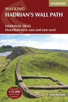
Wandelgids Hadrian's Wall Path | Cicerone
Meest duidelijke wandelgids van de route: veel details in kaarten en informatie, beide kanten op beschreven! The essential guidebook to walking the 84-mile Hadrian’s Wall Path. One of the UK's most visited National Trails, it runs the length of the Roman Wall from Bowness-on-Solway in Cumbria to Wallsend, Newcastle.   Begun in AD122 and stretching from the River Tyne to the Solway Firth, Hadrian’s Wall was a massive feat of engineering and is the best preserved frontier from the classical Roman Empire. Today it is a World Heritage Site, with iconic scenery and fascinating archaeological remains like Birdoswald, Housesteads and Vindolanda, giving a glimpse into Roman life and power. The trail is presented here in 10 stages, with suggestions for five and eight-day itineraries. It is suitable for beginners, although a reasonable level of fitness is required if doing it as a multi-day trek. The route is described both west to east and east to west, and the guidebook also features extension…
24,95

Klanten-reviews van Wandelgids The Cumbria Way | Cicerone

Er zijn nog geen beoordelingen voor dit productBen jij de eerste die een review plaatst?

Meer over Wandelgids The Cumbria Way | Cicerone

Productomschrijving

A guidebook to the Cumbria Way, a 73-mile long distance path through the heart of the English Lake District from Ulverston to Carlisle. The route is largely low-level, and accessible to new trekkers, but this guide offers alternative mountain days to climb some of the famous fells en route.   The guide divides the route into 5 stages of between 12 and 16 miles, but there is plenty of opportunity to plan your itinerary for a more easy-going 7 to 8 days. The Lake District is a walkers paradise, and there is no better way to experience the fells, lakes and woodlands of the Lake District than by trekking through their midst.    This guidebook also provides useful information for every stage, from accommodation to available facilities en route, as well as an annotated OS map and details on points of interest. The result is a guidebook that enhances a walk on the Cumbria Way, as well as providing the walker with the tools to complete the trek.   Steden en Dorpen Ulverston, Torver, Coniston, Elterwater, Great Langdale, Rosthwaite, Keswick, Bassenthwaite, Caldbeck, Dalston and Carlisle

Productspecificaties

Artikelnummer(s)
Brand
Cicerone
Shopblog.nl maakt gebruik van cookies. Ga je verder op onze website, ga dan akkoord met het plaatsen van cookies en de verwerking van deze data door ons en vermelde partners.