shopblog.nl
Categorieën
  Sluiten

Meer Rucksack Readers
Meer Rucksack Readers in Literatuur boeken

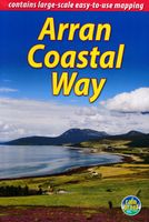
Wandelgids The Arran Coastal Way | Rucksack Readers

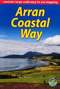
The Arran Coastal Way is perhaps Scotland's finest circular long-distance trail, running 65 miles (105 km) around the Isle of Arran in a memorable week-long hike from Brodick. It's accessible from near Glasgow by the Ardrossan ferry. Famous as`Scotland in miniature', Arran is rich in scenery, castles, caves and standing stones. The walking is varie...
22,50

Webshops met dit product

Webshop
Bezorging
Prijs

Anderen bekeken ook

Wandelgids The Arran Coastal Way | Rucksack Readers
The Arran Coastal Way is perhaps Scotland's finest circular long-distance trail, running 65 miles (105 km) around the Isle of Arran in a memorable week-long hike from Brodick. It's accessible from near Glasgow by the Ardrossan ferry. Famous as`Scotland in miniature', Arran is rich in scenery, castles, caves and standing stones. The walking is varied, from mountain paths to deserted beaches, from minor road-walking to boulder-hopping, and in places it is refreshingly rugged. Arran's wildlife is uniquely approachable, and its residents welcoming. Our second edition was thoroughly updated during 2017 with many route changes and extra options. This guidebook contains all you need to plan and enjoy the Arran Coastal Way, including:   detailed description of the route walked anticlockwise, updated for 2021 background on geology, pre-history and history whisky-making, wildlife and habitats boat trip to the Holy Isle Foreword by wilderness walker Cameron McNeish clear mapping of the e…
22,50
Wandelgids Walking on Arran | Cicerone
Uitstekende wandelgids voor dit uitdagende wandelgebied in Schotland. Dagtochten. The 45 walking routes in this Isle of Arran guidebook range from easy 3km (2 miles) nature trails to long arduous mountain routes with scrambles (up to 32km) providing thorough coverage of Arran, including the ascent of Goatfell and nearby Holy Isle. Most routes are 10km to 15km long but many give opportunities to create longer cross island walks. This guidebook presents a selection of 45 day walks on the popular and accessible Isle of Arran. The routes are between 2 miles (3km) and 20 miles (32km) in length, from easy waymarked forest trails to more arduous mountain walks, exposed ridge routes and scrambles. There are linear and circular walks to choose from, and opportunities to link routes together and create longer walks across the length and breadth of the island. With highlights including Goatfell, Beinn Tarsuinn, the Sannox Horseshoe, Glen Rosa and the Cock of Arran, there's something here to suit …
23,95
Wandelgids Fife Coastal Path | Rucksack Readers
The Fife Coastal Path runs around the coastline of eastern Scotland for 117 miles (187 km) from Kincardine on the Forth to Newburgh on the Tay. Starting west of the famous Forth bridges, the route heads through former mining towns towards the villages of Fife's East Neuk (corner), with their rich tradition of smuggling and fishing. After rounding Fife Ness, the route follows the coastline through St Andrews, golf capital of the world and former religious centre of Scotland.Fife has long played an important part in Scottish history and the route passes many castles, towers and churches. There are splendid views along the coast and over the Firths of Forth and Tay, with great chances to sight seabirds, seals and dolphins. The villages have welcoming pubs, famous fish-and-chip shops and good B&Bs. Transport by train and bus makes for easy access throughout. The guidebook contains everything you need to plan and enjoy the Fife Coastal Path – on foot, or on a bike where cycling is appropria…
23,95
Wandelgids The Kintyre Way | Rucksack Readers
Deze gids geeft een goede beschrijving van de lange afstands route. De kaarten zijn schetsmatig maar wel duidelijk. This fully waymarked trail runs for 101 miles/162 km southward from the beautiful natural harbour of Tarbert to Macrihanish, near the Mull of Kintyre. Criss-crossing the entire peninsula, you pass castles, abbeys and prehistoric remains, sometimes walking along rugged coastline, sometimes high on forestry tracks with glorious views over Arran, the Firth of Clyde and towards Ireland. You will enjoy many wildlife sightings in this peaceful area, famous as Scotland only "mainland island".   Since it opened (2006) the route has changed in places. The 2023 edition of this essential guidebook contains all you need to plan and enjoy your holiday: 11 pages with mapping showing the whole route (1:70,000); the Way step-by-step, with summaries of distance, terrain and refreshment stops; habitats and wildlife; whisky-making in Kintyre; side-trip to the island of Gigha; and plannin…
23,95
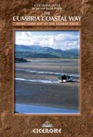
Wandelgids The Cumbria Coastal Way | Cicerone
This guidebook follows the continuous 298km (182 mile) walking route from Silverdale, on Morecambe Bay, towards Gretna on the Scottish border. The route links a number of gems of landscape, wildlife, archaeology and history along this often little-known coastline. A walk of 10-14 days suitable for all levels of ability.   THE CUMBRIA COASTAL WAY is a continuous 298km (182 mile) walking route from north Lancashire towards the Scottish border, and links a number of gems of landscape, wildlife, archaeology and history that are found on this often little-known coastline.   Starting at Silverdale, on Morecambe Bay, and edging the coast up towards Gretna, the coastal way can be walked in its entirety (10–14 days), or in sections, by people of all ages and abilities. Much of the route-finding is easy, and the route, which rarely climbs higher than 100m above sea level, has been designed to link with public transport.    This is a totally new edition of the guidebook written by two walkers who…
18,50
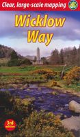
Wandelgids Wicklow Way | Rucksack Readers
Uitgevoerd in de vorm van een klapper, met ringband geeft deze gids een goede beschrijving van de lange afstands route. De kaarten zijn schetsmatig maar wel duidelijk. The Wicklow Way is Ireland’s first and most popular Waymarked Way, running between Marlay Park (Dublin) and Clonegal, 82 miles (132 km) to the south. It offers varied and scenic walking on the flanks of the rugged Wicklow mountains with loughs and waterfalls, passing historic buildings and hospitable villages. Much of the route lies over 1600 feet (500 metres) giving glorious views. Lower sections run through forests and farmland, over a mixture of tracks, roads and pathways rich in wildlife.   Our third edition is based on a research trip made in 2008, further revised in 2011, 2015, 2017 and 2019. It has many route updates, extra photographs and it explains new options for accommodation.   This guidebook contains all you need to plan and enjoy the Wicklow Way:   detailed route description, updated in 2019, with dist…
19,95

Klanten-reviews van Wandelgids The Arran Coastal Way | Rucksack Readers

Er zijn nog geen beoordelingen voor dit productBen jij de eerste die een review plaatst?

Meer over Wandelgids The Arran Coastal Way | Rucksack Readers

Productomschrijving

The Arran Coastal Way is perhaps Scotland's finest circular long-distance trail, running 65 miles (105 km) around the Isle of Arran in a memorable week-long hike from Brodick. It's accessible from near Glasgow by the Ardrossan ferry. Famous as`Scotland in miniature', Arran is rich in scenery, castles, caves and standing stones. The walking is varied, from mountain paths to deserted beaches, from minor road-walking to boulder-hopping, and in places it is refreshingly rugged. Arran's wildlife is uniquely approachable, and its residents welcoming. Our second edition was thoroughly updated during 2017 with many route changes and extra options. This guidebook contains all you need to plan and enjoy the Arran Coastal Way, including:   detailed description of the route walked anticlockwise, updated for 2021 background on geology, pre-history and history whisky-making, wildlife and habitats boat trip to the Holy Isle Foreword by wilderness walker Cameron McNeish clear mapping of the entire route (1:55,000) information about public transport and travel lavishly illustrated, with 125 colour photographs on rainproof paper. Meer informatie kun je vinden op de officiele website: http://www.coastalway.co.uk/

Productspecificaties

Artikelnummer(s)
Brand
Rucksack Readers

Verken gerelateerde categorieën

Shopblog.nl maakt gebruik van cookies. Ga je verder op onze website, ga dan akkoord met het plaatsen van cookies en de verwerking van deze data door ons en vermelde partners.