shopblog.nl
Categorieën
  Sluiten

Wandelgids Skye's Cuillin Ridge Traverse | Cicerone

A guidebook to the Isle of Skye’s Cuillin Ridge Traverse. This 2-volume set is a comprehensive guide to planning and completing this challenging and technical 12km scramble. With a route that includes scrambling sections to Grade 3, technical climbs to Severe and a handful of abseils, a head for heights, technical skill and mental and physical stam...
27,95

Webshops met dit product

Webshop
Bezorging
Prijs

Anderen bekeken ook

Wandelgids Pyrenean Haute Route - a high level trail, Pyreneeën HRP | Cicerone
Beschrijving van de klassieke HRP, Haute Randonnee Pyreneen. Goede beschrijving van de route met hoogteprofielen en andere praktische informatie. Kaartmateriaal is voor deze zware route onvoldoende aanwezig in de gids.  Aanbevolen wandelkaarten voor de hele of een deel van de route: Wandelkaarten van Rando Editions op Schaal 1:50.000 There are three main trekking routes across the Pyrenees from coast to coast: of these, the Pyrenean Haute Route (or HRP for Haute Route Pyrénéenne) is the most challenging - and arguably, the most spectacular. Unlike the GR10 and GR11, it is not waymarked and borders on mountaineering at times, sticking as closely as possible to the main ridge. It stretches 750km from the Atlantic resort of Hendaye to Banyuls-sur-Mer on the Mediterranean, crossing the French-Spanish border many times on its traverse. The hike calls for experience, navigational competence and self-reliance, but offers rich rewards as you pass through some of the most stunning landscapes th…
24,95
Wandelgids Trekking in the Vanoise | Cicerone
Uitstekende wandelgids van dit geweldige gebied. goed beschreven met veel praktische informatie om de route te kunnen lopen, inclusief redelijke kaarten. This guide describes the eleven-day 163km Tour of the Vanoise and the five-day 72km Tour des Glaciers de la Vanoise, two fantastic hut-to-hut treks through the pristine Alpine landscapes of France's Vanoise National Park. Three other short treks - the Tour of the Eastern Vanoise, the Tour of the Western Vanoise and a Traverse of the Vanoise via the GR5 and GR55 - are also summarised. The routes tackle several passes in excess of 2500m but there are no glacier crossings, no significant scrambling and no lengthy paths exposed to either stonefall or vertigo-inspiring exposure (though optional variants may involve some slightly more challenging sections), and waymarking is usually clear - making this an ideal route for those new to Alpine trekking.   The guide contains everything you need to plan and walk the routes, with advice on travel…
23,95
Wandelgids Scrambles in Snowdonia | Cicerone
This revised edition of Steve Ashton's classic guide presents 80 scrambles in the stunning Snowdonia National Park, offering challenge, adventure and exhilaration, but also breathtaking scenery and an unparalleled opportunity to connect with the mountains of North Wales. The graded routes range from introductory traverses to demanding climbs involving technicality and exposure, recommended only for those with considerable experience, a strong head for heights and solid grounding in basic rope technique.   It is now easier than ever to explore the Carneddau, Glyders and Snowdon Group, plus the finest scrambling in Eifionydd, the Moelwyns, Rhinogs and Cadair Idris. The favourites are all here – the Snowdon Horseshoe, North Ridge of Tryfan, Bristly Ridge and Cneifion and Cyfrwy Arêtes – as well as a number of lesser-known routes, including 16 not included in the previous guide.    Photo topos illustrate the ascent routes, alongside comprehensive route description detailing the preferred l…
20,95
Wandelgids Peak Bagging | Vertebrate Publishing
Over fifty years ago, renowned British hillwalker and guidebook author Alfred Wainwright described 214 peaks in the English Lake District in his seven-volume illustrated Pictorial Guide to the Lakeland Fells. Like the Munros in Scotland, bagging all the Wainwrights has become a popular and significant challenge for walkers and runners, often taking many years in fits and starts because of the absence of a clear plan for how to link them together. With this problem in mind, Peak Bagging: Wainwrights by Karen and Dan Parker features forty-five routes designed to link up these iconic fells so you can enjoy the challenge of completing them at your own pace - over years, months or even just a few weeks.   It presents not only the most efficient routes for completing the Wainwrights as quickly as possible, but does so in such a way that each route is a fantastic walk or run in its own right. The featured routes include a round of the Scafells, and the Glenridding Horseshoe, taking in Helvell…
13,95
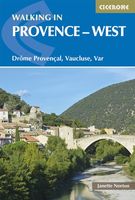
Wandelgids Walking in Provence - West | Cicerone
This guide offers 30 circular day walks in the western half of Provence, the large sun-kissed coastal region of south-east France. Spanning from the Baronnies in the north to the Ste-Baume ridge in the south, the walks are set in the areas of the Drôme Provençale, Vaucluse and the Var. Provence’s sunshine and Mediterranean charm attract many visitors to its coast, yet the area also has much more to offer the walker. The countryside inland boasts a range of scenery from remote mountaintops to spectacular gorges. History is everywhere, in medieval villages, arcaded streets, abbeys, churches and castles.    This guide covers the western regions, with its companion volume, Walking in Provence: East, covering the rest of this fascinating and historic landscape. The walking is incredibly diverse; from the green waves of the Barronies hills in Drôme Provençale, to the unforgettable silhouette of Mont Ventoux giving way to limestone plateaux cut with ravines in the Vauclause. Further south lie…
21,95
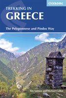
Wandelgids Trekking in Greece - Griekenland | Cicerone
Duidelijke wandelgids van twee belangrijke meerdaagse tochten in Griekenland: the Peloponnese and Pindos Way. Daarnaast een beschrijving van enkele dagtochten in het gebied van Mount Olympos. De beschrijvingen zijn heel goed, met veel praktische informatie. Kaartmateriaal is redelijk. Guidebook describing challenging treks in the mountains of Greece, traversing the Pindhos Range, near Athens, and the Peloponnese, plus a handful of shorter routes including Mount Olympus. The treks demand a high level of commitment and fitness due to their remoteness and difficult terrain, and boast stunning unspoilt scenery. This guidebook presents four specially devised treks in the mountains of Greece, showcasing its beautiful scenery, rich flora and cultural interest. The Peloponnese Way crosses the Peloponnese peninsula from Dhiakoftó in the north to Pantazí beach in the south, via Trípoli. Taking in alpine meadows, a dramatic gorge and forest-clad slopes, the 220km route can be walked in around a f…
24,95
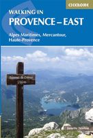
Wandelgids Walking in Provence - East | Cicerone
This guide offers 30 circular day walks in the eastern half of Provence, the large sun-kissed coastal region of south-east France. Spanning from the red rocks in the Ésterel on the Mediterranean to high mountains inland, the walks are set in the areas of the Alpes Maritimes, the Alpes de Haute-Provence and the Mercantour. Provence’s sunshine and Mediterranean charm attract many visitors to its coast, yet the area also has much more to offer the walker. The countryside inland boasts a range of scenery from remote mountaintops to spectacular gorges. History is everywhere, in medieval villages, arcaded streets, abbeys, churches and castles.    This guide covers the eastern regions, with its companion volume, Walking in Provence: West, covering the rest of this fascinating and historic landscape. The walking is incredibly diverse, and explores the country that hugs the Côte d'Azur and Italian border. The Alpes Maritimes rise craggy and wild above towns as unique as Grasse, Cannes and Monac…
21,95
Wandelgids The South West Coast Path | Cicerone
Goede wandelgids van het langste gemarkeerde wandelpad van Groot Brittanië; 1015 km! Uit de bekende Cicerone serie, dus met mooie foto's en duidelijke routebeschrijvingen en kaartjes. The South West Coast Path is Britain's longest way-marked trail, measuring a staggering 1015km (630 miles). Written by the well-known outdoor writer, Paddy Dillon, the guide provides a wealth of detailed knowledge to help tackle this immense route with confidence. It describes the way-marked trail from Minehead to Poole along the north Devon, Cornish and south Devon coastline to finish at Poole Harbour. A full introduction provides the route's historical background, advice on accommodation along the route and details on travelling to and around the South West.There is detailed information on how to use this guide to make the most of your walk, whether you choose to walk the whole route in one go or decide to achieve sections at intervals.Day-by-day route summaries accompany the 45-day stages and the final…
24,95
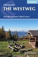
Wandelgids The Westweg | Cicerone
Uitstekende wandelgids van een meerdaagse tocht in het Zwarte Woud in Duitsland. Goede beschrijvingen, veel praktische informatie en redelijke kaarten al zullen deze niet helemaal voldoende zijn. Guidebook to the Westweg (Westway), a 285km walk across Germany's Black Forest from Pforzheim to Basel. This classic route, which includes Feldberg, Black Forest's highest peak, takes 13 to 14 days, each day stage ranging from 15 to 28km. Two variants are described, both well way-marked and suitable for those new to long distance walking. This guidebook is all you need to discover The Westweg, a 285km walk along the length Germany's Black Forest from Pforzheim to Basel. This classic long-distance trail takes around two weeks to walk, in stages of 15-28km. The route is well way-marked and suitable for experienced hikers and those new to long distance walking, though some sections are steep. The Westweg incorporates many of the region's highlights, such the Schwarzwald National Park, the source …
23,95
Wandelgids Walking the GR7 in Andalucia | Cicerone
Uitstekende wandelgids van een gerenommeerde Engelse uitgever. De tochten zijn met zorg beschreven en voorzien van allerhande nuttige informatie. With its white sandy beaches, pine forests, snow-capped peaks, traditional villages, lush river valleys and olive groves, the GR7 in Andalucía takes you on a journey through the most geographically diverse region on the Iberian peninsula. This wonderfully varied route starts at the southernmost tip of Spain at Tarifa, and meanders through the provinces of Cádiz and Málaga before dividing. The northern route heads through Córdoba and Jaén provinces (711km in total), whilst the southern route passes through Almería and Granada (720km). The route crosses seven stunning natural parks and the Sierra Nevada national park. • The first guide to cover the whole of the GR7 in Andalucía. • Detailed route description for around 60 days of walking, with options for creating shorter sections and days. • Information on all the villages en route offering acc…
26,50

Klanten-reviews van Wandelgids Skye's Cuillin Ridge Traverse | Cicerone

Er zijn nog geen beoordelingen voor dit productBen jij de eerste die een review plaatst?

Meer over Wandelgids Skye's Cuillin Ridge Traverse | Cicerone

Productomschrijving

A guidebook to the Isle of Skye’s Cuillin Ridge Traverse. This 2-volume set is a comprehensive guide to planning and completing this challenging and technical 12km scramble. With a route that includes scrambling sections to Grade 3, technical climbs to Severe and a handful of abseils, a head for heights, technical skill and mental and physical stamina are needed.   Volume 1 contains planning and logistics information, training notes, recommended gear list and safety tips. This volume also includes in-depth route description and advice for completing the traverse in winter Volume 2 focuses on the traverse itself, across 10 sections a step-by-step guide to traversing the ridge is given with full route description, Harvey mapping and photo topos. This volume is the perfect size to carry with you during the traverse The traverse is typically completed over 1-2 days 10 classic Cuillin scrambles are also included that can be used as practice routes Easier climbing alternatives (Cuillin Ridge Light) have been provided for the harder climbing sections
Shopblog.nl maakt gebruik van cookies. Ga je verder op onze website, ga dan akkoord met het plaatsen van cookies en de verwerking van deze data door ons en vermelde partners.