shopblog.nl
Categorieën
  Sluiten

Meer Aurum Press

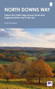
Wandelgids North Downs Way national trail | Aurum Press

Goede engelstalige wandelgids van deze LAW in zuid oost Engeland, net onder Londen. Goede beschrijving en prima kaarten van Ordnance Survey, enigzins beperkte praktische tips, maar die zijn op de website van de route eenvoudig te vinden. This is the complete official guide to walking the well-loved and popular North Downs. Whether you're an experi...
22,50

Webshops met dit product

Webshop
Bezorging
Prijs

Anderen bekeken ook

Wandelgids North Downs Way national trail | Aurum Press
Goede engelstalige wandelgids van deze LAW in zuid oost Engeland, net onder Londen. Goede beschrijving en prima kaarten van Ordnance Survey, enigzins beperkte praktische tips, maar die zijn op de website van de route eenvoudig te vinden. This is the complete official guide to walking the well-loved and popular North Downs. Whether you're an experienced long distance walker or a weekend stroller, this is the only companion you need to this beautiful and scenic route. The North Downs Way is the National Trail that follows the official acorn waymarks from Farnham to the coast at Dover.   This picturesque trail takes in chalk ridges, river valleys and sections of the Pilgrims' Way. At the eastern end you can either walk via Canterbury (a total distance of 130 miles, 208 km) or follow the southern route (123 miles, 197 km). With Ordnance Survey mapping for the entire route, this is a superb guide to the North Downs Way National Trail which can be enjoyed by all.
22,50
Wandelgids The North Downs Way | Cicerone
Uitstekende wandelgids van de North Downs Way, waarbij naast alle noodzakelijke informatie ook gebruik gemaakt wordt van de echte topografische kaart. inclusief gidsje met routekaarten van 1:25000 A guidebook to walking the North Downs Way National Trail, a 130 mile (208km) walk between the high downland of Farnham and the historic city of Dover on the Kent coast, with an optional visit to Canterbury. The route is described in 11 stages, and is fully illustrated with colour photographs and OS map extracts. The North Downs Way is one of the easier national trails with a modest number of steep (but short) ascents and descents and long sections with no noticeable height gain or loss. Several historic sites including Neolithic burial chambers, Roman roads and Norman churches are passed and much of the route follows The Pilgrims' Way. The area also boasts many literary connections with some of the most celebrated voices in English literature. A separate pocket-sized map booklet is included …
23,95
Wandelgids The Ridgeway - National Trail Guides | Aurum Press
Uitstekend routeboek met goede kaarten van Ordnance Survey. Praktische info voor overnachten enigzins beperkt achterin. The Ridgeway follows one of the oldest ‘green roads’ in Europe. It runs for 87 miles (140 km) from Overton Hill in the west, across the Marlborough Downs and the Vale of the White Horse, to Ivinghoe Beacon on the northern edge of the Chilterns. This is the complete, official guide for the long-distance walker or the weekend stroller. All you need is this one book.   Anthony Burton's official guide has been fully revised and updated for 2016, and this new edition has been completely redesigned with more and bigger photographs and much new background history and information.     National Trail Guides are the official guidebooks to the fifteen National Trails in England and Wales and are published in association with Natural England, the official body charged with developing and maintaining the Trails.
20,95
Wandelgids 9 The South West Coast Path National Trail Guide | Aurum Pr
Goede beschrijving van een deel van het beroemde South West Coast path in Cornwall. Men heeft gebruik gemaakt van zeer gedetailleerde kaarten van Ordnance Survey. Part two of the official four-part series covering Britain's longest National Trail in detail. Contains easy to follow Ordnance Survey mapping for individual sections, detailed route descriptions for the National Trail and shorter, circular walks off it. Full colour throughout. The South West Coast Path is the spectacular 630-mile (1008 km) National Trail around the tip of Britain. This volume features the section of the Path from Padstow to Falmouth, a distance of 169 miles (271 km). Following Natural England's acorn waymarks, the route hugs the coast right around Land's End and the Lizard, via the ports of St Ives and Penzance, This is the complete, official guide for the long-distance walker or the weekend stroller. National Trail Guides are the official guidebooks to the fifteen National Trails in England and Wales and ar…
20,95
Wandelatlas Adventure Atlas South Downs Way | A-Z Map Company
AZ heeft de meest gedetailleerde wandelkaarten van de South Downs Way  gebundeld in een atlasje. Daardoor is het heel handig qua formaat. De kaarten zelf zijn perfect voor het wandelen. Schaal 1:25.000 The A-Z Adventure Series of maps combines the best of OS and A-Z, creating the perfect companion for walkers, off-road cyclists, horse riders and anyone wishing to explore the great outdoors.   The South Downs Way is a National Trail along the chalk escarpments and ridges of the South Downs. This undulating path begins in Winchester and finishes in Eastbourne covering 100 miles (160km) and lies completely within the South Downs National Park. The route on the map is clearly highlighted in yellow with mileage markers to gauge distances when planning sections of the walk to enjoy.   This official National Trail Map* of the South Downs Way features 44 pages of continuous Ordnance Survey Explorer** mapping providing complete coverage of the South Downs Way. This atlas includes a route planne…
12,95
Wandelgids The North Downs Way | Cicerone
Uitstekende wandelgids van de North Downs Way, waarbij naast alle noodzakelijke informatie ook gebruik gemaakt wordt van de echte topografische kaart. inclusief gidsje met routekaarten van 1:25000 A guidebook to walking the North Downs Way National Trail, a 130 mile (208km) walk between the high downland of Farnham and the historic city of Dover on the Kent coast, with an optional visit to Canterbury. The route is described in 11 stages, and is fully illustrated with colour photographs and OS map extracts. The North Downs Way is one of the easier national trails with a modest number of steep (but short) ascents and descents and long sections with no noticeable height gain or loss. Several historic sites including Neolithic burial chambers, Roman roads and Norman churches are passed and much of the route follows The Pilgrims' Way. The area also boasts many literary connections with some of the most celebrated voices in English literature. A separate pocket-sized map booklet is included …
23,95
Wandelgids 8 The South West Coast Path | Aurum Press
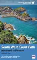
Goede beschrijving van een deel van het beroemde South West Coast path in Cornwall. Men heeft gebruik gemaakt van zeer gedetailleerde kaarten van Ordnance Survey. Part one of the official four-part series covering Britain's longest National Trail in detail. Contains easy to follow Ordnance Survey mapping for individual sections, detailed route descriptions for the National Trail and shorter, circular walks off it. Full colour throughout. The South West Coast Path is the spectacular 630-mile (1008-km) National Trail around the tip of Britain. This volume features the section of the Path from Minehead to Padstow, a distance of 163 miles (262 km). The Trail traces the beautiful coastline, through Exmoor National Park, Clovelly and Tintagel, following Natural England's acorn waymarks. This is the complete, official guide for the long distance walker or the weekend stroller. All you need is this one book. National Trail Guides are the official guidebooks to the fifteen National Trails in En…
20,95

Klanten-reviews van Wandelgids North Downs Way national trail | Aurum Press

Er zijn nog geen beoordelingen voor dit productBen jij de eerste die een review plaatst?

Meer over Wandelgids North Downs Way national trail | Aurum Press

Productomschrijving

Goede engelstalige wandelgids van deze LAW in zuid oost Engeland, net onder Londen. Goede beschrijving en prima kaarten van Ordnance Survey, enigzins beperkte praktische tips, maar die zijn op de website van de route eenvoudig te vinden. This is the complete official guide to walking the well-loved and popular North Downs. Whether you're an experienced long distance walker or a weekend stroller, this is the only companion you need to this beautiful and scenic route. The North Downs Way is the National Trail that follows the official acorn waymarks from Farnham to the coast at Dover.   This picturesque trail takes in chalk ridges, river valleys and sections of the Pilgrims' Way. At the eastern end you can either walk via Canterbury (a total distance of 130 miles, 208 km) or follow the southern route (123 miles, 197 km). With Ordnance Survey mapping for the entire route, this is a superb guide to the North Downs Way National Trail which can be enjoyed by all.

Productspecificaties

Artikelnummer(s)
Brand
Aurum Press
Shopblog.nl maakt gebruik van cookies. Ga je verder op onze website, ga dan akkoord met het plaatsen van cookies en de verwerking van deze data door ons en vermelde partners.