shopblog.nl
Categorieën
  Sluiten

Meer Frances Lincoln
Meer Frances Lincoln in Geschiedenis & politiek boeken

Wandelgids London Thames Path | Frances Lincoln

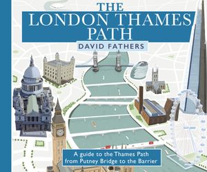
David Fathers presents a unique and richly illustrated guide to the London section of the Thames Path, newly updated to reflect the city's ever-changing landscape. The iconic path, which stretches from the lost floodplains of Richmond all the way  to the Thames Barrier, is a panoramic 40-mile walk through 2000 years of London's history. From the ...
16,50

Webshops met dit product

Webshop
Bezorging
Prijs

Anderen bekeken ook

Wandelgids London Thames Path | Frances Lincoln
David Fathers presents a unique and richly illustrated guide to the London section of the Thames Path, newly updated to reflect the city's ever-changing landscape. The iconic path, which stretches from the lost floodplains of Richmond all the way  to the Thames Barrier, is a panoramic 40-mile walk through 2000 years of London's history. From the old docks and wharves that primed the Industrial Revolution, through the heart of British Government, Monarchy and Church to the City of London that took its very existence from the river. From the site of the Putney Debates at St Mary's Church to Wren's mighty baroque cathedral of St Paul's. From the great Victorian engineering works of Sir Joseph Bazalgette and his attempts to clean up a polluted London and the river to the Thames Barrier seeking to protect huge parts of London from rising sea levels. From London Bridge, site of the oldest crossing point, to the Millennium Bridge, the Thames' newest crossing.  This book explains the pano…
16,50
Wandelgids Thames Path | Trailblazer Guides
This book follows the Thames Path National Trail from the river's source in Gloucestershire to the Thames Barrier in London. Officially 184 miles (294km) in length (although the actual distance you walk will depend on a number of decisions you make en route), the path meanders, accompanied by its watery muse, through pristine and tranquil countryside, past historic sites and buildings, via pub, lock, weir, and the occasional scattering of waterfowl, to a city, once the fulcrum of an empire, and now the heart of modern day England. The river, responsible for the metropolis' very being, tells tales, inspires artists, accommodates swans, geese, and water voles, reflects the silhouettes of red kites and kingfishers, provides employment, entices adventure, and allows time for carefree pilgrims to procrastinate and think. Following its banks is a grand way to go for a ramble. The path begins, as the river does, in a meadow in the Cotswolds; its upper reaches lonely and wild, the meadows and …
19,95
Wandelgids Thames Path in London | Aurum Press
Wandeling langs de Thames dwars door de stad Londen met duidelijke kaartjes.   Fully revised and updated. This comprehensive guide to the London section of the Thames Path Trail Guide covers the route from Hampton Court in the east to the Thames Barrier in the west, with an extension into Crayford Ness. From the Mesolithic Period timber piles near Vauxhall Bridge to the innovative Shard skyscraper at London Bridge, the long and remarkable history of London is revealed.   Clapham covers all the folklore from the famous frost fairs to the much-lamented beach near Tower Bridge, not forgetting the poignant recent visit of a large whale to the centre of London. The Thames winds all the way through London's history and culture, from Henry VIII's Hampton Court to the chequered fate of the Dome/O2. Accompanied by easy-to-read maps and colour photography, the London resident as much as the visiting tourist will find in this guide something new every step of the way.
20,95
Wandelkaart Thames Path | Harvey Maps
Mooie, duidelijke kaart van het Thames Path in Engeland. Geplastificeerd met veel extra informatie en uitsnedes van de route.   Thames Path National Trail   The Thames Path follows the banks of the river for 184 miles (294KM) from the flood barrier at Woolwich in South East London to Kemble Gloucestershire. It is a long distance walking route, most of it cannot be cycled. The Trail passes through water meadows, historic towns & lovely villages. The path is flat which makes for easy walking. Jos Joslin National Trails Manager (Marketing & Projects) said of this map "Really beneficial to have the whole length of the Thames Path upstream of London on just one map. Clear mapping and useful information makes this a very practical map"   XT40 New generation of tough polyethylene maps   The HARVEY series of Long Distance Route maps is an established success. Now the advanced technology used in the creation of our best-selling British Mountain Maps is also applied to the route maps.   These ma…
25,95
Wandelgids Walking in the Thames Valley | Cicerone
Walking in the Thames Valley offers 25 challenging circular walks around the River Thames and River Kennet in the south of England, taking in the Southern Chilterns, the Berkshire and North Hampshire Downs, Southern Oxfordshire and the eastern edge of Wiltshire. All routes are within easy reach of Reading, Newbury, Abingdon and London. While some walks visit Iron Age hill forts, others pass more modern features such as Wilton Windmill and the Kennet and Avon Canal. Some follow sections of the Ridgeway, while others meander along the banks of the Thames. What they all have in common is that they take the keen rambler to some of the best parts of the Thames Valley – a patchwork of open chalk grassland, broadleaved woodland and farmland and home to two Areas of Outstanding Natural Beauty. • walks from 10 to 18 miles, including one 2-day route • shorter, less strenuous alternatives for many of the walks • detailed route descriptions with information on local points of interest, OS mapping …
18,50
Wandelgids Thames Path | Aurum Press
Een mooie wandelgids met een goede beschrijving en hele duidelijke kaarten met ingetekende route. The official guide to the riverside path from its Gloucestershire source all the way to the outskirts of London. With the London Thames now covered by Aurum's separate new guide, a companion volume can concentrate on the appeal of the full 150 miles of the country Thames, which winds all the way from its Gloucestershire source near Cirencester to Hampton Court on the edge of the London conurbation. This new edition has a wealth of new information about the many sights and places of interest along the way, from Wittenham Clumps that Paul Nash used to paint to Heston Blumenthal's Fat Duck restaurant at Bray, as well as full walking tours of historic Oxford and Windsor & Eton. There are sections on Stanley Spencer at Cookham, and Cliveden and the Cliveden Set, as well as on handsome and interesting towns like Henley and Abingdon. There is also a new section on the wildlife and natural history…
20,95

Klanten-reviews van Wandelgids London Thames Path | Frances Lincoln

Er zijn nog geen beoordelingen voor dit productBen jij de eerste die een review plaatst?

Meer over Wandelgids London Thames Path | Frances Lincoln

Productomschrijving

David Fathers presents a unique and richly illustrated guide to the London section of the Thames Path, newly updated to reflect the city's ever-changing landscape. The iconic path, which stretches from the lost floodplains of Richmond all the way  to the Thames Barrier, is a panoramic 40-mile walk through 2000 years of London's history. From the old docks and wharves that primed the Industrial Revolution, through the heart of British Government, Monarchy and Church to the City of London that took its very existence from the river. From the site of the Putney Debates at St Mary's Church to Wren's mighty baroque cathedral of St Paul's. From the great Victorian engineering works of Sir Joseph Bazalgette and his attempts to clean up a polluted London and the river to the Thames Barrier seeking to protect huge parts of London from rising sea levels. From London Bridge, site of the oldest crossing point, to the Millennium Bridge, the Thames' newest crossing.  This book explains the panorama we see today, what came before and how the changes came about. Each double page shows the distance covered so you can plan your own tour of the river.

Productspecificaties

Artikelnummer(s)
Brand
Frances Lincoln

Verken gerelateerde categorieën

Shopblog.nl maakt gebruik van cookies. Ga je verder op onze website, ga dan akkoord met het plaatsen van cookies en de verwerking van deze data door ons en vermelde partners.